Fall City, Washington
| Fall City, Washington | |
|---|---|
| CDP | |
|
Downtown Fall City, 1999 | |
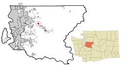 Location of Fall City, Washington | |
| Coordinates: 47°33′59″N 121°53′42″W / 47.56639°N 121.89500°W | |
| Country | United States |
| State | Washington |
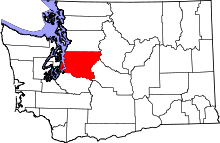
| County | King |
| Government | |
| • Type | Unincorporated area |
| Area | |
| • Total | 1.3 sq mi (3.4 km2) |
| • Land | 1.3 sq mi (3.4 km2) |
| • Water | 0.0 sq mi (0.0 km2) |
| Elevation | 105 ft (32 m) |
| Population (2010) | |
| • Total | 1,993 |
| • Density | 1,253.5/sq mi (484.0/km2) |
| Time zone | Pacific (PST) (UTC-8) |
| • Summer (DST) | PDT (UTC-7) |
| ZIP code | 98024 |
| Area code(s) | 425 |
| FIPS code | 53-23200[1] |
| GNIS feature ID | 1531451[2] |

Fall City is an unincorporated area in King County, Washington, United States. Located 26 miles (42 km) east of Seattle, the community lies along the Snoqualmie River. The population was 1,993 at the 2010 census.
History
The first settlements in the area were two forts built in 1856 during the Puget Sound War to protect future settlers against possible uprisings by the native population. Fort Patterson, a few miles downstream, and Fort Tilton, a few miles upstream, were built with the help of Indians led by Chief Patkanim, and both abandoned within 2 years after interactions with the local tribes remained peaceful. A historical marker can be found north of Fall City on the Fish Hatchery Road where Fort Tilton once stood.
A trading post was established near the present day location of the Last Frontier Saloon in 1869 and became a hub of the local economy. Fall City was known at the time as "The Landing", as shallow water and rapids upstream on the Snoqualmie were impassable to the large dugout canoes used for transporting goods. In the early 1870s the first local mill in the Snoqualmie Valley was opened at the mouth of Tokul Creek, just downstream from Snoqualmie Falls and just upstream from where Fall City would be. The Fall City Post Office opened June 10, 1872.
The first small steamboats started ferrying supplies up the river in 1875. In the late 1880s, a group of Puget Sound businessmen founded and started building the Seattle, Lake Shore & Eastern railroad including a line up into the upper Snoqualmie Valley, in an attempt to build a line over the Cascade range. The land claim holder at the time, Jeremiah "Jerry" Borst, had Fall City surveyed and platted in anticipation of the people the railroad would bring, but was disappointed in 1889 when the railroad line was built a mile (1.6 km) away from the community.
However even a mile (1.6) away the railroad combined with the first bridge over the Snoqualmie River greatly improved the business of the local lumber mills and farmers, and made the area and its scenic features (such as Snoqualmie Falls) accessible to tourists. Hundreds moved to the area over the next two decades.
When the Sunset Highway connecting Seattle with eastern Washington through Fall City was improved in the early 1910s, it further accelerated the economic and residential development of the area. By the late 1920s, most of the population either worked in the burgeoning tourist trade or commuted to work west toward Issaquah and Seattle.
The Great Depression followed by gasoline rationing during World War II hurt the tourist trade in Fall City. Tourism was further hampered after the war as U.S. Highway 10 (now Interstate 90) was rerouted south directly from Preston to North Bend, bypassing Fall City and Snoqualmie. The local economy suffered further impacts as the local logging mills started closing.
Today, Fall City is a bedroom community to the high tech industry of the Seattle metropolitan area with large suburban estates just outside the community juxtaposed with the historical homes and farmsteads built in its heyday.
Geography
Fall City is located at 47°33′59″N 121°53′42″W / 47.56639°N 121.89500°WCoordinates: 47°33′59″N 121°53′42″W / 47.56639°N 121.89500°W.[3] According to the United States Census Bureau, the Fall City Census-designated place (CDP) has a total area of 1.3 square miles (3.4 km²), all of it land.
Fall City sits at the confluence of the Snoqualmie River and the Raging River and is sometimes subject to flooding during the autumn and winter months. More typical is a strong east wind as pressure gradients carry higher pressure air across Snoqualmie Pass and down the Snoqualmie Valley.
Climate
The climate in this area has mild differences between highs and lows, and there is adequate rainfall year round. According to the Köppen Climate Classification system, Fall City has a marine west coast climate, abbreviated "Cfb" on climate maps.[4]
Demographics
| Historical population | |||
|---|---|---|---|
| Census | Pop. | %± | |
| 2000 | 1,638 | — | |
| 2010 | 1,993 | 21.7% | |
| U.S. Decennial Census | |||
At 2010 census,[1] there were 1,798 people, 661 households and 479 families residing in the CDP. The population density was 1,253.5 per square mile (482.8/km²). There were 649 housing units at an average density of 496.6/sq mi (191.3/km²). The racial makeup of the CDP was 92.22% White, 0.24% African American, 0.92% Native American, 1.03% Asian, 1.40% from other races, and 2.26% from two or more races. Hispanic or Latino of any race were 6.01% of the population.
There were 644 households of which 33.9% had children under the age of 18 living with them, 58.9% were married couples living together, 8.5% had a female householder with no husband present and 26.4% were non-families. 19.7% of all households were made up of individuals and 7.8% had someone living alone who was 65 years of age or older. The average household size was 2.54 and the average family size was 2.91.
In the CDP, the age distribution was 25.1% under the age of 18, 5.7% from 18 to 24, 32.0% from 25 to 44, 25.1% from 45 to 64, and 12.1% who were 65 years of age or older. The median age was 40 years. For every 100 females there were 104.0 males. For every 100 females age 18 and over, there were 99.2 males.
The median household income in the CDP was $61,848, and the median family income was $68,529. Males had a median income of $42,325 versus $32,143 for females. The per capita income for the CDP was $25,189. About 7.4% of families and 15.8% of the population were below the poverty line, including 3.7% of those under age 18 and 4.9% of those age 65 or over.
Snoqualmie Valley School District
Fall City residents attend schools from the Snoqualmie Valley School District.
Transportation
According to the Federal Aviation Administration, the Fall City Airport is a small private airport community located roughly 2 miles (3 km) to the east of the city at Latitude: 47-33-34.366 N & Longitude: 121-51-49.413 W. at an elevation of 140 feet (42.5 m).
The Airport is owned by:
FALL CITY AIRPORT ASSOCIATION
4731 – 354TH AVENUE SE
FALL CITY, WA 98024
UNITED STATES
Phone: 425-222-7150
It has no traffic control tower.[5]
References
- 1 2 "American FactFinder". United States Census Bureau. Retrieved 2008-01-31.
- ↑ "Fall City". Geographic Names Information System. United States Geological Survey.
- ↑ "US Gazetteer files: 2010, 2000, and 1990". United States Census Bureau. 2011-02-12. Retrieved 2011-04-23.
- ↑ Climate Summary for Fall City, Washington
- ↑ Federal Aviation Administration. "Fall City", September 2014 <https://nfdc.faa.gov/nfdcApps/airportLookup/airportDisplay.jsp?airportId=1WA6>
External links
| Wikimedia Commons has media related to Fall City, Washington. |
Municipalities and communities of King County, Washington, United States | ||
|---|---|---|
| Cities |
|  |
| Towns | ||
| CDPs |
| |
| Unincorporated communities | ||
| Indian reservation | ||
| Ghost towns | ||
| Footnotes | ‡This populated place also has portions in an adjacent county or counties | |