Klahanie, Washington
| Klahanie, Washington | |
|---|---|
| CDP | |
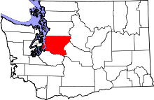
 Klahanie, Washington Location within the state of Washington | |
| Coordinates: 47°34′15″N 122°0′30″W / 47.57083°N 122.00833°WCoordinates: 47°34′15″N 122°0′30″W / 47.57083°N 122.00833°W | |
| Country | United States |
| State | Washington |
| County | King |
| Area | |
| • Total | 1.942 sq mi (5.030 km2) |
| • Land | 1.926 sq mi (4.988 km2) |
| • Water | 0.016 sq mi (0.041 km2) |
| Population (2010) | |
| • Total | 10,674 |
| • Density | 5,500/sq mi (2,100/km2) |
| Time zone | Pacific (PST) (UTC-8) |
| • Summer (DST) | PDT (UTC-7) |
| GNIS feature ID | 1511074[1] |
Klahanie is a census-designated place (CDP) in King County, Washington, United States. The population was 10,674 at the 2010 census.
In a 2005 vote, residents of Klahanie accepted incorporation into the city of Issaquah but did not accept the debts of Issaquah. On January 1, 2016, Klahanie was annexed into Sammamish.
Klahanie is home to many different neighbourhoods inside its boundaries, such as Heatherwood and The Willows. There are two schools in Klahanie, Beaver Lake Middle School and Challenger Elementary School, both in the Issaquah School District. There are two community pools, many tennis courts, basketball courts and parks.
Geography
Klahanie is located at 47°34′15″N 122°00′30″W / 47.57083°N 122.00833°W (47.570970, -122.008391).[2]
According to the United States Census Bureau, the CDP has a total area of 1.942 square miles (5.03 km²), of which, 1.926 square miles (4.988 km²) of it is land and 0.016 square miles (0.041 km²) of it (0.82%) is water.
References
- ↑ "Klahanie". Geographic Names Information System. United States Geological Survey.
- ↑ "US Gazetteer files: 2010, 2000, and 1990". United States Census Bureau. 2011-02-12. Retrieved 2011-04-23.
External links
Municipalities and communities of King County, Washington, United States | ||
|---|---|---|
| Cities |
|  |
| Towns | ||
| CDPs |
| |
| Unincorporated communities | ||
| Indian reservation | ||
| Ghost towns | ||
| Footnotes | ‡This populated place also has portions in an adjacent county or counties | |