Wilderness Rim, Washington
| Wilderness Rim, Washington | |
|---|---|
| CDP | |
 Wilderness Rim, Washington Location of Wilderness Rim, Washington. | |
| Coordinates: 47°26′49″N 121°46′7″W / 47.44694°N 121.76861°WCoordinates: 47°26′49″N 121°46′7″W / 47.44694°N 121.76861°W | |
| Country | United States |
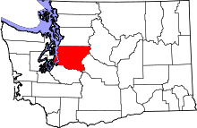
| State | Washington |
| County | King |
| Area | |
| • Total | 0.630 sq mi (1.63 km2) |
| • Land | 0.622 sq mi (1.61 km2) |
| • Water | 0.008 sq mi (0.02 km2) |
| Elevation | 1,043 ft (318 m) |
| Population (2010) | |
| • Total | 1,523 |
| • Density | 2,400/sq mi (930/km2) |
| Time zone | Pacific (PST) (UTC-8) |
| • Summer (DST) | PDT (UTC-7) |
| GNIS feature ID | 2585052[1] |
Wilderness Rim is a census-designated place (CDP) in King County, Washington, United States. It lies at an elevation of 1043 ft (318 m).[1] The population was 1,523 at the 2010 census.
Geography
Wilderness Rim is located at 47°26′49″N 121°46′07″W / 47.44694°N 121.76861°W (47.446975, -121.768572).[2]
According to the United States Census Bureau, the CDP had a total area of 0.630 square miles (1.63 km²), of which, 0.622 square miles (1.61 km²) of it is land and 0.008 square miles (0.02 km²) of it (1.27%) is water.
References
- 1 2 "Wilderness Rim Census Designated Place". Geographic Names Information System. United States Geological Survey.
- ↑ "US Gazetteer files: 2010, 2000, and 1990". United States Census Bureau. 2011-02-12. Retrieved 2011-04-23.
External links
Municipalities and communities of King County, Washington, United States | ||
|---|---|---|
| Cities |
|  |
| Towns | ||
| CDPs |
| |
| Unincorporated communities | ||
| Indian reservation | ||
| Ghost towns | ||
| Footnotes | ‡This populated place also has portions in an adjacent county or counties | |
This article is issued from Wikipedia - version of the 12/16/2014. The text is available under the Creative Commons Attribution/Share Alike but additional terms may apply for the media files.