Jefferson County, Washington
| Jefferson County, Washington | |
|---|---|
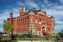 Jefferson County Courthouse in Port Townsend | |
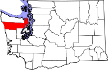 Location in the U.S. state of Washington | |
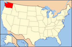 Washington's location in the U.S. | |
| Founded | December 22, 1852 |
| Named for | Thomas Jefferson |
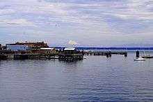
| Seat | Port Townsend |
| Largest city | Port Townsend |
| Area | |
| • Total | 2,183 sq mi (5,654 km2) |
| • Land | 1,804 sq mi (4,672 km2) |
| • Water | 379 sq mi (982 km2), 17% |
| Population (est.) | |
| • (2015) | 30,466 |
| • Density | 17/sq mi (7/km²) |
| Congressional district | 6th |
| Time zone | Pacific: UTC-8/-7 |
| Website |
www |
Jefferson County is a county located in the U.S. state of Washington. As of the 2010 census, the population was 29,872.[1] The county seat and only incorporated city is Port Townsend.[2] The county is named for Thomas Jefferson.[3]
Jefferson County was formed out of Thurston County on December 22, 1852, by the legislature of Oregon Territory,[4] and included the northern 4,854 square miles (12,571.8 km2) portion of the Olympic Peninsula. On April 26, 1854, the legislature of Washington Territory created Clallam County from the northwestern 2,670 square miles (6,915.3 km2) portion of this original area.
The Hood Canal Bridge connects Jefferson County to Kitsap County, Washington. The Coupeville-Port Townsend route of the Washington State Ferries connects the county to Whidbey Island in Island County, Washington.
Geography
According to the U.S. Census Bureau, the county has a total area of 2,183 square miles (5,650 km2), of which 1,804 square miles (4,670 km2) is land and 379 square miles (980 km2) (17%) is water.[5]
The county is split in three parts by its landforms:
- Eastern Jefferson County along the Strait of Juan de Fuca, Admiralty Inlet, and Puget Sound
- Central Jefferson County, which is uninhabited and lies in the Olympic Mountains within Olympic National Park and Olympic National Forest
- Western Jefferson County, along the Pacific Ocean.
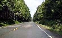
Because of the mountainous barrier, there is no road lying entirely within Jefferson County that connects the eastern and western parts. The most direct land route between the two ends of the county involves a drive of approximately 100 miles (160 km) along U.S. Route 101 through neighbouring Clallam County. The mountains also block the damp Chinook winds, which make the climate much wetter in the west than the so-called eastern "banana belt" in the rain shadow.
Geographic features

- Admiralty Inlet
- Bolton Peninsula
- Destruction Island
- Discovery Bay
- Hood Canal
- Mount Olympus, the highest point on the Olympic Peninsula
- Olympic Mountains
- Olympic Peninsula
- Pacific Ocean
- Point Wilson
- Port Townsend Bay
- Protection Island
- Puget Sound
- Queets River
- Quimper Peninsula
- Strait of Juan de Fuca
- Toandos (Coyle) Peninsula
Major highways
Adjacent counties
- Island County - northeast
- Kitsap County - southeast
- Mason County - south/southeast
- Grays Harbor County - south/southwest
- Clallam County - northwest
- San Juan County - northeast
National protected areas
- Olympic National Forest (part)
- Olympic National Park (part)
- Protection Island National Wildlife Refuge
- Quillayute Needles National Wildlife Refuge (part)
- Pacific Northwest National Scenic Trail (part)
Demographics
| Historical population | |||
|---|---|---|---|
| Census | Pop. | %± | |
| 1860 | 531 | — | |
| 1870 | 1,268 | 138.8% | |
| 1880 | 1,712 | 35.0% | |
| 1890 | 8,368 | 388.8% | |
| 1900 | 5,712 | −31.7% | |
| 1910 | 8,337 | 46.0% | |
| 1920 | 6,557 | −21.4% | |
| 1930 | 8,346 | 27.3% | |
| 1940 | 8,918 | 6.9% | |
| 1950 | 11,618 | 30.3% | |
| 1960 | 9,639 | −17.0% | |
| 1970 | 10,661 | 10.6% | |
| 1980 | 15,965 | 49.8% | |
| 1990 | 20,146 | 26.2% | |
| 2000 | 25,953 | 28.8% | |
| 2010 | 29,872 | 15.1% | |
| Est. 2015 | 30,466 | [6] | 2.0% |
| U.S. Decennial Census[7] 1790–1960[8] 1900–1990[9] 1990–2000[10] 2010–2015[1] | |||
2000 census
As of the census[11] of 2000, there were 25,953 people, 11,645 households, and 7,580 families residing in the county. The population density was 14 people per square mile (6/km²). There were 14,144 housing units at an average density of 8 per square mile (3/km²). The racial makeup of the county was 92.17% White, 0.42% Black or African American, 2.31% Native American, 1.19% Asian, 0.13% Pacific Islander, 0.76% from other races, and 3.02% from two or more races. 2.06% of the population were Hispanic or Latino of any race. 17.4% were of German, 14.8% English, 9.9% Irish and 7.5% Norwegian ancestry. 97.1% spoke English and 1.0% Spanish as their first language.
There were 11,645 households out of which 23.20% had children under the age of 18 living with them, 53.60% were married couples living together, 8.20% had a female householder with no husband present, and 34.90% were non-families. 28.50% of all households were made up of individuals and 11.70% had someone living alone who was 65 years of age or older. The average household size was 2.21 and the average family size was 2.67.
In the county, the population was spread out with 19.80% under the age of 18, 5.00% from 18 to 24, 21.60% from 25 to 44, 32.50% from 45 to 64, and 21.10% who were 65 years of age or older. The median age was 47 years. For every 100 females there were 95.80 males. For every 100 females age 18 and over, there were 94.40 males.
The median income for a household in the county was $37,869, and the median income for a family was $45,415. Males had a median income of $37,210 versus $25,831 for females. The per capita income for the county was $22,211. About 7.20% of families and 11.30% of the population were below the poverty line, including 16.60% of those under age 18 and 6.00% of those age 65 or over.
2010 census
As of the 2010 United States Census, there were 29,872 people, 14,049 households, and 8,394 families residing in the county.[12] The population density was 16.6 inhabitants per square mile (6.4/km2). There were 17,767 housing units at an average density of 9.9 per square mile (3.8/km2).[13] The racial makeup of the county was 91.0% white, 2.3% American Indian, 1.6% Asian, 0.8% black or African American, 0.2% Pacific islander, 0.7% from other races, and 3.4% from two or more races. Those of Hispanic or Latino origin made up 2.8% of the population.[12] In terms of ancestry, 20.8% were English, 20.3% were German, 13.9% were Irish, 8.3% were Norwegian, 5.9% were Scottish, and 4.2% were American.[14]
Of the 14,049 households, 18.2% had children under the age of 18 living with them, 49.1% were married couples living together, 7.3% had a female householder with no husband present, 40.3% were non-families, and 32.2% of all households were made up of individuals. The average household size was 2.08 and the average family size was 2.57. The median age was 53.9 years.[12]
The median income for a household in the county was $46,048 and the median income for a family was $59,964. Males had a median income of $45,616 versus $29,508 for females. The per capita income for the county was $28,528. About 8.9% of families and 13.5% of the population were below the poverty line, including 20.8% of those under age 18 and 7.4% of those age 65 or over.[15]
Politics
Jefferson County is a staunchly Democratic area, with even rural areas giving significant margins to John Kerry against George W. Bush in the 2004 U.S. presidential election. The last Republican to win a majority in the county was Ronald Reagan in 1980.
The communities in the eastern and western halves of Jefferson County tend to not mingle much, because of the barrier dividing the county. The communities also differ in amount and sources of family income, and population size and density, with the west being more dependent on logging, somewhat less prosperous, and having fewer people for roughly the same area. Areas of East Jefferson County located south of Port Townsend remain largely rural and can be divided into two parts, those communities located on the Hood Canal and those on the Admiralty Inlet. Perennial discussions and attempts to separate the west half from the east half gained little support during the twentieth century.
County seat Port Townsend casts a significant number of votes and gave Obama 82% of its votes in the 2012 General Election (source: www.wa.gov). Areas outside of Port Townsend (such as Cape George) gave Obama 2-to-1 victory margins. Democrats also do well in many of the small towns of northern Jefferson County, with strong Democratic leans in Coyle, Discovery Bay, Gardiner, and Nordland, as well as in the towns just southeast of Port Townsend (Chimacum, Irondale, Kala Point, and Port Hadlock). Democrats also perform strongly in the sparsely populated western part of the county, where much of the population is Native American.
Republicans tend to win victories in several parts of the county, particularly the rural areas in the southeast part of the county including Center, Crocker Lake, Brinnon, and Quilcene. Although it has trended Democratic in recent years, Port Ludlow — an affluent area that casts a notable number of votes — still has a Republican lean.
Economy
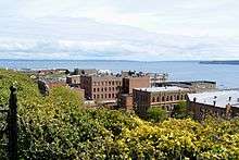
The largest private employer in Jefferson County is the Port Townsend Paper Mill.[16] The largest employer overall (private and public) is Jefferson Healthcare, which operates Jefferson Healthcare Hospital.[17]
Communities
City
- Port Townsend (county seat)
Census-designated places
Unincorporated communities
- Adelma Beach
- Beckett Point
- Cape George
- Center
- Chimacum
- Clearwater
- Coyle
- Crocker Lake
- Dabob
- Discovery Bay
- East Quilcene
- Gardiner
- Glen Cove
- Irondale
- Kala Point
- Kalaloch
- Leland
- Mats Mats
- Oak Bay
See also
References
- 1 2 "State & County QuickFacts". United States Census Bureau. Retrieved January 7, 2014.
- ↑ "Find a County". National Association of Counties. Retrieved 2011-06-07.
- ↑ Gannett, Henry (1905). The Origin of Certain Place Names in the United States. Govt. Print. Off. p. 168.
- ↑ Reinartz, Kay. "History of King County Government 1853–2002" (PDF). p. 2. Retrieved 2007-12-28.
- ↑ "2010 Census Gazetteer Files". United States Census Bureau. August 22, 2012. Retrieved July 5, 2015.
- ↑ "County Totals Dataset: Population, Population Change and Estimated Components of Population Change: April 1, 2010 to July 1, 2015". Retrieved July 2, 2016.
- ↑ "U.S. Decennial Census". United States Census Bureau. Retrieved January 7, 2014.
- ↑ "Historical Census Browser". University of Virginia Library. Retrieved January 7, 2014.
- ↑ "Population of Counties by Decennial Census: 1900 to 1990". United States Census Bureau. Retrieved January 7, 2014.
- ↑ "Census 2000 PHC-T-4. Ranking Tables for Counties: 1990 and 2000" (PDF). United States Census Bureau. Retrieved January 7, 2014.
- ↑ "American FactFinder". United States Census Bureau. Retrieved 2011-05-14.
- 1 2 3 "DP-1 Profile of General Population and Housing Characteristics: 2010 Demographic Profile Data". United States Census Bureau. Retrieved 2016-03-06.
- ↑ "Population, Housing Units, Area, and Density: 2010 - County". United States Census Bureau. Retrieved 2016-03-06.
- ↑ "DP02 SELECTED SOCIAL CHARACTERISTICS IN THE UNITED STATES – 2006-2010 American Community Survey 5-Year Estimates". United States Census Bureau. Retrieved 2016-03-06.
- ↑ "DP03 SELECTED ECONOMIC CHARACTERISTICS – 2006-2010 American Community Survey 5-Year Estimates". United States Census Bureau. Retrieved 2016-03-06.
- ↑ McClary, Daryl C. "Jefferson County -- Thumbnail History". History Ink. Retrieved 7 July 2012.
- ↑ Bermant, Charlie (September 14, 2010). "Hospital's new CEO highest paid public official in Jefferson County". The Peninsula Daily News. Retrieved 7 July 2012.
External links
-
 Geographic data related to Jefferson County, Washington at OpenStreetMap
 - Official Jefferson County Parks and Recreation Department Website The official government website for Jefferson County Parks and Recreation, a Division of Jefferson County Public Works Department.
- University of Washington Libraries Digital Collections – The Pacific Northwest Olympic Peninsula Community Museum A web-based museum showcasing aspects of the rich history and culture of Washington State's Olympic Peninsula communities. Features cultural exhibits, curriculum packets and a searchable archive of over 12,000 items that includes historical photographs, audio recordings, videos, maps, diaries, reports and other documents.
- Jefferson County Official Website
- Jefferson County Historical Society Research Center A searchable, online collection of 49,000 records maintained by the Jefferson County museum and research center, whose mission is to actively discover, collect, preserve, and promote the heritage of Jefferson County in the State of Washington.
- PortLudowToday-Digital Village A non profit organization providing a virtual collection of activities and current events surrounding this master planned community.
 |
Clallam County | Island County and Strait of Juan de Fuca | | |
| Pacific Ocean | |
|||
| ||||
| | ||||
| Grays Harbor County | Mason County | Kitsap County |
Municipalities and communities of Jefferson County, Washington, United States | ||
|---|---|---|
| City | | |
| CDPs | ||
| Other unincorporated communities | ||
| Indian reservation | ||
| Ghost town | ||
| Footnotes | ‡This populated place also has portions in an adjacent county or counties | |
Coordinates: 47°50′N 123°35′W / 47.84°N 123.58°W