Snohomish County, Washington
| Snohomish County, Washington | |||
|---|---|---|---|
|
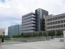
Snohomish County Government Campus in Everett | |||
| |||
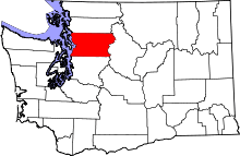 Location in the U.S. state of Washington | |||
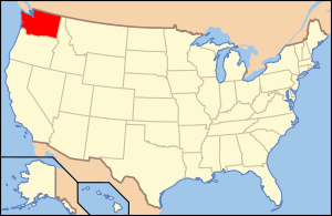 Washington's location in the U.S. | |||
| Founded | January 14, 1861 | ||
| Named for | the Snohomish people | ||
| Seat | Everett | ||
| Largest city | Everett | ||
| Area | |||
| • Total | 2,196 sq mi (5,688 km2) | ||
| • Land | 2,087 sq mi (5,405 km2) | ||
| • Water | 109 sq mi (282 km2), 5.0% | ||
| Population (est.) | |||
| • (2015) | 772,501 | ||
| • Density | 364/sq mi (141/km²) | ||
| Congressional districts | 1st, 2nd, 7th | ||
| Time zone | Pacific: UTC-8/-7 | ||
| Website |
snohomishcountywa | ||

Snohomish County /snoʊˈhoʊmᵻʃ/ is a county located in the U.S. state of Washington. As of the 2015 census, the population was 772,501,[1] making it the third-most populous county in Washington. The county seat and largest city is Everett.[2] The county was created out of Island County on January 14, 1861[3] and is named for the Snohomish tribe.
Snohomish County is included in the Seattle-Tacoma-Bellevue, WA Metropolitan Statistical Area.
Etymology
"Snohomish" comes from the name of the largest Native American tribe in the area when settlers arrived in the 19th century. The name is spelled as "Sdoh-doh-hohbsh" in the Lushootseed language and has a disputed meaning with unclear origins, with Dr. Charles M. Buchanan once saying that he had "never met an Indian who could give a meaning to the word Snohomish" in his 21 years as an Indian agent at the Tulalip tribe. Chief William Shelton, the last hereditary tribal chief of the Snohomish tribe, claimed that it meant "lowland people", a name associated with the tribe's location on the waters of the Puget Sound; other scholars have claimed "a style of union among them", "the braves", or "Sleeping Waters".[4][5]
The name is also used for the Snohomish River, which runs through part of the county, and the City of Snohomish, the former county seat that was renamed after the formation of the county.
The current spelling of the name was adopted by the Surveyor General of Washington Territory in 1857, with earlier documents using the spellings "Sinnahamis", "Sinahomis", and "Tuxpam".[5]
History

Snohomish County was created out of Island County on January 14, 1861.[3]
The county seat of Snohomish when established was the city of Snohomish, Washington starting in 1861.[6] The city of Everett took the seat in a disputed move in 1895. It was in a vote.[7]
One of the first county censuses was taken in 1862 by Sheriff Salem A. Woods.
Early important pioneers in the Snohomish County region included E. F. Cady of Snohomish, E. C. Ferguson of Snohomish and Isaac Cathcart.
Geography

According to the U.S. Census Bureau, the county has a total area of 2,196 square miles (5,690 km2), of which 2,087 square miles (5,410 km2) is land and 109 square miles (280 km2) (5.0%) is water.[8]
Snohomish County is located in the western part of Washington, about halfway between the state's north and south borders. Possession Sound and Puget Sound define the county's western border, while the eastern border is defined by the summits of the Cascade Range. Four counties are adjacent to Snohomish County: Skagit County to the north, Chelan County to the east, King County to the south, and Island County to the west.
The county's surface is covered by plains in the west and mountainous terrain in the east. The Cascade Range passes through the eastern part of the county and includes the highest point in Snohomish County, Glacier Peak at 10,541 feet (3,212.90 m) above sea level. Most of the eastern part of the county is preserved by the Mount Baker National Forest and Snoqualmie National Forest, which are consolidated into the Mount Baker-Snoqualmie National Forest. The mountains provide a source for several major rivers in the east, including the Snohomish, Skykomish, Snoqualmie, and Stillaguamish, that in turn form major bodies of water to the west.
Demographics
| Historical population | |||
|---|---|---|---|
| Census | Pop. | %± | |
| 1870 | 599 | — | |
| 1880 | 1,387 | 131.6% | |
| 1890 | 8,514 | 513.8% | |
| 1900 | 23,950 | 181.3% | |
| 1910 | 59,209 | 147.2% | |
| 1920 | 67,690 | 14.3% | |
| 1930 | 78,861 | 16.5% | |
| 1940 | 88,754 | 12.5% | |
| 1950 | 111,580 | 25.7% | |
| 1960 | 172,199 | 54.3% | |
| 1970 | 265,236 | 54.0% | |
| 1980 | 337,720 | 27.3% | |
| 1990 | 465,642 | 37.9% | |
| 2000 | 606,024 | 30.1% | |
| 2010 | 713,335 | 17.7% | |
| Est. 2015 | 772,501 | [9] | 8.3% |
| U.S. Decennial Census[10] 1790–1960[11] 1900–1990[12] 1990–2000[13] 2010–2015[1] | |||
2000 census
As of the census[14] of 2000, there were 606,024 people, 224,852 households, and 157,846 families residing in the county. The population density was 290 people per square mile (112/km²). There were 236,205 housing units at an average density of 113 per square mile (44/km²). The racial makeup of the county was 85.63% White, 1.67% Black or African American, 1.36% Native American, 5.78% Asian, 0.28% Pacific Islander, 1.92% from other races, and 3.36% from two or more races. 4.72% of the population were Hispanic or Latino of any race. 16.2% were of German, 10.0% English, 8.8% Irish, 8.4% Norwegian and 6.6% United States or American ancestry.
There were 224,852 households out of which 37.30% had children under the age of 18 living with them, 56.00% were married couples living together, 9.80% had a female householder with no husband present, and 29.80% were non-families. 22.60% of all households were made up of individuals and 6.50% had someone living alone who was 65 years of age or older. The average household size was 2.65 and the average family size was 3.13.
In the county, the population was spread out with 27.40% under the age of 18, 8.50% from 18 to 24, 33.00% from 25 to 44, 22.00% from 45 to 64, and 9.10% who were 65 years of age or older. The median age was 35 years. For every 100 females there were 100.10 males. For every 100 females age 18 and over, there were 98.20 males.
The median income for a household in the county was $53,060, and the median income for a family was $60,726. Males had a median income of $43,293 versus $31,386 for females. The per capita income for the county was $23,417. About 4.90% of families and 6.90% of the population were below the poverty line, including 7.60% of those under age 18 and 7.80% of those age 65 or over.
2010 census
As of the 2010 United States Census, there were 713,335 people, 268,325 households, and 182,282 families residing in the county.[15] The population density was 341.8 inhabitants per square mile (132.0/km2). There were 286,659 housing units at an average density of 137.3 per square mile (53.0/km2).[16] The racial makeup of the county was 78.4% white, 8.9% Asian, 2.5% black or African American, 1.4% American Indian, 0.4% Pacific islander, 3.8% from other races, and 4.6% from two or more races. Those of Hispanic or Latino origin made up 9.0% of the population.[15] In terms of ancestry, 20.3% were German, 12.6% were Irish, 12.2% were English, 8.2% were Norwegian, and 3.6% were American.[17]
Of the 268,325 households, 35.2% had children under the age of 18 living with them, 52.4% were married couples living together, 10.4% had a female householder with no husband present, 32.1% were non-families, and 24.3% of all households were made up of individuals. The average household size was 2.62 and the average family size was 3.12. The median age was 37.1 years.[15]
The median income for a household in the county was $66,300 and the median income for a family was $77,479. Males had a median income of $56,152 versus $41,621 for females. The per capita income for the county was $30,635. About 5.9% of families and 8.4% of the population were below the poverty line, including 10.8% of those under age 18 and 7.3% of those age 65 or over.[18]
Law and government
County Executive
The county executive is Dave Somers, a Democrat. Somers is a former Snohomish County Councilman and took office as county executive on December 23, 2015, having won the seat from incumbent and fellow Democrat John Lovick.[19]
The county executive seat was chartered in the 1979.[20] The first county executive was conservative Democrat[20] Willis Tucker of Snohomish from 1980 to 1991.[20] Following Tucker, the next county executive was Democrat[21] Bob Drewel from 1991 to 2002,[20][22] followed by Democrat Aaron Reardon from 2003 to 2013.[23] Reardon resigned on May 31, 2013, amid a series of political scandals, and was replaced by former Snohomish County Sheriff and state legislator John Lovick for the remainder of his term.[24][25]
County Council
The county council is made up of:[26]
- Ken Klein (R) - district 1
- Brian Sullivan Council Vic-Chair (2016)(D) - district 2
- Stephanie Wright (D) - district 3
- Council Chair (2016) Terry Ryan (D) - district 4
- Hans Dunshee (D) - district 5
Education
Snohomish County is one of the most-populous counties in the United States without a four-year, baccalaureate degree-granting institution.[27]
Columbia College offers AA all the way up to a Master's in Business along with other Associate and bachelor's degrees. Everett Community College and Edmonds Community College provide academic transfer degrees, career training and basic education in Snohomish County. Together, the two serve more than 40,000 people annually. About 40 percent of all high school graduates in Snohomish County begin their college education at Edmonds or Everett community college.
Everett Community College is the legislatively appointed leader of the University Center of North Puget Sound,[28] which offers 25 bachelor's and master's degrees through Western Washington University, Washington State University, Central Washington University, Eastern Washington University, The Evergreen State College, Hope International University, and the University of Washington Bothell.
Edmonds Community College and Central Washington University have worked together since 1975 to provide higher education in Snohomish County. After earning a two-year degree online or on campus from Edmonds Community College, students can continue their studies for a bachelor's degree from Central Washington University-Lynnwood in Snoqualmie Hall, a shared building on the Edmonds CC campus.
Media
Residents receive much of their information from Seattle-based media, the most prominent of which include the The Seattle Times and regional TV news stations. The Herald in Everett is the county's most popular daily newspaper, while weekly newspapers such as the Snohomish County Tribune, Everett Tribune, Marysville Globe, and The Monroe Monitor serve their respective communities.[29]
The county is part of the Seattle broadcast television market and is served by several regional television news stations, including KOMO, KING, KIRO, KCTS, and KCPQ.[29]
Local radio stations based in the county include KKXA, KRKO, KSER, and KWYZ.[29]
There are also smaller local publications, with significant online presences: The Monroe Monitor, My Edmonds News, Edmonds Beacon, My Everett News, The Mountlake Terrace News, News of Mill Creek, The Mukilteo Beacon, The Snohomish County Reporter, The Snohomish Times, and The Gold Bar Reporter.[29]
Transportation
Roads
Snohomish County has five major routes that connect the county to the other counties and other areas. There are four north-south routes, which are Interstate 5, Interstate 405, State Route 9, and State Route 99. The only complete east-west route is U.S. Route 2.
 Interstate 5
 Interstate 405
 U.S. Route 2
 State Route 9
 State Route 92
 State Route 96
 State Route 99
 State Route 104
 State Route 203
 State Route 204
 State Route 522
 State Route 524
 State Route 525
 State Route 526
 State Route 527
 State Route 528
 State Route 529
 State Route 530
 State Route 531
 State Route 532
Public transportation
Snohomish County is served by three public transit systems: Community Transit, which provides local service within the county (excluding the city of Everett) and commuter service to the Boeing Everett Factory, Downtown Seattle and the University of Washington campus;[30] Everett Transit, a municipal system serving the city of Everett;[31] and Sound Transit, which provides commuter rail service and express bus service connecting to regional destinations in Seattle and Bellevue. Sound Transit runs four daily Sounder commuter trains at peak hours between Everett Station and Seattle, stopping at Mukilteo and Edmonds.[32][33]
Intercity rail service is provided by Amtrak, which has two lines operating within Snohomish County: Amtrak Cascades between Seattle and Vancouver, British Columbia, stopping in Edmonds, Everett, and Stanwood station; and the Empire Builder between Seattle and Chicago, Illinois, stopping in Edmonds and Everett.[34] Intercity bus service is provided by Greyhound Lines and Northwestern Trailways from Everett Station.[35]
Community Transit also operates a bus rapid transit service called Swift from Everett Station to the Aurora Village in Shoreline along the State Route 99 corridor, which opened in 2009;[36] the service is anticipated to be expanded in 2018, with a new line serving the Airport Road and State Route 527 corridors, from the Boeing Everett Factory to Bothell via Mill Creek.[37] Sound Transit is also planning to extend Link Light Rail service from Northgate to Lynnwood in 2023, having won voter approval for the project in 2008.[38] An additional extension to Everett, not yet approved by voters, has been proposed as part of a regional transit package.[39]
Airports
Snohomish County has one official airport and several municipal airports. The county also is connected by two ferry lines operated by Washington State Ferries.
The one official airport is Paine Field, otherwise known as Snohomish County Airport. There are smaller outlying airports, such as Harvey Field in Snohomish. There are two municipal airports, Arlington Municipal and Darrington Municipal. There are also two private airports, one in Lake Stevens and another in Granite Falls. The Martha Lake Airport in Martha Lake was a former private airport that was closed in 2000 and was converted into a county park that opened in 2010.[40]
Ferries
As said in the introduction above, there are two ferry routes operated by Washington State Ferries in Snohomish County waters that go to and from different counties from the county. The first line is the Edmonds-Kingston route, which carries SR 104. SR 104 terminates in the west at US 101 west of the Kitsap Peninsula, after crossing the Hood Canal over the Hood Canal Bridge. SR 104 terminates in the east at SR 522 in Lake Forest Park. The second line is the Mukilteo-Clinton line, which carries SR 525. SR 525 terminates in the west at SR 20 on Whidbey Island, near where SR 20 goes across on another ferry line to US 101. SR 525 terminates in the east at an interchange with Interstate 5, where it continues as Interstate 405.
Communities
Cities
- Arlington
- Bothell (partly in King County)
- Brier
- Edmonds
- Everett (county seat)
- Gold Bar
- Granite Falls
- Lake Stevens
- Lynnwood
- Marysville
- Mill Creek
- Monroe
- Mountlake Terrace
- Mukilteo
- Snohomish
- Stanwood
- Sultan
- Woodway
Towns
Census-designated places
- Alderwood Manor
- Arlington Heights
- Bothell East
- Bothell West
- Bryant
- Bunk Foss
- Canyon Creek
- Cathcart
- Cavalero
- Chain Lake
- Clearview
- Eastmont
- Esperance
- Fobes Hill
- Hat Island
- High Bridge
- Lake Bosworth
- Lake Ketchum
- Lake Roesiger
- Lake Stickney
- Lochsloy
- Machias
- Maltby
- Martha Lake
- May Creek
- North Marysville
- North Sultan
- Northwest Stanwood
- Oso
- Silvana
- Silver Firs
- Startup
- Sunday Lake
- Swede Heaven
- Three Lakes
- Verlot
- Warm Beach
- Woods Creek
Unincorporated communities
See also
References
- 1 2 "State & County QuickFacts". United States Census Bureau. Retrieved January 7, 2014.
- ↑ "Find a County". National Association of Counties. Retrieved June 7, 2011.
- 1 2 "Milestones for Washington State History — Part 2: 1851 to 1900". HistoryLink.org. March 6, 2003.
- ↑ "History of Snohomish County". Snohomish County. Retrieved May 23, 2016.
- 1 2 Meany, Edmond S. (1923). Origin of Washington Geographic Names (PDF). University of Washington Press. p. 279. OCLC 1963675. Retrieved May 23, 2016 – via Oregon State University Libraries.
- ↑ "Historical Development of Snohomish". Ci.snohomish.wa.us. Retrieved June 20, 2013.
- ↑ Smith, Debra (January 2, 2011). "Divers may have found ship built in Everett in 1894 | HeraldNet.com - Local news". HeraldNet.com. Retrieved June 20, 2013.
- ↑ "2010 Census Gazetteer Files". United States Census Bureau. August 22, 2012. Retrieved July 16, 2015.
- ↑ "County Totals Dataset: Population, Population Change and Estimated Components of Population Change: April 1, 2010 to July 1, 2015". Retrieved July 2, 2016.
- ↑ "U.S. Decennial Census". United States Census Bureau. Retrieved January 7, 2014.
- ↑ "Historical Census Browser". University of Virginia Library. Retrieved January 7, 2014.
- ↑ "Population of Counties by Decennial Census: 1900 to 1990". United States Census Bureau. Retrieved January 7, 2014.
- ↑ "Census 2000 PHC-T-4. Ranking Tables for Counties: 1990 and 2000" (PDF). United States Census Bureau. Retrieved January 7, 2014.
- ↑ "American FactFinder". United States Census Bureau. Retrieved May 14, 2011.
- 1 2 3 "DP-1 Profile of General Population and Housing Characteristics: 2010 Demographic Profile Data". United States Census Bureau. Retrieved March 6, 2016.
- ↑ "Population, Housing Units, Area, and Density: 2010 - County". United States Census Bureau. Retrieved March 6, 2016.
- ↑ "DP02 SELECTED SOCIAL CHARACTERISTICS IN THE UNITED STATES – 2006-2010 American Community Survey 5-Year Estimates". United States Census Bureau. Retrieved March 6, 2016.
- ↑ "DP03 SELECTED ECONOMIC CHARACTERISTICS – 2006-2010 American Community Survey 5-Year Estimates". United States Census Bureau. Retrieved March 6, 2016.
- ↑ "County faces stormy seas with new executive at the helm". The Everett Herald. Retrieved January 4, 2016.
- 1 2 3 4 Brooks, Diane (July 2, 2000). "Willis Tucker Obituary: He led his county into new age with a smile". Seattle Times. Retrieved January 5, 2011.
- ↑ "Building renamed for Bob Drewel". The Seattle Times. November 7, 2007.
- ↑ Stevick, Eric (2008). "Former County Executive Bob Drewel honored with building". The Everett Herald.
- ↑ Heffter, Emily (February 21, 2013). "Embattled Snohomish County executive stepping down". Seattle Times. Retrieved February 21, 2013.
- ↑ Haglund, Noah; North, Scott (May 31, 2013). "Reardon's departure will bring changes for county leadership". The Everett Herald. Retrieved May 24, 2016.
- ↑ Haglund, Noah; North, Scott (June 3, 2013). "Lovick replaces Reardon as county executive". The Everett Herald. Retrieved May 24, 2016.
- ↑ "Snohomish County : Council Districts : Home". .snohomishcountywa.gov. January 5, 2015. Retrieved June 20, 2013.
- ↑ Stephanson, Ray (April 4, 2007). "UW branch a sound option". The Seattle Times.
- ↑ uceverett.org
- 1 2 3 4 "Media". Snohomish County. Retrieved May 24, 2016.
- ↑ Community Transit Bus Plus: Schedules & Route Maps (PDF) (March 2016 ed.). Community Transit. March 27, 2016. Retrieved May 24, 2016.
- ↑ Everett Station (PDF). Everett Transit Bus Schedule & Service Guide. Everett Transit. February 21, 2016. Retrieved May 24, 2016.
- ↑ Regional Transit Map Book (PDF) (Map). Sound Transit. February 2014. pp. 5–7. Retrieved May 24, 2016.
- ↑ Ride the Wave Transit Guide (PDF) (March–Sept. 2016 ed.). Sound Transit. March 19, 2016. pp. 25, 41–54, 60–65. Retrieved May 24, 2016.
- ↑ Passenger Rail System - Washington State (PDF) (Map). Washington State Department of Transportation. January 2012. Retrieved May 24, 2016.
- ↑ Travel Washington Statewide Intercity Bus Network (PDF) (Map). Washington State Department of Transportation. 2010. Retrieved May 24, 2016.
- ↑ "Swift Bus Rapid Transit". Community Transit. Retrieved May 24, 2016.
- ↑ "Second Line of Swift". Community Transit. Retrieved May 24, 2016.
- ↑ "Lynnwood Link Extension". Sound Transit. Retrieved May 24, 2016.
- ↑ Haglund, Noah (March 24, 2016). "Transit ballot measure would extend rail to Everett — in 2041". The Everett Herald. Retrieved May 24, 2016.
- ↑ "Martha Lake Airport Park". Snohomish County Parks and Recreation. Retrieved August 15, 2015.
Further reading
- Jonathan Stuart Burr, Organized Labor's Influence on Local Elections: A Case History of Snohomish County, Washington. Master's thesis. Columbus State University, 2005.
- An Illustrated History of Skagit and Snohomish Counties, Washington, Their People, Their Commerce and Their Resources: With an Outline of the Early History of the State of Washington. Chicago: Interstate Publishing Co., 1906.
- Journal of Everett & Snohomish County History, Everett Public Library, 1981-
External links
| Wikimedia Commons has media related to Snohomish County, Washington. |
- Official Snohomish County website
- Official Snohomish County Tourism Bureau
- Snohomish County Housing Authority (HASCO)
- Everett Housing Authority
- University of Washington Libraries Digital Collections – Lee Pickett Photographs Over 1400 photographs documenting scenes from Snohomish, King and Chelan Counties in Washington State from the early 1900s to the 1940s.
- A Clearview diarist on wikisource
- Sno-Isle Libraries
Archives
- Snohomish County Central Labor Council records. 1915-1999. Approximately 25 cubic feet. At the Labor Archives of Washington, University of Washington Libraries Special Collections.
Education links
 |
Skagit County | | ||
| Island County | |
Chelan County | ||
| ||||
| | ||||
| King County |
Municipalities and communities of Snohomish County, Washington, United States | ||
|---|---|---|
| Cities | | |
| Towns | ||
| CDPs |
| |
| Other unincorporated communities | ||
| Ghost town | ||
| Indian reservation | ||
| Footnotes | ‡This populated place also has portions in an adjacent county or counties | |
Coordinates: 48°02′N 121°43′W / 48.04°N 121.71°W