Marysville, Washington
| Marysville, Washington | |||
|---|---|---|---|
| City | |||
|
Downtown Marysville | |||
| |||
| Nickname(s): The Strawberry City | |||
 Marysville in Washington State | |||
| Coordinates: 48°3′46″N 122°9′48″W / 48.06278°N 122.16333°WCoordinates: 48°3′46″N 122°9′48″W / 48.06278°N 122.16333°W | |||
| Country | United States | ||
| State | Washington | ||
| County | Snohomish | ||
| Founded | 1872 | ||
| Incorporated | March 20, 1891 | ||
| Government | |||
| • Mayor | Jon Nehring | ||
| Area[1] | |||
| • Total | 20.94 sq mi (54.23 km2) | ||
| • Land | 20.68 sq mi (53.56 km2) | ||
| • Water | 0.26 sq mi (0.67 km2) | ||
| Elevation | 20 ft (6 m) | ||
| Population (2010)[2] | |||
| • Total | 60,020 | ||
| • Estimate (2015)[3] | 66,773 | ||
| • Rank | US: 532nd | ||
| • Density | 2,902.3/sq mi (1,120.6/km2) | ||
| Time zone | PST (UTC-8) | ||
| • Summer (DST) | PDT (UTC-7) | ||
| ZIP codes | 98270–98271 | ||
| Area code | 360 | ||
| FIPS code | 53-43955 | ||
| GNIS feature ID | 1512435[4] | ||
| Website | marysvillewa.gov | ||


Marysville is a city in Snohomish County, Washington, United States. As the second-largest city in the county after Everett, its population was 60,020 in the 2010 U.S. census. Located on the north side of the Snohomish River delta, Marysville is part of the Seattle metropolitan area and is located 30 miles (48 km) north of Seattle. The city is oriented north–south along Interstate 5, bordering the Tulalip Indian Reservation to the west, and State Route 9 in the east.
Marysville was established in 1872 as a trading post by James P. Comeford, but was not populated by other settlers until 1883. After the town was platted in 1885, a period of growth brought new buildings and industries to Marysville. In 1891, Marysville was incorporated and welcomed the completed Great Northern Railway. Historically, the area has subsisted on lumber and agrarian products; the growth of strawberry fields in Marysville led to the city being nicknamed the "Strawberry City" in the 1920s.
The city underwent rapid suburbanization in the 1970s and 1980s, resulting in the replacement of older buildings and businesses with chain establishments and construction of new housing. Between 1980 and 2000, the population of Marysville increased five-fold. In the early 2000s, annexations of unincorporated areas to the north and east expanded the city to over 20 square miles (52 km2) and brought the population over 60,000.
The city's landscape includes Mount Pilchuck, whose 5,300-foot (1,600 m) high peak can be seen from various points in the city and appears in the city's flag and seal.
History
Marysville's European-American settlement and history began with the signing of the Point Elliott Treaty in 1855 between the United States and the Tulalip people to establish a reservation for them and allow settlement of others on their former territory. After the treaty was signed, the local area had opened for settlement. The timber industry quickly moved in, staking several claims during the 1860s in the area that would become Marysville. The loggers and the nearby Tulalip reservation provided ample customers for trade, and in 1872, the federal government authorized a small trading post. James P. Comeford and his wife, Maria, moved to the area after he was appointed proprietor of the trading post by the government.

In 1874, Comeford paid $450 for logged timber claims consisting of 1,280 acres (5.2 km2) of land. Four years later, he built a new store with living quarters attached, and a small dock with a plank road called Front Street. Mrs. Comeford began teaching classes to local children and her husband ran the post office, both provided out of their home.
Little growth took place in Marysville until the mid-1880s. The first saw mill opened in 1887, followed by three additional mills over the next few years. The railroad was constructed to town in 1889, which was followed by more growth. It connected the timber industry and the area to other markets.
Marysville was incorporated on March 20, 1891. On December 30, 2009, it annexed property and population, becoming the second largest city in Snohomish County, with a total population of 60,020.
Pre-incorporation (1855–1890)
The history of settlement by European Americans in Marysville starts on January 22, 1855, when the Tulalip Indians and other Indian tribes signed the Point Elliot Treaty with Washington's territorial governor, Issac Stevens at Point Elliot, now known as Mukilteo.[5][6] The treaty stated that the Tulalip Indians had to live, fish, and hunt on the Tulalip Indian Reservation, west of present-day Marysville. This opened up a large area for loggers and settlers to settle the land.
Washington established a government trading post outside of the Tulalip Reservation in current-day Marysville in 1872. The government of Washington Territory hired James and Maria Comeford to be the proprietors of the post. Later, in 1874, James Comeford paid US$450 for a land claim of 1,280 acres (5.2 km2) that would become Downtown Marysville.
There were barely any settlers in the Marysville area until a sawmill opened in 1887. In 1888, in response to the settlers, the Comefords opened a store, with living quarters (hotel), and a plank road that connected to the dock. They called the plank street Front Street, which is now 1st Street. Later on, Maria Comeford started teaching local children in her home and James Comeford set up a post office.
Later, in 1889, Washington became a state and Marysville became a stop on the Great Northern Railroad that ran from Vancouver, British Columbia, Canada to Portland, Oregon. This gave the town enough people to become an incorporated city.
Post-incorporation (1891–1949)
Marysville was officially incorporated March 20, 1891. The request was filed by James P. Comeford. The original city limits were from Kruse Junction (north) to the current boundaries of Downtown Marysville. In 1901, the first Marysville City Hall opened in the present-day Baxter Senior Center. In 1902, the city established its own Crystal Lodge, known as No. 122 F. & A.M. The first high school was completed in 1906 and the first public library was opened in the former old city hall and present-day Baxter Senior Center in 1907. The following year, 1908, the Greater Marysville Chamber of Commerce was established along with the Alumni Association of the high school.
Later in the 1920s, Marysville hosted the first Strawberry Festival, dedicated to its nickname, the "Strawberry City", named for all the strawberries in the area. The festival is held in the month of June. Later, in 1926, the United States Department of Transportation approved U.S. Route 99 (US 99), which would use State Avenue through Marysville. In 1937, Washington's Highway Department approved Primary State Highway 1 (PSH 1) to go on the route of US 99 along State Avenue.
Modernization (1950–1990)
In 1956, President Dwight D. Eisenhower approved the Interstate Highway System. Interstate 5 would take the routes of US 99 and PSH 1 and go west of Downtown Marysville to the border of the Tulalip Indian Reservation.
In 1964, the Washington State Highway Department was renamed the Washington State Department of Transportation (WSDOT) and the highway system was replaced. US 99 was deleted out of the U.S. Route system and PSH 1 was deleted along with the rest of the system. In 1989, Washington celebrated its state centennial.
Recent history (1991–present)
Marysville celebrated its centennial on March 20, 1991.
Marysville started to annex surrounding areas in 1992, when Marysville bought some unincorporated land that is now known as North Marysville. The City of Arlington responded with the annexation of Smokey Point. Marysville also had an economic boost for the opening of the Naval Station Everett Support Complex.
In 2000, Marysville exceeded 25,000 in population. The city kept on annexing until it stretched from Stanwood to Lake Stevens in 2006, after it annexed the community of North Lakewood. The city also broke ground for Lakewood Crossing in 2006 and annexed Sunnyside in 2007.
On October 24, 2014, Marysville was the site of a school shooting. At 10:39 a.m. PDT, a gunman, who was later identified as freshman student Jaylen Fryberg, shot five other students, killing four of them and seriously wounding the fifth, at Marysville Pilchuck High School before killing himself.[7][8][9][10]
Entities collecting historical data
Marysville Historical Society
The Marysville Historical Society is a non-profit organization dedicated to preserving Marysville's history. The society has saved the water tower from demolition, found historic artifacts related to Marysville's historic times, and more. They are currently trying to get donations to have a museum. It was created in 1974.[11]
Museum
| Established | Future |
|---|---|
| Location | Marysville, Snohomish County, Washington, United States |
| Type | Historic museum |
| Director | Marysville Historic Society |
| Website | MarysvilleHistory.org |
The Marysville Historical Society Museum will be a museum that will house the history of Marysville when its completed. The Historical Society bought the land in 1986 and hopes to finish the new museum there. Building is in progress, with the outer shell being complete. The museum is located off of the historic Armar Road next to Jennings Park.
2008 makeover
In 2008, mayor Dennis Kendall announced that the Marysville City Council had decided to redevelop Downtown to make it more attractive, support pedestrians, and attract new business.[12] The project will involve:
- Improving west-side streets for redevelopment
- Add structured parking
- Support 3rd St. business
- Make pedestrian connections
- Reduce traffic and do some "Green Street" treatment
- Develop Mill/P.W. site and market as unique site
- Restore the Ebey waterfront trail and shoreline
- Add a roundabout to access the sawmill site and Downtown from SR 529
- Improve Ebey Waterfront Park and Boat Launch
- And redevelop the marina into Water Quality facility and mixed-use development
Later on, the city will redevelop the Marysville Mall. The Council intends to increase the appeal of Marysville to attract visitors and tourists. Also, the Marysville City Hall will be moved to a new civic campus, to be designed by Everett Community College students.
2014 school shooting
On October 24, 2014, a freshman student, Jaylen Fryberg, shot five other students at Marysville Pilchuck High School before killing himself. One of the victims died at the scene, while three more died while hospitalized. The fifth student was seriously injured by a gunshot wound to the jaw, but survived.[7][8][9][10]
Geography
Marysville is located at 48°3′46″N 122°9′48″W / 48.06278°N 122.16333°W (48.062743, −122.163332).[13]
According to the United States Census Bureau, the city has a total area of 20.94 square miles (54.23 km2), of which, 20.68 square miles (53.56 km2) is land and 0.26 square miles (0.67 km2) is water.[1] Nearby Mount Pilchuck dominates the horizon.
There are four neighborhoods within the city of Marysville: North Lakewood, Sunnyside/Whiskey Ridge (not to be confused with the actual city in Yakima County), Downtown Marysville, and North Marysville.
Demographics
| Historical population | |||
|---|---|---|---|
| Census | Pop. | %± | |
| 1890 | 262 | — | |
| 1900 | 728 | 177.9% | |
| 1910 | 1,239 | 70.2% | |
| 1920 | 1,244 | 0.4% | |
| 1930 | 1,354 | 8.8% | |
| 1940 | 1,748 | 29.1% | |
| 1950 | 2,259 | 29.2% | |
| 1960 | 3,117 | 38.0% | |
| 1970 | 4,343 | 39.3% | |
| 1980 | 5,080 | 17.0% | |
| 1990 | 10,328 | 103.3% | |
| 2000 | 25,315 | 145.1% | |
| 2010 | 60,020 | 137.1% | |
| Est. 2015 | 66,773 | [14] | 11.3% |
| U.S. Decennial Census[15] 2015 Estimate[3] | |||
The dramatic increase in population reflects annexations of territory and people since 2000.
2010 census
As of the census[2] of 2010, there were 60,020 people, 21,219 households, and 15,370 families residing in the city. The population density was 2,902.3 inhabitants per square mile (1,120.6/km2). There were 22,363 housing units at an average density of 1,081.4 per square mile (417.5/km2). The racial makeup of the city was 80.0% White, 1.9% African American, 1.9% Native American, 5.6% Asian, 0.6% Pacific Islander, 4.4% from other races, and 5.5% from two or more races. Hispanic or Latino of any race were 10.3% of the population.
There were 21,219 households of which 40.5% had children under the age of 18 living with them, 53.8% were married couples living together, 12.5% had a female householder with no husband present, 6.2% had a male householder with no wife present, and 27.6% were non-families. 20.9% of all households were made up of individuals and 7.7% had someone living alone who was 65 years of age or older. The average household size was 2.80 and the average family size was 3.22.
The median age in the city was 34.2 years. 27.5% of residents were under the age of 18; 9.1% were between the ages of 18 and 24; 28.8% were from 25 to 44; 24.7% were from 45 to 64; and 9.9% were 65 years of age or older. The gender makeup of the city was 49.4% male and 50.6% female.
2000 census
As of the 2000 census, there were 25,315 people, 9,400 households, and 6,608 families residing in the city. The population density was 2,640.1 people per square mile (1,019.2/km²). There were 9,730 housing units at an average density of 1,014.7 per square mile (391.7/km²). The racial makeup of the city was 88.21% White, 1.02% African American, 1.60% Native American, 3.82% Asian, 0.36% Pacific Islander, 1.89% from other races, and 3.10% from two or more races. Hispanic or Latino of any race were 4.83% of the population.
There were 9,400 households out of which 40.5% had children under the age of 18 living with them, 54.1% were married couples living together, 11.3% had a female householder with no husband present, and 29.7% were non-families. 23.5% of all households were made up of individuals and 10.4% had someone living alone who was 65 years of age or older. The average household size was 2.66 and the average family size was 3.15.
In the city the age distribution of the population shows 30.1% under the age of 18, 7.9% from 18 to 24, 32.9% from 25 to 44, 17.7% from 45 to 64, and 11.3% who were 65 years of age or older. The median age was 33 years. For every 100 females there were 95.2 males. For every 100 females age 18 and over, there were 90.6 males.
The median income for a household in the city was $47,088, and the median income for a family was $55,796. Males had a median income of $42,391 versus $30,185 for females. The per capita income for the city was $20,414. About 3.7% of families and 5.6% of the population were below the poverty line, including 4.0% of those under age 18 and 5.9% of those age 65 or over.
Economy


For much of its history, Marysville was a trading city of a rural area based on farming and lumber production. Other smaller industries contributed to a diverse economy and growth over the years. This economic diversity has buffered the city during times of economic crisis such as the Great Depression. Marysville did not suffer as much as those towns that were more dependent on the timber trade and mining, which both declined sharply in that period.[16]
Although farms still operate in the area around the city, the lumber industry has all but ceased and is no longer a major factor in the local economy. Since 1990, the city has developed a larger retail and service-based economy. It is closely intertwined economically with its neighbors throughout the Puget Sound area through large regional employers such as Boeing.
In 2011, the 364th Expeditionary Sustainment Command of the U.S. Army Reserve moved into a new facility in Marysville, from Fort Lawton, which was closed as a military facility in Seattle. Employment and demand associated with the naval station in nearby Everett and its support facilities also play an increasing role in the local economy.
Newer shopping places in the area include the Seattle Premium Outlets, located within Tulalip, on the west side of I-5. A new shopping center near there includes a Kohl's, Ross, and one WinCo grocery store.
Arts and culture
Annual cultural events
Marysville holds an annual Strawberry Festival in the third week of June, which is highlighted by a grand parade. The first Strawberry Festival was held in 1932.
Summer Jubilee is an August event that offers free school supplies and haircuts for children in the community, typically drawing over 10,000 visitors to its Asbery Field location. Summer Jubilee is a ministry of several Christian churches within Marysville.
Museums
The Marysville Historical Society, a group devoted to preserving historic structures and collecting the history of the city, has bought land near Jennings Park for a planned museum of Marysville.
Library
Marysville is served by the Sno-Isle Library system, a two-county system with a large branch in Marysville on 6120 Grove Street.
Community arts
In August 2012, The Red Curtain Foundation for the Arts began work on renovating a former lumber store into a community arts center. The Red Curtain Arts Center officially opened in April 2013, and offers art, music and theatre classes for all ages, presents a full season of community theatre, and is available for rentals. It is also the home of the Marysville Arts Coalition and the Sonus Boreal Choir.
Parks and recreation

The City of Marysville has several historic parks and places. They include Comeford Park, Jennings Park, the Marysville Water Tower, the Gehl House, Ken Baxter Senior Center, and more. All are public and have free admission.
Marysville had two 150,000-gallon water towers constructed in 1921, which served until the 1970s. Red beacons on their tops were used until the late 1940s to alert police when they needed to respond to an emergency. The only surviving tower is located in Comeford Park. The other tower was located on Second Avenue. It was demolished in 1987, along with many of Marysville's historical buildings, to make way for the Marysville Mall. This was built on six square blocks, replacing much of the original structures of downtown.
Comeford Park is in downtown next to the Ken Baxter Senior Center. In addition to the water tower, the center has a large gazebo donated by Marysville's Rotary Club. A children's playground is also located in the park.
Jennings Park is near Downtown and located off historic Armar Road. It is the site of the historic Gehl House, a small log cabin that has been restored and furnished to reflect life in 1884. The park features a children's area. A wide trail leads to another children's area and a pond for fishing.
The Ken Baxter Senior Center is in Downtown Marysville and located in historic Comeford Park. The building was used as a city hall, police station, jail, fire station, and library before being adapted as a senior center in 1997.
Government
.jpg)
Marysville, a designated code city, operates under a mayor–council government with an elected mayor and an elected city council. The mayor serves a term of four years and is limited to two terms, for a total of eight years.[17] The 32nd and current mayor of Marysville, Jon Nehring, was appointed on June 28, 2010, after the resignation of incumbent Dennis Kendall;[18] Nehring was elected to a full term in November 2011, and re-elected in November 2015 after running unopposed.[19]
The city council is composed of seven residents who are elected in at-large, non-partisan elections to four-year terms. The elections are staggered, with three positions elected on the same ballot as the mayor, and four positions elected two years later. The council also selects a member to serve as Council President for a one-year term.[17] The council meets twice per month, excluding holidays and during the month of August, in the City Council Chambers at the city hall.[20]
Symbols
Seal
The city seal consists of an outline of a house and Mount Pilchuck inside the words City of Marysville, Washington. The seal is displayed in the middle of the city's flag.
Education

For most of its history, the city of Marysville had a single school district within its municipal boundaries. With annexations and population increases since 2000, the geographic territory of the city has increased substantially, and it has parts of four public school districts within the city limits:
- Marysville School District
- Lake Stevens School District
- Lakewood School District
- Arlington School District
Media
Marysville is served by two weekly newspapers, the Marysville Globe and the North County Outlook, which also serves Arlington, Tulalip, and Lakewood. Other newspapers that provide coverage of Marysville include the daily Everett Herald and the daily newspaper The Seattle Times.
Infrastructure
Transportation
Marysville is a city located along the Interstate 5 corridor. It has many state highways running through city limits and connecting the city to other areas. The state highways and Interstates near and in Marysville include:
-
 Interstate 5
-
 State Route 9 (connected via State Route 528)
Marysville also has one major non-state highway connector that runs through the city, State Avenue. The route from the interchange with Interstate 5 to the intersection with State Route 528 (Fourth Street) in Downtown is known as State Route 529. The route from Interstate 5 to 116th Street and then west on 116th Street to Interstate 5 used to be known as Interstate 5 Business.
Several Community Transit routes connect the city to Seattle, the University of Washington, and more. Six major bus stops in Marysville are park and rides, park and pools, and flyer stops. Though Marysville has no Amtrak or passenger railroad connections, the city's primary arterial is paralleled by the principal west coast north/south rail line, operated by Burlington Northern Santa Fe. The nearest passenger station is in Everett. The nearest municipal airport is Arlington Municipal.
The Centennial Trail is a biking/hiking trail nearby. Some proposals have been discussed for a trail in the East Marysville area.[21]
References
- 1 2 "US Gazetteer files 2010". United States Census Bureau. Retrieved December 19, 2012.
- 1 2 "American FactFinder". United States Census Bureau. Retrieved December 19, 2012.
- 1 2 "Population Estimates". United States Census Bureau. Retrieved June 15, 2016.
- ↑ "Marysville, Washington". Geographic Names Information System. United States Geological Survey. Retrieved September 13, 2016.
- ↑ Tulalip Tribes. "Tulalip Tribes-Text of the Point Elliot Treaty". Retrieved May 24, 2008.
- ↑ Duwamish Tribe. "Duwamish Indian Tribe-About the Point Elliot Treaty". Archived from the original on January 25, 2008. Retrieved May 24, 2008.
- 1 2 "1 confirmed dead, several injured in shooting at Washington state high school". Fox News. October 24, 2014. Retrieved October 24, 2014.
- 1 2 Duchon, Richie; Jaramillo, Sofia. "Washington High School Shooting Victim Gia Soriano Dies: Official". NBC News. Retrieved October 26, 2014.
- 1 2 http://www.king5.com/story/news/local/marysville-shooting/2014/10/31/shaylee-chuckulnaskit-marysville-pilchuck-shooting-victim/18277719/
- 1 2 http://www.king5.com/story/news/local/marysville-shooting/2014/11/08/marysville-shooting-victim-andrew-fryberg/18681377/
- ↑ Marysville Historical Society. "Marysville Historic Society-History". Archived from the original on July 13, 2007. Retrieved May 24, 2008.
- ↑ "Mayor Dennis Kendall's 2008 State of the City Address" (PDF). Marysville Messenger. city of Marysville. Winter 2008. Retrieved September 15, 2008.
- ↑ "US Gazetteer files: 2010, 2000, and 1990". United States Census Bureau. February 12, 2011. Retrieved April 23, 2011.
- ↑ "Annual Estimates of the Resident Population for Incorporated Places: April 1, 2010 to July 1, 2015". Retrieved July 2, 2016.
- ↑ "U.S. Decennial Census". Census.gov. Retrieved June 6, 2013.
- ↑ HistoryLink Essay: Marysville – Thumbnail History
- 1 2 "Form of Government". City of Marysville. Retrieved September 27, 2016.
- ↑ Daybert, Amy (June 29, 2010). "Marysville City Council appoints a new mayor". The Everett Herald. Retrieved September 27, 2016.
- ↑ Winters, Chris (October 12, 2015). "One contested race, fireworks ban on ballot in Marysville". The Everett Herald. Retrieved September 27, 2016.
- ↑ "City Council". City of Marysville. Retrieved September 27, 2016.
- ↑ Sheets, Bill (February 19, 2008). "Marysville trail draws resistance". Everett Herald. Retrieved April 27, 2008.
External links
| Wikimedia Commons has media related to Marysville, Washington. |
- Marysville Tulalip: The City and The Tribe
- City of Marysville
- Marysville Public Library (A branch of the Sno-Isle Libraries)
| History and People | | |
|---|---|---|
| Education | ||
| Places | ||
Municipalities and communities of Snohomish County, Washington, United States | ||
|---|---|---|
| Cities | 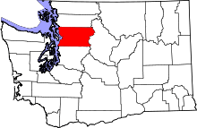 | |
| Towns | ||
| CDPs |
| |
| Other unincorporated communities | ||
| Ghost town | ||
| Indian reservation | ||
| Footnotes | ‡This populated place also has portions in an adjacent county or counties | |
 |
Stanwood | Arlington | Darrington | |
| Tulalip Indian Reservation | |
Granite Falls | ||
| ||||
| | ||||
| Everett | Everett | Lake Stevens |