Franklin County, Washington
| Franklin County, Washington | |
|---|---|
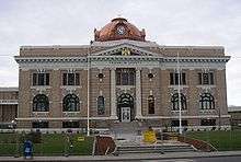 Franklin County Courthouse in Pasco | |
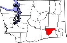 Location in the U.S. state of Washington | |
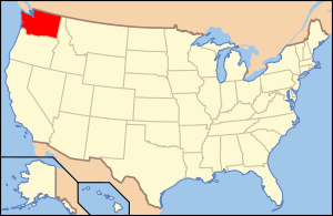 Washington's location in the U.S. | |
| Founded | November 28, 1883 |
| Named for | Benjamin Franklin |
| Seat | Pasco |
| Largest city | Pasco |
| Area | |
| • Total | 1,265 sq mi (3,276 km2) |
| • Land | 1,242 sq mi (3,217 km2) |
| • Water | 23 sq mi (60 km2), 1.8% |
| Population (est.) | |
| • (2015) | 88,807 |
| • Density | 71/sq mi (27/km²) |
| Congressional district | 4th |
| Time zone | Pacific: UTC-8/-7 |
| Website |
www |
Franklin County is a county located in the U.S. state of Washington. As of the 2010 census, its population was 78,163.[1] The county seat and largest city is Pasco.[2] The county was formed out of Whitman County on November 28, 1883[3] and is named for Benjamin Franklin.[4]
Franklin County is included in the Kennewick-Richland, WA Metropolitan Statistical Area.
Geography
According to the U.S. Census Bureau, the county has a total area of 1,265 square miles (3,280 km2), of which 1,242 square miles (3,220 km2) is land and 23 square miles (60 km2) (1.8%) is water.[5]
Geographic features
Major highways
Adjacent counties
- Adams County - north
- Whitman County - east
- Walla Walla County - southeast
- Columbia County - southeast
- Benton County - southwest
- Grant County - northwest
National protected areas
Demographics
| Historical population | |||
|---|---|---|---|
| Census | Pop. | %± | |
| 1890 | 696 | — | |
| 1900 | 486 | −30.2% | |
| 1910 | 5,153 | 960.3% | |
| 1920 | 5,877 | 14.1% | |
| 1930 | 6,137 | 4.4% | |
| 1940 | 6,307 | 2.8% | |
| 1950 | 13,563 | 115.0% | |
| 1960 | 23,342 | 72.1% | |
| 1970 | 25,816 | 10.6% | |
| 1980 | 35,025 | 35.7% | |
| 1990 | 37,473 | 7.0% | |
| 2000 | 49,347 | 31.7% | |
| 2010 | 78,163 | 58.4% | |
| Est. 2015 | 88,807 | [6] | 13.6% |
| U.S. Decennial Census[7] 1790–1960[8] 1900–1990[9] 1990–2000[10] 2010–2015[1] | |||
2000 census
As of the census[11] of 2000, there were 49,347 people, 14,840 households, and 11,604 families residing in the county. The population density was 40 people per square mile (15/km²). There were 16,084 housing units at an average density of 13 per square mile (5/km²). The racial makeup of the county was 61.91% White, 2.49% Black or African American, 0.73% Native American, 1.62% Asian, 0.12% Pacific Islander, 28.98% from other races, and 4.14% from two or more races. 46.67% of the population were Hispanic or Latino of any race. 9.7% were of German, 6.7% United States or American and 6.2% English ancestry. 55.8% spoke English and 41.6% Spanish as their first language.
There were 14,840 households out of which 45.00% had children under the age of 18 living with them, 60.80% were married couples living together, 11.40% had a female householder with no husband present, and 21.80% were non-families. 17.80% of all households were made up of individuals and 7.30% had someone living alone who was 65 years of age or older. The average household size was 3.26 and the average family size was 3.67.
In the year 2000 the population was spread out with 34.60% under the age of 18, 10.90% from 18 to 24, 28.10% from 25 to 44, 17.90% from 45 to 64, and 8.50% who were 65 years of age or older. The median age was 28 years. For every 100 females there were 109.10 males. For every 100 females age 18 and over, there were 108.60 males.
The median income for a household in the county was $38,991, and the median income for a family was $41,967. Males had a median income of $32,209 versus $24,533 for females. The per capita income for the county was $15,459. About 15.50% of families and 19.20% of the population were below the poverty line, including 26.00% of those under age 18 and 7.70% of those age 65 or over.
The 2012 county population is estimated to be 85,845, a 9.8% increase since 2010. This far outpaces Washington State's overall growth of 2.6% over the same time interval, and puts Franklin County among the fastest-growing counties in the nation.
According to the 2007 estimates 11.1% of the population was under 5 years old, 33.6% under 17, and 7.1% over 65. 93.2% of the population consisted of white persons, 2.4% black. American Indian and Alaska Native persons accounted for 0.9%, Asians for 2%, Native Hawaiian and other Pacific Islanders 0.1%. 1.4% of people reported two or more races. Finally, persons of Hispanic or Latino origin accounted for 48.8% while non-Hispanic whites were at 46.0%. 47.7% of the population is female, and 52.3% male.
In 2012 the county contained 25,683 housing units.
2010 census
As of the 2010 United States Census, there were 78,163 people, 23,245 households, and 18,163 families residing in the county.[12] The population density was 62.9 inhabitants per square mile (24.3/km2). There were 24,423 housing units at an average density of 19.7 per square mile (7.6/km2).[13] The racial makeup of the county was 60.5% white, 1.9% black or African American, 1.8% Asian, 0.7% American Indian, 0.1% Pacific islander, 31.8% from other races, and 3.2% from two or more races. Those of Hispanic or Latino origin made up 51.2% of the population.[12] In terms of ancestry, 13.1% were German, 6.8% were English, 6.5% were Irish, and 3.3% were American.[14]
Of the 23,245 households, 49.9% had children under the age of 18 living with them, 57.9% were married couples living together, 13.4% had a female householder with no husband present, 21.9% were non-families, and 16.4% of all households were made up of individuals. The average household size was 3.28 and the average family size was 3.68. The median age was 28.4 years.[12]
The median income for a household in the county was $47,749 and the median income for a family was $52,218. Males had a median income of $40,604 versus $29,517 for females. The per capita income for the county was $18,660. About 16.5% of families and 19.9% of the population were below the poverty line, including 25.6% of those under age 18 and 13.7% of those age 65 or over.[15]
Communities
Cities
Census-designated places
Unincorporated communities
See also
References
- 1 2 "State & County QuickFacts". United States Census Bureau. Retrieved January 7, 2014.
- ↑ "Find a County". National Association of Counties. Retrieved 2011-06-07.
- ↑ "Milestones for Washington State History — Part 2: 1851 to 1900". HistoryLink.org. 2003-03-06.
- ↑ Gannett, Henry (1905). The Origin of Certain Place Names in the United States. Govt. Print. Off. p. 131.
- ↑ "2010 Census Gazetteer Files". United States Census Bureau. August 22, 2012. Retrieved July 5, 2015.
- ↑ "County Totals Dataset: Population, Population Change and Estimated Components of Population Change: April 1, 2010 to July 1, 2015". Retrieved July 2, 2016.
- ↑ "U.S. Decennial Census". United States Census Bureau. Retrieved January 7, 2014.
- ↑ "Historical Census Browser". University of Virginia Library. Retrieved January 7, 2014.
- ↑ "Population of Counties by Decennial Census: 1900 to 1990". United States Census Bureau. Retrieved January 7, 2014.
- ↑ "Census 2000 PHC-T-4. Ranking Tables for Counties: 1990 and 2000" (PDF). United States Census Bureau. Retrieved January 7, 2014.
- ↑ "American FactFinder". United States Census Bureau. Retrieved 2011-05-14.
- 1 2 3 "DP-1 Profile of General Population and Housing Characteristics: 2010 Demographic Profile Data". United States Census Bureau. Retrieved 2016-03-01.
- ↑ "Population, Housing Units, Area, and Density: 2010 - County". United States Census Bureau. Retrieved 2016-03-01.
- ↑ "DP02 SELECTED SOCIAL CHARACTERISTICS IN THE UNITED STATES – 2006-2010 American Community Survey 5-Year Estimates". United States Census Bureau. Retrieved 2016-03-01.
- ↑ "DP03 SELECTED ECONOMIC CHARACTERISTICS – 2006-2010 American Community Survey 5-Year Estimates". United States Census Bureau. Retrieved 2016-03-01.
Further reading
- An illustrated history of the Big Bend country : embracing Lincoln, Douglas, Adams, and Franklin counties, state of Washington. Western Historical Pub. Co. 1904.
- Available online through the Washington State Library's Classics in Washington History collection
External links
- Franklin County, Washington at HistoryLink.org
- Tri-City Regional Chamber of Commerce
 |
Grant County | Adams County | | |
| |
Whitman County | |||
| ||||
| | ||||
| Benton County | Walla Walla County |
Municipalities and communities of Franklin County, Washington, United States | ||
|---|---|---|
| Cities | | |
| CDPs | ||
| Unincorporated communities | ||
| Ghost towns | ||
Coordinates: 46°32′N 118°54′W / 46.54°N 118.90°W