Ferry County, Washington
| Ferry County, Washington | |
|---|---|
 Ferry County Courthouse in Republic | |
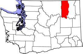 Location in the U.S. state of Washington | |
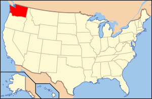 Washington's location in the U.S. | |
| Founded | February 21, 1899 |
| Named for | Elisha P. Ferry |
| Seat | Republic |
| Largest city | Republic |
| Area | |
| • Total | 2,257 sq mi (5,846 km2) |
| • Land | 2,203 sq mi (5,706 km2) |
| • Water | 54 sq mi (140 km2), 2.4% |
| Population (est.) | |
| • (2015) | 7,582 |
| • Density | 3.5/sq mi (1/km²) |
| Congressional district | 5th |
| Time zone | Pacific: UTC-8/-7 |
| Website |
www |
Ferry County is a county located in the U.S. state of Washington. As of the 2010 census, the population was 7,551,[1] making it the fourth-least populous county in Washington. The county seat and largest city is Republic.[2] The county was created out of Stevens County on February 21, 1899[3] and is named for Elisha P. Ferry, the state's first governor.[4]
Geography
According to the U.S. Census Bureau, the county has a total area of 2,257 square miles (5,850 km2), of which 2,203 square miles (5,710 km2) is land and 54 square miles (140 km2) (2.4%) is water.[5] Most of the county is covered by the rugged Kettle River Range, which extends from the Canada–US border at the north, all the way to its southernmost perimeter bounded by the Columbia River and Lake Roosevelt. Only a narrow north–south strip running the length of the county on the west between the San Poil River and the Okanogan County line is covered by the Okanogan Highland. Except for the town of Republic, the county is very sparsely populated.
Geographic features
|
|
|
Major rivers and lakes

- Columbia River
- Kettle River
- Sanpoil River
- Franklin D. Roosevelt Lake, called Lake Roosevelt
- Curlew Lake
- Swan Lake
- Ferry Lake
- Fish Lake
- Long Lake
Adjacent counties
- Stevens County, east
- Lincoln County, southwest
- Okanogan County, west
- Kootenay Boundary Regional District, British Columbia, north
National protected areas
- Pacific Northwest National Scenic Trail (part)
- Colville National Forest (part)
- Lake Roosevelt National Recreation Area (part)
Demographics
| Historical population | |||
|---|---|---|---|
| Census | Pop. | %± | |
| 1900 | 4,562 | — | |
| 1910 | 4,800 | 5.2% | |
| 1920 | 5,143 | 7.1% | |
| 1930 | 4,292 | −16.5% | |
| 1940 | 4,701 | 9.5% | |
| 1950 | 4,096 | −12.9% | |
| 1960 | 3,889 | −5.1% | |
| 1970 | 3,655 | −6.0% | |
| 1980 | 5,811 | 59.0% | |
| 1990 | 6,295 | 8.3% | |
| 2000 | 7,260 | 15.3% | |
| 2010 | 7,551 | 4.0% | |
| Est. 2015 | 7,582 | [6] | 0.4% |
| U.S. Decennial Census[7] 1790–1960[8] 1900–1990[9] 1990–2000[10] 2010–2015[1] | |||
2000 census
As of the census[11] of 2000, there were 7,260 people, 2,823 households, and 1,987 families residing in the county. The population density was 3 inhabitants per square mile (1.2/km2). There were 3,775 housing units at an average density of 2 per square mile (1/km²). The racial makeup of the county was 75.48% White, 0.21% Black or African American, 18.28% Native American, 0.29% Asian, 0.06% Pacific Islander, 2.23% from other races, and 3.46% from two or more races. 2.82% of the population were Hispanic or Latino of any race. 14.1% were of German, 9.5% United States or American, 9.1% Irish, and 7.6% English ancestry. 96.7% spoke English and 1.9% Spanish as their first language.
There were 2,823 households out of which 30.10% had children under the age of 18 living with them, 54.70% were married couples living together, 10.20% had a female householder with no husband present, and 29.60% were non-families. 24.80% of all households were made up of individuals and 9.10% had someone living alone who was 65 years of age or older. The average household size was 2.49 and the average family size was 2.95.
In the county, the population was spread out with 26.90% under the age of 18, 7.60% from 18 to 24, 23.40% from 25 to 44, 29.50% from 45 to 64, and 12.60% who were 65 years of age or older. The median age was 40 years. For every 100 females there were 107.70 males. For every 100 females age 18 and over, there were 105.20 males.
The median income for a household in the county was $30,388, and the median income for a family was $35,691. Males had a median income of $32,103 versus $23,371 for females. The per capita income for the county was $15,019. About 13.30% of families and 19.00% of the population were below the poverty line, including 20.40% of those under age 18 and 10.30% of those age 65 or over.
2010 census
As of the 2010 United States Census, there were 7,551 people, 3,190 households, and 2,070 families residing in the county.[12] The population density was 3.4 inhabitants per square mile (1.3/km2). There were 4,403 housing units at an average density of 2.0 per square mile (0.77/km2).[13] The racial makeup of the county was 76.3% white, 16.7% American Indian, 0.7% Asian, 0.3% black or African American, 0.1% Pacific islander, 1.2% from other races, and 4.8% from two or more races. Those of Hispanic or Latino origin made up 3.4% of the population.[12] In terms of ancestry, 23.0% were German, 18.0% were English, 12.3% were Irish, and 3.7% were American.[14]
Of the 3,190 households, 23.9% had children under the age of 18 living with them, 49.2% were married couples living together, 9.2% had a female householder with no husband present, 35.1% were non-families, and 28.5% of all households were made up of individuals. The average household size was 2.29 and the average family size was 2.75. The median age was 47.3 years.[12]
The median income for a household in the county was $35,485 and the median income for a family was $43,576. Males had a median income of $41,755 versus $30,972 for females. The per capita income for the county was $18,021. About 13.6% of families and 20.8% of the population were below the poverty line, including 24.3% of those under age 18 and 12.4% of those age 65 or over.[15]
Communities
City

- Republic (county seat)
Census-designated places
Unincorporated communities
See also
- Ansorge Hotel
- Ferry County Carousel
- National Register of Historic Places listings in Ferry County, Washington
- Stonerose Interpretive Center and Fossil Site
References
- 1 2 "State & County QuickFacts". United States Census Bureau. Retrieved January 7, 2014.
- ↑ "Find a County". National Association of Counties. Retrieved 2011-06-07.
- ↑ "Milestones for Washington State History — Part 2: 1851 to 1900". HistoryLink.org. 2003-03-06.
- ↑ Gannett, Henry (1905). The Origin of Certain Place Names in the United States. Govt. Print. Off. p. 125.
- ↑ "2010 Census Gazetteer Files". United States Census Bureau. August 22, 2012. Retrieved July 5, 2015.
- ↑ "County Totals Dataset: Population, Population Change and Estimated Components of Population Change: April 1, 2010 to July 1, 2015". Retrieved July 2, 2016.
- ↑ "U.S. Decennial Census". United States Census Bureau. Retrieved January 7, 2014.
- ↑ "Historical Census Browser". University of Virginia Library. Retrieved January 7, 2014.
- ↑ "Population of Counties by Decennial Census: 1900 to 1990". United States Census Bureau. Retrieved January 7, 2014.
- ↑ "Census 2000 PHC-T-4. Ranking Tables for Counties: 1990 and 2000" (PDF). United States Census Bureau. Retrieved January 7, 2014.
- ↑ "American FactFinder". United States Census Bureau. Retrieved 2011-05-14.
- 1 2 3 "DP-1 Profile of General Population and Housing Characteristics: 2010 Demographic Profile Data". United States Census Bureau. Retrieved 2016-03-01.
- ↑ "Population, Housing Units, Area, and Density: 2010 - County". United States Census Bureau. Retrieved 2016-03-01.
- ↑ "DP02 SELECTED SOCIAL CHARACTERISTICS IN THE UNITED STATES – 2006-2010 American Community Survey 5-Year Estimates". United States Census Bureau. Retrieved 2016-03-01.
- ↑ "DP03 SELECTED ECONOMIC CHARACTERISTICS – 2006-2010 American Community Survey 5-Year Estimates". United States Census Bureau. Retrieved 2016-03-01.
Further reading
- An illustrated history of Stevens, Ferry, Okanogan and Chelan counties, State of Washington. Western Historical Pub. Co. 1904.Available online through the Washington State Library's Classics in Washington History collection
External links
- Ferry County, Washington at HistoryLink.org
- Official website of Ferry County Government
- SummitPost.org, Kettle River Range (Washington State)
- Ferry County, Washington at DMOZ
 |
|
| ||
| Okanogan County | |
Stevens County | ||
| ||||
| | ||||
| Lincoln County |
Municipalities and communities of Ferry County, Washington, United States | ||
|---|---|---|
| City | | |
| CDPs | ||
| Other unincorporated communities | ||
| Indian reservation | ||
| Footnotes | ‡This populated place also has portions in an adjacent county or counties | |
Coordinates: 48°28′N 118°31′W / 48.47°N 118.51°W