Windsor, Missouri
| Windsor, Missouri | |
|---|---|
| City | |
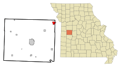 Location of Windsor, Missouri | |
| Coordinates: 38°31′56″N 93°31′24″W / 38.53222°N 93.52333°WCoordinates: 38°31′56″N 93°31′24″W / 38.53222°N 93.52333°W | |
| Country | United States |
| State | Missouri |
| Counties | Henry, Pettis |
| Area[1] | |
| • Total | 2.45 sq mi (6.35 km2) |
| • Land | 2.42 sq mi (6.27 km2) |
| • Water | 0.03 sq mi (0.08 km2) |
| Elevation | 912 ft (278 m) |
| Population (2010)[2] | |
| • Total | 2,901 |
| • Estimate (2012[3]) | 2,863 |
| • Density | 1,198.8/sq mi (462.9/km2) |
| Time zone | Central (CST) (UTC-6) |
| • Summer (DST) | CDT (UTC-5) |
| ZIP code | 65360 |
| Area code(s) | 660 |
| FIPS code | 29-80350[4] |
| GNIS feature ID | 0729832[5] |
| Website | http://www.windsormo.org/ |
Windsor is a city in Henry and Pettis Counties, Missouri. The population was 2,893 at the 2010 census.
History
Windsor was laid out in 1855, and originally known as Belmont.[6] Its named was changed to Windsor in 1859, after Windsor Castle, in England.[7] A post office called Windsor has been in operation since 1850.[8]
Geography
Windsor is located at 38°31′56″N 93°31′24″W / 38.53222°N 93.52333°W (38.532198, -93.523212).[9] According to the United States Census Bureau, the city has a total area of 2.45 square miles (6.35 km2), of which, 2.42 square miles (6.27 km2) is land and 0.03 square miles (0.08 km2) is water.[1]
Demographics
| Historical population | |||
|---|---|---|---|
| Census | Pop. | %± | |
| 1880 | 872 | — | |
| 1890 | 1,427 | 63.6% | |
| 1900 | 1,502 | 5.3% | |
| 1910 | 2,241 | 49.2% | |
| 1920 | 2,034 | −9.2% | |
| 1930 | 1,879 | −7.6% | |
| 1940 | 2,373 | 26.3% | |
| 1950 | 2,429 | 2.4% | |
| 1960 | 2,714 | 11.7% | |
| 1970 | 2,778 | 2.4% | |
| 1980 | 3,058 | 10.1% | |
| 1990 | 3,044 | −0.5% | |
| 2000 | 3,087 | 1.4% | |
| 2010 | 2,901 | −6.0% | |
| Est. 2015 | 2,808 | [10] | −3.2% |
| U.S. Decennial Census | |||
2010 census
As of the census[2] of 2010, there were 2,901 people, 1,193 households, and 781 families residing in the city. The population density was 1,198.8 inhabitants per square mile (462.9/km2). There were 1,381 housing units at an average density of 570.7 per square mile (220.3/km2). The racial makeup of the city was 96.8% White, 0.1% African American, 1.1% Native American, 0.2% Asian, 0.2% Pacific Islander, 0.1% from other races, and 1.4% from two or more races. Hispanic or Latino of any race were 2.0% of the population.
There were 1,193 households of which 31.3% had children under the age of 18 living with them, 48.4% were married couples living together, 12.4% had a female householder with no husband present, 4.7% had a male householder with no wife present, and 34.5% were non-families. 29.6% of all households were made up of individuals and 13.1% had someone living alone who was 65 years of age or older. The average household size was 2.39 and the average family size was 2.94.
The median age in the city was 38.2 years. 24.8% of residents were under the age of 18; 8.2% were between the ages of 18 and 24; 24.9% were from 25 to 44; 23.4% were from 45 to 64; and 18.8% were 65 years of age or older. The gender makeup of the city was 47.5% male and 52.5% female.
2000 census
As of the census[4] of 2000, there were 3,087 people, 1,280 households, and 848 families residing in the city. The population density was 1,310.5 people per square mile (505.0/km²). There were 1,418 housing units at an average density of 602.0 per square mile (232.0/km²). The ethnical makeup of the city was 97.02% White, 0.52% African American, 0.65% Native American, 0.26% Asian, 0.36% from other races, and 1.20% from two or more ethnicities. Hispanic or Latino of any ethnicity were 0.52% of the population.
There were 1,280 households out of which 30.7% had children under the age of 18 living with them, 52.0% were married couples living together, 10.5% had a female householder with no husband present, and 33.7% were non-families. 29.5% of all households were made up of individuals and 16.2% had someone living alone who was 65 years of age or older. The average household size was 2.38 and the average family size was 2.91.
In the city the population was spread out with 25.3% under the age of 18, 8.4% from 18 to 24, 26.8% from 25 to 44, 20.1% from 45 to 64, and 19.5% who were 65 years of age or older. The median age was 38 years. For every 100 females there were 88.5 males. For every 100 females age 18 and over, there were 84.4 males.
The median income for a household in the city was $29,922, and the median income for a family was $32,477. Males had a median income of $27,986 versus $19,605 for females. The per capita income for the city was $16,052. About 16.5% of families and 16.5% of the population were below the poverty line, including 18.0% of those under age 18 and 19.7% of those age 65 or over.
Education
Windsor is within the Henry County R-1 School District. It has an elementary school, and a junior and senior high school.
Notable people
- Charles Stark Draper, American scientist and engineer, founder of the Charles Stark Draper Laboratory, born in Windsor[11]
- Helen Duhamel (1904–1991), Rapid City, South Dakota, businesswoman and broadcaster, born in Windsor[12][13]
- Winfred J. Sanborn, Los Angeles, California, City Council member, born in or near Windsor
References
- 1 2 "US Gazetteer files 2010". United States Census Bureau. Retrieved 2012-07-08.
- 1 2 "American FactFinder". United States Census Bureau. Retrieved 2012-07-08.
- ↑ "Population Estimates". United States Census Bureau. Retrieved 2013-05-30.
- 1 2 "American FactFinder". United States Census Bureau. Retrieved 2008-01-31.
- ↑ "US Board on Geographic Names". United States Geological Survey. 2007-10-25. Retrieved 2008-01-31.
- ↑ "Henry County Place Names, 1928–1945 (archived)". The State Historical Society of Missouri. Retrieved 6 October 2016.
- ↑ Eaton, David Wolfe (1916). How Missouri Counties, Towns and Streams Were Named. The State Historical Society of Missouri. p. 172.
- ↑ "Post Offices". Jim Forte Postal History. Retrieved 6 October 2016.
- ↑ "US Gazetteer files: 2010, 2000, and 1990". United States Census Bureau. 2011-02-12. Retrieved 2011-04-23.
- ↑ "Annual Estimates of the Resident Population for Incorporated Places: April 1, 2010 to July 1, 2015". Retrieved July 2, 2016.
- ↑ http://www.nasonline.org/publications/biographical-memoirs/memoir-pdfs/draper-charles.pdf
- ↑ Switzer, Mary Kay (2004). Sterling, Christopher H., ed. The Museum of Broadcast Communications Encyclopedia of Radio Vol 1: Entries A-E. New York: Fitzroy Dearborn. p. 813. ISBN 978-1-57958-431-3.
- ↑ "Helen Duhamel: Hall of Fame 1992". Nebraska Broadcasters’ Association Hall of Fame. Omaha, Nebraska: Nebraska Broadcasters’ Association. 1992. Retrieved April 10, 2012.
External links
- Windsor Chamber of Commerce
- Windsor Slideshow and Data
- Historic maps of Windsor in the Sanborn Maps of Missouri Collection at the University of Missouri
Municipalities and communities of Henry County, Missouri, United States | ||
|---|---|---|
| Cities |  | |
| Villages | ||
| Townships | ||
| CDP | ||
| Other unincorporated communities | ||
| Ghost town | ||
| Footnotes | ‡This populated place also has portions in an adjacent county or counties | |
Municipalities and communities of Pettis County, Missouri, United States | ||
|---|---|---|
| Cities | 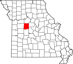 | |
| Villages | ||
| Townships |
| |
| Unincorporated communities | ||
| Ghost towns | ||
| Footnotes | ‡This populated place also has portions in an adjacent county or counties | |