Bollinger County, Missouri
| Bollinger County, Missouri | |
|---|---|
|
Bollinger County Courthouse, April 2014 | |
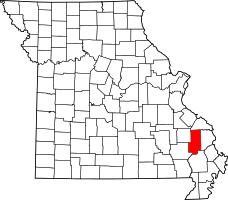 Location in the U.S. state of Missouri | |
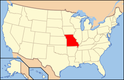 Missouri's location in the U.S. | |
| Founded | March 1, 1851 |
| Named for | George Frederick Bollinger |
| Seat | Marble Hill |
| Largest city | Marble Hill |
| Area | |
| • Total | 621 sq mi (1,608 km2) |
| • Land | 618 sq mi (1,601 km2) |
| • Water | 3.3 sq mi (9 km2), 0.5% |
| Population (est.) | |
| • (2015) | 12,182 |
| • Density | 20/sq mi (8/km²) |
| Congressional district | 8th |
| Time zone | Central: UTC-6/-5 |

Bollinger County is a county located in the southeastern part of the U.S. state of Missouri. As of the 2010 census, the county's population was 12,363.[1] The county seat is Marble Hill.[2] The county was officially organized in 1851.
Bollinger County is part of the Cape Girardeau, MO-IL Metropolitan Statistical Area. The county is the home of the Missouri dinosaur and Blue Pond, the deepest natural pond in Missouri, is located in the southern portion of the county.
History
Sixty million years ago, dinosaurs roamed the area that would eventually become known as Bollinger County. The "Missouri Dinosaur," a hadrosaur (duck-billed), was discovered at a dig near Glen Allen. It has produced bones from different dinosaurs and aquatic species.
The county was named after George Frederick Bollinger,[3] who persuaded 20 other families to leave North Carolina in the fall of 1799 and settle in a region immediately west of what is now Cape Girardeau, Missouri. To acquire the land, Bollinger first had to sign off a document asserting that he and his fellow settlers were all Roman Catholics. In reality, most of the group were members of the German Reformed Church and none were actually Catholic. However, Don Louis Lorimier, the Spanish Land Commandant of Cape Girardeau, had been impressed by Bollinger on an earlier visit and decided to bend the rules for him and his fellow settlers.
Making the journey from North Carolina with Bollinger were his brothers John, Daniel, and Mathias Bollinger and two nephews, Mann Henry Bollinger and William Bollinger. Several friends also joined the expedition including brothers George and Peter Grount (Grounds) along with Peter's young son Daniel Grount, brothers Peter and Conrad Statler, Joseph Neyswanger, Peter Crytes, Jacob Cotner, John and Isaac Miller, Frederick Limbaugh, Leonard Welker and Frederick Slinkard. Also with him family of Johannes Caspar Shell; Michael, Caspar and Benjamin Shell. Benjamin Shell later married George's sister Elizabeth in Cape Girardeau in 1807. All had immigrated with their families from Germany in the early 18th century and later migrated down the Shenandoah Valley into North Carolina by the late 18th century.
Lorimier's willingness to place German Reformed settlers west of Cape Girardeau is somewhat perplexing given his earlier role in placing a group of Shawnee settlers in that same location. Lorimier had intimate ties to the Shawnee group. His wife, Charlotte Bougainville of Ohio, was half French and half Shawnee. In Pickawillany, Ohio, Lorimier had supported the British and had led Shawnee and Delaware Indian raids against the growing American presence there. His raids had led to an attempt by George Rogers Clark to exterminate the French and Shawnee population at Pickawillany. Lorimier survived and fled to Spanish territory, where he eventually became the Spanish Land Commandant. With Lorimier's help, Shawnee tribe members from Ohio were granted the right by the Spanish in 1793 to take up residence in the land to the west of Cape Girardeau.[4] By that time the earlier indigenous tribes of that area were no longer present, presumably due to their lack of resistance to European diseases such as measles and smallpox that had been carried in earlier by European traffic and settlement along the Mississippi River. Despite Lorimier's historically protective role of the Shawnee group, the Shawnee appear to have been viewed with distrust by many of the inhabitants of Cape Girardeau.
The Bollinger-led group of German Reformed families moved into the area in January 1800, crossing their wagons over the Mississippi River after an unusually cold stretch of weather had frozen the surface all the way across. Meanwhile, ownership of the region shifted in quick succession from Spain to France and then in 1803 to the United States via the Louisiana Purchase.
The change in national ownership did not bode well for the earlier Shawnee settlers. In 1825 they were removed permanently when the U.S. government enacted the treaty with the Shawnee in 1825.[5] This treaty, whose first signatory was William Clark of the Lewis and Clark Expedition fame, required that the Shawnee move to what is now known as Shawnee Mission, Kansas, on land that had previously belonged to the Osage tribes. The Osage tribe was the major Native American influence at the time of European settlement. By the 1830s most of the Native Americans were displaced by white settlers. One of the Cherokee Trail of Tears routes passed through Sedgewickville while another route passed through Glennon and Zalma.
The region west of Cape Girardeau was organized as a county in 1851 and named Bollinger County in honor of George Frederick Bollinger. In the next county to the west, Madison County, the settlement of Fredericktown was also named after George Frederick Bollinger.
Geography
According to the U.S. Census Bureau, the county has a total area of 621 square miles (1,610 km2), of which 618 square miles (1,600 km2) is land and 3.3 square miles (8.5 km2) (0.5%) is water.[6] The county's terrain ranges from the Mississippi Delta flatlands in the south to the Ozark Hills in the north.
Adjacent counties
- Perry County (north)
- Cape Girardeau County (east)
- Stoddard County (south)
- Wayne County (southwest)
- Madison County (northwest)
Major highways
National protected area
- Mark Twain National Forest (part)
Demographics
| Historical population | |||
|---|---|---|---|
| Census | Pop. | %± | |
| 1860 | 7,371 | — | |
| 1870 | 8,162 | 10.7% | |
| 1880 | 11,130 | 36.4% | |
| 1890 | 13,121 | 17.9% | |
| 1900 | 14,650 | 11.7% | |
| 1910 | 14,576 | −0.5% | |
| 1920 | 13,909 | −4.6% | |
| 1930 | 12,269 | −11.8% | |
| 1940 | 12,898 | 5.1% | |
| 1950 | 11,019 | −14.6% | |
| 1960 | 9,167 | −16.8% | |
| 1970 | 8,820 | −3.8% | |
| 1980 | 10,301 | 16.8% | |
| 1990 | 10,619 | 3.1% | |
| 2000 | 12,029 | 13.3% | |
| 2010 | 12,363 | 2.8% | |
| Est. 2015 | 12,182 | [7] | −1.5% |
| U.S. Decennial Census[8] 1790-1960[9] 1900-1990[10] 1990-2000[11] 2010-2015[1] | |||
As of the census[12] of 2000, there were 12,029 people, 4,576 households, and 3,464 families residing in the county. The population density was 19 people per square mile (7/km²). There were 5,522 housing units at an average density of 9 per square mile (3/km²). The racial makeup of the county was 97.79% White, 0.72% Native American, 0.22% Asian, 0.21% Black or African American, 0.13% from other races, and 0.93% from two or more races. Approximately 0.57% of the population were Hispanic or Latino of any race.
There were 4,576 households out of which 34.30% had children under the age of 18 living with them, 63.80% were married couples living together, 8.40% had a female householder with no husband present, and 24.30% were non-families. 21.60% of all households were made up of individuals and 10.50% had someone living alone who was 65 years of age or older. The average household size was 2.59 and the average family size was 3.00.
In the county the population was spread out with 26.20% under the age of 18, 7.80% from 18 to 24, 26.80% from 25 to 44, 24.50% from 45 to 64, and 14.80% who were 65 years of age or older. The median age was 38 years. For every 100 females there were 97.90 males. For every 100 females age 18 and over, there were 95.80 males.
The median income for a household in the county was $36,744, and the median income for a family was $42,948. Males had a median income of $26,078 versus $17,588 for females. The per capita income for the county was $16,387. About 10.90% of families and 13.80% of the population were below the poverty line, including 15.40% of those under age 18 and 17.40% of those age 65 or over.
Bollinger County is a predominantly youthful community. According to the Economic Development Intelligence System (EDIS),[13] as of 2007, 25.5% of the total population was aged 0–19, 12.5% was aged 20–29, 12.3% was aged 30–39, 14.9% was aged 40–49, 13.9% was aged 50–59, and 20.8% of the total population was aged 60 and over in Bollinger County.
In Bollinger County, 99.6% of all residents were born in the United States. Of these American-born citizens in the county, 81.28% were born in Missouri, 7.71% were born elsewhere in the Midwest, 7.32% were born in the South, 2.81% were born in the Inner Mountain or Pacific West, and 0.89% were born in the Northeast or New England region of the country.[13]
In Bollinger County, 48 residents (0.4%) are foreign-born, which is lower than the Missouri state average of 2.7%. Of all foreign-born residents in Bollinger County, 40% were born in Germany, 13% in Yugoslavia, 13% in the Philippines, 13% in Canada, 6% in Chile, 4% in the Netherlands, and another 4% was born somewhere else in Europe.[13]
The most commonly reported first ancestries in Bollinger County were 34% German, 24% United States or American, 10% Irish, 9% English, 3% Dutch, 2% French (excluding Basque), and 1% Scottish.[13]
Religion
According to the Association of Religion Data Archives County Membership Report (2010), most residents (60.66%) in Bollinger County do not adhere to a religion.
Among those who do adhere to a religion (39.34%), the majority of Bollinger County residents' religious affiliations are:
- 58.31% Evangelical Protestantism
- 25.19% Catholicism
- 16.49% Mainline Protestantism
The main religious families among all adherents in Bollinger County are:
- 44.74% Baptists
- 25.19% Catholics
- 14.76% Methodists
- 7.59% Nondenominationals
- 4.21% Lutherans
Economy
Like many rural areas, the standard of living in Bollinger County is significantly lower than many other places. In 2008, the cost of living index in Bollinger County was low (76.0) compared to the U.S. average of 100. The unemployment rate in Bollinger County is also lower than the state and national levels. According to the U.S. Bureau of Labor Statistics (BLS), the October 2008 unemployment rate in the United States was 6.7 percent whereas in Missouri it was 6.5 percent. According to economic research compiled by the Federal Reserve Bank of St. Louis, the October 2008 unemployment rate in Bollinger County was 5.6 percent.[14]
The most common industries providing employment in Bollinger County consist of manufacturing (25.5%), educational, health and social services (14.7%), construction (12.3%), and retail trade (10.8%) while other kinds of industries account for the rest (36.7%). The most common industries for males in Bollinger County are construction (20%), agriculture, forestry, fishing and/or hunting (8%), truck transportation (5%), transportation equipment (5%), metal and metal products (4%), repair and maintenance (4%), and paper (4%). The most common occupations for males in the county included driving/sales workers and truck drivers (9%), other production occupations including supervisors (8%), electrical equipment mechanics and other installation, maintenance and repair occupations including supervisors (6%), vehicle and mobile equipment mechanics, installers and repairers (6%), metal and plastic workers (6%), carpenters (5%), and hand-laborers and material movers (5%). For females, the most common industries are health care (16%), educational services (9%), apparel (8%), accommodation and food services (6%), finance and insurance (4%), public administration (4%), and metal and metal products (4%). The most common occupations for females includes other production occupations including supervisors (9%), textile, apparel and furnishings workers (8%), secretaries and administrative assistants (6%), other sales and related workers including supervisors (4%), building and grounds cleaning and maintenance occupations (4%), other office and administrative support workers including supervisors (3%), and retail sales workers not including cashiers (3%).
A majority of employees in Bollinger County (78%) receive a private wage or salary, 10% work in public or government jobs, 11% is self-employed while another 1% performs some sort of unpaid family work. A majority of workers in the county (76%) drive their own cars to work, 16% carpools, 5% works at home, 2% walks, 1% takes a bus or trolley bus, and less than 1 percent rides to work on a motorcycle or uses some other form of transportation.
Agriculture
Like it is in many rural areas, agriculture and farming plays a critical role in the economy of Bollinger County. The average size of a farm in the county is 250 acres (1 km2). The average value of agricultural products sold per farm was $21,451 while the average total farm production expenses per farm was $19,413. The average market value of all machinery and equipment per farm was $36,801 and 31.69% of land in farms consisted of harvested croplands. In the county, 93.65% of all farms were operated by a family or one individual. The average age of the principal farm owner in the county was 56 years old. The average number of cattle and calves per 100 acres (0.40 km2) of all land in farms in the county was 14.10 while 0.61% of all cattle and cows were used for milking. There were 33 acres (130,000 m2) of land in orchards in Bollinger County. The most common crops are soybeans for beans with 20,279 acres (82 km2) harvested, corn for grain with 10,057 acres (41 km2) harvested, and all wheat for grain with 2,857 acres (12 km2) harvested.
Education
As of 2007, 70.7% of residents 25 years of age and older in Bollinger County had a high school diploma or higher as their highest educational attainment while 6.9% had a bachelor's degree or higher.
Public schools
- Leopold R-III School District — Leopold
- Leopold Elementary School (K-06)
- Leopold High School (07-12)
- Meadow Heights R-II School District — Patton
- Meadow Heights Elementary School (PK-06)
- Meadow Heights High School (07-12)
- Woodland R-IV School District — Marble Hill
- Woodland Elementary School (K-04)
- Woodland Middle School (05-08)
- Woodland High School (09-12)
- Zalma R-V School District — Zalma
- Zalma Elementary School (K-06)
- Zalma High School (07-12)
Crime
Although it is not as prevalent in Bollinger County as it is in more urban areas, the county is not immune from crime. As reported by the Bollinger County Sheriff's Department, there were no murders, six rapes, no robberies, 44 assaults, 54 burglaries, 84 thefts, and three auto thefts reported in the county in 2004–2005.
While Missouri has the notorious reputation as the state with the most methamphetamine lab busts in the United States, the number of lab incidents in Bollinger County is significantly lower and basically nonexistent when compared to the regional and statewide average. According to the Missouri State Highway Patrol, there were no methamphetamine lab busts reported in Bollinger County in 2008.[15]
A growing concern among residents in Bollinger County, however, is underage drinking and driving while intoxicated.
Climate and weather
Missouri generally has a humid continental climate with cool to cold winters and long, hot summers. Due to its location in the interior United States, Missouri often experiences extremes in temperatures. Not having either large mountains or oceans nearby to moderate its temperature, its climate is alternately influenced by air from the cold Arctic and the hot and humid Gulf of Mexico. In the southern part of the state, particularly in the Bootheel, the climate borders on a humid subtropical climate. Therefore, Bollinger County, which is located above the Bootheel, can be said to have more of a humid continental climate sometimes influenced by a humid subtropical climate. Average temperatures in Bollinger County range from 22 °F (−6 °C) in January to 89 °F (32 °C) in July. According to Weather.com, some weather facts about Bollinger County include the following:
- On average, the warmest month in Bollinger County is July.
- The highest recorded temperature in Bollinger County was 108 °F (42 °C) in 1954.
- January is the average coolest month in Bollinger County.
- The lowest recorded temperature in Bollinger County was −27 °F (−33 °C) in 1951.
- The maximum average precipitation in Bollinger County occurs in March (4.91 inches).
The historical area-adjusted tornado activity in Bollinger County is near the Missouri state average but is 1.7 times above the U.S. national average. Tornadoes in the county have caused one fatality and 24 injuries recorded between 1950 and 2004. On April 27, 2002, an F3 tornado with maximum wind speeds of 158-206 mph killed a teenage boy in between Hahn and Marble Hill and injured 16 people and caused $4 million in damages.
Politics
Local
| Bollinger County, Missouri | ||||
|---|---|---|---|---|
| Elected countywide officials | ||||
| Assessor | Ronda Elfrink | Republican | ||
| Circuit Clerk | Jeaneal Vandeven | Republican | ||
| County Clerk | Diane H. Holzum | Republican | ||
| Collector | Bob Anderson | Democratic | ||
| Commissioner (Presiding) |
Travis M. Elfrink | Republican | ||
| Commissioner (District 1) |
James Null | Republican | ||
| Commissioner (District 2) |
Steve Jordan | Republican | ||
| Coroner | Charles Hutchings | Republican | ||
| Prosecuting Attorney | Stephen P. Gray | Republican | ||
| Public Administrator | Larry L. Welker | Republican | ||
| Recorder | Dana Fulbright | Republican | ||
| Sheriff | Darin Shell | Republican | ||
| Surveyor | John W. Reilly | Democratic | ||
| Treasurer | Naomi Null | Republican | ||
The Republican Party predominantly controls politics at the local level in Bollinger County. Republicans hold all but two of Bollinger County’s elected positions.
State
All of Bollinger County is represented in the Missouri House of Representatives by Republican Shelley Keeney and in the Missouri Senate by Republican Wayne Wallingford.
| Year | Republican | Democratic | Third Parties |
|---|---|---|---|
| 2012 | 57.48% 3,114 | 39.53% 2,142 | 2.99% 162 |
| 2008 | 56.05% 3,232 | 42.06% 2,425 | 1.89% 109 |
| 2004 | 67.25% 3,902 | 31.76% 1,843 | 0.98% 57 |
| 2000 | 61.76% 3,190 | 36.98% 1,910 | 1.26% 65 |
| 1996 | 47.96% 2,372 | 51.11% 2,528 | 0.93% 46 |
| 1992 | 55.01% 2,867 | 44.99% 2,345 | 0.00% 0 |
| 1988 | 63.63% 2,930 | 36.31% 1,672 | 0.07% 3 |
| 1984 | 59.10% 2,754 | 40.90% 1,906 | 0.00% 0 |
| 1980 | 51.93% 2,641 | 48.01% 2,442 | 0.06% 3 |
| 1976 | 48.68% 2,338 | 51.32% 2,465 | 0.00% 0 |
| 1972 | 50.62% 2,521 | 49.14% 2,447 | 0.24% 12 |
| 1968 | 45.55% 2,021 | 54.45% 2,416 | 0.00% 0 |
| 1964 | 44.21% 2,130 | 55.79% 2,688 | 0.00% 0 |
| 1960 | 55.02% 2,637 | 44.98% 2,156 | 0.00% 0 |
Federal
Bollinger County is represented in the U.S. Senate by Democrat Claire McCaskill Republican Roy Blunt.
All of Bollinger County is included in Missouri's 8th Congressional District in the U.S. House of Representatives and is represented by Republican Jason T. Smith.
Political culture
| Statewide Election Results | ||
|---|---|---|
| Year | Office | Results |
| 2012 | President | Romney 75.05% — 22.23% Obama |
| U.S. Senator | Akin 55.94% — 38.67% McCaskill | |
| Governor | Spence 57.48% — 39.53% Nixon | |
| Lt. Governor | Kinder 70.92% — 24.27% Montee | |
| Secretary of State | Schoeller 65.84% — 30.00% Kander | |
| State Treasurer | McNary 64.11% — 31.52% Zweifel | |
| Attorney General | Martin 57.40% — 38.72% Koster | |
| 2010 | U.S. Senator | Blunt 70.29% — 24.60% Carnahan |
| State Auditor | Schweich 65.69% — 26.41% Montee | |
| 2008 | President | McCain 68.67% — 29.22% Obama |
| Governor | Hulshof 56.05% — 42.06% Nixon | |
| Lt. Governor | Kinder 68.34% — 29.41% Page | |
| Secretary of State | Hubbard 49.09% — 48.51% Carnahan | |
| State Treasurer | Lager 64.26% — 33.20% Zweifel | |
| Attorney General | Gibbons 58.31% — 41.69% Koster | |
| 2006 | U.S. Senator | Talent 60.79% — 35.27% McCaskill |
| State Auditor | Thomas 55.17% — 40.16% Montee | |
| 2004 | President | Bush 69.58% — 29.75% Kerry |
| U.S. Senator | Bond 71.77% — 27.49% Farmer | |
| Governor | Blunt 67.25% — 31.76% McCaskill | |
| Lt. Governor | Kinder 65.86% — 32.91% Cook | |
| Secretary of State | Hanaway 62.62% — 35.63% Carnahan | |
| State Treasurer | Steelman 61.84% — 34.59% Powell | |
| Attorney General | Byrd 55.31% — 43.21% Nixon | |
Bollinger County is a Republican stronghold at the presidential level. No Democrat has won Bollinger County since Jimmy Carter in 1976. Since then, voters in the county have consistently (and often decisively) backed Republican presidential nominees. Former Republican Governor of Massachusetts Mitt Romney carried Bollinger County by a three-to-one margin in 2012, the largest margin of victory in the county for any presidential nominee in over 40 years.
Like most rural areas, Bollinger County in general strongly supports socially and culturally conservative principles and therefore predominantly vote Republican. In 2004, Missourians voted on a constitutional amendment to define marriage as the union between a man and a woman—it overwhelmingly passed Bollinger County with 88.78 percent of the vote. The initiative passed the state with 71 percent of support from voters as Missouri became the first state to ban marriage equality. In 2006, Missourians voted on a constitutional amendment to fund and legalize embryonic stem cell research in the state—it failed in Bollinger County with 67.72 percent voting against the measure. The initiative narrowly passed the state with 51 percent of support from voters as Missouri became one of the first states in the nation to approve embryonic stem cell research. Despite Bollinger County’s longstanding tradition of supporting socially conservative platforms, voters in the county have a penchant for advancing populist causes like increasing the minimum wage. In 2006, Missourians voted on a proposition (Proposition B) to increase the minimum wage in the state to $6.50 an hour—it passed Bollinger County with 66.71 percent of the vote. The proposition strongly passed every single county in Missouri with 75.94 percent voting in favor as the minimum wage was increased to $6.50 an hour in the state. During the same election, voters in five other states also strongly approved increases in the minimum wage.
| Year | Republican | Democratic | Third Parties |
|---|---|---|---|
| 2016 | 85.15% 4,827 | 12.44% 705 | 2.41% 137 |
| 2012 | 75.05% 4,094 | 22.24% 1,213 | 2.71% 148 |
| 2008 | 68.67% 3,972 | 29.22% 1,690 | 2.11% 122 |
| 2004 | 69.58% 4,102 | 29.75% 1,754 | 0.66% 39 |
| 2000 | 65.87% 3,487 | 31.96% 1,692 | 2.17% 115 |
| 1996 | 47.95% 2,420 | 40.50% 2,044 | 11.55% 583 |
| 1992 | 42.68% 2,289 | 40.09% 2,150 | 16.95% 909 |
| 1988 | 58.94% 2,710 | 40.95% 1,883 | 0.11% 5 |
| 1984 | 59.09% 2,778 | 40.91% 1,923 | 0.00% 0 |
| 1980 | 56.08% 2,863 | 42.31% 2,160 | 1.61% 82 |
| 1976 | 43.46% 2,113 | 56.36% 2,740 | 0.19% 9 |
| 1972 | 62.80% 3,069 | 37.20% 1,818 | 0.00% 0 |
| 1968 | 50.08% 2,283 | 37.14% 1,693 | 12.79% 583 |
| 1964 | 43.22% 2,125 | 56.78% 2,792 | 0.00% 0 |
| 1960 | 59.86% 2,886 | 40.14% 1,935 | 0.00% 0 |
Missouri Presidential Preference Primary (2008)
Voters in Bollinger County from both political parties supported candidates who finished in second place in the state at large and nationally.
- Hillary Rodham Clinton received more votes, a total of 971, than any candidate from either party in Bollinger County during the 2008 presidential primary. Bollinger County was Clinton's sixth strongest county in Missouri.
| Bollinger County, Missouri | ||
|---|---|---|
| 2008 Republican primary in Missouri | ||
| John McCain | 518 (31.32%) | |
| Mike Huckabee | 657 (39.72%) | |
| Mitt Romney | 384 (23.22%) | |
| Ron Paul | 65 (3.93%) | |
| Bollinger County, Missouri | ||
|---|---|---|
| 2008 Democratic primary in Missouri | ||
| Hillary Clinton | 971 (74.12%) | |
| Barack Obama | 293 (22.37%) | |
| John Edwards (withdrawn) | 38 (2.90%) | |
Attractions
A part of Missouri's River Heritage Region, Bollinger County has several historical points of interest:
- The Bollinger County Museum of Natural History, located in Marble Hill, houses a growing collection of natural history specimens and Native American artifacts from Missouri and other artifacts from around the world.[16] The museum is home to "the Missouri dinosaur"
- The Massey Log House, built in 1869, located in Marble Hill
- The Alma Fisher One-Room School in Marble Hill
- The Cat Ranch Art Guild,[17] a non-profit organization dedicated to promoting the arts in the county, is located in Marble Hill. It was started in memory of Tom Runnels, a local artist, sculptor and writer who died of brain cancer on September 3, 2000. The Guild's name is taken from Tom and his wife Saundra Runnels's property, which is called The Cat Ranch.
- St. John's Catholic Church in Leopold has one of the oldest pipe organs west of the Mississippi River.[18]
Communities
City
Villages
Unincorporated communities
- Alliance - Previously known as Bristol and also known as Jugtown, it is located on County Road 214 north of Patton about a mile off Highway 51. The Alliance Post Office was in existence from November 13, 1889 – December 31, 1953.
- Arab
- Bessville - Located at the end of Route OO northwest of Glen Allen, there once was a station here on the Belmont Branch Railroad. Bessville is named after the Bess family, including Sam Bess (who was the owner of the very first store here) and Levi Bess, the first postmaster of the post office that was in existence in Bessville from July 25, 1856 – March 21, 1864 and then again from April 6, 1871 – April 30, 1955.
- Buchanan, Missouri - Located on Route Y south of Highway 51 near Castor River. It is named after President James Buchanan, the first person for whom Postmaster Washington A. McMinn voted.
- Dongola - Located on Highway 51 just west of the Highway 91 intersection, it was destroyed by a tornado on May 30, 1917 and never recovered. Dongola is still intact today, though.
- Drum - Founded in 1893 by John W. Laird, Drum is located just south of the Route T and Route F intersection east of Glennon. It was named after State Senator Richard Drum (R-Marble Hill).
- Gipsy
- Glennon - Located at the intersection of Route T and Route AB, it is named after Archbishop John Glennon, who gave permission to establish a parish here on November 29, 1905. It is home to St. Anthony's Catholic Church as well as the Glennon Rural Volunteer Fire Department.
- Grassy
- Greenbrier - Located at the end of Route W northeast of Arab, there once was a station here along the Zalma Branch Railroad. The Greenbrier Post Office was in existence from November 15, 1889 – September 30, 1957.
- Grisham - Previously known as Grisham Spur, it is located on County Road 840 northwest of Bessville. There once was a point here on the Belmont Branch Railroad. It is named after Loyd Grisham, a man who helped build a railroad spur here from the Belmont Branch Railroad around 1910.
- Hahn - Previously known as North Zalma, it is located on Route H just south of the Route FF intersection about halfway between Marble Hill and Zalma. It was founded in 1875 by Jacob Hahn and Harmon Gray. The Hahn Post Office started sometime in 1895 and existed until January 31, 1954.
- Hurricane - Located near the intersection of County Road 328 and County Road 330 south of Patton.
- Laflin - Located at the end of Route U northeast of Leopold, there once was a station here on the Belmont Branch Railroad. It is named after Sylvester M. Laflin, a director of the St. Louis & Iron Mountain Railroad. The Laflin Post Office existed from January 4, 1871 – April 15, 1954.
- Leopold
- Lixville - Located at the intersection of Route K and Route KK north of Sedgewickville, it is named after the Lix family although there are disparities between which member. Some say it is named after Henry Lix who received a land patent on January 3, 1856; others claim it is named after Louis W. Lix, the first postmaster of the office that existed from November 25, 1895 – April 15, 1945.
- Lodge - Previously known as Sumac, the post office that once operated here changed its name to Lodge around 1880. It is located on Route DD near the Madison County line.
- Mayfield - Located at the end of Route JJ southeast of Patton.
- North Patton - Located on Highway 51 north of Patton Junction and Patton.
- Patton
- Patton Junction - Located at the intersection of Highway 51 and Highway 72 north of Patton.
- Sank - Located on County Road 528 just north of Highway 51 about halfway in between Zalma and the Highway 51-91 Junction.
- Schlatitz - Located on Highway 51 just west of Dongola and east of Sank not far from Zalma.
- Scopus - Located at the intersection of Route B and Route M northeast of Marble Hill, today Scopus is a small little community that consists of a tiny convenience store. A state-licensed daycare, Little Rascals, also exists in Scopus.
- Shrum - Located on County Road 306 east of Bessville.
- Sturdivant
- Tallent - Located at the intersection of Route A and Route YY.
Extinct towns
- Bollinger Mill - Located just off Route EE northwest of Sedgewickville on Whitewater River, it was named after Mathias Bollinger, brother of George Frederick Bollinger, who established the mill here sometime around 1815. The mill was purchased by John Hermann Dolle in 1853 and operated by the Dolle family until 1936 when it was sold to Terry Bollinger.
- Burg - Located somewhere between Zalma and Gipsy on Route E, the Pioneer Cooperage Company operated a lumber mill here from about 1906–1911, after which the company was moved to Coldwater in Wayne County when the timber played out. The town died soon thereafter.
- Castor - Located at the end of Route MM near the Wayne County line.
- Castor Bridge - Located on Castor River near the end of County Road 615 southeast of Zalma, it used to be where the river crossed between Zalma and Greenbrier on the Zalma Branch Railroad.
- Castor Station - Also known as simply just "Castor," it is located on a county road southwest of Brownwood near the Castor River. There used to be a point on the Cape Girardeau Southwestern Line here.
- Choat - Located on County Road 702 southwest of Grassy, it was named after Postmaster Albert Choat who also owned a store here.
- Clippard - Located somewhere northeast of Laflin, possibly near a county road crossing of Granny Creek. Some sources, however, place Clippard Post Office a few miles south of Laflin.
- Ezra - Located possibly near County Road 916 east of Route HH northwest of Patton, it is named after Ezra Martin, who was a popular local schoolteacher. The Ezra Post Office was in existence from October 30, 1908 – September 30, 1913.
- Heitmans Mill - Located on Whitewater River just south of the Perry County line near the junction of County Road 920 and County Road 930.
- Huskey - Also spelled Husky, it is located on Highway 34 near the bridge over Hog Creek. The post office here existed from August 4, 1887 – October 22, 1891 and then again from May 5, 1899 – August 31, 1907.
- Huxie - Previously known as Need More, it is located somewhere between Hahn and Marble Hill. It was named after William J. Huxie, a sawmill operator.
- Loyd - Located somewhere east of Marquand, possibly near the end of Route YY.
- Lutesville
- Precinct - Located north of Patton at the intersection of Highway 51 and Route NN.
- Richardson - Located at the end of County Road 644 along the Diversion Channel east of Greenbrier, there used to be a station on the Zalma Branch Railroad between Greenbrier and Brownwood.
- Rose - Located somewhere west of Mayfield.
- Scheperville - Located south of Marble Hill along Highway 51, it was named after Frederick Scheper, the first postmaster.
- Sitze Store - Named for Adam Sitze's General Mercantile Store, also known as Twin Bridges, it was located at the intersection of Highway 34 and Route MM along the Castor River. Today it is home to Twin Bridges Park, a popular camping and swimming spot along the river.
- Storis - Also known as Stores, there used to be a station on an old railroad branch between Richardson and Brownwood.
- Trowel - Located somewhere north of Schlatitz, probably somewhere in the woods.
- Younts Store - Located at the intersection of Route A and O northeast of Marquand.
- Zephyr - Located somewhere west of Hahn.
Townships
Bollinger County is divided into eight townships:
References
- 1 2 "State & County QuickFacts". United States Census Bureau. Retrieved September 7, 2013.
- ↑ "Find a County". National Association of Counties. Archived from the original on 2011-05-31. Retrieved 2011-06-07.
- ↑ Eaton, David Wolfe (1916). How Missouri Counties, Towns and Streams Were Named. The State Historical Society of Missouri. p. 210.
- ↑ http://department.monm.edu/history/urban/dendurent/dendurent_history.html
- ↑ http://digital.library.okstate.edu/Kappler/Vol2/treaties/sha0262.htm
- ↑ "2010 Census Gazetteer Files". United States Census Bureau. August 22, 2012. Retrieved November 13, 2014.
- ↑ "County Totals Dataset: Population, Population Change and Estimated Components of Population Change: April 1, 2010 to July 1, 2015". Retrieved July 2, 2016.
- ↑ "U.S. Decennial Census". United States Census Bureau. Archived from the original on May 11, 2015. Retrieved November 13, 2014.
- ↑ "Historical Census Browser". University of Virginia Library. Retrieved November 13, 2014.
- ↑ "Population of Counties by Decennial Census: 1900 to 1990". United States Census Bureau. Retrieved November 13, 2014.
- ↑ "Census 2000 PHC-T-4. Ranking Tables for Counties: 1990 and 2000" (PDF). United States Census Bureau. Retrieved November 13, 2014.
- ↑ "American FactFinder". United States Census Bureau. Archived from the original on 2013-09-11. Retrieved 2008-01-31.
- 1 2 3 4 "Archived copy" (PDF). Archived from the original (PDF) on 2011-10-04. Retrieved 2008-12-19.
- ↑ http://research.stlouisfed.org/fred2/series/MOBOURN?cid=1074
- ↑ Missouri State Highway Patrol - 2008 Statewide Methamphetamine Lab Incidents Totals
- ↑ http://www.bcmnh.org/
- ↑ http://www.thecatranchartguild.com/
- ↑ "Archived copy". Archived from the original on 2014-02-27. Retrieved 2014-02-23.
External links
| Wikimedia Commons has media related to Bollinger County, Missouri. |
- City of Marble Hill Website
- Digitized 1930 Plat Book of Bollinger County from University of Missouri Division of Special Collections, Archives, and Rare Books
- Bollinger County Sheriff's Office
 |
Madison County | Perry County | | |
| |
Cape Girardeau County | |||
| ||||
| | ||||
| Wayne County | Stoddard County |
Municipalities and communities of Bollinger County, Missouri, United States | ||
|---|---|---|
| City | | |
| Villages | ||
| Townships | ||
| Unincorporated communities | ||
| Abandoned villages | ||
Coordinates: 37°19′N 90°02′W / 37.32°N 90.03°W