Howard County, Missouri
| Howard County, Missouri | |
|---|---|
 Howard County Courthouse in Fayette | |
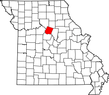 Location in the U.S. state of Missouri | |
 Missouri's location in the U.S. | |
| Founded | January 23, 1816 |
| Named for | Benjamin Howard |
| Seat | Fayette |
| Largest city | Fayette |
| Area | |
| • Total | 472 sq mi (1,222 km2) |
| • Land | 464 sq mi (1,202 km2) |
| • Water | 7.7 sq mi (20 km2), 1.6% |
| Population (est.) | |
| • (2015) | 10,139 |
| Congressional district | 4th |
| Time zone | Central: UTC-6/-5 |
Howard County is a county in the U.S. state of Missouri, with its southern border made by the Missouri River. As of the 2010 census, the population was 10,144.[1] Its county seat is Fayette.[2] The county was organized January 23, 1816 and named for Benjamin Howard, the first Governor of the Missouri Territory.[3]
History
Located on the north bank of the Missouri River, Howard County was settled primarily from the Upper Southern states of Kentucky, Tennessee and Virginia. They brought slaves and slaveholding traditions with them, and cultivated hemp and tobacco. Howard was one of several counties settled mainly by Southerners along the Missouri River in the center of the state. Because of this, this area became known as Little Dixie, and Howard County was at its heart.[4] Following the 1848 revolutions in the German nations, many German immigrants also came to this region.
Because of the reliance on slave labor, by 1860 African American slaves composed at least 25 percent of the county's population.[5] Many Howard County residents supported the Confederacy during the Civil War. After the end of Reconstruction, Jim Crow laws and segregation were enforced in the county. Five African Americans were lynched in Howard between 1891 and 1914: Olli Truxton, Frank Embree, Thomas Hayden, Arthur McNeal, and Dallas Shields.[6]
The county continued to be developed for agriculture and is still largely rural. However, Howard has lost population since reaching its peak in 1900. The mechanization of farming reduced the demand for labor, and many left for jobs in the cities. In 2000 African-Americans in the county had declined to less than 7 percent of the total. Nearly one-third of the residents now identify themselves as of German ancestry.
Geography
According to the U.S. Census Bureau, the county has a total area of 472 square miles (1,220 km2), of which 464 square miles (1,200 km2) is land and 7.7 square miles (20 km2) (1.6%) is water.[7]
Adjacent counties
- Chariton County (northwest)
- Randolph County (northeast)
- Boone County (southeast)
- Cooper County (south)
- Saline County (west)
Major highways
National protected area
Demographics
| Historical population | |||
|---|---|---|---|
| Census | Pop. | %± | |
| 1820 | 13,426 | — | |
| 1830 | 10,854 | −19.2% | |
| 1840 | 13,108 | 20.8% | |
| 1850 | 13,969 | 6.6% | |
| 1860 | 15,946 | 14.2% | |
| 1870 | 17,233 | 8.1% | |
| 1880 | 18,428 | 6.9% | |
| 1890 | 17,371 | −5.7% | |
| 1900 | 18,337 | 5.6% | |
| 1910 | 15,653 | −14.6% | |
| 1920 | 13,997 | −10.6% | |
| 1930 | 13,490 | −3.6% | |
| 1940 | 13,026 | −3.4% | |
| 1950 | 11,857 | −9.0% | |
| 1960 | 10,859 | −8.4% | |
| 1970 | 10,561 | −2.7% | |
| 1980 | 10,008 | −5.2% | |
| 1990 | 9,631 | −3.8% | |
| 2000 | 10,212 | 6.0% | |
| 2010 | 10,144 | −0.7% | |
| Est. 2015 | 10,139 | [8] | 0.0% |
| U.S. Decennial Census[9] 1790-1960[10] 1900-1990[11] 1990-2000[12] 2010-2015[1] | |||
As of the census[13] of 2000, there were 10,212 people, 3,836 households, and 2,631 families residing in the county. The population density was 22 people per square mile (8/km²). There were 4,346 housing units at an average density of 9 per square mile (4/km²). The racial makeup of the county was 91.13% White, 6.84% Black or African American, 0.33% Native American, 0.12% Asian, 0.08% Pacific Islander, 0.40% from other races, and 1.10% from two or more races. Approximately 0.86% of the population were Hispanic or Latino of any race. 32.4% were of German, 16.1% American, 8.9% English and 8.3% Irish ancestry.
There were 3,836 households out of which 31.50% had children under the age of 18 living with them, 55.30% were married couples living together, 9.50% had a female householder with no husband present, and 31.40% were non-families. 27.30% of all households were made up of individuals and 13.30% had someone living alone who was 65 years of age or older. The average household size was 2.46 and the average family size was 2.98.
In the county the population was spread out with 24.00% under the age of 18, 13.30% from 18 to 24, 25.20% from 25 to 44, 21.30% from 45 to 64, and 16.10% who were 65 years of age or older. The median age was 37 years. For every 100 females there were 94.00 males. For every 100 females age 18 and over, there were 94.40 males.
The median income for a household in the county was $31,614, and the median income for a family was $40,167. Males had a median income of $26,369 versus $19,950 for females. The per capita income for the county was $15,198. About 7.50% of families and 11.60% of the population were below the poverty line, including 14.70% of those under age 18 and 14.40% of those age 65 or over.
Education
Public schools
- Fayette R-III School District – Fayette
- Laurence J. Daly Elementary School (PK-05)
- William N. Clark Middle School (06-08)
- Fayette High School (09-12)
- Glasgow School District – Glasgow
- Howard County Elementary School (PK-06)
- Glasgow High School (07-12)
- New Franklin R-I School District – New Franklin
- New Franklin Elementary School (PK-05)
- New Franklin Middle/High School (06-12)
Private schools
- St. Mary’s Catholic School – Glasgow (K-08) – Roman Catholic
- Grace & Glory Christian Academy – New Franklin (K-12) – Baptist - [Closed]
Post-secondary
- Central Methodist University – Fayette – A private, four-year Methodist university.
Politics
Local
The Democratic Party predominantly controls politics at the local level in Howard County. Democrats hold all but two of the elected positions in the county.
| Howard County, Missouri | ||||
|---|---|---|---|---|
| Elected countywide officials | ||||
| Assessor | John (Woody) McCutcheon | Democratic | ||
| Circuit Clerk | Charles J. Flaspohler | Democratic | ||
| County Clerk | Kathyrne Harper | Republican | ||
| Collector | Jinger Felten | Republican | ||
| Commissioner (Presiding) |
Sam Stroupe | Democratic | ||
| Commissioner (District 1) |
Richard Conrow | Democratic | ||
| Commissioner (District 2) |
Howard McMillan | Democratic | ||
| Coroner | Frank Flaspohler | Democratic | ||
| Prosecuting Attorney | Deborah Riekhof | Republican | ||
| Public Administrator | Lisa Asbury | Democratic | ||
| Recorder | Charles J. Flaspohler | Democratic | ||
| Sheriff | Mike Neal | Republican | ||
| Surveyor | Gene Bowen | Democratic | ||
| Treasurer | Susan Keyton | Democratic | ||
State
| Year | Republican | Democratic | Third Parties |
|---|---|---|---|
| 2008 | 48.69% 2,358 | 49.08% 2,377 | 2.33% 108 |
| 2004 | 52.46% 2,578 | 46.34% 2,277 | 1.20% 59 |
| 2000 | 44.96% 2,029 | 52.12% 2,352 | 2.92% 132 |
| 1996 | 33.90% 1,436 | 63.53% 2,691 | 2.57% 109 |
All of Howard County is a part of Missouri’s 9th District and is represented by Paul Quinn (D-Monroe City) in the Missouri House of Representatives.
| Party | Candidate | Votes | % | ± | |
|---|---|---|---|---|---|
| Democratic | Paul Quinn | 3,020 | 100.00 | ||
All of Howard County is a part of Missouri’s 21st District in the Missouri Senate and is currently represented by Bill Stouffer (R-Napton).
| Party | Candidate | Votes | % | ± | |
|---|---|---|---|---|---|
| Republican | Bill Stouffer | 3,004 | 64.49 | ||
| Democratic | Joe Sadeghi | 1,654 | 35.51 | ||
Federal
All of Howard County is included in Missouri’s 6th Congressional District and is currently represented by Sam Graves (R-Tarkio) in the U.S. House of Representatives.
| Party | Candidate | Votes | % | ± | |
|---|---|---|---|---|---|
| Republican | Sam Graves | 2,567 | 70.74 | ||
| Democratic | Clint Hylton | 1,061 | 29.26 | ||
| Year | Republican | Democratic | Third Parties |
|---|---|---|---|
| 2008 | 55.78% 2,708 | 41.94% 2,036 | 2.28% 111 |
| 2004 | 59.24% 2,915 | 40.07% 1,972 | 0.69% 34 |
| 2000 | 53.50% 2,414 | 43.09% 1,944 | 3.41% 154 |
| 1996 | 36.76% 1,545 | 47.92% 2,014 | 15.32% 644 |
Missouri Presidential Preference Primary (2008)
- Former U.S. Senator Hillary Clinton (D-New York) received more votes, a total of 685, than any candidate from either party in Howard County during the 2008 presidential primary.
| Howard County, Missouri | ||
|---|---|---|
| 2008 Republican primary in Missouri | ||
| John McCain | 283 (28.44%) | |
| Mike Huckabee | 328 (32.96%) | |
| Mitt Romney | 319 (32.06%) | |
| Ron Paul | 52 (5.23%) | |
| Howard County, Missouri | ||
|---|---|---|
| 2008 Democratic primary in Missouri | ||
| Hillary Clinton | 685 (48.38%) | |
| Barack Obama | 660 (46.61%) | |
| John Edwards (withdrawn) | 50 (3.53%) | |
| Uncommitted | 14 (0.99%) | |
Cities and towns
- Armstrong
- Boonesboro
- Fayette (county seat)
- Estill
- Franklin
- Glasgow
- New Franklin
- Roanoke
Notable people
- Frank P. Briggs - former United States Senator and Assistant U.S. Secretary of the Interior.
- Sara Evans - American country music singer.
- Spottswood Rice - Union Soldier in the Civil War and African Methodist Episcopal Church minister.
See also
References
- 1 2 "State & County QuickFacts". United States Census Bureau. Retrieved September 9, 2013.
- ↑ "Find a County". National Association of Counties. Retrieved 2011-06-07.
- ↑ Eaton, David Wolfe (1916). How Missouri Counties, Towns and Streams Were Named. The State Historical Society of Missouri. p. 174.
- ↑ The Story of Little Dixie, Missouri, Missouri Division, Sons of Confederate Veterans, accessed 3 June 2008
- ↑ T. J. Stiles, Jesse James: The Last Rebel of the Civil War, New York: Vintage Books, 2003, pp.10-11
- ↑ NAACP (1919). Thirty Years of Lynching in the United States, 1889—1918. NAACP. pp. 80–81.
- ↑ "2010 Census Gazetteer Files". United States Census Bureau. August 22, 2012. Retrieved November 16, 2014.
- ↑ "County Totals Dataset: Population, Population Change and Estimated Components of Population Change: April 1, 2010 to July 1, 2015". Retrieved July 2, 2016.
- ↑ "U.S. Decennial Census". United States Census Bureau. Retrieved November 16, 2014.
- ↑ "Historical Census Browser". University of Virginia Library. Retrieved November 16, 2014.
- ↑ "Population of Counties by Decennial Census: 1900 to 1990". United States Census Bureau. Retrieved November 16, 2014.
- ↑ "Census 2000 PHC-T-4. Ranking Tables for Counties: 1990 and 2000" (PDF). United States Census Bureau. Retrieved November 16, 2014.
- ↑ "American FactFinder". United States Census Bureau. Retrieved 2008-01-31.
Further reading
- History of Howard and Chariton Counties, Missouri (1883) full text
External links
- Digitized 1930 Plat Book of Howard County from University of Missouri Division of Special Collections, Archives, and Rare Books
 |
Chariton County | Randolph County | | |
| Saline County | |
|||
| ||||
| | ||||
| Cooper County | Boone County |
Municipalities and communities of Howard County, Missouri, United States | ||
|---|---|---|
| Cities | | |
| Townships | ||
| Unincorporated> communities | ||
| Ghost town | ||
| Footnotes | ‡This populated place also has portions in an adjacent county or counties | |
Coordinates: 39°08′N 92°42′W / 39.14°N 92.70°W