Taney County, Missouri
| Taney County, Missouri | ||
|---|---|---|
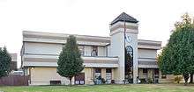 Taney County Courthouse in Forsyth | ||
| ||
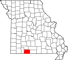 Location in the U.S. state of Missouri | ||
 Missouri's location in the U.S. | ||
| Founded | January 4, 1837 | |
| Named for | Roger B. Taney | |
| Seat | Forsyth | |
| Largest city | Branson | |
| Area | ||
| • Total | 652 sq mi (1,689 km2) | |
| • Land | 632 sq mi (1,637 km2) | |
| • Water | 19 sq mi (49 km2), 2.9% | |
| Population (est.) | ||
| • (2015) | 54,592 | |
| • Density | 82/sq mi (32/km²) | |
| Congressional district | 7th | |
| Time zone | Central: UTC-6/-5 | |
| Website |
www | |

Taney County is a county located in the southwestern portion of the U.S. state of Missouri. As of the 2010 census, the population was 51,675.[1] Its county seat is Forsyth.[2] The county was officially organized on January 4, 1837, and named in honor of Roger Brooke Taney, the fifth Chief Justice of the U.S. Supreme Court, most remembered for later delivering the infamous majority opinion in Dred Scott v. Sandford.
Taney County includes the popular tourist destination city of Branson. It is included in the Branson, MO Micropolitan Statistical Area, which is also included in the Springfield-Branson, MO Combined Statistical Area. With a wide range of live music shows, restaurants and shopping locations, Taney County is also the home of Table Rock, Taneycomo and Bull Shoals Lakes.
History
The first Taney County Courthouse was built on the mouth of Bull Creek at the confluence of the White River, by early pioneers in 1837, followed closely by a second "official" Courthouse in Forsyth after it was named the County seat. The first Courthouse was not used after Forsyth was named the County seat, and was destroyed in a tornado in 1963.
The Courthouse in Forsyth was destroyed two times, the first of which was July 22, 1861, during a Civil War Battle, and the rebuilt Courthouse was destroyed by fire on December 19, 1885. A third Courthouse was built and subsequently removed in 1952 to permit the building of Bull Shoals Lake. The fourth, and present, Courthouse was occupied on August 1, 1952. In 1989, an addition was started and completed in 1991.
Geography
According to the U.S. Census Bureau, the county has a total area of 652 square miles (1,690 km2), of which 632 square miles (1,640 km2) is land and 19 square miles (49 km2) (2.9%) is water.[3]
The county is drained by White River and its affluents.[4]
Adjacent counties
- Christian County (north)
- Douglas County (northeast)
- Ozark County (east)
- Marion County, Arkansas (southeast)
- Boone County, Arkansas (south)
- Carroll County, Arkansas (southwest)
- Stone County (west)
Major highways
National protected area
- Mark Twain National Forest (part)
Demographics
| Historical population | |||
|---|---|---|---|
| Census | Pop. | %± | |
| 1840 | 3,264 | — | |
| 1850 | 4,373 | 34.0% | |
| 1860 | 3,576 | −18.2% | |
| 1870 | 4,347 | 21.6% | |
| 1880 | 5,599 | 28.8% | |
| 1890 | 7,973 | 42.4% | |
| 1900 | 10,812 | 35.6% | |
| 1910 | 9,287 | −14.1% | |
| 1920 | 8,878 | −4.4% | |
| 1930 | 8,867 | −0.1% | |
| 1940 | 10,323 | 16.4% | |
| 1950 | 9,863 | −4.5% | |
| 1960 | 10,238 | 3.8% | |
| 1970 | 13,023 | 27.2% | |
| 1980 | 20,467 | 57.2% | |
| 1990 | 25,561 | 24.9% | |
| 2000 | 39,703 | 55.3% | |
| 2010 | 51,675 | 30.2% | |
| Est. 2015 | 54,592 | [5] | 5.6% |
| U.S. Decennial Census[6] 1790-1960[7] 1900-1990[8] 1990-2000[9] 2010-2015[1] | |||
As of the census[10] of 2000, there were 39,703 people, 16,158 households, and 11,052 families residing in the county. The population density was 24/km² (63/mi²). There were 19,688 housing units at an average density of 12/km² (31/mi²). The racial makeup of the county was 96.22% White, 0.35% Black or African American, 0.87% Native American, 0.34% Asian, 0.05% Pacific Islander, 0.74% from other races, and 1.42% from two or more races. Approximately 2.42% of the population were Hispanic or Latino of any race. Among the major first ancestries reported in Taney County were 20.8% German, 18.9% American, 12.4% Irish, and 12.3% English.
There were 16,158 households out of which 27.80% had children under the age of 18 living with them, 56.60% were married couples living together, 8.60% had a female householder with no husband present, and 31.60% were non-families. 25.70% of all households were made up of individuals and 10.00% had someone living alone who was 65 years of age or older. The average household size was 2.37 and the average family size was 2.83.
In the county the population was spread out with 22.40% under the age of 18, 10.20% from 18 to 24, 26.20% from 25 to 44, 25.00% from 45 to 64, and 16.20% who were 65 years of age or older. The median age was 39 years. For every 100 females there were 94.00 males. For every 100 females age 18 and over, there were 90.40 males.
The median income for a household in the county was $39,771, and the median income for a family was $47,664. Males had a median income of $25,431 versus $19,655 for females. The per capita income for the county was $21,663. About 9.40% of families and 12.40% of the population were below the poverty line, including 17.60% of those under age 18 and 8.80% of those age 65 or over.
Religion
According to the Association of Religion Data Archives County Membership Report (2000), Taney County is a part of the Bible Belt with evangelical Protestantism being the majority religion. The most predominant denominations among residents in Taney County who adhere to a religion are Southern Baptists (32.88%), Roman Catholics (12.36%), and Presbyterians (9.13%).
Education
Of adults 25 years of age and older in Taney County, 81.4% possess a high school diploma or higher while 14.9% hold a bachelor's degree or higher as their highest educational attainment.
Colleges and universities
Taney County is home to Ozarks Technical Community College, in Historic Hollister.
Public schools
- Bradleyville R-I School District - Bradleyville
- Bradleyville Elementary School (PK-06)
- Bradleyville High School (07-12)
- Branson R-IV School District - Branson
- Branson Primary School (PK-01)
- Branson Elementary East (02-04)
- Branson Elementary West (02-04)
- Branson Intermediate School (05-06)
- Branson Jr. High School (07-08)
- Branson High School (09-12)
- Forsyth R-III School District - Forsyth
- Forsyth Elementary School (K-04)
- Forsyth Middle School (05-08)
- Forsyth High School (09-12)
- Hollister R-V School District - Hollister
- Hollister Elementary School (PK-04)
- Hollister Middle School (05-06)
- Hollister Jr. High School (07-08)
- Hollister High School (09-12)
- Kirbyville R-VI School District - Kirbyville
- Kirbyville Elementary School (K-03)
- Kirbyville Middle School (04-08)
- Mark Twain R-VIII School District - Rueter
- Mark Twain Elementary School (K-08)
- Taneyville R-II School District - Taneyville
- Taneyville Elementary School (K-08)
Private schools
- Faith Christian Academy - Branson - (PK-12) - Non-denominational Christian
- Trinity Christian Academy - Hollister - (PK-12) - Non-denominational Christian
- Riverview Bible Baptist Church School - Forsyth - (05-08) - Baptist
Alternative & vocational schools
- Delmina Woods Youth Facility - Forsyth - (06-12) - Alternative/Other School
Politics
Local
The Republican Party completely controls politics at the local level in Taney County. Republicans hold every elected position in the county.
| Taney County, Missouri | ||||
|---|---|---|---|---|
| Elected countywide officials | ||||
| Assessor | Chuck Pennel | Republican | ||
| Circuit Clerk | Brenda Kay Neal | Republican | ||
| County Clerk | Donna Neeley | Republican | ||
| Collector | Sheila L. Wyatt | Republican | ||
| Commissioner (Presiding) |
Mike Scofield | Republican | ||
| Commissioner (District 1) |
Brandon Williams | Republican | ||
| Commissioner (District 2) |
Danny Strahan | Republican | ||
| Coroner | Kevin Tweedy | Republican | ||
| Prosecuting Attorney | Jeffrey M. Merrell | Republican | ||
| Public Administrator | Carol S. Davis | Republican | ||
| Recorder | Robert A. Dixon | Republican | ||
| Sheriff | Jimmie Russell | Republican | ||
| Treasurer | Melanie Smith | Republican | ||
State
| Year | Republican | Democratic | Third Parties |
|---|---|---|---|
| 2008 | 51.16% 10,903 | 46.31% 9,870 | 2.53% 540 |
| 2004 | 68.88% 13,207 | 29.91% 5,734 | 1.21% 233 |
| 2000 | 60.03% 9,003 | 37.30% 5,594 | 2.67% 400 |
| 1996 | 58.07% 7,516 | 38.89% 5,034 | 3.04% 394 |
Taney County is divided into three legislative districts in the Missouri House of Representatives, all of which are held by Republicans.
- District 62 – Currently represented by Donald E. Phillips (R-Kimberling City) and consists of the southwestern parts of the county and includes Branson, Hollister, and Table Rock.
| Party | Candidate | Votes | % | ± | |
|---|---|---|---|---|---|
| Republican | Donald E. Phillips | 5,051 | 100.00 | +29.69 | |
- District 142 – Currently represented by Raymond Weter (R-Nixa) and consists of the northeastern parts of the county and includes Bull Creek and Taneyville.
| Party | Candidate | Votes | % | ± | |
|---|---|---|---|---|---|
| Republican | Raymond Weter* | 1,466 | 85.88 | -14.12 | |
| Libertarian | Bradley W. Stubbs | 241 | 14.12 | +14.12 | |
- District 143 – Currently represented by Lyle Rowland (R-Cedar Creek) and consists of the southeastern parts of the county and includes Forsyth, Merriam Woods, and Rockaway Beach.
| Party | Candidate | Votes | % | ± | |
|---|---|---|---|---|---|
| Republican | Lyle Rowland | 5,353 | 74.14 | +8.27 | |
| Independent | Michael Chipman | 1,867 | 25.86 | +25.86 | |
All of Taney County is a part of Missouri's 29th District in the Missouri Senate and is currently represented by State Senator Jack Goodman (R-Mt. Vernon). In 2008, Goodman ran unopposed and was reelected with 100 percent of the vote. The 29th Senatorial District consists of Barry, Lawrence, McDonald, Ozark, Stone, and Taney counties.
| Party | Candidate | Votes | % | ± | |
|---|---|---|---|---|---|
| Republican | Jack Goodman | 17,564 | 100.00 | ||
Federal
Currently, Taney County is split in its federal representation, with Jo Ann Emerson (R-Cape Girardeau) representing most of the central and eastern portions of the county in Missouri's 8th Congressional District while Billy Long (R-Springfield) represents the western parts of the county (including Branson) in Missouri's 7th Congressional District. Following redistricting, all of Taney County will now be included in the 7th Congressional District.
| Party | Candidate | Votes | % | ± | |
|---|---|---|---|---|---|
| Republican | Jo Ann Emerson | 2,588 | 65.85 | -0.97 | |
| Democratic | Tommy Sowers | 1,049 | 26.69 | -2.77 | |
| Independent | Larry Bill | 154 | 3.92 | +3.92 | |
| Libertarian | Rick Vandeven | 139 | 3.54 | +0.91 | |
Political culture
| Year | Republican | Democratic | Third Parties |
|---|---|---|---|
| 2008 | 68.02% 14,736 | 30.85% 6,683 | 1.13% 245 |
| 2004 | 70.43% 13,578 | 29.05% 5,601 | 0.52% 101 |
| 2000 | 63.84% 9,647 | 33.70% 5,092 | 2.46% 373 |
| 1996 | 52.01% 6,844 | 35.13% 4,623 | 12.86% 1,693 |
Like most counties situated in Southwest Missouri, Taney County is a Republican stronghold in presidential elections. George W. Bush carried Taney County in 2000 and 2004 by more than two-to-one margins, and like many other rural counties throughout Missouri, Taney County strongly favored John McCain over Barack Obama in 2008. No Democratic presidential nominee has won Taney County in over 50 years.
Like most rural areas throughout the Bible Belt in Southwest Missouri, voters in Taney County traditionally adhere to socially and culturally conservative principles which tend to strongly influence their Republican leanings. In 2004, Missourians voted on a constitutional amendment to define marriage as the union between a man and a woman—it overwhelmingly passed Taney County with 80.04 percent of the vote. The initiative passed the state with 71 percent of support from voters as Missouri became the first state to ban same-sex marriage. In 2006, Missourians voted on a constitutional amendment to fund and legalize embryonic stem cell research in the state—it failed in Taney County with 56.64 percent voting against the measure. The initiative narrowly passed the state with 51 percent of support from voters as Missouri became one of the first states in the nation to approve embryonic stem cell research. Despite Taney County’s longstanding tradition of supporting socially conservative platforms, voters in the county have a penchant for advancing populist causes like increasing the minimum wage. In 2006, Missourians voted on a proposition (Proposition B) to increase the minimum wage in the state to $6.50 an hour—it passed Taney County with 77.78 percent of the vote. The proposition strongly passed every single county in Missouri with 78.99 percent voting in favor as the minimum wage was increased to $6.50 an hour in the state. During the same election, voters in five other states also strongly approved increases in the minimum wage.
Missouri Presidential Preference Primary (2008)
In the 2008 Missouri Presidential Preference Primary, voters in Taney County from both political parties supported candidates who finished in second place in the state at large and nationally.
- Former Governor Mike Huckabee (R-Arkansas) received more votes, a total of 3,850, than any candidate from either party in Taney County during the 2008 Missouri Presidential Preference Primary.
| Taney County, Missouri | ||
|---|---|---|
| 2008 Republican primary in Missouri | ||
| John McCain | 1,784 (25.90%) | |
| Mike Huckabee | 3,850 (55.89%) | |
| Mitt Romney | 976 (14.17%) | |
| Ron Paul | 195 (2.83%) | |
| Taney County, Missouri | ||
|---|---|---|
| 2008 Democratic primary in Missouri | ||
| Hillary Clinton | 2,626 (63.69%) | |
| Barack Obama | 1,391 (33.74%) | |
| John Edwards (withdrawn) | 78 (1.89%) | |
Communities
Miscellaneous
In 2009, Taney County officials voted to begin charging inmates $45 a day to stay at the jail. One critic referred to the charge as a "poor person's tax."[11]
The 2010 film "Winter's Bone" was filmed entirely in Taney County and Christian County. Many locals were cast in significant roles in the film.
The NAIA Men's Basketball Championships are hosted every March at College of the Ozarks.
See also
References
- 1 2 "State & County QuickFacts". United States Census Bureau. Retrieved September 14, 2013.
- ↑ "Find a County". National Association of Counties. Retrieved 2011-06-07.
- ↑ "2010 Census Gazetteer Files". United States Census Bureau. August 22, 2012. Retrieved November 22, 2014.
- ↑
 Ripley, George; Dana, Charles A., eds. (1879). "Taney". The American Cyclopædia.
- ↑ "County Totals Dataset: Population, Population Change and Estimated Components of Population Change: April 1, 2010 to July 1, 2015". Retrieved July 2, 2016.
- ↑ "U.S. Decennial Census". United States Census Bureau. Retrieved November 22, 2014.
- ↑ "Historical Census Browser". University of Virginia Library. Retrieved November 22, 2014.
- ↑ "Population of Counties by Decennial Census: 1900 to 1990". United States Census Bureau. Retrieved November 22, 2014.
- ↑ "Census 2000 PHC-T-4. Ranking Tables for Counties: 1990 and 2000" (PDF). United States Census Bureau. Retrieved November 22, 2014.
- ↑ "American FactFinder". United States Census Bureau. Retrieved 2008-01-31.
- ↑ http://www.csmonitor.com/2009/0515/p25s10-usgn.htm
External links
| Wikimedia Commons has media related to Taney County, Missouri. |
- Taney County government's website
- Digitized 1930 Plat Book of Taney County from University of Missouri Division of Special Collections, Archives, and Rare Books
- http://2010.census.gov/2010census/popmap/
 |
Stone County | Christian County | Douglas County | |
| Stone County | |
Ozark County | ||
| ||||
| | ||||
| Carroll County, Arkansas | Boone County, Arkansas | Marion County, Arkansas |
Municipalities and communities of Taney County, Missouri, United States | ||
|---|---|---|
| Cities | | |
| Villages | ||
| Townships |
| |
| CDP | ||
| Other unincorporated communities | ||
| Footnotes | ‡This populated place also has portions in an adjacent county or counties | |
Coordinates: 36°39′N 93°02′W / 36.65°N 93.04°W