Benton County, Missouri
| Benton County, Missouri | |
|---|---|
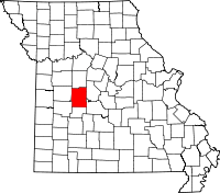 Location in the U.S. state of Missouri | |
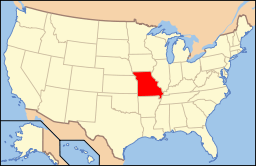 Missouri's location in the U.S. | |
| Founded | January 3, 1835 |
| Named for | Thomas Hart Benton |
| Seat | Warsaw |
| Largest city | Warsaw |
| Area | |
| • Total | 753 sq mi (1,950 km2) |
| • Land | 704 sq mi (1,823 km2) |
| • Water | 48 sq mi (124 km2), 6.4 |
| Population (est.) | |
| • (2015) | 18,670 |
| • Density | 27/sq mi (10/km²) |
| Congressional district | 4th |
| Time zone | Central: UTC-6/-5 |
| Website |
www |
Benton County is a county located in the west central part of the U.S. state of Missouri. The population was 19,056 as of the 2010 Census.[1] Its county seat is Warsaw.[2] The county was organized January 3, 1835, and named for U.S. Senator Thomas Hart Benton of Missouri.[3]
Geography
According to the U.S. Census Bureau, the county has a total area of 753 square miles (1,950 km2), of which 704 square miles (1,820 km2) is land and 48 square miles (120 km2) (6.4%) is water.[4]
Adjacent counties
- Pettis County (north)
- Morgan County (northeast)
- Camden County (southeast)
- Hickory County (south)
- St. Clair County (southwest)
- Henry County (west)
Major highways
Demographics
| Historical population | |||
|---|---|---|---|
| Census | Pop. | %± | |
| 1840 | 4,205 | — | |
| 1850 | 5,015 | 19.3% | |
| 1860 | 9,072 | 80.9% | |
| 1870 | 11,322 | 24.8% | |
| 1880 | 12,396 | 9.5% | |
| 1890 | 14,973 | 20.8% | |
| 1900 | 16,556 | 10.6% | |
| 1910 | 14,881 | −10.1% | |
| 1920 | 12,989 | −12.7% | |
| 1930 | 11,708 | −9.9% | |
| 1940 | 11,142 | −4.8% | |
| 1950 | 9,080 | −18.5% | |
| 1960 | 8,737 | −3.8% | |
| 1970 | 9,695 | 11.0% | |
| 1980 | 12,183 | 25.7% | |
| 1990 | 13,859 | 13.8% | |
| 2000 | 17,180 | 24.0% | |
| 2010 | 19,056 | 10.9% | |
| Est. 2015 | 18,670 | [5] | −2.0% |
| U.S. Decennial Census[6] 1790-1960[7] 1900-1990[8] 1990-2000[9] 2010-2015[1] | |||
As of the census[10] of 2000, there were 17,180 people, 7,420 households, and 5,179 families residing in the county. The population density was 24 people per square mile (9/km²). There were 12,691 housing units at an average density of 18 per square mile (7/km²). The racial makeup of the county was 97.96% White, 0.15% Black or African American, 0.53% Native American, 0.13% Asian, 0.01% Pacific Islander, 0.12% from other races, and 1.10% from two or more races. Approximately 0.89% of the population were Hispanic or Latino of any race.
There were 7,420 households out of which 23.20% had children under the age of 18 living with them, 59.60% were married couples living together, 6.80% had a female householder with no husband present, and 30.20% were non-families. 26.30% of all households were made up of individuals and 13.80% had someone living alone who was 65 years of age or older. The average household size was 2.28 and the average family size was 2.72.
In the county the population was spread out with 20.50% under the age of 18, 5.70% from 18 to 24, 21.80% from 25 to 44, 29.70% from 45 to 64, and 22.30% who were 65 years of age or older. The median age was 46 years. For every 100 females there were 98.20 males. For every 100 females age 18 and over, there were 96.70 males.
The median income for a household in the county was $26,646, and the median income for a family was $32,459. Males had a median income of $26,203 versus $19,054 for females. The per capita income for the county was $15,457. About 10.20% of families and 15.70% of the population were below the poverty line, including 24.50% of those under age 18 and 9.60% of those age 65 or over.
Education
Public schools
- Cole Camp R-I School District – Cole Camp
- Cole Camp Elementary School (PK-05)
- Cole Camp Middle School (06-08)
- Cole Camp High School (09-12)
- Lincoln R-II School District – Lincoln
- Lincoln Elementary School (K-06)
- Lincoln High School (07-12)
- Warsaw R-IX School District – Warsaw
- Ruth Mercer Elementary School (K-02)
- North Elementary School (PK-05)
- South Elementary School (PK-05)
- John Boise Middle School (06-08)
- Warsaw High School (09-12)
Private schools
- Lutheran School Association – Cole Camp (K-08) – Lutheran
- It should be noted that most of the students who attend Cole Camp's Lutheran School Association attend Benton County R-1 High in Cole Camp.
Politics
Local
The Republican Party predominantly controls politics at the local level in Benton County. Republicans hold all but one of the elected positions in the county.
| Benton County, Missouri | ||||
|---|---|---|---|---|
| Elected countywide officials | ||||
| Assessor | Rodger L. Reedy | Republican | ||
| Circuit Clerk | Cheryl Lutjen-Schultz | Republican | ||
| County Clerk | Mary Lutman | Republican | ||
| Collector | Donna Hart | Democratic | ||
| Commissioner (Presiding) |
Michelle McLerran-Morgan | Republican | ||
| Commissioner (District 1) |
Jim Hansen | Republican | ||
| Commissioner (District 2) |
Steve Daleske | Republican | ||
| Coroner | James A. Miller | Republican | ||
| Prosecuting Attorney | Karen Coffey Woodley | Republican | ||
| Public Administrator | Lori Dunklin | Republican | ||
| Recorder | Beverly Burnett | Republican | ||
| Sheriff | Rick Fajen | Republican | ||
| Surveyor | Jerry Dill | Republican | ||
| Treasurer | Rick Renno | Republican | ||
State
| Year | Republican | Democratic | Third Parties |
|---|---|---|---|
| 2008 | 41.57% 3,967 | 56.09% 5,353 | 2.34% 223 |
| 2004 | 56.67% 5,088 | 41.95% 3,767 | 1.39% 124 |
| 2000 | 52.76% 3,944 | 45.58% 3,407 | 1.66% 124 |
| 1996 | 44.36% 2,979 | 52.42% 3,520 | 3.22% 216 |
All of Benton County is a part of Missouri’s 116th District in the Missouri House of Representatives and is represented by Wanda Brown (R-Lincoln).
| Party | Candidate | Votes | % | ± | |
|---|---|---|---|---|---|
| Republican | Wanda Brown | 4,758 | 64.26 | ||
| Democratic | Mike Stevenson | 2,302 | 31.09 | ||
| Constitution | Ray Herron | 344 | 4.64 | ||
All of Benton County is a part of Missouri’s 28th District in the Missouri Senate and is currently represented by Mike Parson (R-Bolivar).
| Party | Candidate | Votes | % | ± | |
|---|---|---|---|---|---|
| Republican | Mike Parson | 5,585 | 81.99 | ||
| Constitution | Bennie B. Hatfield | 1,227 | 18.01 | ||
Federal
All of Benton County is included in Missouri’s 4th Congressional District and is currently represented by Vicky Hartzler (R-Harrisonville) in the U.S. House of Representatives.
| Party | Candidate | Votes | % | ± | |
|---|---|---|---|---|---|
| Republican | Vicky Hartzler | 3,653 | 48.99 | ||
| Democratic | Ike Skelton* | 3,418 | 45.84 | ||
| Libertarian | Jason Michael Braun | 237 | 3.18 | ||
| Constitution | Greg Cowan | 148 | 1.98 | ||
Political Culture
| Year | Republican | Democratic | Third Parties |
|---|---|---|---|
| 2008 | 59.92% 5,759 | 37.76% 3,629 | 2.32% 223 |
| 2004 | 61.88% 5,575 | 37.53% 3,381 | 0.59% 53 |
| 2000 | 55.99% 4,218 | 41.81% 3,150 | 2.20% 166 |
| 1996 | 43.11% 2,895 | 44.62% 2,996 | 12.27% 824 |
Missouri Presidential Preference Primary (2008)
- Former U.S. Senator Hillary Clinton (D-New York) received more votes, a total of 1,753, than any candidate from either party in Benton County during the 2008 presidential primary.
| Benton County, Missouri | ||
|---|---|---|
| 2008 Republican primary in Missouri | ||
| John McCain | 803 (34.67%) | |
| Mike Huckabee | 824 (35.58%) | |
| Mitt Romney | 580 (25.04%) | |
| Ron Paul | 75 (3.24%) | |
| Benton County, Missouri | ||
|---|---|---|
| 2008 Democratic primary in Missouri | ||
| Hillary Clinton | 1,753 (68.77%) | |
| Barack Obama | 687 (26.95%) | |
| John Edwards (withdrawn) | 80 (3.14%) | |
Communities
See also
References
- 1 2 "State & County QuickFacts". United States Census Bureau. Retrieved September 7, 2013.
- ↑ "Find a County". National Association of Counties. Archived from the original on 2011-05-31. Retrieved 2011-06-07.
- ↑ Eaton, David Wolfe (1916). How Missouri Counties, Towns and Streams Were Named. The State Historical Society of Missouri. p. 209.
- ↑ "2010 Census Gazetteer Files". United States Census Bureau. August 22, 2012. Retrieved November 13, 2014.
- ↑ "County Totals Dataset: Population, Population Change and Estimated Components of Population Change: April 1, 2010 to July 1, 2015". Retrieved July 2, 2016.
- ↑ "U.S. Decennial Census". United States Census Bureau. Archived from the original on May 11, 2015. Retrieved November 13, 2014.
- ↑ "Historical Census Browser". University of Virginia Library. Retrieved November 13, 2014.
- ↑ "Population of Counties by Decennial Census: 1900 to 1990". United States Census Bureau. Retrieved November 13, 2014.
- ↑ "Census 2000 PHC-T-4. Ranking Tables for Counties: 1990 and 2000" (PDF). United States Census Bureau. Retrieved November 13, 2014.
- ↑ "American FactFinder". United States Census Bureau. Archived from the original on 2013-09-11. Retrieved 2011-05-14.
Further reading
- History of Cole, Moniteau, Morgan, Benton, Miller, Maries and Osage counties, Missouri : from the earliest time to the present, including a department devoted to the preservation of sundry personal, business,professional and the private records; besides a valuable fund of notes, original observations, etc. etc. (1889) online
External links
- http://www.hearthstonelegacy.com/benton.htm
- Benton County Courthouse Official Website
- Digitized 1930 Plat Book of Benton County from University of Missouri Division of Special Collections, Archives, and Rare Books
 |
Pettis County | Morgan County | | |
| Henry County | |
|||
| ||||
| | ||||
| St. Clair County | Hickory County | Camden County |
Municipalities and communities of Benton County, Missouri, United States | ||
|---|---|---|
| Cities | | |
| Village | ||
| Townships |
| |
| Unincorporated communities |
| |
| Former settlements | ||
| Footnotes | ‡This populated place also has portions in an adjacent county or counties | |
Coordinates: 38°18′N 93°17′W / 38.30°N 93.29°W