Christian County, Missouri
| Christian County, Missouri | |
|---|---|
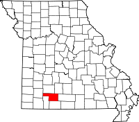 Location in the U.S. state of Missouri | |
 Missouri's location in the U.S. | |
| Founded | March 8, 1859[1] |
| Named for | William Christian |
| Seat | Ozark |
| Largest city | Nixa |
| Area | |
| • Total | 564 sq mi (1,461 km2) |
| • Land | 563 sq mi (1,458 km2) |
| • Water | 1.2 sq mi (3 km2), 0.2% |
| Population (est.) | |
| • (2015) | 83,279 |
| • Density | 138/sq mi (53/km²) |
| Congressional district | 7th |
| Time zone | Central: UTC-6/-5 |
| Website |
christiancountymo |
Christian County is a county located in the southwestern part of the U.S. state of Missouri. As of the 2010 census, the population was 77,422.[2] Its county seat is Ozark.[3] The county was organized in 1859 and is named after William Christian, a Kentucky soldier of the American Revolutionary War.[4]
Christian County is part of the Springfield, MO Metropolitan Statistical Area. Between 2000 and 2010, it was the fastest growing county in Missouri and one of the fastest growing in the nation as the county became more suburban due to the booming growth in Springfield.[5]
Geography
According to the U.S. Census Bureau, the county has a total area of 564 square miles (1,460 km2), of which 563 square miles (1,460 km2) is land and 1.2 square miles (3.1 km2) (0.2%) is water.[6] The county is drained by James River and branches of the White River. The surface is undulating or hilly.[7]
Adjacent counties
- Greene County (north)
- Webster County (northeast)
- Douglas County (east)
- Taney County (south)
- Stone County (southwest)
- Lawrence County (west)
Major highways
National protected area
- Mark Twain National Forest (part)
Demographics
| Historical population | |||
|---|---|---|---|
| Census | Pop. | %± | |
| 1860 | 5,491 | — | |
| 1870 | 6,707 | 22.1% | |
| 1880 | 9,628 | 43.6% | |
| 1890 | 14,017 | 45.6% | |
| 1900 | 16,939 | 20.8% | |
| 1910 | 15,832 | −6.5% | |
| 1920 | 15,252 | −3.7% | |
| 1930 | 13,169 | −13.7% | |
| 1940 | 13,538 | 2.8% | |
| 1950 | 12,412 | −8.3% | |
| 1960 | 12,359 | −0.4% | |
| 1970 | 15,124 | 22.4% | |
| 1980 | 22,402 | 48.1% | |
| 1990 | 32,644 | 45.7% | |
| 2000 | 54,285 | 66.3% | |
| 2010 | 77,422 | 42.6% | |
| Est. 2015 | 83,279 | [8] | 7.6% |
| U.S. Decennial Census[9] 1790-1960[10] 1900-1990[11] 1990-2000[12] 2010-2015[2] | |||
As of the census[13] of 2000, there were 54,285 people, 20,425 households, and 15,645 families residing in the county. The population density was 96 people per square mile (37/km²). There were 21,827 housing units at an average density of 39 per square mile (15/km²). The racial makeup of the county was 97.31% White, 0.27% Black or African American, 0.56% Native American, 0.29% Asian, 0.03% Pacific Islander, 0.42% from other races, and 1.13% from two or more races. Approximately 1.32% of the population were Hispanic or Latino of any race. 23.7% were of American, 21.1% German, 12.3% English and 11.3% Irish ancestry.
There were 20,425 households out of which 38.60% had children under the age of 18 living with them, 64.00% were married couples living together, 9.30% had a female householder with no husband present, and 23.40% were non-families. 19.10% of all households were made up of individuals and 7.00% had someone living alone who was 65 years of age or older. The average household size was 2.63 and the average family size was 3.00.
In the county the population was spread out with 27.80% under the age of 18, 8.10% from 18 to 24, 31.70% from 25 to 44, 21.80% from 45 to 64, and 10.60% who were 65 years of age or older. The median age was 34 years. For every 100 females there were 94.70 males. For every 100 females age 18 and over, there were 91.50 males.
The median income for a household in the county was $50,200, and the median income for a family was $58,806. Males had a median income of $31,929 versus $21,852 for females. The per capita income for the county was $23,873. About 7.10% of families and 9.10% of the population were below the poverty line, including 13.20% of those under age 18 and 7.80% of those age 65 or over.
Politics
Local
The Republican Party controls politics at the local level in Christian County. The Republicans hold all but one of the elected positions in the county.
On May 20, 2015, Sheriff Joey Kyle plead guilty to embezzling county funds and participating in an illegal fraud scheme. As a part of a plea agreement, he immediately resigned as sheriff, was sentenced to one year plus one day in federal prison, and must repay more than $50,000 in restitution to Christian County.[14]
| Christian County, Missouri | ||||
|---|---|---|---|---|
| Elected countywide officials | ||||
| Assessor | Danny Gray | Republican | ||
| Circuit Clerk | Barbie Barnett-Stillings | Republican | ||
| County Clerk | Kay Brown | Republican | ||
| Collector | Ted Nichols | Republican | ||
| Commissioner (Presiding) |
Ray Weter | Republican | ||
| Commissioner (District 1) |
Sue Ann Childers | Democratic | ||
| Commissioner (District 2) |
Bill Barnett | Republican | ||
| Coroner | Mandi Armintage | Republican | ||
| Prosecuting Attorney | Amy Fite | Republican | ||
| Public Administrator | Ken Davis | Republican | ||
| Recorder | Kelly Hall | Republican | ||
| Sheriff | Brad Cole | Republican | ||
| Treasurer | Karen Matthews | Republican | ||
State
| Year | Republican | Democratic | Third Parties |
|---|---|---|---|
| 2008 | 49.65% 18,556 | 47.73% 17,840 | 2.61% 977 |
| 2004 | 68.61% 21,400 | 30.27% 9,443 | 1.12% 348 |
| 2000 | 58.90% 13,646 | 39.49% 9,148 | 1.61% 373 |
| 1996 | 56.69% 10,559 | 40.22% 7,491 | 3.10% 577 |
Christian County is divided into two legislative districts in the Missouri House of Representatives, both of which are represented by Republicans.
- District 139 - Rep. Jered Taylor (R-Nixa).
- District 140 – Rep. Lynn Morris (R-Fremont Hills).
All of Christian County is a part of Missouri's 20th District in the Missouri Senate and is currently represented by State Senator Jay Wasson (R-Nixa). The 20th Senatorial District consists of Christian, Douglas, Webster and parts of Greene counties in Southwest Missouri.
Federal
All of Christian County is included in Missouri's 7th Congressional District and is currently represented by Billy Long (R-Springfield) in the U.S. House of Representatives.
Political culture
| Year | Republican | Democratic | Third Parties |
|---|---|---|---|
| 2008 | 67.08% 25,382 | 31.41% 11,883 | 1.51% 572 |
| 2004 | 70.51% 22,102 | 28.90% 9,059 | 0.60% 187 |
| 2000 | 63.82% 14,824 | 33.99% 7,896 | 2.19% 508 |
| 1996 | 50.97% 9,477 | 35.64% 6,627 | 13.40% 2,491 |
Like most counties situated in Southwest Missouri, Christian County is a Republican stronghold in presidential elections. George W. Bush carried Christian County in 2000 and 2004 by more than two-to-one margins, and like many other rural and exurban counties throughout Missouri, Christian County strongly favored John McCain over Barack Obama in 2008. No Democratic presidential nominee has won Christian County in over 50 years.
Like most areas throughout the Bible Belt in Southwest Missouri, voters in Christian County traditionally adhere to socially and culturally conservative principles which tend to strongly influence their Republican leanings. In 2004, Missourians voted on a constitutional amendment to define marriage as the union between a man and a woman—it overwhelmingly passed Christian County with 80.46 percent of the vote. The initiative passed the state with 71 percent of support from voters as Missouri became the first state to ban same-sex marriage. In 2006, Missourians voted on a constitutional amendment to fund and legalize embryonic stem cell research in the state—it failed in Christian County with 58.98 percent voting against the measure. The initiative narrowly passed the state with 51 percent of support from voters as Missouri became one of the first states in the nation to approve embryonic stem cell research. Despite Christian County’s longstanding tradition of supporting socially conservative platforms, voters in the county have a penchant for advancing populist causes like increasing the minimum wage. In 2006, Missourians voted on a proposition (Proposition B) to increase the minimum wage in the state to $6.50 an hour—it passed Christian County with 73.01 percent of the vote. The proposition strongly passed every single county in Missouri with 78.99 percent voting in favor as the minimum wage was increased to $6.50 an hour in the state. During the same election, voters in five other states also strongly approved increases in the minimum wage.
Missouri Presidential Preference Primary (2008)
Voters in Christian County from both political parties supported candidates who finished in second place in the state at large and nationally.
- Former Governor Mike Huckabee (R-Arkansas) received more votes, a total of 5,852, than any candidate from either party in Christian County during the 2008 Missouri Presidential Preference Primary.
| Christian County, Missouri | ||
|---|---|---|
| 2008 Republican primary in Missouri | ||
| John McCain | 2,943 (24.37%) | |
| Mike Huckabee | 5,852 (48.46%) | |
| Mitt Romney | 2,748 (22.75%) | |
| Ron Paul | 416 (3.44%) | |
| Christian County, Missouri | ||
|---|---|---|
| 2008 Democratic primary in Missouri | ||
| Hillary Clinton | 4,308 (57.68%) | |
| Barack Obama | 2,982 (39.93%) | |
| John Edwards (withdrawn) | 145 (1.94%) | |
Education
Public schools
- Billings R-IV School District - Billings
- Billings Elementary School (PK-06)
- Billings High School (07-12)
- Chadwick R-I School District - Chadwick
- Chadwick Elementary School (PK-06)
- Chadwick High School (07-12)
- Clever R-V School District - Clever
- Clever Elementary School (PK-03)
- Clever Upper Elementary School (04-05)
- Clever Middle School (06-08)
- Clever High School (09-12)
- Nixa R-II School District - Nixa
- High Pointe Elementary School (K-04)
- Main Street Elementary School (PK-06)
- Mathews Elementary School (K-04)
- Nicholas A. Inman Elementary School (05-06)
- Century Elementary School (K-04)
- Espy Elementary School (K-04)
- John Thomas Elementary School (K-04)
- Nixa Jr. High School (07-08)
- Nixa High School (09-12)
- Ozark R-VI School District - Ozark
- North Elementary School (K-04)
- East Elementary School (K-04)
- West Elementary School (K-04)
- South Elementary School (K-04)
- Upper Elementary School (05-06)
- Ozark Jr. High School (07-08)
- Ozark High School (09-12)
- Sparta R-III School District - Sparta
- Sparta Elementary School (PK-05)
- Sparta Middle School (06-08)
- Sparta High School (09-12)
- Spokane R-VII School District - Spokane
- Highlandville Elementary School (PK-05) - Highlandville
- Spokane Middle School (06-08)
- Spokane High School (09-12)
Private schools
- Faith Christian School - Spokane - (PK-12) - Baptist
Colleges and universities
- Columbia College - Ozark Campus - Private - Nonsectarian
Public Safety
- Billings Fire Protection District
- Billings Police Department
- Chadwick Fire Protection District - Chadwick
- Christian County Ambulance District
- Christian County Sheriff's Department
- Clever Fire Protection District
- Clever Police Department
- Highlandville Fire Protection District
- Highlandville Police Department
- Nixa Fire Protection District
- Nixa Police Department
- Ozark Fire Protection District
- Ozark Police Department
- Sparta Fire Protection District
- Sparta Police Department
Communities
- Billings
- Boaz
- Bruner
- Chadwick
- Chestnutridge
- Clever
- Elkhead
- Fremont Hills
- Garrison
- Highlandville
- Keltner
- Linden
- Nixa
- Oldfield
- Ozark (county seat)
- Republic (mostly in Greene County)
- Saddlebrooke
- Sparta
- Spokane
- Springfield (mostly in Greene County)
Townships
- Billings Township
- Chadwick Township
- East Benton Township
- Finley Township
- Garrison Township
- Lead Hill Township
- Lincoln Township
- Linden Township
- McCracken Township
- North Galloway Township
- North Linn Township
- Oldfield Township
- Polk Township
- Porter Township
- Seneca Township
- South Gallaway Township
- South Linn Township
- Sparta Township
- West Benton Township
In popular culture
The 2010 film Winter's Bone was filmed entirely in Taney County and Christian County. Many locals were cast in significant roles in the film.
See also
References
- ↑ "History of Christian County". Christian County, Mo. Retrieved November 23, 2014.
- 1 2 "State & County QuickFacts". United States Census Bureau. Retrieved September 7, 2013.
- ↑ "Find a County". National Association of Counties. Archived from the original on May 31, 2011. Retrieved 2011-06-07.
- ↑ Eaton, David Wolfe (1916). How Missouri Counties, Towns and Streams Were Named. The State Historical Society of Missouri. p. 275.
- ↑ Tang, Didi (11 February 2011). "New Census numbers: Christian County fastest growing in state". The Springfield News-Leader. Retrieved 18 February 2013.
- ↑ "2010 Census Gazetteer Files". United States Census Bureau. August 22, 2012. Retrieved November 14, 2014.
- ↑
 Ripley, George; Dana, Charles A., eds. (1879). "Christian. III. A S. W. county of Missouri". The American Cyclopædia.
- ↑ "County Totals Dataset: Population, Population Change and Estimated Components of Population Change: April 1, 2010 to July 1, 2015". Retrieved July 2, 2016.
- ↑ "U.S. Decennial Census". United States Census Bureau. Archived from the original on May 11, 2015. Retrieved November 14, 2014.
- ↑ "Historical Census Browser". University of Virginia Library. Retrieved November 14, 2014.
- ↑ "Population of Counties by Decennial Census: 1900 to 1990". United States Census Bureau. Retrieved November 14, 2014.
- ↑ "Census 2000 PHC-T-4. Ranking Tables for Counties: 1990 and 2000" (PDF). United States Census Bureau. Retrieved November 14, 2014.
- ↑ "American FactFinder". United States Census Bureau. Archived from the original on 2013-09-11. Retrieved 2011-05-14.
- ↑ http://www.news-leader.com/story/news/local/christian-county/2015/05/20/joey-kyle/27652909/
External links
- Official Website
- Digitized 1930 Plat Book of Christian County from University of Missouri Division of Special Collections, Archives, and Rare Books
 |
Greene County | Webster County | | |
| Lawrence County | |
Douglas County | ||
| ||||
| | ||||
| Stone County | Taney County |
Municipalities and communities of Christian County, Missouri, United States | ||
|---|---|---|
| Cities | | |
| Village | ||
| CDP | ||
| Unincorporated communities | ||
| Ghost towns | ||
| Footnotes | ‡This populated place also has portions in an adjacent county or counties | |
Coordinates: 36°58′N 93°11′W / 36.97°N 93.19°W