Lafayette County, Missouri
| Lafayette County, Missouri | |
|---|---|
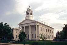 Lafayette County Courthouse in Lexington | |
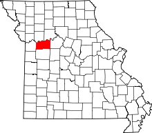 Location in the U.S. state of Missouri | |
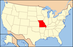 Missouri's location in the U.S. | |
| Founded | November 16, 1820 |
| Named for | Marquis de La Fayette |
| Seat | Lexington |
| Largest city | Odessa |
| Area | |
| • Total | 639 sq mi (1,655 km2) |
| • Land | 628 sq mi (1,627 km2) |
| • Water | 11 sq mi (28 km2), 1.6% |
| Population (est.) | |
| • (2015) | 32,701 |
| • Density | 53/sq mi (20/km²) |
| Congressional district | 5th |
| Time zone | Central: UTC-6/-5 |
| Website |
www |
Lafayette County is a county located in the western portion of the U.S. state of Missouri. As of the 2010 census, the population was 33,381.[1] Its county seat is Lexington.[2] The county was organized November 16, 1820 from Cooper County and originally named Lillard County for James Lillard of Tennessee, who served in the first state constitutional convention and first state legislature.[3] It was renamed Lafayette County on February 16, 1825, in honor of Revolutionary War hero the Marquis de La Fayette, who was then visiting the United States.[4]
Lafayette County is part of the Kansas City, MO-KS Metropolitan Statistical Area.
History
Lafayette County was settled primarily from migrants from the Upper Southern states of Kentucky, Tennessee and Virginia. They brought slaves and slaveholding traditions and started cultivating crops similar to those in Middle Tennessee and Kentucky: hemp and tobacco. As a result, this part of Missouri, and neighboring counties, became known as Little Dixie. In 1860 slaves made up 25 percent or more of the county's population, and the county was strongly pro-Confederate during the American Civil War.[5]
Newcomers from Germany as well as German Americans from St. Louis began arriving shortly before the war, with many more to come afterwards. They eventually made up a large part of the populations of Concordia, Emma, Wellington, Napoleon, Higginsville, Mayview, and Lexington. The German immigrants generally supported the Union during the war.
In November 2013, Leland Ray Kolkmeyer pleaded guilty, in federal court, of a fraud scheme in which he embezzled more than $1.5 million from Wellington-Napoleon Fire Protection District and Special Road District while being their former treasurer.[6][7][8]
Geography
According to the U.S. Census Bureau, the county has a total area of 639 square miles (1,660 km2), of which 628 square miles (1,630 km2) is land and 11 square miles (28 km2) (1.6%) is water.[9]
Adjacent counties
- Ray County (northwest)
- Carroll County (northeast)
- Saline County (east)
- Johnson County (south)
- Jackson County (west)
- Pettis County (southeast)
Major highways
National protected area
Demographics
| Historical population | |||
|---|---|---|---|
| Census | Pop. | %± | |
| 1830 | 2,912 | — | |
| 1840 | 6,815 | 134.0% | |
| 1850 | 13,690 | 100.9% | |
| 1860 | 20,098 | 46.8% | |
| 1870 | 22,623 | 12.6% | |
| 1880 | 25,710 | 13.6% | |
| 1890 | 30,184 | 17.4% | |
| 1900 | 31,679 | 5.0% | |
| 1910 | 30,154 | −4.8% | |
| 1920 | 30,006 | −0.5% | |
| 1930 | 29,259 | −2.5% | |
| 1940 | 27,856 | −4.8% | |
| 1950 | 25,272 | −9.3% | |
| 1960 | 25,274 | 0.0% | |
| 1970 | 26,626 | 5.3% | |
| 1980 | 29,925 | 12.4% | |
| 1990 | 31,107 | 3.9% | |
| 2000 | 32,960 | 6.0% | |
| 2010 | 33,381 | 1.3% | |
| Est. 2015 | 32,701 | [10] | −2.0% |
| U.S. Decennial Census[11] 1790-1960[12] 1900-1990[13] 1990-2000[14] 2010-2015[1] | |||
As of the census[15] of 2000, there were 32,960 people, 12,569 households, and 9,099 families residing in the county. The population density was 52 people per square mile (20/km²). There were 13,707 housing units at an average density of 22 per square mile (8/km²). The racial makeup of the county was 95.52% White, 2.27% Black or African American, 0.29% Native American, 0.25% Asian, 0.03% Pacific Islander, 0.51% from other races, and 1.12% from two or more races. Approximately 1.17% of the population were Hispanic or Latino of any race. 37.3% were of German, 17.5% American, 9.9% English and 9.7% Irish ancestry.
There were 12,569 households out of which 33.90% had children under the age of 18 living with them, 59.30% were married couples living together, 9.40% had a female householder with no husband present, and 27.60% were non-families. 24.00% of all households were made up of individuals and 11.20% had someone living alone who was 65 years of age or older. The average household size was 2.55 and the average family size was 3.01.
In the county, the population was spread out with 26.20% under the age of 18, 7.60% from 18 to 24, 27.50% from 25 to 44, 23.30% from 45 to 64, and 15.40% who were 65 years of age or older. The median age was 38 years. For every 100 females there were 95.90 males. For every 100 females age 18 and over, there were 92.00 males.
The median income for a household in the county was $38,235, and the median income for a family was $45,717. Males had a median income of $31,972 versus $22,684 for females. The per capita income for the county was $18,493. About 6.90% of families and 8.80% of the population were below the poverty line, including 10.90% of those under age 18 and 9.10% of those ages 65 or over.
Education
Public schools
- Concordia R-II School District – Concordia
- Concordia Elementary School (PK-06)
- Concordia High School (07-12)
- Lafayette County C-1 School District – Higginsville
- Grandview Elementary School (PK-05)
- Lafayette County Middle School (06-08)
- Lafayette County High School (09-12)
- Lexington R-V School District – Lexington
- Leslie Bell Elementary School (PK-04)
- Lexington Middle School (05-08)
- Lexington High School (09-12)
- Odessa R-VII School District – Odessa
- McQuerry Elementary School (K-02)
- Odessa Upper Elementary School (03-05)
- Odessa Middle School (06-08)
- Odessa High School (09-12)
- Santa Fe R-X School District – Alma
- Santa Fe Elementary School (K-06)
- Santa Fe High School (07-12)
- Wellington-Napoleon R-IX School District – Wellington
- Wellington-Napoleon Elementary School (PK-06)
- Wellington-Napoleon High School (07-12)
Private schools
- Sionita School – Bates City (PK-08) – Mormon
- Trinity Lutheran School – Alma (K-09) – Lutheran
- Holy Cross Lutheran School – Emma (PK-08) – Lutheran
- Immanuel Lutheran School – Higginsville (K-09) – Lutheran
- Victory Christian Fellowship School – Waverly (K-12) – Nondenominational Christian
- Wentworth Military Academy – Lexington (08-12) – Military
- St. Paul Lutheran Schools – Concordia (K-12) – Lutheran
- St. Paul Lutheran Elementary School (K-08)
- St. Paul Lutheran High School (09-12)
Politics
Local
The Republican Party mostly controls politics at the local level in Lafayette County. Republicans hold a little more than half of the elected positions in the county.
| Lafayette County, Missouri | ||||
|---|---|---|---|---|
| Elected countywide officials | ||||
| Assessor | Mike Dobson | Democratic | ||
| Circuit Clerk | Deana Aversman | Republican | ||
| County Clerk | Linda Niendick | Republican | ||
| Collector | Lori Fiegenbaum | Democratic | ||
| Commissioner (Presiding) |
Harold Hoflander | Republican | ||
| Commissioner (District 1) |
Gil Rector | Democratic | ||
| Commissioner (District 2) |
Tracy Dyer | Republican | ||
| Coroner | Daljeet Singh | Democratic | ||
| Prosecuting Attorney | Kristen Ellis | Democratic | ||
| Public Administrator | Barb Copenhaver | Republican | ||
| Recorder | Patsy Olvera | Republican | ||
| Sheriff | Kerrick Alumbaugh | Democratic | ||
| Surveyor | Mark Nolte | Republican | ||
| Treasurer | Dale Ensor | Democratic | ||
State
| Year | Republican | Democratic | Third Parties |
|---|---|---|---|
| 2008 | 42.70% 7,022 | 55.09% 9,060 | 2.21% 364 |
| 2004 | 52.97% 8,541 | 45.59% 7,351 | 1.43% 231 |
| 2000 | 50.32% 7,276 | 47.94% 6,932 | 1.74% 251 |
| 1996 | 34.00% 4,450 | 63.05% 8,252 | 2.94% 385 |
Lafayette County is divided into four legislative districts in the Missouri House of Representatives, three of which are held by Republicans and one by a Democrat.
- District 26 – Joe Aull (D-Marshal). Consists of the communities of Alma, Concordia, Corder, Dover, Lexington, Waverly, and Wellington.
| Party | Candidate | Votes | % | ± | |
|---|---|---|---|---|---|
| Democratic | Joe Aull | 3,945 | 100.00 | ||
- District 55 – Sheila Solon (R-Blue Springs). Consists of a tiny sliver of the western part of the county.
| Party | Candidate | Votes | % | ± | |
|---|---|---|---|---|---|
| Republican | Sheila Solon | 27 | 75.00 | ||
| Democratic | Clay Rodgers | 8 | 22.22 | ||
| Libertarian | Jeffrey Hoorfar | 1 | 2.78 | ||
- District 118 – Stanley Cox (R-Sedalia). Consists of the community of Emma.
| Party | Candidate | Votes | % | ± | |
|---|---|---|---|---|---|
| Republican | Stanley Cox | 38 | 70.37 | ||
| Democratic | Raymond F. Kinney | 13 | 24.07 | ||
| Constitution | Curtis Shipman | 3 | 5.56 | ||
- District 122 – Mike McGhee (R-Odessa). Consists of the communities of Aullville, Bates City, Higginsville, Lake Lafayete, Napoleon, and Odessa.
| Party | Candidate | Votes | % | ± | |
|---|---|---|---|---|---|
| Republican | Mike McGhee | 4,467 | 62.23 | ||
| Democratic | Holmes Osborne | 2,711 | 37.77 | ||
All of Lafayette County is a part of Missouri’s 21st District in the Missouri Senate and is currently represented by Bob Stouffer (R-Napton).
| Party | Candidate | Votes | % | ± | |
|---|---|---|---|---|---|
| Republican | Bob Stouffer | 10,128 | 63.21 | ||
| Democratic | Joe Sadeghi | 5,896 | 36.79 | ||
Federal
All of Lafayette County is included in Missouri’s 5th Congressional District, which is currently represented by Emanuel Cleaver (D-Kansas City) in the U.S. House of Representatives. Prior to redistricting following the 2010 United States Census, all of Lafayette County was included in Missouri's 4th Congressional District.
| Party | Candidate | Votes | % | ± | |
|---|---|---|---|---|---|
| Democratic | Ike Skelton* | 6,610 | 55.32 | ||
| Republican | Vicky Hartzler | 4,945 | 41.39 | ||
| Libertarian | Jason Michael Braun | 238 | 1.99 | ||
| Constitution | Greg Cowan | 155 | 1.30 | ||
Political culture
| Year | Republican | Democratic | Third Parties |
|---|---|---|---|
| 2008 | 56.88% 9,442 | 41.58% 6,902 | 1.52% 256 |
| 2004 | 59.67% 9,656 | 39.62% 6,412 | 0.70% 114 |
| 2000 | 54.06% 7,849 | 43.68% 6,343 | 2.26% 328 |
| 1996 | 41.57% 5,489 | 46.34 6,118 | 12.09% 1,596 |
Missouri Presidential Preference Primary (2008)
- Former U.S. Senator Hillary Clinton (D-New York) received more votes, a total of 2,464, than any candidate from either party in Lafayette County during the 2008 presidential primary.
| Lafayette County, Missouri | ||
|---|---|---|
| 2008 Republican primary in Missouri | ||
| John McCain | 1,148 (35.28%) | |
| Mike Huckabee | 979 (30.09%) | |
| Mitt Romney | 898 (27.60%) | |
| Ron Paul | 160 (4.92%) | |
| Lafayette County, Missouri | ||
|---|---|---|
| 2008 Democratic primary in Missouri | ||
| Hillary Clinton | 2,464 (60.75%) | |
| Barack Obama | 1,436 (35.04%) | |
| John Edwards (withdrawn) | 106 (2.61%) | |
Communities
- Alma
- Aullville
- Bates City
- Blackburn
- Concordia
- Corder
- Dover
- Emma
- Higginsville
- Lake Lafayette
- Lexington (county seat)
- Mayview
- Napoleon
- Oak Grove
- Odessa
- Waverly
- Wellington
See also
- List of counties in Missouri
- National Register of Historic Places listings in Lafayette County, Missouri
References
- 1 2 "State & County QuickFacts". United States Census Bureau. Retrieved September 10, 2013.
- ↑ "Find a County". National Association of Counties. Retrieved 2011-06-07.
- ↑ "Disappearing Missouri Names". The Kansas City Star. March 19, 1911. p. 15. Retrieved August 15, 2014 – via Newspapers.com.

- ↑ Eaton, David Wolfe (1916). How Missouri Counties, Towns and Streams Were Named. The State Historical Society of Missouri. p. 183.
- ↑ T. J. Stiles, Jesse James: The Last Rebel of the Civil War, New York: Vintage Books, 2003, pp. 10-11
- ↑ Public servant steals $1.5 million from two tiny towns in Missouri; The Kansas City Star; November 22, 2013.
- ↑ Treasurer admits to embezzling over $1 million from small towns’ funds; Fox4KC; November 22, 2013.
- ↑ Treasurer for road district and fire district pleads guilty to embezzling $1.5 million; justice.gov; November 20, 2013.
- ↑ "2010 Census Gazetteer Files". United States Census Bureau. August 22, 2012. Retrieved November 16, 2014.
- ↑ "County Totals Dataset: Population, Population Change and Estimated Components of Population Change: April 1, 2010 to July 1, 2015". Retrieved July 2, 2016.
- ↑ "U.S. Decennial Census". United States Census Bureau. Retrieved November 16, 2014.
- ↑ "Historical Census Browser". University of Virginia Library. Retrieved November 16, 2014.
- ↑ "Population of Counties by Decennial Census: 1900 to 1990". United States Census Bureau. Retrieved November 16, 2014.
- ↑ "Census 2000 PHC-T-4. Ranking Tables for Counties: 1990 and 2000" (PDF). United States Census Bureau. Retrieved November 16, 2014.
- ↑ "American FactFinder". United States Census Bureau. Retrieved 2008-01-31.
External links
- Lafayette County Website
- Digitized 1930 Plat Book of Lafayette County from University of Missouri Division of Special Collections, Archives, and Rare Books
 |
Ray County | Carroll County | | |
| Jackson County | |
Saline County | ||
| ||||
| | ||||
| Johnson County | Pettis County |
Kansas City metropolitan area's cities and counties | ||
|---|---|---|
| Central city | 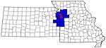 | |
| Largest cities (over 100,000 in 2000) | ||
| Medium-sized cities (10,000 to 100,000 in 2000) | ||
| Smaller Cities (between 5,000 and 9,900 in 2010) | ||
| Counties | ||
Municipalities and communities of Lafayette County, Missouri, United States | ||
|---|---|---|
| Cities | | |
| Villages | ||
| Townships | ||
| Unincorporated communities | ||
| Ghost towns | ||
| Footnotes | ‡This populated place also has portions in an adjacent county or counties | |
Coordinates: 39°04′N 93°47′W / 39.06°N 93.78°W