Knox County, Missouri
| Knox County, Missouri | |
|---|---|
 Knox County Courthouse in Edina | |
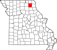 Location in the U.S. state of Missouri | |
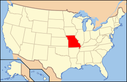 Missouri's location in the U.S. | |
| Founded | February 14, 1845 |
| Named for | Henry Knox |
| Seat | Edina |
| Largest city | Edina |
| Area | |
| • Total | 507 sq mi (1,313 km2) |
| • Land | 504 sq mi (1,305 km2) |
| • Water | 2.8 sq mi (7 km2), 0.6% |
| Population (est.) | |
| • (2015) | 3,910 |
| • Density | 8.2/sq mi (3/km²) |
| Congressional district | 6th |
| Time zone | Central: UTC-6/-5 |
| Website |
www |
Knox County is a county located in the northeast portion of the U.S. state of Missouri. As of the 2010 census, the population was 4,131,[1] making it the third-least populous county in Missouri. Its county seat is Edina.[2] The county was organized February 14, 1845 and named for U.S. Secretary of War General Henry Knox.[3]
Geography
According to the U.S. Census Bureau, the county has a total area of 507 square miles (1,310 km2), of which 504 square miles (1,310 km2) is land and 2.8 square miles (7.3 km2) (0.6%) is water.[4]
Adjacent counties
- Scotland County (north)
- Clark County (northeast)
- Lewis County (east)
- Shelby County (south)
- Macon County (southwest)
- Adair County (west)
Major highways
Demographics
| Historical population | |||
|---|---|---|---|
| Census | Pop. | %± | |
| 1850 | 2,894 | — | |
| 1860 | 8,727 | 201.6% | |
| 1870 | 10,974 | 25.7% | |
| 1880 | 13,047 | 18.9% | |
| 1890 | 13,501 | 3.5% | |
| 1900 | 13,479 | −0.2% | |
| 1910 | 12,403 | −8.0% | |
| 1920 | 10,783 | −13.1% | |
| 1930 | 9,658 | −10.4% | |
| 1940 | 8,878 | −8.1% | |
| 1950 | 7,617 | −14.2% | |
| 1960 | 6,558 | −13.9% | |
| 1970 | 5,692 | −13.2% | |
| 1980 | 5,508 | −3.2% | |
| 1990 | 4,482 | −18.6% | |
| 2000 | 4,361 | −2.7% | |
| 2010 | 4,131 | −5.3% | |
| Est. 2015 | 3,910 | [5] | −5.3% |
| U.S. Decennial Census[6] 1790-1960[7] 1900-1990[8] 1990-2000[9] 2010-2015[1] | |||
As of the census[10] of 2010, there are 4,131 people in the county, organized into 1,791 households and 1,217 families. The population density is 9 people per square mile (3/km²). There are 2,317 housing units at an average density of 5 per square mile (2/km²). The racial makeup of the county is 98.51% White, 0.09% Black or African American, 0.09% Asian, 0.02% Native American, 0.16% from other races, and 1.12% from two or more races. Approximately 0.60% of the population were Hispanic or Latino of any race.
There are 1,791 households out of which 27.90% have children under the age of 18 living with them, 57.50% are married couples living together, 6.90% have a female householder with no husband present, and 32.00% are non-families. 29.30% of all households are made up of individuals and 16.00% have someone living alone who is 65 years of age or older. The average household size is 2.38 and the average family size is 2.93.
24.90% of the county's population is under the age of 18, 6.20% from 18 to 24, 23.70% from 25 to 44, 23.90% from 45 to 64, and 21.20% who are 65 years of age or older. The median age is 42 years. For every 100 females there are 92.9 males. For every 100 females age 18 and over, there are 91.6 males.
The median income for a household in the county is $27,124, and the median income for a family is $31,741. Males have a median income of $22,636 versus $18,902 for females. The per capita income for the county is $13,075. 18.00% of the population and 12.90% of families are below the poverty line. Out of the total population, 24.10% of those under the age of 18 and 16.50% of those 65 and older are living below the poverty line.
The TFR for Knox County in 2004 was relatively high at 2.64, despite the population being 98% white.
Education
Public schools
- Knox County R-I School District – Edina
- Knox County Elementary School (PK-06)
- Knox County High School (07-12)
Politics
Local
The Democratic Party mostly controls politics at the local level in Knox County. Democrats hold all but five of the elected positions in the county.
| Knox County, Missouri | ||||
|---|---|---|---|---|
| Elected countywide officials | ||||
| Assessor | Anita James | Republican | ||
| Circuit Clerk | James Gibbons | Democratic | ||
| County Clerk | Marlene Spory | Republican | ||
| Collector | Brent Karhoff | Republican | ||
| Commissioner (Presiding) |
Evan Glasgow | Republican | ||
| Commissioner (District 1) |
Terry (“Red”) Callahan | Democratic | ||
| Commissioner (District 2) |
Roger Parton | Democratic | ||
| Coroner | Jeffrey Doss | Democratic | ||
| Prosecuting Attorney | David M. Brown | Republican | ||
| Public Administrator | Theresa Allen-Hamlin | Republican | ||
| Recorder | Sandy Woods | Democratic | ||
| Sheriff | Allen Gudehus | Democratic | ||
| Surveyor | Dilbert Sullivan | Democratic | ||
| Treasurer | Donnie Davis | Democratic | ||
State
| Year | Republican | Democratic | Third Parties |
|---|---|---|---|
| 2012 | 47.35% 912 | 50.16% 966 | 2.49% 49 |
| 2008 | 58.88% 1,180 | 39.57% 793 | 1.55% 31 |
| 2004 | 67.41% 1,328 | 31.62% 623 | 0.96% 19 |
| 2000 | 55.48% 1,124 | 43.34% 878 | 1.19% 24 |
| 1996 | 30.52% 623 | 67.71% 1,382 | 1.76% 36 |
All of Knox County is included in Missouri’s 4th District in the Missouri House of Representatives and is represented by Craig Redmon (R-Canton).
| Party | Candidate | Votes | % | ± | |
|---|---|---|---|---|---|
| Republican | Craig Redmon | 1,144 | 100.00 | ||
| Party | Candidate | Votes | % | ± | |
|---|---|---|---|---|---|
| Republican | Craig Redmon | 1,587 | 100.00 | ||
All of Knox County is a part of Missouri’s 18th District in the Missouri Senate and is currently represented by Brian Munzlinger (R-Williamstown).
| Party | Candidate | Votes | % | ± | |
|---|---|---|---|---|---|
| Republican | Brian Munzlinger | 1,174 | 100.00 | +34.28 | |
| Party | Candidate | Votes | % | ± | |
|---|---|---|---|---|---|
| Republican | Brian Munzlinger | 1,068 | 65.72 | ||
| Democratic | Wes Shoemyer | 557 | 34.28 | ||
Federal
| Party | Candidate | Votes | % | ± | |
|---|---|---|---|---|---|
| Democratic | Claire McCaskill | 965 | 49.69 | ||
| Republican | Todd Akin | 905 | 46.60 | ||
| Libertarian | Jonathan Dine | 72 | 3.71 | ||
All of Knox County is included in Missouri’s 6th Congressional District and is currently represented by Sam Graves (R-Tarkio) in the U.S. House of Representatives.
| Party | Candidate | Votes | % | ± | |
|---|---|---|---|---|---|
| Republican | Sam Graves | 971 | 75.45 | +7.72 | |
| Democratic | Bill Hedge | 282 | 21.91 | -8.55 | |
| Libertarian | Russ Monchil | 34 | 2.64 | +0.83 | |
| Party | Candidate | Votes | % | ± | |
|---|---|---|---|---|---|
| Republican | Sam Graves | 1,232 | 67.73 | ||
| Democratic | Kyle Yarber | 554 | 30.46 | ||
| Libertarian | Russ Monchil | 33 | 1.81 | ||
| Year | Republican | Democratic | Third Parties |
|---|---|---|---|
| 2012 | 61.57% 1,205 | 35.67% 698 | 2.76% 54 |
| 2008 | 59.73% 1,212 | 37.41% 759 | 2.86% 58 |
| 2004 | 61.02% 1,207 | 38.47% 761 | 0.50% 10 |
| 2000 | 59.66% 1,226 | 38.30% 787 | 2.04% 42 |
| 1996 | 42.65% 862 | 44.09% 891 | 13.26% 268 |
Missouri Presidential Preference Primary (2008)
- Former U.S. Senator Hillary Clinton (D-New York) received more votes, a total of 300, than any candidate from either party in Knox County during the 2008 presidential primary.
| Knox County, Missouri | ||
|---|---|---|
| 2008 Republican primary in Missouri | ||
| John McCain | 101 (29.45%) | |
| Mike Huckabee | 142 (41.40%) | |
| Mitt Romney | 72 (20.99%) | |
| Ron Paul | 16 (2.53%) | |
| Knox County, Missouri | ||
|---|---|---|
| 2008 Democratic primary in Missouri | ||
| Hillary Clinton | 300 (61.73%) | |
| Barack Obama | 150 (30.86%) | |
| John Edwards (withdrawn) | 28 (5.76%) | |
| Uncommitted | 5 (1.03%) | |
Communities
Townships
Knox County is divided into 13 townships:
- Bee Ridge Township
- Benton Township
- Bourbon Township
- Center Township
- Colony Township
- Fabius Township
- Greensburg Township
- Jeddo Township
- Liberty Township
- Lyon Township
- Myrtle Township
- Salt River Township
- Shelton Township
Notable people
- Terry Joyce, collegiate football All-American and professional football player.
- George Turner, U.S. Senator
See also
References
- 1 2 "State & County QuickFacts". United States Census Bureau. Retrieved September 9, 2013.
- ↑ "Find a County". National Association of Counties. Retrieved 2011-06-07.
- ↑ Eaton, David Wolfe (1916). How Missouri Counties, Towns and Streams Were Named. The State Historical Society of Missouri. p. 182.
- ↑ "2010 Census Gazetteer Files". United States Census Bureau. August 22, 2012. Retrieved November 16, 2014.
- ↑ "County Totals Dataset: Population, Population Change and Estimated Components of Population Change: April 1, 2010 to July 1, 2015". Retrieved July 2, 2016.
- ↑ "U.S. Decennial Census". United States Census Bureau. Retrieved November 16, 2014.
- ↑ "Historical Census Browser". University of Virginia Library. Retrieved November 16, 2014.
- ↑ "Population of Counties by Decennial Census: 1900 to 1990". United States Census Bureau. Retrieved November 16, 2014.
- ↑ "Census 2000 PHC-T-4. Ranking Tables for Counties: 1990 and 2000" (PDF). United States Census Bureau. Retrieved November 16, 2014.
- ↑ "American FactFinder". United States Census Bureau. Retrieved 2008-01-31.
External links
- Digitized 1930 Plat Book of Knox County from University of Missouri Division of Special Collections, Archives, and Rare Books
 |
Scotland County | Clark County | | |
| Adair County | |
Lewis County | ||
| ||||
| | ||||
| Macon County | Shelby County |
Municipalities and communities of Knox County, Missouri, United States | ||
|---|---|---|
| Cities | | |
| Villages | ||
| Townships | ||
| CDP | ||
| Unincorporated communities | ||
| Ghost town | ||
Coordinates: 40°07′N 92°09′W / 40.12°N 92.15°W