The Hammocks, Florida
| The Hammocks | |
|---|---|
| CDP | |
| Nickname(s): Little Bogota | |
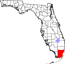
 Location in Miami-Dade County and the state of Florida | |
 U.S. Census Bureau map showing CDP boundaries | |
| Coordinates: 25°40′14″N 80°26′10″W / 25.67056°N 80.43611°WCoordinates: 25°40′14″N 80°26′10″W / 25.67056°N 80.43611°W | |
| Country | United States |
| State | Florida |
| County | Miami-Dade |
| Area | |
| • CDP | 8.1 sq mi (20.8 km2) |
| • Land | 7.9 sq mi (20.4 km2) |
| • Water | 0.2 sq mi (0.4 km2) |
| • Metro | 6,137 sq mi (15,890 km2) |
| Elevation | 3 ft (1 m) |
| Population (2010) | |
| • CDP | 51,003 |
| • Density | 6,300/sq mi (2,500/km2) |
| • Metro | 5,413,212 |
| • Metro density | 880/sq mi (340/km2) |
| Time zone | EST (UTC-5) |
| • Summer (DST) | EDT (UTC-4) |
| ZIP code | 33186, 33196 |
| FIPS code | 12-71569[1] |
| GNIS feature ID | 1853293[2] |
The Hammocks is an unincorporated census-designated place Miami suburb in Miami-Dade County, Florida, United States. The population was 51,003 at the 2010 census.
Name Origin
The name of the CDP originates from a planned community called, "The Hammocks". The area of the planned community is smaller than the CDP, encompassing the area west of SW 137th Ave, south of SW 88th St, east of SW 177 Ave, and north of SW 120th St.
Geography
The Hammocks is located at 25°40′14″N 80°26′10″W / 25.67056°N 80.43611°W (25.670601, -80.436006);[3] or about 6 miles west of Kendall.
According to the United States Census Bureau, the CDP has a total area of 8.0 square miles (21 km2), of which, 7.9 square miles (20 km2) of it is land and 0.2 square miles (0.52 km2) of it (2.12%) is water.
Government and infrastructure
The Miami-Dade Police Department operates the Hammocks District Station in The Hammocks.[4][5]
Education
Public education in The Hammocks is serviced by the Miami-Dade County Public Schools system.
Elementary schools
- Claude Pepper Elementary School
- Gilbert L. Porter Elementary School
- Oliver Hoover Elementary School
- Christina M. Eve Elementary School
Middle school
- Hammocks Middle School
High school
Private school
- Archbishop Coleman F. Carroll High School
- Our Lady of Lourdes Parish School[6]
Demographics
| The Hammocks Demographics | |||
|---|---|---|---|
| 2010 Census | The Hammocks | Miami-Dade County | Florida |
| Total population | 51,003 | 2,496,435 | 18,801,310 |
| Population, percent change, 2000 to 2010 | +7.6% | +10.8% | +17.6% |
| Population density | 6,470.3/sq mi | 1,315.5/sq mi | 350.6/sq mi |
| White or Caucasian (including White Hispanic) | 85.0% | 73.8% | 75.0% |
| (Non-Hispanic White or Caucasian) | 14.0% | 15.4% | 57.9% |
| Black or African-American | 6.1% | 18.9% | 16.0% |
| Hispanic or Latino (of any race) | 76.9% | 65.0% | 22.5% |
| Asian | 3.1% | 1.5% | 2.4% |
| Native American or Native Alaskan | 0.2% | 0.2% | 0.4% |
| Pacific Islander or Native Hawaiian | 0.0% | 0.0% | 0.1% |
| Two or more races (Multiracial) | 2.9% | 2.4% | 2.5% |
| Some Other Race | 2.7% | 3.2% | 3.6% |
As of 2010, there were 17,565 households, with 6.7% being vacant. As of 2000, there were 15,203 households out of which 46.5% had children under the age of 18 living with them, 58.4% were married couples living together, 16.1% had a female householder with no husband present, and 20.7% were non-families. 15.1% of all households were made up of individuals and 1.8% had someone living alone who was 65 years of age or older. The average household size was 3.10 and the average family size was 3.47.
In 2000, the CDP the population was spread out with 28.3% under the age of 18, 10.3% from 18 to 24, 36.2% from 25 to 44, 18.9% from 45 to 64, and 6.3% who were 65 years of age or older. The median age was 32 years. For every 100 females there were 90.3 males. For every 100 females age 18 and over, there were 86.5 males.
In 2000, the median income for a household in the CDP was $50,909, and the median income for a family was $54,444. Males had a median income of $35,159 versus $30,178 for females. The per capita income for the CDP was $18,962. About 7.0% of families and 8.6% of the population were below the poverty line, including 8.6% of those under age 18 and 11.3% of those age 65 or over.
As of 2000, speakers of Spanish as a first language accounted for 71.34% of residents, while English made up 22.82%, French was at 1.21%, French Creole at 0.94%, Portuguese 0.83%, and Arabic was 0.54% of the population. Tagalog made up 0.49% of the population.[7]
As of 2000, The Hammocks had the third highest percentage of Colombian residents in the US, with 10.02% of the populace.[8] It had the twenty-eighth highest percentage of Cuban residents in the US, at 17.59% of the population,[9] the fifth highest percentage of Peruvians in the US, at 3.36%,[10] and the third highest percentage of Venezuelan residents in the US, at 3.14% of its population (tied with Fontainebleau.)[11] It also had the thirteenth most Nicaraguans in the US, at 2.88%,[12] while it had the fifty-fifth highest percentage of Dominicans, at 2.46% of all residents,[13] while the Ecuadorian community had the fifty-fifth highest percentage of residents, which was at 1.10% of the population.[14]
| Historical population | |||
|---|---|---|---|
| Census | Pop. | %± | |
| 1990 | 10,897 | — | |
| 2000 | 47,379 | 334.8% | |
| 2010 | 51,003 | 7.6% | |
| source:[15][16] | |||
Economy

Alienware has its headquarters in The Hammocks.[4][17]
References
- ↑ "American FactFinder". United States Census Bureau. Retrieved 2008-01-31.
- ↑ "US Board on Geographic Names". United States Geological Survey. 2007-10-25. Retrieved 2008-01-31.
- ↑ "US Gazetteer files: 2010, 2000, and 1990". United States Census Bureau. 2011-02-12. Retrieved 2011-04-23.
- 1 2 "The Hammocks CDP, Florida." U.S. Census Bureau. Retrieved on January 9, 2010.
- ↑ "Hammocks District Station." Miami-Dade Police Department. Retrieved on March 12, 2010.
- ↑ Home. Our Lady of Lourdes Parish School. Retrieved on November 14, 2016. "14000 S.W. 112 Street | Miami, FL 33186"
- ↑ "MLA Data Center Results of The Hammocks, FL". Modern Language Association. Retrieved November 11, 2007.
- ↑ "Ancestry Map of Colombian Communities". Epodunk.com. Retrieved November 11, 2007.
- ↑ "Ancestry Map of Cuban Communities". Epodunk.com. Retrieved November 11, 2007.
- ↑ "Ancestry Map of Peruvian Communities". Epodunk.com. Retrieved November 12, 2007.
- ↑ "Ancestry Map of Venezuelan Communities". Epodunk.com. Retrieved November 11, 2007.
- ↑ "Ancestry Map of Nicaraguan Communities". Epodunk.com. Retrieved November 11, 2007.
- ↑ "Ancestry Map of Dominican Communities". Epodunk.com. Retrieved November 11, 2007.
- ↑ "Ancestry Map of Ecuadorian Communities". Epodunk.com. Retrieved November 11, 2007.
- ↑ "CENSUS OF POPULATION AND HOUSING (1790-2000)". U.S. Census Bureau. Retrieved July 17, 2010.
- ↑ Census area returned as Hammocks in 1990.
- ↑ "Empire: Total War Online Contest." Alienware. Retrieved on January 9, 2010.