Gilchrist County, Florida
| Gilchrist County, Florida | |
|---|---|
 | |
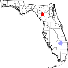 Location in the U.S. state of Florida | |
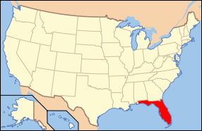 Florida's location in the U.S. | |
| Founded | December 4, 1925 |
| Named for | Albert W. Gilchrist |
| Seat | Trenton |
| Largest city | Trenton |
| Area | |
| • Total | 355 sq mi (919 km2) |
| • Land | 350 sq mi (906 km2) |
| • Water | 5.6 sq mi (15 km2), 1.6% |
| Population (est.) | |
| • (2015) | 17,199 |
| • Density | 48/sq mi (19/km²) |
| Congressional district | 3rd |
| Time zone | Eastern: UTC-5/-4 |
| Website |
gilchrist |

Gilchrist County is a rural county located in the U.S. state of Florida. As of the 2010 census, the population was 16,939.[1] The county seat is Trenton, Florida.[2]
Gilchrist County is included in the Gainesville, FL Metropolitan Statistical Area.
History
Gilchrist County was created in 1925 making it the youngest county in Florida. It was named for Albert W. Gilchrist, Governor of Florida from 1909 to 1913.
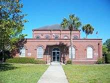
Historic buildings
Historic buildings in Gilchrist County include:
- First Baptist Church, on East Wade Street
- Gilchrist County Courthouse
- Trenton Depot
- The old Trenton Church of Christ on South Main Street.
Geography
According to the U.S. Census Bureau, the county has a total area of 355 square miles (920 km2), of which 350 square miles (910 km2) is land and 5.6 square miles (15 km2) (1.6%) is water.[3] It is the fifth-smallest county in Florida by land area and fourth-smallest by total area.
Adjacent counties
- Columbia County, Florida – northeast
- Alachua County, Florida – east
- Levy County, Florida – south
- Dixie County, Florida – southwest
- Suwannee County, Florida – northwest
- Lafayette County, Florida – northwest
Demographics
| Historical population | |||
|---|---|---|---|
| Census | Pop. | %± | |
| 1930 | 4,137 | — | |
| 1940 | 4,250 | 2.7% | |
| 1950 | 3,499 | −17.7% | |
| 1960 | 2,868 | −18.0% | |
| 1970 | 3,551 | 23.8% | |
| 1980 | 5,767 | 62.4% | |
| 1990 | 9,667 | 67.6% | |
| 2000 | 14,437 | 49.3% | |
| 2010 | 16,939 | 17.3% | |
| Est. 2015 | 17,199 | [4] | 1.5% |
| U.S. Decennial Census[5] 1790–1960[6] 1900–1990[7] 1990–2000[8] 2010–2015[1] | |||
As of the census[9] of 2000, there were 14,437 people, 5,021 households, and 3,715 families residing in the county. The population density was 41 people per square mile (16/km²). There were 5,906 housing units at an average density of 17 per square mile (7/km²). The racial makeup of the county was 90.52% White, 7.00% Black or African American, 0.37% Native American, 0.17% Asian, 0.01% Pacific Islander, 0.69% from other races, and 1.26% from two or more races. 2.80% of the population were Hispanic or Latino of any race.
There were 5,021 households out of which 32.90% had children under the age of 18 living with them, 59.00% were married couples living together, 11.20% had a female householder with no husband present, and 26.00% were non-families. 21.10% of all households were made up of individuals and 8.70% had someone living alone who was 65 years of age or older. The average household size was 2.61 and the average family size was 3.01.
In the county the population was spread out with 24.40% under the age of 18, 14.20% from 18 to 24, 24.80% from 25 to 44, 22.90% from 45 to 64, and 13.60% who were 65 years of age or older. The median age was 35 years. For every 100 females there were 112.50 males. For every 100 females age 18 and over, there were 115.10 males.
The median income for a household in the county was $30,328, and the median income for a family was $34,485. Males had a median income of $27,359 versus $21,946 for females. The per capita income for the county was $13,985. About 10.90% of families and 14.10% of the population were below the poverty line, including 17.60% of those under age 18 and 12.90% of those age 65 or over.
Economy
The Trenton State Farmer's Market is located on State Road 47, north of Trenton.[10]
Politics
Voter registration
According to the Secretary of State's office, Republicans maintain a plurality of registered voters in Gilchrist County.
| Gilchrist County Voter Registration & Party Enrollment as of September 30, 2015[11] | |||||
|---|---|---|---|---|---|
| Political Party | Total Voters | Percentage | |||
| Republican | 5,295 | 49.17% | |||
| Democratic | 3,767 | 34.98% | |||
| Independent | 1,396 | 12.96% | |||
| Third Parties | 311 | 2.89% | |||
| Total | 10,769 | 100.00% | |||
Statewide Elections
| Year | Republican | Democratic | Third Parties |
|---|---|---|---|
| 2012 | 74.55% 5,917 | 23.75% 1,885 | 1.70% 135 |
| 2008 | 72.34% 5,656 | 25.53% 1,996 | 2.13% 167 |
| 2004 | 70.36% 4,936 | 28.75% 2,017 | 0.89% 62 |
| 2000 | 61.17% 3,300 | 35.40% 1,910 | 3.43% 185 |
| 1996 | 40.44% 1,939 | 41.40% 1,985 | 18.16% 871 |
| 1992 | 34.73% 1,395 | 37.62% 1,511 | 27.66% 1,111 |
| Year | Republican | Democratic | Third Parties |
|---|---|---|---|
| 2014 | 69.24% 4,129 | 24.90% 1,485 | 5.86% 349 |
| 2010 | 61.71% 3,321 | 33.39% 1,797 | 4.90% 264 |
| 2006 | 59.59% 3,160 | 35.94% 1,906 | 4.47% 237 |
| 2002 | 60.34% 3,060 | 38.06% 1,930 | 1.60% 81 |
| 1998 | 59.83% 2,097 | 40.17% 1,408 | 0.00% 0 |
| 1994 | 53.05% 1,922 | 46.95% 1,701 | 0.00% 0 |
Library
The Gilchrist County Public library is part of the Three Rivers Regional Library System, which also serves Dixie, Lafayette, and Taylor counties.
Communities
- Bell
- Fanning Springs (shared with Levy County)
- Spring Ridge
- Trenton
Notable people
Easton Corbin, country music singer
References
- 1 2 "State & County QuickFacts". United States Census Bureau. Retrieved June 12, 2014.
- ↑ "Find a County". National Association of Counties. Retrieved 2011-06-07.
- ↑ "US Gazetteer files: 2010, 2000, and 1990". United States Census Bureau. 2011-02-12. Retrieved 2011-04-23.
- ↑ "County Totals Dataset: Population, Population Change and Estimated Components of Population Change: April 1, 2010 to July 1, 2015". Retrieved July 2, 2016.
- ↑ "U.S. Decennial Census". United States Census Bureau. Retrieved June 13, 2014.
- ↑ "Historical Census Browser". University of Virginia Library. Retrieved June 13, 2014.
- ↑ "Population of Counties by Decennial Census: 1900 to 1990". United States Census Bureau. Retrieved June 13, 2014.
- ↑ "Census 2000 PHC-T-4. Ranking Tables for Counties: 1990 and 2000" (PDF). United States Census Bureau. Retrieved June 13, 2014.
- ↑ "American FactFinder". United States Census Bureau. Retrieved 2011-05-14.
- ↑ "Trenton State Farmer's Market" Florida Department of Agriculture and Consumer Services
- ↑ http://dos.myflorida.com/elections/data-statistics/voter-registration-statistics/voter-registration-monthly-reports/voter-registration-current-by-county/
External links
| Wikimedia Commons has media related to Gilchrist County, Florida. |
Government links/Constitutional offices
- Gilchrist County Board of County Commissioners
- Gilchrist County Supervisor of Elections
- Gilchrist County Property Appraiser
- Gilchrist County Sheriff's Office
- Gilchrist County Tax Collector
Special districts
- Gilchrist County Public Schools
- Suwannee River Water Management District [Dead link 26 August 2016]
Judicial branch
- Gilchrist County Clerk of Courts
- Office of the State Attorney, 8th Judicial Circuit of Florida serving Alachua, Baker, Bradford, Gilchrist, Levy and Union Counties
- Circuit and County Court for the 8th Judicial Circuit of Florida
Museum and Library Resources
- The Gilchrist County Journal, the local newspaper for Gilchrist County, Florida fully and openly available in the Florida Digital Newspaper Library
 |
Lafayette County and Suwannee County | Columbia County | | |
| |
Alachua County | |||
| ||||
| | ||||
| Dixie County | Levy County |
Municipalities and communities of Gilchrist County, Florida, United States | ||
|---|---|---|
| Cities | | |
| Town | ||
| CDP | ||
| Unincorporated communities | ||
| Footnotes | ‡This populated place also has portions in an adjacent county or counties | |

Coordinates: 29°44′N 82°48′W / 29.73°N 82.80°W