Golden Glades, Florida
| Golden Glades, Florida | |
|---|---|
| CDP | |
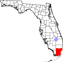
 Location in Miami-Dade County and the state of Florida | |
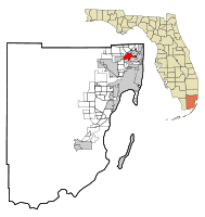
 U.S. Census Bureau map showing CDP boundaries | |
| Coordinates: 25°54′46″N 80°11′52″W / 25.91278°N 80.19778°WCoordinates: 25°54′46″N 80°11′52″W / 25.91278°N 80.19778°W | |
| Country |
|
| State |
|
| County | Miami-Dade |
| Area | |
| • Total | 5 sq mi (12.9 km2) |
| • Land | 4.9 sq mi (12.7 km2) |
| • Water | 0.1 sq mi (0.2 km2) |
| Elevation | 3 ft (1 m) |
| Highest elevation | 42 ft (13 m) |
| Population (2010) | |
| • Total | 33,145 |
| • Density | 6,524.6/sq mi (2,528.9/km2) |
| Time zone | Eastern (EST) (UTC-5) |
| • Summer (DST) | EDT (UTC-4) |
| FIPS code | 12-26375[1] |
| GNIS feature ID | 1867145[2] |
Golden Glades is a census-designated place (CDP) in Miami-Dade County, Florida, United States. The population was 33,145 at the 2010 census.[3]
It is the location for a major highway interchange of the same name which connects the Florida Turnpike, Interstate 95, US 441, State Road 9, and the Palmetto Expressway.
Geography
Golden Glades is located at 25°54′46″N 80°11′52″W / 25.91278°N 80.19778°W (25.912771, -80.197688).[4]
According to the United States Census Bureau, the CDP has a total area of 12.9 km² (5.0 mi²). 12.7 km² (4.9 mi²) of it is land and 0.2 km² (0.1 mi²) of it (1.20%) is water.
Demographics
| Historical population | |||
|---|---|---|---|
| Census | Pop. | %± | |
| 1980 | 23,154 | — | |
| 1990 | 25,474 | 10.0% | |
| 2000 | 32,623 | 28.1% | |
| 2010 | 33,145 | 1.6% | |
| source:[3][5] | |||
As of the census[1] of 2010, there were 33,145 people, 9,826 households, and 7,281 families residing in the CDP. The population density was 2,560.1/km² (6,635.0/mi²). There were 10,540 housing units at an average density of 827.1/km² (2,143.7/mi²). The racial makeup of the CDP was 23.38% White (7.0% were Non-Hispanic White,)[6] 72.8% African American, 0.28% Native American, 1.6% Asian, 0.07% Pacific Islander, 2.1% from other races, and 3.1% from two or more races. Hispanic or Latino of any race were 18.5% of the population.
In 2010 Golden Glades 40.12% of the population reported Haitian ancestry,[7] the highest percentage of any community in the United States.
There were 9,826 households out of which 44.5% had children under the age of 18 living with them, 41.8% were married couples living together, 24.5% had a female householder with no husband present, and 25.9% were non-families. 20.6% of all households were made up of individuals and 7.3% had someone living alone who was 65 years of age or older. The average household size was 3.23 and the average family size was 3.72.
In the CDP the population was spread out with 31.1% under the age of 18, 10.2% from 18 to 24, 30.1% from 25 to 44, 18.5% from 45 to 64, and 10.1% who were 65 years of age or older. The median age was 31 years. For every 100 females there were 89.2 males. For every 100 females age 18 and over, there were 83.8 males.
The median income for a household in the CDP was $30,841, and the median income for a family was $33,577. Males had a median income of $25,036 versus $21,409 for females. The per capita income for the CDP was $12,341. About 18.5% of families and 20.9% of the population were below the poverty line, including 25.4% of those under age 18 and 24.0% of those age 65 or over.
As of 2000, speakers of English as a first language accounted for 44.27% of residents, while French Creole made up 31.35%, Spanish was at 18.63%, and French was at 3.82% of the population.[8]
As of 2010, Golden Glades had the highest percentage of Haitian residents in the US, with 40.12% of the populace It had the percentage of Bahamian residents in the US, at 0.6% of the population,[9] and the percentage of Jamaican residents in the US, at 2.47% [10] It also had the percentage of Cubans in the US, at 4.3% of the population,[11] while it had the percentage of Dominicans, at 2.12% of all residents (tied with North Miami and East Newark, New Jersey.)[12]
Education
Golden Glades is within the Miami-Dade County Public Schools.
Transportation
Golden Glades is served by Tri-Rail at the Golden Glades station. It contains a park-and-ride facility, and also serves as a feeder for buses from the surrounding area, run by both Miami-Dade Transit and Broward County Transit.
References
- 1 2 "American FactFinder". United States Census Bureau. Retrieved 2008-01-31.
- ↑ "US Board on Geographic Names". United States Geological Survey. 2007-10-25. Retrieved 2008-01-31.
- 1 2 "American FactFinder - Community Facts". Factfinder2.census.gov. 2010-10-05. Retrieved 2013-07-18.
- ↑ "US Gazetteer files: 2010, 2000, and 1990". United States Census Bureau. 2011-02-12. Retrieved 2011-04-23.
- ↑ "CENSUS OF POPULATION AND HOUSING (1790-2000)". U.S. Census Bureau. Retrieved 2010-07-17.
- ↑ "Demographics of Golden Glades, FL". MuniNetGuide.com. Retrieved 2007-11-06.
- ↑ Haitian ancestry by city - ePodunk
- ↑ "MLA Data Center Results of Golden Glades, FL". Modern Language Association. Retrieved 2007-11-06.
- ↑ "Ancestry Map of Bahamian Communities". Epodunk.com. Retrieved 2007-11-06.
- ↑ "Ancestry Map of Jamaican Communities". Epodunk.com. Retrieved 2007-11-06.
- ↑ "Ancestry Map of Cuban Communities". Epodunk.com. Retrieved 2007-11-06.
- ↑ "Ancestry Map of Dominican Communities". Epodunk.com. Retrieved 2007-11-06.