Tamiami, Florida
| Tamiami, Florida | |
|---|---|
| CDP | |
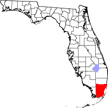
 Location in Miami-Dade County and the state of Florida | |
 U.S. Census Bureau map showing CDP boundaries | |
| Coordinates: 25°45′18″N 80°24′13″W / 25.75500°N 80.40361°WCoordinates: 25°45′18″N 80°24′13″W / 25.75500°N 80.40361°W | |
| Country |
|
| State |
|
| County | Miami-Dade |
| Area | |
| • Total | 7.5 sq mi (19.6 km2) |
| • Land | 7.3 sq mi (19 km2) |
| • Water | 0.2 sq mi (0.6 km2) |
| Elevation | 3 ft (1 m) |
| Population (2000) | |
| • Total | 54,788 |
| • Density | 7,305.1/sq mi (2,795.3/km2) |
| Time zone | Eastern (EST) (UTC-5) |
| • Summer (DST) | EDT (UTC-4) |
| FIPS code | 12-70700[1] |
| GNIS feature ID | 1867216[2] |
Tamiami is a census-designated place (CDP) in Miami-Dade County, Florida, United States. The population was 55,271 at the 2010 census.
Name Origin
Tamiami is a contraction of the phrase "Tampa to Miami". The Tamiami Trail, a roadway that goes through the Everglades, connecting the two cities, was the reason for this unique combination. While the name is a combination of both cities' names, the accepted pronunciation is "Tammee-Ammy," not "Tam-My-Ammy."
Geography
Tamiami is located at 25°45′18″N 80°24′13″W / 25.75500°N 80.40361°W (25.754945, -80.403611).[3]
According to the United States Census Bureau, the CDP has a total area of 7.6 square miles (20 km2), of which, 7.3 square miles (19 km2) of it is land and 0.2 square miles (0.52 km2) of it (3.04%) is water.
Demographics
| Tamiami Demographics | |||
|---|---|---|---|
| 2010 Census | Tamiami | Miami-Dade County | Florida |
| Total population | 55,271 | 2,496,435 | 18,801,310 |
| Population, percent change, 2000 to 2010 | +0.9% | +10.8% | +17.6% |
| Population density | 7,819.7/sq mi | 1,315.5/sq mi | 350.6/sq mi |
| White or Caucasian (including White Hispanic) | 94.5% | 73.8% | 75.0% |
| (Non-Hispanic White or Caucasian) | 6.2% | 15.4% | 57.9% |
| Black or African-American | 1.3% | 18.9% | 16.0% |
| Hispanic or Latino (of any race) | 92.7% | 65.0% | 22.5% |
| Asian | 0.7% | 1.5% | 2.4% |
| Native American or Native Alaskan | 0.1% | 0.2% | 0.4% |
| Pacific Islander or Native Hawaiian | 0.0% | 0.0% | 0.1% |
| Two or more races (Multiracial) | 1.3% | 2.4% | 2.5% |
| Some Other Race | 2.1% | 3.2% | 3.6% |
As of 2010, there were 17,256 households, with 3.0% being vacant. As of 2000, 42.1% had children under the age of 18 living with them, 66.0% were married couples living together, 16.2% had a female householder with no husband present, and 12.6% were non-families. 9.4% of all households were made up of individuals and 3.5% had someone living alone who was 65 years of age or older. The average household size was 3.33 and the average family size was 3.50.
As of 2000, the CDP population was spread out with 24.4% under the age of 18, 8.7% from 18 to 24, 30.0% from 25 to 44, 24.1% from 45 to 64, and 12.9% who were 65 years of age or older. The median age was 37 years. For every 100 females there were 90.4 males. For every 100 females age 18 and over, there were 85.4 males.
As of 2000, the median income for a household in the CDP was $47,503, and the median income for a family was $49,763. Males had a median income of $30,716 versus $26,426 for females. The per capita income for the CDP was $17,601. About 7.6% of families and 9.4% of the population were below the poverty line, including 12.0% of those under age 18 and 9.7% of those age 65 or over.
As of 2000, speakers of Spanish as a first language accounted for 92.39% of residents, while English was the mother tongue of 6.99% of the population. Other languages spoken were well below 1% of the population.[4]
As of 2000, Tamiami had the seventh highest percentage of Cuban and Cuban American residents in the US, with 56.63% of the populace.[5] Nicaraguans and Nicaraguan American made up the fifth highest percentage, at 4.66% of Tamiami residents.[6] It had the thirty-second highest percentage of Colombian and Colombian American residents in the US, at 3.94% of the population,[7] and the 105th highest percentage of Dominican and Dominican American residents in the US, at 1.53% of its population (tied with Ives Estates, FL, Adelphi, Maryland, and Dover, New Jersey.)[8] It also had the eighteenth most Venezuelan and Venezuelan American residents in the US, at 1.06% of the population (tied with Miami Lakes.)[9]
| Historical population | |||
|---|---|---|---|
| Census | Pop. | %± | |
| 1980 | 17,607 | — | |
| 1990 | 33,845 | 92.2% | |
| 2000 | 54,788 | 61.9% | |
| 2010 | 55,271 | 0.9% | |
| source:[10] | |||
References
- ↑ "American FactFinder". United States Census Bureau. Retrieved 2008-01-31.
- ↑ "US Board on Geographic Names". United States Geological Survey. 2007-10-25. Retrieved 2008-01-31.
- ↑ "US Gazetteer files: 2010, 2000, and 1990". United States Census Bureau. 2011-02-12. Retrieved 2011-04-23.
- ↑ "MLA Data Center Results of Tamiami, FL". Modern Language Association. Retrieved 2007-11-10.
- ↑ "Ancestry Map of Cuban Communities". Epodunk.com. Retrieved 2007-11-10.
- ↑ "Ancestry Map of Nicaraguan Communities". Epodunk.com. Retrieved 2007-12-05.
- ↑ "Ancestry Map of Colombian Communities". Epodunk.com. Retrieved 2007-11-10.
- ↑ "Ancestry Map of Dominican Communities". Epodunk.com. Retrieved 2007-11-10.
- ↑ "Ancestry Map of Venezuelan Communities". Epodunk.com. Retrieved 2007-11-10.
- ↑ "CENSUS OF POPULATION AND HOUSING (1790-2000)". U.S. Census Bureau. Retrieved 2010-07-17.