Osceola County, Florida
| Osceola County, Florida | |||
|---|---|---|---|
 The Osceola County courthouse in October 2009 | |||
| |||
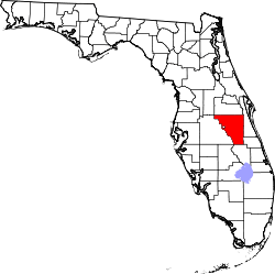 Location in the U.S. state of Florida | |||
 Florida's location in the U.S. | |||
| Founded | May 12, 1887 | ||
| Named for | Osceola | ||
| Seat | Kissimmee | ||
| Largest city | Kissimmee | ||
| Area | |||
| • Total | 1,506 sq mi (3,901 km2) | ||
| • Land | 1,327 sq mi (3,437 km2) | ||
| • Water | 178 sq mi (461 km2), 11.9% | ||
| Population (est.) | |||
| • (2015) | 323,993 | ||
| • Density | 244/sq mi (94.3/km²) | ||
| Congressional district | 9th | ||
| Time zone | Eastern: UTC-5/-4 | ||
| Website |
www | ||


Osceola County (/ɒsiˈoʊlə/, o-si-OH-lə) is a county located in the U.S. state of Florida. As of the 2010 census, the population was 268,685.[1] Its county seat is Kissimmee.[2]
Osceola County is included in the Orlando-Kissimmee-Sanford, Fla. Metropolitan Statistical Area.
Etymology
Osceola County is named for the Indian leader Osceola,[3] whose name means "Black Drink Cry [Asi Yaholo]".
History
Osceola County was created in 1887. On July 21, 1821, Florida was divided into two counties, named Escambia County to the west and St. John's County to the east. In 1824, the southern part of St. John's County became Mosquito County, with Enterprise as the county seat. In 1844, Brevard County was carved out from Mosquito County. When Florida became a state in 1845, Mosquito County was renamed Orange County. On May 12, 1887, Osceola was named a county, having been created from both Orange and Brevard Counties. Osceola County reached all the way down to Lake Okeechobee until 1917 when Okeechobee County was formed.
Since the late 20th century, Osceola County has experienced a significant influx of migrants from the Commonwealth of Puerto Rico, the unincorporated territory of the United States,[4] and in the 2000 U.S. Census Puerto Rican was the largest self-reported ancestry group.[5]
Government
| Year | Republican | Democratic | Other |
|---|---|---|---|
| 2016 | 35.56% 50,293 | 60.41% 85,431 | 4.01% 5,704 |
| 2012 | 37.27% 40,592 | 61.73% 67,239 | 1.00% 1,091 |
| 2008 | 39.72% 40,086 | 59.41% 59,962 | 0.87% 877 |
| 2004 | 52.45% 43,117 | 47.00% 38,633 | 0.55% 354 |
| 2000 | 47.11% 26,237 | 50.61% 28,187 | 2.27% 1,266 |
Osceola County is a Charter county, and a subdivision within the State of Florida. Voters approved the County Charter in March 1992, and it took effect on October 1, 1992. The structure of County government under the charter does not depart dramatically from the structure of a County government outlined in the Florida Statutes.
Osceola County Government is governed by three sets of elected officials, each of which independently directs separate branches of County Government. These include: the five-member County Commission, five separate Constitutional Officers, and a number of Judicial Officers. Under State law, the County Commission is responsible for funding the budgets of all Osceola County Government, including the independently elected Constitutional Officers and Judicial Officers, as well as the Commission's own departments. Each independent officer has discretion to administer his or her own programs. The County Commission exercises oversight only over its own departments.
Osceola County has five electoral districts each represented by a commissioner. All the commissioners compose the Board of Commissioners that appoint a County Manager. There also is a Commission Auditor and County Attorney.
Legislature
- Board of County Commissioners
- District 1 - Michael E. Harford (D)
- District 2 - Viviana Janer (D)
- District 3 - Brandon Arrington (D)
- District 4 - Cheryl Grieb (D)
- District 5 - Fred Hawkins, Jr. (R)
Executive
- County Manager
- Deputy County Manager
- Commission Auditor
- County Attorney
Constitutional Officers
- Sheriff - Bob Hansell (D)
- Property Appraiser - Katrina Scarborough (R)
- Clerk of the Courts - Armando Ramirez (D)
- Supervisor of Elections - Mary Jane Arrington (D)
- Tax Collector - Patsy Heffner (R)
- Public Defender - Bob Wesley Ocseola County Organizational Chart -
- State's Attorney - Jeff Ashton
Voter registration
| Registered Voters as of November, 20th, 2016[7] | |||||
|---|---|---|---|---|---|
| Party | Total | Percentage | |||
| Democratic | 87,213 | 43.79% | |||
| Republican | 47,531 | 23.86% | |||
| Minor parties | 4,013 | 2.01% | |||
| Unaffiliated | 60,410 | 30.33% | |||
| Total | 199,167 | 100.00% | |||
Geography
According to the U.S. Census Bureau, the county has a total area of 1,506 square miles (3,900 km2), of which 1,327 square miles (3,440 km2) is land and 178 square miles (460 km2) (11.9%) is water.[8]
Adjacent counties
- Orange County - north
- Brevard County - northeast
- Indian River County - east
- Okeechobee County - southeast
- Highlands County - south
- Polk County - west
- Lake County - northwest
Transportation
Airports
Major highways
Demographics
| Historical population | |||
|---|---|---|---|
| Census | Pop. | %± | |
| 1890 | 3,133 | — | |
| 1900 | 3,444 | 9.9% | |
| 1910 | 5,507 | 59.9% | |
| 1920 | 7,195 | 30.7% | |
| 1930 | 10,699 | 48.7% | |
| 1940 | 10,119 | −5.4% | |
| 1950 | 11,406 | 12.7% | |
| 1960 | 19,029 | 66.8% | |
| 1970 | 25,267 | 32.8% | |
| 1980 | 49,287 | 95.1% | |
| 1990 | 107,728 | 118.6% | |
| 2000 | 172,493 | 60.1% | |
| 2010 | 268,685 | 55.8% | |
| Est. 2015 | 323,993 | [9] | 20.6% |
| U.S. Decennial Census[10] 1790-1960[11] 1900-1990[12] 1990-2000[13] 2010-2015[1] | |||
As of the census[14] of 2012, there were 287,416 people, and 92,526 households residing in the county. The population density was 203 people per square mile (50/km²). There were 128,170 housing units at an average density of 60 per square mile (21/km²). The racial makeup of the county was 38.2% Non-Hispanic White, 13.0% Non-Hispanic Black or African American, 0.7% Native American, 3.0% Asian, 0.2% Pacific Islander, and 2.5% from two or more races. 47.8% of the population were Hispanic or Latino of any race, majority of which are Puerto Ricans, who account for 25.0% of the population and are the largest ancestral group in the county.
36.72% of the county population is affiliated with a religious congregation. There are 206 religious congregations in the county. 15.87% are Catholic; 1.22% are Mormons; 4.83% are Baptist, 3.53% are Pentecostal, 7.92% are members of other Christian faiths, 0.05% are Jewish, 0.18% affiliate with an eastern faith, and 3.12% affilitate with Islam.
There were 60,977 households out of which 36.40% had children under the age of 18 living with them, 56.10% were married couples living together, 12.80% had a female householder with no husband present, and 26.10% were non-families. 19.10% of all households were made up of individuals and 7.00% had someone living alone who was 65 years of age or older. The average household size was 2.79 and the average family size was 3.18.
In the county the population was spread out with 26.80% under the age of 18, 9.30% from 18 to 24, 31.00% from 25 to 44, 21.60% from 45 to 64, and 11.40% who were 65 years of age or older. The median age was 35 years. For every 100 females there were 97.20 males. For every 100 females age 18 and over, there were 94.20 males.
The median income for a household in the county was $39,214, and the median income for a family was $44,061. Males had a median income of $30,034 versus $23,750 for females. The per capita income for the county was $20,536. About 13.3% of the population were below the poverty line, including 14.70% of those under age 18 and 8.60% of those age 65 or over.
Education
The School District of Osceola County, Florida serves the county.
Colleges
- Johnson University Florida
- Florida Technical College
- Heritage University & Seminary
- Stetson University
- Valencia College - Osceola Campus
Libraries
- Hart Memorial Central Library
- Veterans Memorial Library, St. Cloud Branch
- Buenaventura Lakes Branch Library
- Poinciana Branch Library
- Osceola Library System
- Kenansville Branch Library
- Narcoossee Library Annex
Communities
Cities
Unincorporated communities
Planned development
Currently, a new suburb is planned in Osceola County called Destiny. If completely built, it would house up to 240,000 residents.
Special district
- Reedy Creek Improvement District
- Crescent Lake Common Facilities District
See also
References
- 1 2 "State & County QuickFacts". United States Census Bureau. Retrieved February 14, 2014.
- ↑ "Find a County". National Association of Counties. Retrieved 2011-06-07.
- ↑ Publications of the Florida Historical Society. Florida Historical Society. 1908. p. 33.
- ↑ Rohter, Larry (1994-01-31). "A Puerto Rican Boom for Florida - NYTimes.com". New York Times. Retrieved 2010-02-19.
- ↑ Image:Census-2000-Data-Top-US-Ancestries-by-County.jpg
- ↑ http://uselectionatlas.org/
- ↑ "Registration and Party Enrollment Statistics as of November 20, 2016" (PDF). Osceola County Supervisor of Elections. Retrieved 2016-11-20.
- ↑ "US Gazetteer files: 2010, 2000, and 1990". United States Census Bureau. 2011-02-12. Retrieved 2011-04-23.
- ↑ "County Totals Dataset: Population, Population Change and Estimated Components of Population Change: April 1, 2010 to July 1, 2015". Retrieved July 2, 2016.
- ↑ "U.S. Decennial Census". United States Census Bureau. Retrieved June 16, 2014.
- ↑ "Historical Census Browser". University of Virginia Library. Retrieved June 16, 2014.
- ↑ "Population of Counties by Decennial Census: 1900 to 1990". United States Census Bureau. Retrieved June 16, 2014.
- ↑ "Census 2000 PHC-T-4. Ranking Tables for Counties: 1990 and 2000" (PDF). United States Census Bureau. Retrieved June 16, 2014.
- ↑ "American FactFinder". United States Census Bureau. Retrieved 2011-05-14.
- ↑ "Crescent Lakes Common Facilities District". http://www.osceola.org. Osceola County Government. Retrieved 28 July 2014. External link in
|website=(help)
External links
| Wikimedia Commons has media related to Osceola County, Florida. |
Government links/Constitutional offices
- Osceola County Charter
- Osceola County Government / Board of County Commissioners
- Osceola County Supervisor of Elections
- Osceola County Property Appraiser
- Osceola County Sheriff's Office
- Osceola County Tax Collector
- Kissimmee Utility Authority (local power and Internet provider)
Library System
Special Districts
- School District of Osceola County
- South Florida Water Management District
- St. Johns River Water Management District
Judicial branch
- Osceola County Clerk of Courts
- Public Defender, 9th Judicial Circuit of Florida serving Orange and Osceola Counties
- Circuit and County Court for the 9th Judicial Circuit of Florida
External links
- Official website
- Kissimmee Convention & Visitors Bureau
- Kissimmee/Osceola County Chamber of Commerce
- Osceola County Guide
- Florida Association of Counties (FAC)
History
 |
Lake County | Orange County | Brevard County | |
| Polk County | |
Indian River County | ||
| ||||
| | ||||
| Highlands County | Okeechobee County |
Municipalities and communities of Osceola County, Florida, United States | ||
|---|---|---|
| Cities | | |
| CDPs | ||
| Unincorporated communities |
| |
| Footnotes | ‡This populated place also has portions in an adjacent county or counties | |

Coordinates: 28°04′N 81°09′W / 28.06°N 81.15°W