Surfside, Florida
| Town of Surfside, Florida Surfside | ||
|---|---|---|
| Town | ||
|
Surfside with buildings on Collins Ave in background | ||
| ||
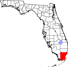
 Location in Miami-Dade County and the state of Florida | ||
 U.S. Census Bureau map showing town boundaries | ||
| Coordinates: 25°52′42.27″N 80°7′33.58″W / 25.8784083°N 80.1259944°WCoordinates: 25°52′42.27″N 80°7′33.58″W / 25.8784083°N 80.1259944°W | ||
| Country |
| |
| State |
| |
| County |
| |
| Incorporated | May 18, 1935 | |
| Government | ||
| • Type | Council-Manager | |
| • Mayor | Daniel Dietch | |
| • Vice Mayor | Barry Cohen | |
| • Commissioners |
Daniel Gielchinsky, Michael Karukin, Tina Paul | |
| • Town Manager | Guillermo Olmedillo | |
| • Town Clerk | Sandra Novoa | |
| Area | ||
| • Total | 1.0 sq mi (2.5 km2) | |
| • Land | 0.5 sq mi (1.3 km2) | |
| • Water | 0.5 sq mi (1.2 km2) 47.42% | |
| Elevation | 0 ft (0 m) | |
| Population (2010) | ||
| • Total | 5,744 | |
| • Density | 10,067.9/sq mi (3,887.2/km2) | |
| Time zone | EST (UTC-5) | |
| • Summer (DST) | EDT (UTC-4) | |
| Zip Code | 33154 | |
| Area code(s) | 305, 786 | |
| FIPS code | 12-70075[1] | |
| GNIS feature ID | 0291892[2] | |
| Website | http://www.townofsurfsidefl.gov | |

.png)

Surfside is a town in Miami-Dade County, Florida, United States. As of 2010, the population recorded by the U.S. Census Bureau is 5,744. The current Mayor is Daniel Dietch.[3]
Geography
According to the United States Census Bureau, the town has a total area of 2.5 km2 (1.0 sq mi). 1.3 km2 (0.5 sq mi) of it is land and 1.2 km2 (0.5 sq mi) of it (47.42%) is water.
Surrounding areas
- Bal Harbour
- Bay Harbor Islands


 Atlantic Ocean
 - Bay Harbor Islands, Indian Creek

 Atlantic Ocean
 - Miami Beach


 Atlantic Ocean
 - Miami Beach
Demographics
| Historical population | |||
|---|---|---|---|
| Census | Pop. | %± | |
| 1940 | 295 | — | |
| 1950 | 1,852 | 527.8% | |
| 1960 | 3,157 | 70.5% | |
| 1970 | 3,614 | 14.5% | |
| 1980 | 3,763 | 4.1% | |
| 1990 | 4,108 | 9.2% | |
| 2000 | 4,909 | 19.5% | |
| 2010 | 5,744 | 17.0% | |
| Est. 2015 | 6,024 | [4] | 4.9% |
| Surfside Demographics | |||
|---|---|---|---|
| 2010 Census | Surfside | Miami-Dade County | Florida |
| Total population | 5,744 | 2,496,435 | 18,801,310 |
| Population, percent change, 2000 to 2010 | +17.0% | +10.8% | +17.6% |
| Population density | 10,067.9/sq mi | 1,315.5/sq mi | 350.6/sq mi |
| White or Caucasian (including White Hispanic) | 94.6% | 73.8% | 75.0% |
| (Non-Hispanic White or Caucasian) | 50.1% | 15.4% | 57.9% |
| Black or African-American | 1.3% | 18.9% | 16.0% |
| Hispanic or Latino (of any race) | 46.5% | 65.0% | 22.5% |
| Asian | 1.3% | 1.5% | 2.4% |
| Native American or Native Alaskan | 0.1% | 0.2% | 0.4% |
| Pacific Islander or Native Hawaiian | 0.0% | 0.0% | 0.1% |
| Two or more races (Multiracial) | 1.7% | 2.4% | 2.5% |
| Some Other Race | 1.0% | 3.2% | 3.6% |
As of 2010, there were 3,890 households out of which 32.9% were vacant. In 2000, 20.5% had children under the age of 18 living with them, 46.6% were married couples living together, 9.6% had a female householder with no husband present, and 40.8% were non-families. 32.9% of all households were made up of individuals and 15.1% had someone living alone who was 65 years of age or older. The average household size was 2.18 and the average family size was 2.75.
In 2000, the town's population was spread out with 16.3% under the age of 18, 4.5% from 18 to 24, 29.3% from 25 to 44, 24.0% from 45 to 64, and 25.9% who were 65 years of age or older. The median age was 45 years. For every 100 females there were 86.9 males. For every 100 females age 18 and over, there were 86.4 males.
In 2000, the median income for a household in the town was $50,927, and the median income for a family was $56,327. Males had a median income of $47,147 versus $39,181 for females. The per capita income for the town was $38,375. About 6.7% of families and 11.5% of the population were below the poverty line, including 19.4% of those under age 18 and 7.9% of those age 65 or over.
As of 2000, Spanish was spoken as a first language by 49.41% of residents, while English was spoken by 42.11% of the population. Other languages spoken included Portuguese 2.36%, Russian 2.04%, German and Yiddish were both tied at 1.40%, and French was the mother tongue for 1.29% of the populace.[6]
As of 2000, Surfside had the twentieth highest percentage of Brazilian residents in the US, with 1.60% of the US populace (tied with five other places in the US, including Ojus, FL.)[7] It had the twenty-third highest percentage of Colombian residents in the US, at 4.66% of the town's population,[8] as well as the twenty-third highest percentage of Cuban residents in the US, at 20.15% of the its population.[9] It also had the thirty-fourth most Peruvians in the US, at 1.47%,[10] while it had the eleventh highest percentage of Trinidadians and Tobagonians, at 1.30% of all residents (tied with North Amityville, New York and Gordon Heights, New York.)[11] Surfside's Venezuelan community had the eleventh highest percentage of residents, which was at 1.41% of all residents.[12]
References
- ↑ "American FactFinder". United States Census Bureau. Retrieved 2008-01-31.
- ↑ "US Board on Geographic Names". United States Geological Survey. 2007-10-25. Retrieved 2008-01-31.
- ↑ "Surfside, FL". Town of Surfside, FL. Retrieved 2016-07-06.
- ↑ "Annual Estimates of the Resident Population for Incorporated Places: April 1, 2010 to July 1, 2015". Retrieved July 2, 2016.
- ↑ "Census of Population and Housing". Census.gov. Retrieved June 4, 2015.
- ↑ "MLA's Data Center Results of Surfside, FL". Modern Language Association. Retrieved 2007-10-28.
- ↑ "Ancestry Map of Brazilian Communities". Epodunk.com. Retrieved 2007-10-28.
- ↑ "Ancestry Map of Colombian Communities". Epodunk.com. Retrieved 2007-10-28.
- ↑ "Ancestry Map of Cuban Communities". Epodunk.com. Retrieved 2007-10-28.
- ↑ "Ancestry Map of Peruvian Communities". Epodunk.com. Retrieved 2007-10-28.
- ↑ "Ancestry Map of Trinidadian and Tobagonian Communities". Epodunk.com. Retrieved 2007-10-28.
- ↑ "Ancestry Map of Venezuelan Communities". Epodunk.com. Retrieved 2007-10-28.
External links
- Town of Surfside Official Government Website
- Visit Surfside Official Tourism Website