Charlotte County, Florida
| Charlotte County, Florida | ||
|---|---|---|
| County | ||
| Charlotte County | ||
.JPG) The Charlotte County Courthouse at Punta Gorda in April 2010. | ||
| ||
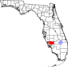 Location in the U.S. state of Florida | ||
 Florida's location in the U.S. | ||
| Founded | April 23, 1921 | |
| Named for | Charlotte Harbor | |
| Seat | Punta Gorda | |
| Largest community | Port Charlotte | |
| Area | ||
| • Total | 858 sq mi (2,222 km2) | |
| • Land | 680 sq mi (1,761 km2) | |
| • Water | 178 sq mi (461 km2), 20.7% | |
| Population (est.) | ||
| • (2015) | 173,115 | |
| • Density | 235/sq mi (91/km²) | |
| Congressional district | 17th | |
| Time zone | Eastern: UTC-5/-4 | |
| Website |
www | |

Charlotte County is a county located in the U.S. state of Florida. As of the 2010 census, the population was 159,978.[1] Its county seat is Punta Gorda.[2]
Charlotte County comprises the Punta Gorda, FL Metropolitan Statistical Area, which is included in the North Port-Sarasota, FL Combined Statistical Area.
History
Charlotte County was established April 23, 1921. It was named for the Bay of Charlotte Harbor. "Charlotte" came from "Carlos" (Spanish), "Charles" (English), or "Calos" (Calusa Indian). In 1565, the Spanish named "Carlos Bay," followed by the English in 1775 who named the area Charlotte Harbor in tribute to the Queen Charlotte Sophia, wife of King George III. Punta Gorda is the only incorporated city in Charlotte County.
On August 13, 2004 Charlotte County was devastated when Hurricane Charley came ashore near Port Charlotte as a Category 4 hurricane.
Historic places
Historic places in Charlotte County include the Old Charlotte County Courthouse as well as those on the List of Registered Historic Places in Charlotte County.
Geography
According to the U.S. Census Bureau, the county has a total area of 858 square miles (2,220 km2), of which 680 square miles (1,800 km2) is land and 178 square miles (460 km2) (20.7%) is water.[3] Charlotte Harbor Estuary is an important natural preserve and one of the most productive in Florida.
Adjacent counties
- Sarasota County - northwest
- DeSoto County - north
- Highlands County - northeast
- Glades County - east
- Hendry County - southeast
- Lee County - south
National protected area
Demographics
| Historical population | |||
|---|---|---|---|
| Census | Pop. | %± | |
| 1930 | 4,013 | — | |
| 1940 | 3,663 | −8.7% | |
| 1950 | 4,286 | 17.0% | |
| 1960 | 12,594 | 193.8% | |
| 1970 | 27,559 | 118.8% | |
| 1980 | 58,460 | 112.1% | |
| 1990 | 110,975 | 89.8% | |
| 2000 | 141,627 | 27.6% | |
| 2010 | 159,978 | 13.0% | |
| Est. 2015 | 173,115 | [4] | 8.2% |
| U.S. Decennial Census[5] 1790-1960[6] 1900-1990[7] 1990-2000[8] 2010-2015[1] | |||
As of the census[9] of 2010, there were 159,978 people, 73,370 households, and 44,130 families residing in the county. The population density was 234 people per square mile (79/km²). There were 100,632 housing units at an average density of 115 per square mile (44/km²). The racial makeup of the county was 90.05% White, 5.68% Black or African American, 0.26% Native American, 1.19% Asian, 0.04% Pacific Islander, 1.10% from other races, and 1.67% from two or more races. 5.76% of the population were Hispanic or Latino of any race. 92.3% spoke only English at home. 3.0% of the population spoke Spanish at home and 1.1% French.
There were 73,370 households out of which 17.66% had children under the age of 18 living with them, 59.20% were married couples living together, 7.20% had a female householder with no husband present, and 30.90% were non-families. 26.00% of all households were made up of individuals and 16.70% had someone living alone who was 65 years of age or older. The average household size was 2.18 and the average family size was 2.56.
In the county the population was spread out with 14.30% under the age of 18, 5.38% from 18 to 24, 6.99% from 25 to 34, 17.50% from 35 to 64, and 34.12% who are 65 years of age or older (making this the county with the highest percentage of people over 65 in America). The median age is 56.43 years. For every 100 females there were 94.58 males.
The median income for a household (2007-2011) in the county was $45,112; median income for families (2007-2011) was $47,415. Males (2011) had a median income of $27,352 versus $26,861 for females. The per capita income for the county was $28,875. About 5.30% of families and 11.9% of the population were below the poverty line, including 17.40% of those under age 18 and 5.60% of those age 65 or over.
According to an October 2001 Census Brief of the 2000 Census, Charlotte County had the highest median age of any U.S. county with a population of more than 100,000 people at 54.3.[10] The median age in 2010 for Charlotte County was 55.9 years, second only to Sumter County in Florida.
Government

The county is governed by a five-person Commission, all of them elected to represent districts within the county for a four-year term. The elections are partisan according to political party affiliation and primaries are held months earlier in the event there are numerous candidates. All registered voters in the county are allowed to vote for a candidate Commissioner in each the five districts, not just the voters living in a particular district.
The five current Commissioners for Charlotte County, Florida and terms of office expirations:
- Ken Doherty (R), District 1, November 8, 2016
- Christopher Constance (R), District 2, November 6, 2018
- Bill Truex (R) District 3, November 8, 2016
- Stephen R. Deutsch (R) District 4, November 6, 2018
- Tricia Duffy (R) District 5, November 8, 2016
Education
Florida SouthWestern State College maintains a campus in the county. Southern Technical College operates a campus in the county. Charlotte County Public Schools administers all public schools from kindergarten through twelfth grade.
Library
The Charlotte County Library System consists of 4 library branches.[11]
- Port Charlotte Public Library
- Punta Gorda Public Library
- Englewood Charlotte Public Library
- Mid-County Regional Library
The erection of the first library was in 1963.[12] In 1976, Charlotte County and Glades County joined to make the Charlotte-Glades Library System. One reason the counties paired together was due to the additional $50,000 in state aid to libraries who join together to serve the public. Charlotte County was financially responsible in the relationship. In 2008 the two counties separated and reverted to providing services to residents and visitors of their own communities.[13] The newest addition to the library system was an expansion to the Englewood Branch; the new building created is an additional 6,500 square feet. This provides more space for the youth services department, a new computer lab, and an archives run by the historical department.[14]
Communities
City
New city
- Babcock Ranch, a proposed solar-powered city.
Unincorporated communities
- Boca Grande
- Cape Haze
- Adrian Town
- Charlotte Harbor
- Charlotte Park
- Cleveland
- Deep Creek
- Englewood
- Grove City
- Harbour Heights
- Manasota Key
- Murdock
- Placida
- Port Charlotte
- Rotonda
- Solana
Transportation
Airports
See also
References
- 1 2 "State & County QuickFacts". United States Census Bureau. Retrieved June 13, 2014.
- ↑ "Find a County". National Association of Counties. Archived from the original on 2011-05-31. Retrieved 2011-06-07.
- ↑ "US Gazetteer files: 2010, 2000, and 1990". United States Census Bureau. 2011-02-12. Retrieved 2011-04-23.
- ↑ "County Totals Dataset: Population, Population Change and Estimated Components of Population Change: April 1, 2010 to July 1, 2015". Retrieved July 2, 2016.
- ↑ "U.S. Decennial Census". United States Census Bureau. Archived from the original on May 11, 2015. Retrieved June 13, 2014.
- ↑ "Historical Census Browser". University of Virginia Library. Retrieved June 13, 2014.
- ↑ "Population of Counties by Decennial Census: 1900 to 1990". United States Census Bureau. Retrieved June 13, 2014.
- ↑ "Census 2000 PHC-T-4. Ranking Tables for Counties: 1990 and 2000" (PDF). United States Census Bureau. Retrieved June 13, 2014.
- ↑ "American FactFinder". United States Census Bureau. Archived from the original on 2013-09-11. Retrieved 2011-05-14.
- ↑ Last accessed November 16, 2012.
- ↑ http://www2.youseemore.com/charlottecounty/
- ↑ Charlotte County Government. Charlotte County Weekly Department Highlights. Retrieved From: http://www.charlottecountyfl.gov/dept.admin/Documents/Highlights20131022.pdf[]
- ↑ Charlotte County Government. Charlotte-Glades Library System Long-Range Plan of Service. Web. Retrieved From: http://www2.charlottefl.com/NovusAgenda/AttachmentViewer.ashx?
- ↑ Sweet Sparkman Architects. Englewood Charlotte Library. Web. Retrieved From: http://www.sweetsparkman.com/projects/master-planning/
External links
| Wikimedia Commons has media related to Charlotte County, Florida. |
- Charlotte County Government / Board of County Commissioners Main Portal
- Charlotte County Chamber of Commerce
 |
Sarasota County | DeSoto County | Highlands County | |
| Gulf of Mexico | |
Glades County | ||
| ||||
| | ||||
| Lee County | Hendry County |
Municipalities and communities of Charlotte County, Florida, United States | ||
|---|---|---|
| City | | |
| CDPs | ||
| Unincorporated communities | ||
| Footnotes | ‡This populated place also has portions in an adjacent county or counties | |

Coordinates: 26°54′N 81°57′W / 26.90°N 81.95°W