South Miami Heights, Florida
- For the separate city, see South Miami.
| South Miami Heights, Florida | |
|---|---|
| CDP | |
|
South Miami Heights, 1972 | |
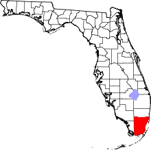
 Location in Miami-Dade County and the state of Florida | |
 U.S. Census Bureau map showing CDP boundaries | |
| Coordinates: 25°35′20″N 80°23′7″W / 25.58889°N 80.38528°WCoordinates: 25°35′20″N 80°23′7″W / 25.58889°N 80.38528°W | |
| Country |
|
| State |
|
| County | Miami-Dade |
| Area | |
| • Total | 4.9 sq mi (12.8 km2) |
| • Land | 4.9 sq mi (12.8 km2) |
| • Water | 0 sq mi (0 km2) |
| Elevation | 10 ft (3 m) |
| Population (2010) | |
| • Total | 35,696 |
| • Density | 6,841.2/sq mi (2,618.9/km2) |
| Time zone | Eastern (EST) (UTC-5) |
| • Summer (DST) | EDT (UTC-4) |
| ZIP code | 33157, 33177, 33189 |
| Area code(s) | 305 |
| FIPS code | 12-67575[1] |
| GNIS feature ID | 0291396[2] |

South Miami Heights is a census-designated place (CDP) in Miami-Dade County, within the U.S. state of Florida. The population was 35,696 as of the 2010 census.
Geography
South Miami Heights is located at 25°35′20″N 80°23′7″W / 25.58889°N 80.38528°W (25.588784, -80.385209).[3]
According to the United States Census Bureau, the CDP has a total area of 4.9 square miles (12.8 km²), all of it land.
Demographics
| Historical population | |||
|---|---|---|---|
| Census | Pop. | %± | |
| 1970 | 10,395 | — | |
| 1980 | 23,559 | 126.6% | |
| 1990 | 30,030 | 27.5% | |
| 2000 | 33,522 | 11.6% | |
| 2010 | 35,696 | 6.5% | |
| source:[4] | |||
As of the census in 2010, there were 35,696 people, 10,706 households, and 8,358 families residing in the CDP.[1] The population density was 6,800.4 people per square mile (2,625.3/km²). There were 10,364 housing units at an average density of 2,102.5/sq mi (811.7/km²). The racial makeup of the CDP was 67.2% White (11.2% Non-Hispanic White,) 24.3% African American, 0.28% Native American, 1.5% Asian, 0.02% Pacific Islander, 6.85% from other races, and 5.23% from two or more races.[5] Hispanic or Latino of any race were 68.0% of the population.[5]
There were 10,706 households out of which 55.3% had children under the age of 18 living with them, 52.4% were married couples living together.[6] Hispanic or Latino of any race were 68.0% of the population.[5] The average household size was 3.30 and the average family size was 3.63.[6]
In the CDP, the population was spread out with 27.6% under the age of 19, 14.0% from 20 to 29, 12.8% from 30 to 39, 32.6% from 40 to 64, and 12.9% who were 65 years of age or older. The median age was 37 years. For every 100 females there were 93.3 males. For every 100 females age 18 and over, there were 88.4 males.[5]
The median income for a family in the CDP was $45,334. Males had a median income of $32,054 versus $27,254 for females. The per capita income for the CDP was $16,229. About 18.5% of families and 18.9% of the population were below the poverty line, including 27.0% of those under age 18 and 26.2% of those age 65 or over.[7]
As of 2010, speakers of Spanish as a first language accounted for 46.0% of residents, while English made up 35.7%, French was at 0.94%, and French Creole was the mother tongue of 0.81% of the population.[8]
References
- 1 2 "American FactFinder". United States Census Bureau. Retrieved 2008-01-31.
- ↑ "US Board on Geographic Names". United States Geological Survey. 2007-10-25. Retrieved 2008-01-31.
- ↑ "US Gazetteer files: 2010, 2000, and 1990". United States Census Bureau. 2011-02-12. Retrieved 2011-04-23.
- ↑ "CENSUS OF POPULATION AND HOUSING (1790-2000)". U.S. Census Bureau. Retrieved 2010-07-17.
- 1 2 3 4 "General Housing and Population Characteristics". U.S. Census Bureau. Retrieved 2014-12-14.
- 1 2 "Household and Families". U.S. Census Bureau. Retrieved 2014-12-14.
- ↑ "Income". U.S. Census Bureau. Retrieved 2014-12-14.
- ↑ "Language Spoken at Home". U.S. Census Bureau. Retrieved 2014-12-14.