Orange County, Florida
| Orange County, Florida | |||
|---|---|---|---|
| County | |||
| County of Orange | |||
 The Orange County Courthouse in 2011 | |||
| |||
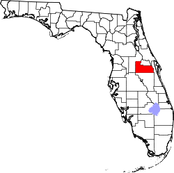 Location in the U.S. state of Florida | |||
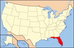 Florida's location in the U.S. | |||
| Founded | 1845 | ||
| Named for | Orange fruit | ||
| Seat | Orlando | ||
| Largest city | Orlando | ||
| Area | |||
| • Total | 1,003 sq mi (2,598 km2) | ||
| • Land | 903 sq mi (2,339 km2) | ||
| • Water | 100 sq mi (259 km2) | ||
| Population (est.) | |||
| • (2015) | 1,288,126 | ||
| • Density | 1,249.25/sq mi (482/km²) | ||
| Congressional districts | 5th, 7th, 8th, 9th, 10th | ||
| Time zone | Eastern: UTC-5/-4 | ||
| Website |
www | ||

Orange County is a county in the state of Florida, in the United States. As of the 2010 census, the population was 1,145,956,[1] making it Florida's fifth-most populous county. The county seat is Orlando.[2]
Orange County is the central county Orlando-Kissimmee-Sanford, Florida Metropolitan Statistical Area.
History
The land that is Orange County was part of the first land to emerge from below the Early Oligocene sea 33.9–28.4 million years ago and is known as Orange Island. Orange County's Rock Spring location is a Pleistocene fossil bearing area and has yielded a vast variety of birds and mammals including giant sloth, mammoth, camel, and the dire wolf dating around 1.1 million years ago.[3]
In 1821, two counties formed Florida: Escambia to the west and St. Johns to the east. In 1824, the area to the south of St. Johns County became Mosquito County, and Enterprise was named the county seat. This massive county took up much of central Florida. Mosquito County was renamed Orange County in 1845 when Florida became a state.[4] Several counties, such as Osceola, Seminole, Lake, and Volusia were carved out of Orange County.
Orange County was renamed from Mosquito County for the fruit that constituted the county's main product. At its peak in the early 1970s, some 80,000 acres (320 km2) were planted in citrus in Orange County. There was the dark green foliage of orange trees and the scent of the orange blossoms when in bloom. Fewer commercial orange groves remained by the end of the twentieth century. The majority of groves were destroyed by the freezing temperatures experienced in successive winters of 1985-1986, in particular by the January 1985 cold wave, the worst since 1899.
The financial setbacks, not the first in the grove region's history, were too challenging for many growers. Economically destroyed, many walked away from the land and its obligations. Others awaited other opportunities. One of the region's major land owners and growers was the Tropicana company. They, however, also withdrew rather than try to come back from these seemingly endless generational decimation. With no realistic avenues for agricultural use of this rural land, and Florida's continuing strong population growth and its attendant needs (aided and supported by the success of nearby Walt Disney World and Universal Studios Florida), these areas began and continue to be swallowed up by growing housing developments. However, several packing facilities and wholesalers are still in Orange County.
Geography

According to the U.S. Census Bureau, the county has a total area of 1,003 square miles (2,600 km2), of which 903 square miles (2,340 km2) is land and 100 square miles (260 km2) (10.0%) is water.[5]
Adjacent counties
- Seminole County - north
- Volusia County - northeast
- Brevard County - east
- Osceola County - south
- Polk County - southwest
- Lake County - west
Transportation
Airports
- Bob White Field
- Executive Airport
- Orlando Apopka Airport
- Orlando International Airport
Major highways
Demographics
| Historical population | |||
|---|---|---|---|
| Census | Pop. | %± | |
| 1840 | 73 | — | |
| 1850 | 466 | 538.4% | |
| 1860 | 987 | 111.8% | |
| 1870 | 2,195 | 122.4% | |
| 1880 | 6,618 | 201.5% | |
| 1890 | 12,584 | 90.1% | |
| 1900 | 11,374 | −9.6% | |
| 1910 | 19,107 | 68.0% | |
| 1920 | 19,890 | 4.1% | |
| 1930 | 49,737 | 150.1% | |
| 1940 | 70,074 | 40.9% | |
| 1950 | 114,950 | 64.0% | |
| 1960 | 263,540 | 129.3% | |
| 1970 | 344,311 | 30.6% | |
| 1980 | 471,016 | 36.8% | |
| 1990 | 677,491 | 43.8% | |
| 2000 | 896,344 | 32.3% | |
| 2010 | 1,145,956 | 27.8% | |
| Est. 2015 | 1,288,126 | [6] | 12.4% |
| U.S. Decennial Census[7] 1790-1960[8] 1900-1990[9] 1990-2000[10] 2010-2015[1] | |||
Census
U.S. Census Bureau 2010 Ethnic/Race Demographics:[11][12]
- White (non-Hispanic) (63.6% when including White Hispanics): 46.0% (10.0% German, 8.5% Irish, 7.4% English, 5.6% Italian, 2.1% French, 1.8% Polish, 1.5% Scottish, 1.3% Scotch-Irish, 1.0% Dutch, 0.8% Swedish, 0.7% Russian, 0.6% Norwegian, 0.5% Welsh, 0.5% French Canadian)[11]
- Black (non-Hispanic) (20.8% when including Black Hispanics): 19.5% (5.4% West Indian/Afro-Caribbean American [2.6% Haitian, 1.5% Jamaican, 0.4% Other and Unspecified West Indian, 0.3% Trinidadian and Tobagonian, 0.1% British West Indian, 0.1% U.S. Virgin Islander, 0.1% Bahamian,] 0.7% Subsaharan African)[11][13]
- Hispanic or Latino of any race: 26.9% (13.0% Puerto Rican, 3.2% Mexican, 2.0% Colombian, 2.0% Cuban, 1.8% Dominican, 0.7% Venezuelan, 0.5% Ecuadoran, 0.5% Peruvian)[11][14]
- Asian: 4.9% (1.4% Indian, 0.9% Vietnamese, 0.8% Filipino, 0.7% Chinese, 0.6% Other Asian, 0.3% Korean, 0.2% Japanese)[11][12]
- Two or more races: 3.4%
- American Indian and Alaska Native: 0.4%
- Native Hawaiian and Other Pacific Islander: 0.1%[11][12]
- Other Races: 6.7% (0.8% Arab)[11]
In 2010, 5.9% of the population considered themselves to be of only "American" ancestry (regardless of race or ethnicity.)[11]
There were 421,847 households out of which 30.81% had children under the age of 18 living with them, 43.50% were married couples living together, 15.65% had a female householder with no husband present, and 35.18% were non-families. 24.85% of all households were made up of individuals and 6.08% (1.71% male and 4.37% female) had someone living alone who was 65 years of age or older. The average household size was 2.64 and the average family size was 3.19.[12][15]
In the county the population was spread out with 23.6% under the age of 18, 12.8% from 18 to 24, 29.8% from 25 to 44, 24.1% from 45 to 64, and 9.7% who were 65 years of age or older. The median age was 33.7 years. For every 100 females there were 97.0 males. For every 100 females age 18 and over, there were 94.9 males.[15]
The median income for a household in the county was $50,138, and the median income for a family was $57,473. Males had a median income of $40,619 versus $31,919 for females. The per capita income for the county was $25,490. About 10.0% of families and 13.4% of the population were below the poverty line, including 17.2% of those under age 18 and 9.4% of those aged 65 or over.[16]
In 2010, 19.1% of the county's population was foreign born, with 43.8% being naturalized American citizens. Of foreign-born residents, 68.9% were born in Latin America, 17.8% born in Asia, 8.1% were born in Europe, 3.0% born in Africa, 2.0% in North America, and 0.2% were born in Oceania.[17]
Languages
As of 2010, 67.43% of all residents spoke English as their first language, while 22.59% spoke Spanish, 2.44% French Creole (mostly Haitian Creole,) 1.23% Portuguese, 0.88% Vietnamese, 0.78% Indian languages (including Gujarati and Hindi,) 0.58% Tagalog, 0.53% Chinese, 0.50% French, and 0.45% of the population spoke Arabic as their mother language.[18] In total, 32.57% of the population spoke languages other than English as their primary language.[18]
Government
The county functions under a charter form of government. The charter serves as a constitution, detailing the structure and operation of the local government. A Charter Review Commission has the power to consider and place amendments on the ballot. Voters then decide whether to accept or reject all amendments put forth. If voters approve an amendment, it is then inserted into the charter.
Federal representation
Five districts of the US House of Representatives represent parts of Orange County.
| Federal representation | ||||
|---|---|---|---|---|
| District | Incumbent | Hometown | % Orange County voters[19] | Next election |
| 5 | Corrine Brown | Jacksonville | 21.44 | 2016 |
| 7 | John Mica | Winter Park | 16.25 | 2016 |
| 8 | Bill Posey | Rockledge | 1.35 | 2016 |
| 9 | Alan Grayson | Orlando | 31.41 | 2016 |
| 10 | Daniel Webster | Winter Garden | 29.55 | 2016 |
District 5 is a district extending from Downtown Orlando to Jacksonville. The district continues north of Orange County, with voters in Alachua, Clay, Duval, Lake, Marion, Putnam, and Seminole.
Places include: Apopka, Eatonville, Pine Hills, and Tangelo Park.
District 7 is situated in north Orange, extending north into Seminole and Volusia.
Places include: Lockhart, Maitland, University, and Winter Park.
District 8 is situated in east Orange, extending southeast into Brevard and Indian River.
Places include: Bithlo, Christmas, and Wedgefield.
District 9 is a Hispanic plurality district situated in central Orange, extending southwest into Osceola and Polk.
Places include: Azalea Park, Hunter's Creek, Meadow Woods, and Union Park.
District 10 is situated in central and southwestern Orange. The district takes in a majority of Downtown Orlando and extends west into Lake and Polk.
Places include: Ocoee, Pine Castle, Williamsburg, Windermere and all of Orlando's major theme parks: Walt Disney World, Universal Studios Florida, and SeaWorld.
State representation
Orange County residents are represented in Tallahassee with 5 Senate seats.
| State senators | ||||
|---|---|---|---|---|
| District | Incumbent | Hometown | % Voters[20] | Next election |
| 11 | Alan Hays | Umatilla | 1.71 | 2016 |
| 12 | Geraldine Thompson | Orlando | 37.39 | 2014 |
| 13 | Andy Gardiner | Orlando | 32.60 | 2016 |
| 14 | Darren Soto | Orlando | 20.55 | 2014 |
| 15 | Kelli Stargel | Lakeland | 7.76 | 2016 |
District 11 is largely based in Lake and Marion. It also includes a small portion of Sumter.
District 12 is wholly composed of Orange.
District 13 is largely composed of Orange, but includes portions of Brevard.
District 14 is largely split between Orange and Osceola. It also includes a small portion of Polk.
District 15 is predominantly centered in Polk, yet includes a small part of Orange and Osceola.
Orange County residents are represented in Tallahassee with 9 House seats.
| State representatives | ||||
|---|---|---|---|---|
| District | Incumbent | Hometown | % Voters[21] | Next election |
| 30 | Karen Castor Dentel | Maitland | 4.87 | 2014 |
| 31 | Bryan Nelson | Apopka | 5.28 | 2014 |
| 44 | Stephen Precourt | Orlando | 14.49 | 2014 |
| 45 | Randolph Bracy | Orlando | 12.73 | 2014 |
| 46 | Bruce Antone | Orlando | 10.80 | 2014 |
| 47 | Linda Stewart | Orlando | 16.30 | 2014 |
| 48 | Victor Torres, Jr. | Orlando | 12.76 | 2014 |
| 49 | Joe Saunders | Orlando | 13.96 | 2014 |
| 50 | Tom Goodson | Titusville | 8.82 | 2014 |
District 30 is largely based in Seminole. One-third of voters are situated in Orange.
District 31 is largely based in Lake. Slightly more than one-third of voters are situated in Orange.
District 44, 45, 46, 47, 48, and 49 are wholly composed of Orange.
District 50 is predominantly composed of Orange and Brevard.
County representation
Orange County is served by a Board of Commissioners. The board consists of an elected mayor and six commissioners. The mayor is elected At-large, while commissioners are elected from single districts. The mayor and commissioners each serve staggered four year terms. Commissioners from Districts 1, 3, and 5 are elected in presidential election years, while the mayor and commissioners from Districts 2, 4, and 6 are elected in alternate years. The county is also served by a clerk of courts, sheriff, property appraiser, tax collector, supervisor of elections, state attorney, and public defender. All positions are four year terms, requiring direct election by voters in presidential election years.
| Orange County officials | ||
|---|---|---|
| Position | Incumbent | Next election |
| Mayor | Teresa Jacobs | 2018 |
| District 1 Commissioner | Scott Boyd | 2016 |
| District 2 Commissioner | Brian Nelson | 2018 |
| District 3 Commissioner | Pete Clarke | 2016 |
| District 4 Commissioner | Jennifer Thompson | 2018 |
| District 5 Commissioner | Ted Edwards | 2016 |
| District 6 Commissioner | Victoria P Siplin | 2018 |
| Clerk of Courts | Tiffany Moore Russell | 2018 |
| Sheriff | Jerry Demings | 2016 |
| Comptroller | Martha Haynie | 2016 |
| Property Appraiser | Rick Singh | 2016 |
| Tax Collector | Scott Randolph | 2016 |
| Supervisor of Elections | Bill Cowles | 2016 |
| State Attorney | Jeff Ashton | 2016 |
| Public Defender | Bob Wesley | 2016 |
Education
Public education
The Orange County Public Schools are responsible in delivering public education to students countywide. An elected school board composed of a chairman, elected At-large, and seven members, elected from single-member districts, oversees the functions and expenditures of the school system. Each member is elected to a staggered four-year term. Four are elected in presidential election years, while the chairman and three other members are elected in gubernatorial election years. The school system operates 182 schools (123 elementary, 3 K-8, 35 middle, 19 high, and 4 exceptional learning). In October 2012, the district had 183,562 students, making it the fourth largest school district statewide and eleventh in the nation.[22]
| Orange County School Board | ||
|---|---|---|
| Position | Incumbent | Next election |
| Chairman | Bill Sublette | 2014 |
| District 1 | Joie Cadle | 2014 |
| District 2 | Daryl Flynn | 2014 |
| District 3 | Rick Roach | 2014 |
| District 4 | Pam Gould | 2016 |
| District 5 | Kathleen Butler-Gordon | 2016 |
| District 6 | Nancy Robbinson | 2016 |
| District 7 | Christine Moore | 2016 |
Colleges and universities
The University of Central Florida is the sole public university. A fall 2012 enrollment of 59,767, currently places it second in the nation amongst public colleges and universities for student enrollment.[23] The university's massive campus is situated in northeast Orange County.
Nearby Winter Park is home to Rollins College, a private college situated only a few miles from Downtown Orlando. In 2012, it was ranked #1 by U.S. News & World Report amongst regional universities in the South.[24]
With six campuses spread throughout the county, Valencia Community College offers two-year degree programs.
The law schools for Barry University and Florida A&M are also conveniently located in Downtown Orlando.
Full Sail University is a for-profit university in Winter Park, Florida. Full Sail is not regionally accredited, but is nationally accredited by the Accrediting Commission of Career Schools and Colleges (ACCSC) to award associate's, bachelor's degrees, and master's degrees in audio, film, design, computer animation, business, and other fields.[10] The school offers 35 degree programs and 2 graduate certificates and has a student population of more than 16,800.
Films
Walt Before Mickey, a feature film about Walt Disney creating Mickey Mouse, was shot locally.
Libraries
Orange County is served by the Orange County Library System, which was established in 1923. Before the opening of the Albertson Public Library in 1923, a circulating library maintained by the Sorosis Club of Orlando offered book lending services to patrons on a subscription basis. The Albertson Public Library was established with the collection of Captain Charles L. Albertson and the library was named in his honor. In 1924, the Booker T. Washington Branch of the Albertson Library was established to service the African American community of Orlando. In 1966, the current Orlando Public Library building was completed on the grounds of the Albertson Public Library. [25] Currently there are 16 libraries within the Orange County Library system.[26]
Politics
| Year | Republican | Democratic |
|---|---|---|
| 2016 | 35.4% 195,216 | 59.8% 329,894 |
| 2012 | 40.4% 188,589 | 58.6% 273,665 |
| 2008 | 40.3% 186,832 | 59.0% 273,009 |
| 2004 | 49.6% 192,539 | 49.8% 193,354 |
| 2000 | 48.0% 134,531 | 50.1% 140,236 |
| 1996 | 45.9% 106,059 | 45.7% 105,539 |
| 1992 | 45.9% 108,788 | 34.9% 82,683 |
| 1988 | 67.9% 117,237 | 31.3% 54,023 |
| 1984 | 71.4% 122,068 | 28.5% 48,752 |
| 1980 | 61.1% 87,454 | 34.1% 48,767 |
| 1976 | 54.0% 70,451 | 44.8% 58,442 |
| 1972 | 79.6% 94,516 | 20.1% 23,840 |
| 1968 | 50.5% 50,874 | 22.4% 22,548 |
| 1964 | 56.1% 48,884 | 43.9% 38,248 |
| 1960 | 71.0% 48,244 | 29.0% 19,729 |
Orange County is located along the pivotal Interstate 4 corridor, the swing part of the state. Many close elections are won or lost depending on the voting outcome along the corridor. Voters are considered independent, traditionally splitting their votes, electing Democrats and Republicans on the same ballot. As a result of such independence, voters are inundated with non-stop television and radio ads months preceding a general election.
In September 2000,[28] Democrats overtook Republicans in voter registration. This was a factor in Al Gore becoming the first Democratic presidential candidate to carry the county since 1948. In the years since, Republicans have yet to retake the advantage they once enjoyed. In the twelve years that followed, Democrats experienced a modest increase in their voter registration percentage from 41.40% to 42.73% of the electorate. Minor party voters also had modest growth, increasing from 2.17% to 2.37%. In contrast, Republicans experienced a sharp decrease in registered voters, sliding from 40.95% in 2000 down to 29.85% in 2012. The beneficiary of the Republican losses have been unaffiliated voters. The percentage of the electorate identifying as an unaffiliated voter increased from 15.47% to 25.06% during this same period.
Voter registration
| Voter registration and party enrollment as of April 14, 2015[29] | |||||
|---|---|---|---|---|---|
| Party | Total | Percentage | |||
| Democratic | 299,794 | 41.53% | |||
| Republican | 204,852 | 28.38% | |||
| Minor parties | 45,236 | 6.27% | |||
| Unaffiliated | 172,039 | 23.83% | |||
| Total | 721,921 | 100.00% | |||
Communities
Cities
Towns
Census-designated places
- Alafaya
- Azalea Park
- Bay Hill
- Bithlo
- Christmas
- Clarcona
- Conway
- Dr. Phillips
- Fairview Shores
- Four Corners
- Goldenrod
- Gotha
- Holden Heights
- Horizon West
- Hunter's Creek
- Lake Butler
- Lake Hart
- Lake Mary Jane
- Lockhart
- Meadow Woods
- Oak Ridge
- Orlo Vista
- Paradise Heights
- Pine Castle
- Pine Hills
- Rio Pinar
- Sky Lake
- South Apopka
- Southchase
- Taft
- Tangelo Park
- Tangerine
- Tildenville
- Union Park
- University
- Wedgefield
- Williamsburg
- Zellwood
Unincorporated communities
See also
- List of amusement parks in Greater Orlando
- Innovation Way
- Teresa Jacobs
- Mayor of Orange County
- Board of County Commissioners
- National Register of Historic Places listings in Orange County, Florida
References
- 1 2 "State & County QuickFacts". United States Census Bureau. Retrieved June 16, 2014.
- ↑ "Find a County". National Association of Counties. Archived from the original on May 10, 2015. Retrieved 2011-06-07.
- ↑ Petuch, Edward J., Roberts, Charles; The geology of the Everglades and adjacent areas, 2007, ISBN 1-4200-4558-X.
- ↑ Publications of the Florida Historical Society. Florida Historical Society. 1908. p. 33.
- ↑ "US Gazetteer files: 2010, 2000, and 1990". United States Census Bureau. 2011-02-12. Retrieved 2011-04-23.
- ↑ "County Totals Dataset: Population, Population Change and Estimated Components of Population Change: April 1, 2010 to July 1, 2015". Retrieved July 2, 2016.
- ↑ "U.S. Decennial Census". United States Census Bureau. Archived from the original on May 11, 2015. Retrieved June 16, 2014.
- ↑ "Historical Census Browser". University of Virginia Library. Retrieved June 16, 2014.
- ↑ "Population of Counties by Decennial Census: 1900 to 1990". United States Census Bureau. Retrieved June 16, 2014.
- ↑ "Census 2000 PHC-T-4. Ranking Tables for Counties: 1990 and 2000" (PDF). United States Census Bureau. Retrieved June 16, 2014.
- 1 2 3 4 5 6 7 8 "Orange County: SELECTED SOCIAL CHARACTERISTICS IN THE UNITED STATES 2006-2010 American Community Survey 5-Year Estimates". factfinder.census.gov. Retrieved October 20, 2015.
- 1 2 3 4 "Orange County Demographic Characteristics". ocala.com. Retrieved October 20, 2015.
- ↑ "Orange County, Florida FIRST ANCESTRY REPORTED Universe: Total population - 2006-2010 American Community Survey 5-Year Estimates". factfinder.census.gov. Retrieved November 12, 2015.
- ↑ "Hispanic or Latino by Type: 2010 -- 2010 Census Summary File 1". factfinder.census.gov. Retrieved October 20, 2015.
- 1 2 "Orange County: Age Groups and Sex: 2010 - 2010 Census Summary File 1". factfinder.census.gov. Retrieved October 20, 2015.
- ↑ "Orange County, Florida: SELECTED ECONOMIC CHARACTERISTICS - 2006-2010 American Community Survey 5-Year Estimates". factfinder.census.gov. Archived from the original on November 29, 2014. Retrieved November 18, 2015.
- ↑ "Palm Beach County: SELECTED SOCIAL CHARACTERISTICS IN THE UNITED STATES 2006-2010 American Community Survey 5-Year Estimates". factfinder.census.gov. Retrieved October 19, 2015.
- 1 2 "Modern Language Association Data Center Results of Orange County, Florida". Modern Language Association. Retrieved October 20, 2015.
- ↑ "Voter Statistic - Congressional District" (PDF). Orange County Supervisor of Elections. Archived from the original (PDF) on 2013-05-12. Retrieved 2013-05-01.
- ↑ "Voter Statistic - Florida State Senate" (PDF). Orange County Supervisor of Elections. Archived from the original (PDF) on 2013-05-10. Retrieved 2013-05-01.
- ↑ "Voter Statistic - Florida State House" (PDF). Orange County Supervisor of Elections. Archived from the original (PDF) on 2013-05-10. Retrieved 2013-05-01.
- ↑ "Pocket Guide 2012-2013" (PDF). Orange County Public Schools. Archived from the original (PDF) on 2013-05-10. Retrieved 2013-05-01.
- ↑ "University Student Profile". University of Central Florida. Archived from the original (PDF) on 2013-05-10. Retrieved 2012-10-01.
- ↑ "Best Colleges". US News & World Report. Archived from the original (PDF) on 2013-05-10. Retrieved 2012-10-01.
- ↑ "Library History". Orange County Library System. 2015-09-18. Retrieved 2016-11-22.
- ↑ "Location & Hours". Orange County Library System. 2015-09-08. Retrieved 2016-11-22.
- ↑ http://uselectionatlas.org/
- ↑ "Registration and Party Enrollment Statistics as of September 30, 2000" (PDF). Florida Department of State. Archived from the original (PDF) on 2013-05-10. Retrieved 2000-10-30. Check date values in:
|access-date=(help) - ↑ "Registration and Party Enrollment Statistics as of March 31, 2015" (PDF). Orange County Supervisor of Elections. Retrieved 2014-04-14.
External links
- Photographs From the State Archives of Florida.
- Central Florida Memory is a unique digital collection where visitors can discover the history of Orange County and surrounding areas of Central Florida.
- Orange County Regional History Center
- The West Orange Times newspaper that serves Orange County, Florida available in full-text with images in Florida Digital Newspaper Library
- Orange County Health Department
- Orange County Collection on RICHES Mosaic Interface
 |
Seminole County | Volusia County | | |
| Lake County | |
Brevard County | ||
| ||||
| | ||||
| Polk County | Osceola County |
Municipalities and communities of Orange County, Florida, United States | ||
|---|---|---|
| Cities | | |
| Towns | ||
| CDPs |
| |
| Unincorporated communities | ||
| Footnotes | ‡This populated place also has portions in an adjacent county or counties | |
