Carol City, Florida
| Carol City | |
|---|---|
| Neighborhood of Miami Gardens | |
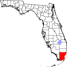
 Location in the state of Florida | |
| Coordinates: 25°56′32″N 80°16′12″W / 25.94222°N 80.27000°WCoordinates: 25°56′32″N 80°16′12″W / 25.94222°N 80.27000°W | |
| Country | United States |
| State | Florida |
| County | Miami-Dade |
| City | Miami Gardens |
| Area | |
| • Total | 7.7 sq mi (20.0 km2) |
| • Land | 7.6 sq mi (19.7 km2) |
| • Water | 0.1 sq mi (0.3 km2) |
| Population (2010) | |
| • Total | 61,233 |
| • Density | 8,057.0/sq mi (3,108.0/km2) |
| Time zone | Eastern (EST) (UTC-5) |
| • Summer (DST) | EDT (UTC-4) |
| ZIP codes | 33055-33056 |
| Area code(s) | 305 |
| FIPS code | 12-10650[1] |
Carol City is a neighborhood in Miami Gardens, Florida, United States. The population was 61,233 at the 2010 census.
History
In the 1960s, much of Carol City included farmland.[2] As the decades progressed, many people in Miami Gardens blamed the public housing in the area, including the developments around Carol City High School, of importing crime and recreational drugs into the area. In 2007, Mayor Shirley Gibson of Miami Gardens announced she would not allow any more public housing projects to open in Miami Gardens.[3]
Geography
Carol City is located at 25°56′32″N 80°16′12″W / 25.94222°N 80.27000°W (25.942121, -80.269920).[4] According to the United States Census Bureau, the community has a total area of 20.0 km² (7.7 mi²). 19.7 km² (7.6 mi²) of it is land and 0.3 km² (0.1 mi²) of it (1.42%) is water.
Notable people
- Rick Ross - Rapper
- Denzel Curry - Rapper
- Flo Rida - Rapper
- Gunplay - Rapper
- Spaceghostpurrp - Rapper
- Torch - Rapper
- Bigg D - Record producer
- Jim Lewis - Professional baseball pitcher
- Nick Turnbull - American football safety
- Trayvon Martin
- Allen Hurns
Demographics
| Historical population | |||
|---|---|---|---|
| Census | Pop. | %± | |
| 1960 | 21,749 | — | |
| 1970 | 27,361 | 25.8% | |
| 1980 | 47,349 | 73.1% | |
| 1990 | 53,331 | 12.6% | |
| 2000 | 59,443 | 11.5% | |
| 2010 | 61,233 | 3.0% | |
| source:[5] | |||
As of the census[1] of 2000, there were 59,443 people, 16,402 households, and 14,089 families residing in the community. The population density was 3,012.0/km² (7,796.0/mi²). There were 17,049 housing units at an average density of 863.9/km² (2,236.0/mi²). The racial makeup of the CDP was 52.10% African American, 38.11% White (6.4% were Non-Hispanic White,).[6] 0.55% Asian, 0.19% Native American, 0.04% Pacific Islander, 5.53% from other races, and 3.48% from two or more races. Hispanic or Latino of any race were 42.00% of the population.
There were 16,402 households out of which 42.7% had children under the age of 18 living with them, 52.4% were married couples living together, 26.5% had a female householder with no husband present, and 14.1% were non-families. 10.8% of all households were made up of individuals and 2.6% had someone living alone who was 65 years of age or older. The average household size was 3.58 and the average family size was 3.75.
In the area the population was spread out with 31.0% under the age of 18, 9.7% from 18 to 24, 28.6% from 25 to 44, 22.4% from 45 to 64, and 8.2% who were 65 years of age or older. The median age was 32 years. For every 100 females there were 92.5 males. For every 100 females age 18 and over, there were 87.1 males.
The median income for a household in the community was $38,652, and the median income for a family was $39,596. Males had a median income of $26,079 versus $22,169 for females. The per capita income for the community was $12,600. About 14.3% of families and 16.5% of the population were below the poverty line, including 21.5% of those under age 18 and 18.2% of those age 65 or over.
As of 2000, before being annexed to Miami Gardens, English as a first language accounted for 53.73% of all residents, while Spanish accounted for 43.16%, and French Creole as a mother tongue made up 2.15% of the population.[7]
As of 2000, the Carol City section of Miami Gardens had the twenty-seventh highest percentage of Cuban residents in the US, with 18.75% of the populace.[8] It had the nineteenth highest percentage of Jamaican residents in the US, at 5.80% (which tied with Lake Park, Florida,)[9] and the thirty-ninth highest percentage of Dominican residents in the US, at 3% of its population.[10] It also had the fifty-sixth most Haitians in the US, at 2.50% (tied with five other areas in the US, including Plantation and Taft, Florida)[11] while it had the twentieth highest percentage of Nicaraguans, at 2.20% of all residents.[12] The Carol City neighborhood of Miami Gardens is also home to the seventieth highest percentage of Colombian residents in the US, at 2.15% of the population.[13]
Education

Carol City is within the Miami-Dade Public Schools district.
Elementary schools within the former CDP that are now in Miami Gardens include Brentwood, Carol City, Barbara Hawkins, Miami Gardens, Myrtle Grove, and Skyway. Elementary schools within the former CDP that are in unincorporated areas include Lake Stevens, North Glade, and Charles David Wyche, Jr.[14]
Carol City Middle School is located in Miami Gardens and in the former CDP. Lake Stevens Middle School is located in an unincorporated area and in the former CDP. Miami Carol City High School is located within Miami Gardens and in the former Carol City CDP.[14] It opened in fall 1963.[2]
The North Campus of Sandor Weiner School of Opportunity, a charter school, is located in the former CDP and in an unincorporated area.[14][15]
References
- 1 2 "American FactFinder". United States Census Bureau. Archived from the original on 2013-09-11. Retrieved 2008-01-31.
- 1 2 Garcia-Roberts, Gus. "The Curse." Miami New Times. February 10, 2009. 1. Retrieved on February 11, 2009.
- ↑ Garcia-Roberts, Gus. "The Curse." Miami New Times. February 10, 2009. 2. Retrieved on February 11, 2009.
- ↑ "US Gazetteer files: 2010, 2000, and 1990". United States Census Bureau. 2011-02-12. Retrieved 2011-04-23.
- ↑ "CENSUS OF POPULATION AND HOUSING (1790-2000)". U.S. Census Bureau. Retrieved 2010-07-17.
- ↑ "Demographics of Carol City, Florida". MuniNetGuide.com. Archived from the original on 2008-04-15. Retrieved 2007-11-04.
- ↑ "MLA Data Center Results of Carol City, Florida". Modern Language Association. Retrieved 2007-11-04.
- ↑ "Ancestry Map of Cuban Communities". Epodunk.com. Retrieved 2007-11-04.
- ↑ "Ancestry Map of Jamaican Communities". Epodunk.com. Retrieved 2007-11-04.
- ↑ "Ancestry Map of Dominican Communities". Epodunk.com. Retrieved 2007-11-04.
- ↑ "Ancestry Map of Haitian Communities". Epodunk.com. Retrieved 2007-11-04.
- ↑ "Ancestry Map of Nicaraguan Communities". Epodunk.com. Retrieved 2007-11-04.
- ↑ "Ancestry Map of Colombian Communities". Epodunk.com. Retrieved 2007-11-04.
- 1 2 3 "Carol City CDP, Florida." U.S. Census Bureau. Retrieved on September 27, 2009.
- ↑ "Contact Us." Sandor Weiner School of Opportunity. Retrieved on September 27, 2009.