Saumane, Alpes-de-Haute-Provence
| Saumane | ||
|---|---|---|
|
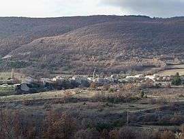
A general view of the village of Saumane | ||
| ||
 Saumane | ||
|
Location within Provence-A.-C.d'A. region  Saumane | ||
| Coordinates: 44°05′29″N 5°41′28″E / 44.0914°N 5.6911°ECoordinates: 44°05′29″N 5°41′28″E / 44.0914°N 5.6911°E | ||
| Country | France | |
| Region | Provence-Alpes-Côte d'Azur | |
| Department | Alpes-de-Haute-Provence | |
| Arrondissement | Forcalquier | |
| Canton | Banon | |
| Intercommunality | Pays de Banon | |
| Government | ||
| • Mayor (2008–2014) | Aymé Reynaud | |
| Area1 | 3.21 km2 (1.24 sq mi) | |
| Population (2008)2 | 106 | |
| • Density | 33/km2 (86/sq mi) | |
| Time zone | CET (UTC+1) | |
| • Summer (DST) | CEST (UTC+2) | |
| INSEE/Postal code | 04201 / 04150 | |
| Elevation |
746–980 m (2,448–3,215 ft) (avg. 820 m or 2,690 ft) | |
|
1 French Land Register data, which excludes lakes, ponds, glaciers > 1 km² (0.386 sq mi or 247 acres) and river estuaries. 2 Population without double counting: residents of multiple communes (e.g., students and military personnel) only counted once. | ||

Saumane is a commune in the Alpes-de-Haute-Provence department in southeastern France.
Population
| Historical population | ||
|---|---|---|
| Year | Pop. | ±% |
| 1765 | 250 | — |
| 1793 | 282 | +12.8% |
| 1800 | 284 | +0.7% |
| 1806 | 280 | −1.4% |
| 1821 | 297 | +6.1% |
| 1831 | 335 | +12.8% |
| 1836 | 320 | −4.5% |
| 1841 | 289 | −9.7% |
| 1846 | 279 | −3.5% |
| 1851 | 264 | −5.4% |
| 1856 | 265 | +0.4% |
| 1861 | 250 | −5.7% |
| 1866 | 256 | +2.4% |
| 1872 | 260 | +1.6% |
| 1876 | 270 | +3.8% |
| 1881 | 259 | −4.1% |
| 1886 | 275 | +6.2% |
| 1891 | 247 | −10.2% |
| 1896 | 228 | −7.7% |
| 1901 | 206 | −9.6% |
| 1906 | 223 | +8.3% |
| 1911 | 213 | −4.5% |
| 1921 | 196 | −8.0% |
| 1926 | 165 | −15.8% |
| 1931 | 152 | −7.9% |
| 1936 | 125 | −17.8% |
| 1946 | 118 | −5.6% |
| 1954 | 104 | −11.9% |
| 1962 | 77 | −26.0% |
| 1968 | 74 | −3.9% |
| 1975 | 63 | −14.9% |
| 1982 | 60 | −4.8% |
| 1990 | 80 | +33.3% |
| 1999 | 83 | +3.8% |
| 2008 | 106 | +27.7% |
See also
References
| Wikimedia Commons has media related to Saumane, Alpes-de-Haute-Provence. |
This article is issued from Wikipedia - version of the 2/4/2015. The text is available under the Creative Commons Attribution/Share Alike but additional terms may apply for the media files.