Aubignosc
| Aubignosc | ||
|---|---|---|
|
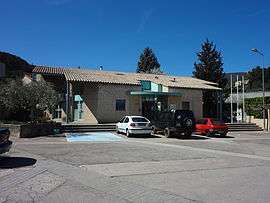
The Town Hall | ||
| ||
 Aubignosc | ||
|
Location within Provence-A.-C.d'A. region  Aubignosc | ||
| Coordinates: 44°07′50″N 5°58′11″E / 44.1306°N 5.9697°ECoordinates: 44°07′50″N 5°58′11″E / 44.1306°N 5.9697°E | ||
| Country | France | |
| Region | Provence-Alpes-Côte d'Azur | |
| Department | Alpes-de-Haute-Provence | |
| Arrondissement | Forcalquier | |
| Canton | Volonne | |
| Intercommunality | Lure-Vançon-Durance | |
| Government | ||
| • Mayor (2008–2020) | René Avinens | |
| Area1 | 14.74 km2 (5.69 sq mi) | |
| Population (2010)2 | 553 | |
| • Density | 38/km2 (97/sq mi) | |
| Time zone | CET (UTC+1) | |
| • Summer (DST) | CEST (UTC+2) | |
| INSEE/Postal code | 04013 / 04200 | |
| Elevation |
432–1,330 m (1,417–4,364 ft) (avg. 460 m or 1,510 ft) | |
|
1 French Land Register data, which excludes lakes, ponds, glaciers > 1 km² (0.386 sq mi or 247 acres) and river estuaries. 2 Population without double counting: residents of multiple communes (e.g., students and military personnel) only counted once. | ||
Aubignosc is a French commune in the Alpes-de-Haute-Provence department in the Provence-Alpes-Côte d'Azur region of south-eastern France.
The inhabitants of the commune are known as Aubignoscais or Aubignoscaises.[1]
Geography
Aubignosc is located in the west of the Durance valley some 8 km south by south-east of Sisteron, 21 km west of Digne-les-Bains and 36 km north by north-east of Manosque.[2] Apart from the village there are the hamlets of Les Jardins and Le Forest.[3]
Topography
The village is located at 460 metres above sea level[4] on the eastern slope of the valley of the Durance. The land is on the border of the Pre-Alps of Digne to the east and the Baronnies to the west. The altitude varies from 432 metres to 1,330 metres (east of the Lure mountain whose summit is at 1,826 metres between Cruis and Noyers-sur-Jabron. It once corresponded to a linguistic border between two varieties of Occitan). South of the village is hilly terrain with carved valleys and gullies over 600 metres deep. There are the Redonnette Ravine, the Maurieu Ravine, the Côtes chaudes Ravine, the Trou de Loupe Ravine, and the valley of the Grand Champ successively from north to south along the hills.[5]
Environment
The town has 734 hectares of woods and forests.[6]
Transport
The commune lies between Forcalquier (south-west), Digne-les-Bains to the east and Gap farther north. Access to the commune is by the A51 autoroute from La Brillanne in the south passing through the east of the commune with Exit 21 in the commune and continuing north. Route nationale N85 comes from Malijai in the south and joins the A51 in the commune. The D4085 comes from Sisteron in the north and joins the N85 in the commune. The D951 comes from Peipin in the north and passes south through the west of the commune and continues to Mallefougasse-Augès in the south-west. Access to the village is by the D503 which branches off the D4085 in the commune and goes south-west to join the D951 in the commune.[3]
The nearest railway station served by the TER (Marseille - Briancon) is located in Sisteron as well as a bus station. Buses provide connections to the Digne-les-Bains - Château-Arnoux - Veynes service as well as the Digne - Avignon service.
The aerodrome of Sisteron-Theze is located twenty kilometres to the north at Vaumeilh.
There is a short hiking trail (equestrian route) passing through the commune from north to south.
Hydrology

The entire eastern border of the commune is formed by the Durance as it flows south to eventually join the Rhone at Avignon.[3] The Durance is both an Alpine and Mediterranean river with very specific morphology. It is called "capricious" and was once feared for its Flash floods (it was called the 3rd scourge of Provence[7]) as well as for its low flow. Several intermittent streams trickle down the slopes and the Faillée gorge (east of the Lure mountain), and through the Prieuré forest. They flow into the Riou stream which flows north or to the Ravine de Maurieu, both tributaries of the Durance.[8]
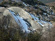
Geology

Related article: Geology of the Alps.
The commune lies on the eastern edge of Lure mountain with Provençal limestone formations of the Upper Jurassic and Lower Cretaceous periods (sedimentary rocks from a former Alpine Ocean), between several major geological formations of the Alps:[9]
- the Lure secondary mountains which are marked by numerous faults oriented north-west to south-east;
- the Durance fault to the south-east in the valley.
Natural and technological hazards
None of the 200 communes of the department are in a no seismic risk zone. The Canton of Volonne to which Aubignosc belongs is zone 1b (low risk) according to the deterministic classification of 1991 which is based on historical seismic activity, and zone 4 (medium risk) according to probabilistic classification EC8 of 2011. Farther south, along the Durance fault, the cantons of Peyruis, Les Mees, Manosque-Nord, Manosque-Sud-Est, Manosque-Sud-Ouest, and Valensole are in Zone 2 (medium risk).[10]
Aubignosc commune is also exposed to three other natural hazards:[11]
- forest fire,
- flood (in the valley of the Bléone),[12]
- landslide: the commune has a high risk in a substantial part of its territory.[13]
Aubignosc is also exposed to technological risks:
- risk of dam failure (the valley of the Durance would be submerged in case of failure of the Serre-Ponçon dam);[14]
- risk of transporting hazardous materials by rail, road, and pipeline. This is from the transport of primary materials to its destination or finished products from the Arkema factory at Saint-Auban. These products are likely to be carried on the A51 autoroute, Route nationale N85, or the Lyon-Marseille via Grenoble railway. Finally the Transalpes and Transéthylène pipelines are used to carry ethylene through the commune.[15]
The Risk prevention plan for foreseeable natural risks (PPR) does not exist for the commune. A DICRIM does not exist.[16]
The town has been the victim of several natural disasters of floods and mudslides in 1994 and 1998.[11] The earthquake that was felt the most in Aubignosc was the Lambesc earthquake on 11 June 1909[17]
Neighbouring communes and villages[3]
 |
Valbelle | Peipin | Sourribes | |
| |
||||
| ||||
| | ||||
| Mallefougasse-Augès | Montfort | Volonne |
Toponymy

The commune is called Aubinhòsc in classical Provençal and Lou Bignosc in Provençal of the Mistralian norm. The locality appears for the first time in texts from 1040 as de Albinosco. The name is derived from the Roman Gens Albinus with the suffix -osc[18][19][20] and became Bignosc in the 16th century.[20]
The toponymy of the commune is influenced by the mountainous character of the region, the Mediterranean climate, and the Occitan culture. The Chemin des Côtes (Path of the hills) which passes over the crest of the Lure, bordering Peipin, is also a path which is used to climb the peaks.[21] Its neighbour, the Chemin de Plaine Longue (Path of the long plain) leads to the high plateau.[22] There is also the Côtes Chaudes (Hot hills), near the Ponchonnière (pointed summit).[21] The Pas des Bœufs indicates a way of passage or a pass in Occitan dialect.[21]
Erosion, aggravated by deforestation, washes pebbles from the mountains that accumulate at the bottom of slopes: this kind of area is called Gravas (near Forest);[22] the Roubines refer to black marl or clay - i.e. robines in French.
The Ravines de la Romigière and of Buis are named after the vegetation: in Occitan romigière is a place where brambles grow.[22]
Human occupation and land use have resulted in several specific names: there are several places called Grand-Champ; Condamine is manorial land, indivisible and exempt from taxation;[22] Forest is a hamlet - not in a forest but an isolated village.[22] Finally, sheepfarming with the Occitan Jas (sheep pen) has provided several names: Jas de Mathieu in Lure, Les Jas, and the hamlet of Jas in the Forest vale.
History
Prehistory
During the construction of the A51 autoroute a prehistoric site was excavated at Ponchonnières which was occupied by the Chasséen, then the Neolithic, and finally the Chalcolithic peoples around 3000 B.C. The site was occupied by agro-pastoralists who built huts of about 20 m2 with the top being 4 or 5 m high.[23] Their herds consisted mainly of small ruminants (70-80%) and cattle (about 20%). The consumption of meat from the herd was supplemented by the collection of molluscs (snails but also 18 other species).[24] Anthracological studies have shown that the wood used for fires was oak (green or pubescent) which shows that the forest was still quite widely present at this time.[25]
Gallic and Roman period
During Antiquity the territory of Aubignosc belonged to the Sogiontii whose territory extended from south of the Baronnies to the Durance. The Sogiontiques were federated with the Vocontii and, after the Roman conquest, they were attached with them to the Roman province of Gallia Narbonensis. In the 2nd century they are detached from Voconces and form a distinct civitas with its capital at Segustero (Sisteron).[26] An ancient tomb was found in the commune in 1962.[27]
The A51 works also identified Gallo-Roman buildings.[20] These facilities, located at Présidentes, corresponded to a village or a small town.[28] The inhabitants lived on agriculture while there was a large area where a libertus (freedman), Gaius Iulius Thallus,[29] lived on the site of the current village.[30] Thallus, a Roman citizen, is the oldest known inhabitant of Aubignosc.[29] The quality of the construction of the village at Présidentes is fairly average: the walls are made of pebbles and the mortar is simple lime.[28]
The Romans built a temple to Sylvanus whose altar was reused in the church as the base of the font.[20]
Middle Ages
While the south-east of Gaul was Burgundian land, the king of the Ostrogoths, Theodoric the Great, conquered the region between the Durance, the Rhône, and Isère in 510. The commune depended briefly on Italy until 526. In order to reconcile with the Burgundian king Godomar III, the Ostrogothic regent Amalasontha gave him the territory.[31]
In the Middle Ages the Aubignosc community was part of the viguerie of Sisteron[32] and the Abbey of Cruis owned a priory.[33] The Aubignosc community had the privilege of not paying queste (similar to Taille) to the Counts of Provence (and their successors, the kings of France) until the French Revolution.[34]
Contemporary period
Following a dispute between the priest and his parishioners, a large part of the community embraced Protestant worship en masse.[35]
After the French coup of 1851 of 2 December by Louis-Napoleon Bonaparte, the areas around Sisteron, Forcalquier, and Manosque developed a resistance movement to defend the Republic: 15,000 armed men were mobilized. The Resistance took control of the prefecture at Digne and formed a "Departmental Committee of resistance". The army, who rallied to Napoleon III, overcame this movement. After the failure of the insurrection severe repression continued for those who stood to defend the Republic: 8 inhabitants of Aubignosc were brought before the Joint Commission, the most common punishment being deportation to Algeria.[36]
As with many communes in the department Aubignosc had schools well before the Jules Ferry laws: in 1863 it had two - installed in the main village and also in Forest - which provided primary education for boys.[37] No instruction was given to girls: neither the Falloux Act (1851), which required the opening of a girls' school in communes with more than 800 inhabitants[38] nor the first Duruy Law (1867), which lowers the threshold to 500 inhabitants, affected Aubignosc.[39] The town benefited from subsidies from the second Duruy law (1877) to construct new schools to replace the old[40] but it was not until the Ferry laws that girls from the commune had regular schooling.
In many communes the department has had a significant rural exodus from the 1850s. The commune lost half of its population in a little over a hundred years.
The region was also affected by regional or national fatal episodes: epidemics of cholera and the world wars (men died at the front during the First World War). During the Second World War the department was occupied by Italy in 1942-1943 then by Nazi Germany until August 1944. At that time the nearby town of Sisteron was bombed by the Allies as part of the Provence landings. The commune and Digne were liberated on 19 August 1944.
Until the middle of the 20th century, vines were cultivated in Aubignosc. The wine product, however, was of poor quality and was for home consumption with a portion of the production attributable to owners from Sisteron. This culture is now abandoned.[41]
Heraldry
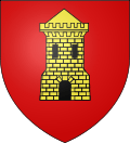 |
These Arms are used on signs for streets and places in the commune.
Blazon: |
Politics and Administration
Municipal administration
According to its size, the commune has a municipal council of 15 members (Article L2121-2 of the General Code of local authorities[43]). During the 2014 elections there was only one round and René Avinens was elected councillor with 258 votes, or 94.5% of the vote. The turnout was 68.76%. He was then appointed mayor by the council.[44]
Mayors
The election of mayors was a major innovation from the French Revolution of 1789. From 1790 to 1795 mayors were elected by suffrage for a 2-year term. From 1795 to 1800, there were no mayors - the commune simply designated a municipal agent who was delegated to the Municipality of the Canton.
In 1799-1800, the Consulate revisited the election of mayors who were now appointed by the central government. This system is maintained in subsequent governments with the exception of the Second Republic (1848-1851). After retaining the authoritarian system, the Third Republic liberalized it with the law of 5 April 1884 administration of Commons: the council, elected by universal suffrage, elects the mayor from among its members.
List of Successive Mayors[45]
| From | To | Name | Party | Position |
|---|---|---|---|---|
| 1793 | 1796 | Jean-Antoine Maurel | ||
| 1798 | 1800 | Joseph Pulvérail | ||
| 1800 | 1803 | Jean-Michel Amayenc | ||
| 1806 | 1812 | François Mathieu Féraud | ||
| 1813 | 1815 | Pierre Joseph Bonnet | ||
| 1816 | 1821 | Jean-Pierre Fabre | ||
| 1821 | 1825 | Pierre, François Mathieu Féraud | ||
| 1826 | 1831 | Jacques Pierre Dominique Corbon | ||
| 1832 | 1834 | Jean-Pierre Fabre | ||
| 1835 | 1840 | Pierre Maurel | ||
| 1841 | 1848 | Jean-Louis Gallissian | ||
| 1849 | 1850 | Joseph Mathieu Roubaud | ||
| 1850 | 1852 | Jean-Pierre Amayenc | ||
| 1853 | 1854 | Jean-Baptiste Benoît | ||
| 1855 | 1859 | Pierre Maurel | ||
| 1860 | 1871 | Alfred Corbon | ||
| 1871 | 1873 | Joseph Pulvérail | ||
| 1874 | 1876 | Alfred Corbon | ||
| 1876 | 1877 | Jacques Joseph Pulvérail | ||
| 1877 | 1878 | Antoine Féraud | ||
| 1878 | 1880 | Joseph Péllissier | ||
| 1880 | 1884 | Fortuné Fabre | ||
| 1885 | 1904 | Aimé Magnan | ||
| 1904 | 1908 | Frédéric Adrien Bérenguier | ||
| 1909 | 1910 | Fortuné Fabre | ||
| 1910 | 1919 | Lucien Laurent | ||
| 1920 | 1929 | Henri Pulvérail |
- Mayors from 1930
| From | To | Name | Party | Position |
|---|---|---|---|---|
| 1930 | 1958 | Élie Magnan | ||
| 1958 | 1972 | Arthur Silve | ||
| 1973 | 1983 | Emile Arbouet | ||
| 1983 | 2008 | Vincent Ponce | UMP[46] | |
| 2008 | 2020 | René Avinens |
- War memorials in the commune
-

Monument to the two world wars at Forest.
-

War Memorial for the First Indochina War (at the town hall).
-
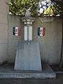
War memorial for the two world wars.
Administrative and legal bodies
Aubignosc is one of the nine communes in the Canton of Volonne which totalled 11,550 inhabitants in 2008. The canton was part of the Arrondissement of Sisteron from 17 February 1800 to 10 September 1926 when it was incorporated into the Arrondissement of Forcalquier and the second constituency of Alpes-de-Haute-Provence. Aubignosc has been part of the Canton of Volonne since 1793.[47] Aubignosc is under the jurisdiction of the Tribunal d'instance of Forcalquier, the Industrial Tribunal of Manosque, and the High Court of Digne-les-Bains.[48]
Tax system
| Tax | Communal part | Inter-communal part | Departmental part | Regional part |
|---|---|---|---|---|
| Housing Tax (TH) | 1.27% | 0.00% | 5.53% | 0.00% |
| Property Tax on buildings (TFPB) | 15.39% | 0.00% | 14.49% | 2.36% |
| Property tax on vacant land (TFPNB) | 46.49% | 0.00% | 47.16% | 8.85% |
| Business Tax (TP) | 0.00% | 13.26% | 10.80% | 3.84% |
The regional part of tax is not applicable for Aubignosc.
Business Tax (TP) was replaced in 2010 by the Enterprise property contribution (CFE) based on the rental value of property and the value-added contribution of the business sector (CVAE) (the two forming the Territorial Economic Contribution (CET) which is a Local Tax introduced by the Finance Act of 2010[50]
Demography
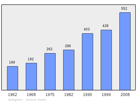
In 1471 the commune had 26 fires and in 1765 the population was 264.[51]
In 2010 the commune had 553 inhabitants. The evolution of the number of inhabitants is known from the population censuses conducted in the commune since 1793. From the 21st century, a census of communes with fewer than 10,000 inhabitants is held every five years, unlike larger towns that have a sample survey every year.[Note 1]
| 1793 | 1800 | 1806 | 1821 | 1831 | 1836 | 1841 | 1846 | 1851 |
|---|---|---|---|---|---|---|---|---|
| 276 | 333 | 315 | 329 | 239 | 353 | 356 | 348 | 343 |
| 1856 | 1861 | 1866 | 1872 | 1876 | 1881 | 1886 | 1891 | 1896 |
|---|---|---|---|---|---|---|---|---|
| 349 | 337 | 330 | 361 | 311 | 324 | 259 | 269 | 262 |
| 1901 | 1906 | 1911 | 1921 | 1926 | 1931 | 1936 | 1946 | 1954 |
|---|---|---|---|---|---|---|---|---|
| 253 | 225 | 196 | 192 | 201 | 169 | 168 | 200 | 178 |
| 1962 | 1968 | 1975 | 1982 | 1990 | 1999 | 2006 | 2010 | - |
|---|---|---|---|---|---|---|---|---|
| 169 | 192 | 262 | 286 | 403 | 428 | 532 | 553 | - |
Sources : Ldh/EHESS/Cassini until 1962, INSEE database from 1968 (population without double counting and municipal population from 2006)
Economy
Overview
In 2009, the active population stood at 271 people which included 20 unemployed[52] (it was 31 at the end of 2011[53]). These workers are mostly employed (78%)[54] and mostly work outside the commune (81%).[54] Most of the active population (65%) are employed in services and administration and the construction sector accounts for nearly a third of employment.[55]
On 1 January 2011 the active establishments in the commune were mainly shops and services (25 out of 64 establishments) and companies in the construction sector (13 out of 64).[55]
There is an Equestrian centre and some local tourism with associated businesses such as La Magnanerie restaurant.[56]
Agriculture
There is an important agricultural cooperative in the commune.
At the end of 2010 the primary sector (agriculture, forestry, fisheries) had 12 establishments.[55]
The number of farms, according to the Agreste Department of Agriculture survey, remained stable in the 2000s with 7 professional farms and 3 polyculture farms.[57] Conversely the utilized agricultural area (UAA) has declined sharply in the same period, from 1,051 to 483 hectares,[57] a figure that is higher than that of 1988 when the utilized agricultural area was only 314 hectares.[58]
Labels
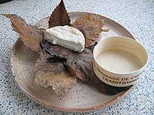
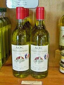
Aubignosc is included in the area for four Appellation d'origine contrôlée (AOC) labels (including Lavender oil of Haute-Provence and Banon cheese) and nine Protected Geographical Indication (IGP) labels (including Apples of Alpes de Haute-Durance, Honey of Provence, Lamb of Sisteron).[59]
The culture of the olive has been practiced in the commune for centuries although limited to small areas. The terrain of the commune is at the altitudinal limit for the olive tree which can hardly be grown above 650 metres.[60] Currently olives cover 22 hectares of the commune with 1,600 trees.[61] The oil produced from olives harvested in the commune use the AOC labels Huile d'olive de Provence and Huile d'olive de Haute-Provence.[59]
From the labels covering the commune, those for wine (VDP of Alpes-de-Haute-Provence white, red and rosé; VDP of Méditerranée, white, red and rosé) are not used as the vines are not cultivated for commercial production in the commune.[41]
- Agricultural production in Aubignosc
-

Field of Lavender
-
Banon cheese AOC
-
Huile de Provence AOC
-
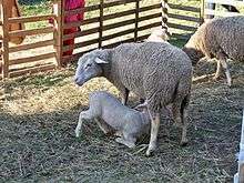
Lamb of Sisteron with its mother
-

Lavender Honey
-
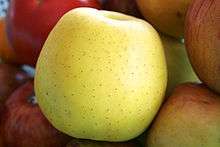
Golden delicious and Gala apples
Although the culture of lavender is now mechanized and now has an organized market as well as an AOC for "Essential oil of Lavender from Haute-Provence" since 1981,[62] it has not seen its production revived in the region.[63]
Goats milk from Provençal, Rove, and Alpine goats can be used to manufacture Banon cheese as in 111 other communes in Alpes-de-Haute-Provence.
Lamb of Sisteron is a red label appellation protected since 26 June 2003.[64][65]
Honey of Provence is protected by a red label associated with a protected geographical indication as for honey from all flowers for Lavender Honey.[66]
Apples of Alpes de Haute-Durance received a Protected Geographical Indication in 2010.[67]
Industry
At the end of 2010 the secondary sector (industry and construction) had 20 establishments employing 31 people.[55]
A quarry operated by Carrières et ballastières des Alpes transforms the limestone into aggregate.[68]
Service activities
At the end of 2010, the tertiary sector (trades and services) had 25 establishments (with 32 employees) plus seven administrative establishments (with 29 employees).[55]
According to the Departmental Observatory of tourism, tourism is secondary in the commune with less than 1 per capita tourist per year.[69] Nevertheless, the commune has several tourist accommodations available:
- at least one hotel in 2007,[70] (two-star).[71] It has only 9 rooms;[72]
- the town also has a small range of furnished accommodation.[73]
Second homes are of marginal importance with 16 units out of the 260 housing units in the commune.[74]
Culture and heritage
Civil heritage
The commune has one building that is registered as a historical monument:
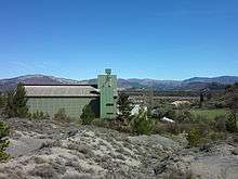
- The Agricultural Cooperative (1983)
 [75]
[75]
Other places of interest in the commune:
- A Noble House in Gravas decorated with a tower[76] called a country house and which had an Ice house at the end of the 17th century.[77]
- A Renaissance-style House at Forest which may have been the priory.[32]
Religious heritage
- The Church of Saint Julien dates to 1662 andfeatures a double Nave and a cul-de-four[Note 2] vault over the Apse. The rectangular building adjoining it has some cut stones which were reused from an old church.[78] The Church contains many items that are registered as historical objects:
- A Painting: Saint Ann, Saint Mary, and Saint Joachim (17th century)
 [79]
[79] - A Chalice (19th century)[80]
- 2 Monstrances (18th century)[81]
- A Painting with frame: Virgin with a rose (18th century)[82]
- A Statue: Virgin and Child (18th century)[83]
- A Statue: Saint Julien (19th century)[84]
- A Painting: Virgin and Child between Saint Roch and Saint Ignace of Loyola (18th century)[85]
- A Painting: Saint Ann, Saint Mary, and Saint Joachim (17th century)
- The Church of the Nativity of the Virgin (1754)[51] is located in the hamlet of Forest. The Church contains many items that are registered as historical objects:
- Monuments in Aubignosc
-
.JPG)
Church of Saint Julien.
-

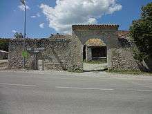
Entrance to the church.
-
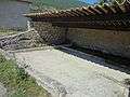
An old Lavoir (Public laundry) at Forest.
-
.JPG)
Church of the Nativity of the Virgin at Forest.
Facilities
Education

The commune has a public primary school. The fourth class closed in 2010 at which date there were 64 children but there is nevertheless a canteen and a daycare centre.[91]
Health
There is no doctor in Aubignosc and the closest is at Peipin (1.16 km), two others at Volonne (4.14 km), and there are others in Château-Arnoux (4.81 km).[92] The nearest pharmacy is also at Peipin or Volonne.[93]
Aubignosc depends on the Manosque hospital.
Sports
There is a sports field is on the communal boundary straddling Aubignosc and Peipin.
Worship
Prior to joining the Canton of Volonne Aubignosc was part of the diocese and viguerie of Sisteron.[32]
See also
Bibliography
- Raymond Collier, Haute-Provence monumental and artistic, Digne, Imprimerie Louis Jean, 1986, 559 p. (French)
- Under the direction of Édouard Baratier, Georges Duby, and Ernest Hildesheimer, Historical Atlas of Provence, County of Venaissin, Principality of Orange, County of Nice, Principality of Monaco, Librairie Armand Colin, Paris, 1969 (French)
- Guy Barruol, Nerte Dautier, and Bernard Mondon (coord.), Mount Ventoux. Encyclopedia of a Provençale Mountain (French)
External links
- Aubignosc on the old IGN website (French)
- Official Aubignosc website (French)
- Aubignosc on Google Maps
- Aubignosc on Géoportail, National Geographic Institute (IGN) website (French)
- Aubignosc on the 1750 Cassini Map
- Aubignosc on the INSEE website (French)
- INSEE (French)
Notes and references
Notes
- ↑ At the beginning of the 21st century, the methods of identification have been modified by Law No. 2002-276 of 27 February 2002, the so-called "law of local democracy" and in particular Title V "census operations" allows, after a transitional period running from 2004 to 2008, the annual publication of the legal population of the different French administrative districts. For communes with a population greater than 10,000 inhabitants, a sample survey is conducted annually, the entire territory of these communes is taken into account at the end of the period of five years. The first "legal population" after 1999 under this new law came into force on 1 January 2009 and was based on the census of 2006.
- ↑ An Arch-shaped quarter-sphere similar to a bread oven
References
- ↑ Inhabitants of Alpes-de-Haute-Provence (French)
- ↑ Acme Mapper Orthodromic Distances
- 1 2 3 4 Google Maps
- ↑ Michel de La Torre, Alpes-de-Haute-Provence: the complete guide to 200 communes, Paris, Deslogis-Lacoste, coll. "Towns and Villages of France", 1989, Relié, 72 p. (non-paginated) ISBN 2-7399-5004-7 (French).
- ↑ Institut géographique national and Fédération française de randonnée pédestre (French Hiking Federation), Loure Mountain, Les Mées-Château-Arnoux, Map at 1:25000 scale, Paris, IGN, 2011. coll. "Top 25: one map, one website"; No. 3341 OT. ISBN 978-2-7585-2264-5 (French)
- ↑ Roger Brunet, Canton of Volonne, Le Trésor des régions, consulted on 8 June 2013. (French)
- ↑ Provençale tradition says that the first two are the mistral and the Parliament of Aix
- ↑ Riou river page (X1110500), Sandre (French)
- ↑ Maurice Gidon, The secondary mountains of Digne (French)
- ↑ Risk of Seismic Activity 26 January 2012 (French)
- 1 2 Ministry of Ecology, Sustainable development, Transport, and Housing, Communal Notice on the Gaspar database, online 27 May 2011, consulted on 26 June 2012. (French)
- ↑ Flood Risk 26 January 2012 (French)
- ↑ Risk of Avalanche 26 January 2012 (French)
- ↑ Rupture of Barrage Risk document, 26 January 2012 (French)
- ↑ Transport of dangerous materials by road 26 January 2012 (French)
- ↑ Search Page Archived May 25, 2012, at the Wayback Machine., Dicrim database, consulted on 26 June 2011. (French)
- ↑ BRGM, Epicentres of seismic events (greater than 40 km) felt at Aubignosc, Sisfrance, consulted on 26 June 2012. (French)
- ↑ Charles Rostaing, Essay on the Toponymy of Provence (from its origins to the barbarian invasions), Laffite Reprints, Marseille, 1973 (1st edition 1950), p. 348. (French)
- ↑ Ernest Nègre, General Toponymy of France: Etymology of 35,000 place names, vol. 1: Pre-celtic, celtic, roman, Geneva, Librairie Droz, coll. "Publications romanes et françaises" (No. 193), 1990, 1869 p. (ISBN 978-2-600-02884-4, Read online) § 1240, p. 62. (French)
- 1 2 3 4 Irène Magnaudeix et al., Haute-Provence Country: from Lure to Luberon, Manosque, Forcalquier Country, of Lure mountain to Luberon, guide of discovery by the pathways, ADRI/Les Alpes de Lumière, 1999, ISBN 2-906924-25-3, ISBN 2-906162-47-7, p. 164. (French)
- 1 2 3 Claude Martel, The oronymy of a provençale mountain, in Guy Barruol, André de Réparaz, Jean-Yves Royer (directors of the publication), The Mountain of Lure, encyclopedia of a mountain in Haute-Provence, Forcalquier, Alpes de Lumière, collection "Les Alpes de Lumière", No. 145-146, 2004, ISBN 2-906162-70-1, 320 p., p. 220. (French)
- 1 2 3 4 5 Guy Barruol, Claude Martel, Jean-Yves Royer, Glossary linked to the topography and the toponymy of Lure, in Guy Barruol, André de Réparaz, Jean-Yves Royer (directors of the publication), The Mountain of Lure, encyclopedia of a mountain in Haute-Provence, Forcalquier, Alpes de Lumière, collection "Les Alpes de Lumière", No. 145-146, 2004, ISBN 2-906162-70-1, 320 p., p. 229. (French)
- ↑ A. Müller et al., La Ponchonnière, in Drac Paca, Arcaeological researches in the Durance valley: salvage works on the A51 autoroute construction site, Éditions de la société des Autoroutes Estérel Côte d’Azur, 1990, 55 p, p. 37. (French)
- ↑ A. Müller et al., La Ponchonnière, in Drac Paca, Arcaeological researches in the Durance valley: salvage works on the A51 autoroute construction site, Éditions de la société des Autoroutes Estérel Côte d’Azur, 1990, 55 p, p. 48. (French)
- ↑ A. Müller et al., La Ponchonnière, in Drac Paca, Arcaeological researches in the Durance valley: salvage works on the A51 autoroute construction site, Éditions de la société des Autoroutes Estérel Côte d’Azur, 1990, 55 p, p. 48-49. (French)
- ↑ Brigitte Beaujard, The Cities of southern Gaul from the 3rd to the 7th centuries, Gallia, 63, 2006, CNRS éditions, p. 18-19. (French)
- ↑ Raymond Collier, Haute-Provence monumental and artistic, Digne, Imprimerie Louis Jean, 1986, 559 p., p. 20. (French)
- 1 2 Philippe Leveau, The rural habitat in Provence of Antiquity: villa, vicus and mansio. Case studies, Revue archéologique de Narbonnaise, Vol. 35, 2002, p. 64. (French)
- 1 2 Philippe Leveau, The rural habitat in Provence of Antiquity: villa, vicus and mansio. Case studies, Revue archéologique de Narbonnaise, Vol. 35, 2002, p. 65. (French)
- ↑ Philippe Leveau, The rural habitat in Provence of Antiquity: villa, vicus and mansio. Case studies, Revue archéologique de Narbonnaise, Vol. 35, 2002, p. 66. (French)
- ↑ Audrey Becker-Piriou, On Galla Placidia atà Amalasonthe, on women in roman-barbarian diplomacy in the west?, Historical Review, 2008/3, No. 647, p. 531. (French)
- 1 2 3 Daniel Thiery, Aubignosc, On the origins of churches and rural chapels of Alpes-de-Haute-Provence, published on 12 December 2010, online 15 December 2010, consulted on 25 June 2012. (French)
- ↑ Guy Barruol, Roman religious architecture, in Guy Barruol, André de Réparaz, Jean-Yves Royer (directors of the publication), The Mountain of Lure, encyclopedia of a mountain in Haute-Provence, Forcalquier, Alpes de Lumière, collection "Les Alpes de Lumière", No. 145-146, 2004, ISBN 2-906162-70-1, 320 p., p. 233. (French)
- ↑ Édouard Baratier, Provençale demography from the 13th to the 16th centuries, with key comparisons with the 18th century, Paris: SEVPEN/EHESS, 1961. Collection "Demography and society", 5. p. 21. (French)
- ↑ Peter M. Jones, Some elementary forms of religious life in rural France (end of the 18th and the 19th centuries), "Annales, Économies, Sociétés, Civilisations". Volume 42, No. 1, 1987, p. 99. (French)
- ↑ Henri Joannet and Jean-Pierre Pinatel, Arrests and condemnations, "1851-Pour mémoire", Les Mées: Les Amis des Mées, 2001, p. 71. (French)
- ↑ Jean-Christophe Labadie (director), The School houses, Digne-les-Bains, Departmental Archives of Alpes-de-Haute-Provence, 2013, ISBN 978-2-86-004-015-0, p. 9. (French)
- ↑ Jean-Christophe Labadie (director), The School houses, Digne-les-Bains, Departmental Archives of Alpes-de-Haute-Provence, 2013, ISBN 978-2-86-004-015-0, p. 16. (French)
- ↑ Jean-Christophe Labadie (director), The School houses, Digne-les-Bains, Departmental Archives of Alpes-de-Haute-Provence, 2013, ISBN 978-2-86-004-015-0, p. 18. (French)
- ↑ Jean-Christophe Labadie (director), The School houses, Digne-les-Bains, Departmental Archives of Alpes-de-Haute-Provence, 2013, ISBN 978-2-86-004-015-0, p. 11. (French)
- 1 2 André de Réparaz, Lost Lands, Constant Lands, Land won: Vines and olives in Haute-Provence 19th-21st centuries, Méditerranée, 109, 2007, pp. 56 and 59. (French)
- ↑ Aubignosc Town Hall. (French)
- ↑ Number of members of municipal councils of communes, Legifrance (French)
- ↑ Results of municipal elections in 2014 at Aubignosc, linternaute.com (French)
- ↑ List of Mayors of France (French)
- ↑ Annual of Town Halls of Alpes-de-Haute-Provence 2006-2007 (French)
- ↑ Communal Notice for Aubignosc, Ehess website (French)
- ↑ The Judicial jurisdictions of Alpes-de-Haute-Provence, Ministry of Justice and Liberties (French)
- ↑ Local taxes in Aubignosc, taxes.com (French)
- ↑ Law No. 2009-1673 of 30 December 2009 of Finance for 2010, (Légifrance) (French)
- 1 2 Under the direction of Édouard Baratier, Georges Duby, and Ernest Hildesheimer, Historical Atlas of Provence, County of Venaissin, Principality of Orange, County of Nice, Principality of Monaco, Librairie Armand Colin, Paris, 1969 p. 159. (French)
- ↑ Local Dossier - Commune: Aubignosc (04012), INSEE, p. 5. (French)
- ↑ Local Dossier - Commune: Aubignosc (04012), INSEE, p. 8. (French)
- 1 2 Local Dossier - Commune: Aubignosc (04012), INSEE, p. 7. (French)
- 1 2 3 4 5 Local Dossier - Commune: Aubignosc (04012), INSEE, p. 16. (French)
- ↑ Restaurants near the Tourist Office of the Durance valley, Tourism Office website (French)
- 1 2 Ministry of Agriculture, "Techno-economic orientation of farming", Agricultural census of 2010 and 2000. (Online: N.B. The page is 4,4 Mb). (French)
- ↑ Agricultural businesses in 1988 and 2000, INSEE, 2012 (Page of 7.4 Mb). (French)
- 1 2 List of appellations AOC and IGP for Aubignosc, INAO (French)
- ↑ André de Réparaz, Lost Lands, Constant Lands, Land won: Vines and olives in Haute-Provence 19th-21st centuries, Méditerranée, 109, 2007, p. 58. (French)
- ↑ André de Réparaz, Lost Lands, Constant Lands, Land won: Vines and olives in Haute-Provence 19th-21st centuries, Méditerranée, 109, 2007, p. 60. (French)
- ↑ Jean-Paul Bonnefoy, p. 127. (French)
- ↑ Jean-Paul Bonnefoy, p. 128. (French)
- ↑ Lamb of Sisteron from 26 June 2003, agneaudesisteron.fr (French)
- ↑ IGP page on Red Label Lamb of Sisteron, 20 February 2007, INAO (French)
- ↑ Légifrance relative to the publication at JO of the order of 30 July 2009 (French)
- ↑ Apples of Alpes de Haute-Durance obtain the IGP, 19 April 2010, INAO (French)
- ↑ Regional Directorate of the Environment, planning, and housing List of quarries in Alpes de Haute Provence, online 31 December 2011, consulted on 28 September 2012. (French)
- ↑ Departmental Observatory of tourism, Atlas of Tourist Accommodation, December 2008, p. 6. (French)
- ↑ Departmental Observatory of tourism, Atlas of Tourist Accommodation, December 2008, p. 11. (French)
- ↑ Departmental Observatory of tourism, Atlas of Tourist Accommodation, December 2008, p. 16. (French)
- ↑ Tourist Acccommodations in communes, 2008, 2009, and 2012, INSEE, 2012 (Page of 4.9 Mb). (French)
- ↑ Departmental Observatory of tourism, Atlas of Tourist Accommodation, December 2008, p. 32. (French)
- ↑ Local Dossier - Commune: Aubignosc (04012), INSEE, p. 17. (French)
- ↑ Ministry of Culture, Mérimée IA04000056 Agricultural Cooperative (French)
- ↑ Raymond Collier, Haute-Provence monumental and artistic, Digne, Imprimerie Louis Jean, 1986, 559 p., p. 270. (French)
- ↑ Guy Barruol, Jean Proust, « Glacières », in Guy Barruol, André de Réparaz, Jean-Yves Royer (directors of the publication), The Mountain of Lure, encyclopedia of a mountain in Haute-Provence, Forcalquier, Alpes de Lumière, collection "Les Alpes de Lumière", No. 145-146, 2004, ISBN 2-906162-70-1, 320 p., p. 56. (French)
- ↑ Raymond Collier, Haute-Provence monumental and artistic, Digne, Imprimerie Louis Jean, 1986, 559 p., p. 213. (French)
- ↑ Ministry of Culture, Palissy PM04001434 Painting: Saint Ann, Saint Mary, and Saint Joachim (French)
- ↑ Ministry of Culture, Palissy PM04001433 Chalice (French)
- ↑ Ministry of Culture, Palissy PM04001432 Painting: Saint Ann, Saint Mary, and Saint Joachim (French)
- ↑ Ministry of Culture, Palissy PM04001431 Painting with frame: Virgin with a rose (French)
- ↑ Ministry of Culture, Palissy PM04001430 Statue: Virgin and Child (French)
- ↑ Ministry of Culture, Palissy PM04001429 Statue: Saint Julien (French)
- ↑ Ministry of Culture, Palissy PM04000572 Painting: Virgin and Child between Saint Roch and Saint Ignace of Loyola (French)
- ↑ Ministry of Culture, Palissy PM04001603 Cross (French)
- ↑ Ministry of Culture, Palissy PM04001602 Statue: Virgin and Child (French)
- ↑ Ministry of Culture, Palissy PM04001601 Statue: Saint Antoine of Padoue (French)
- ↑ Ministry of Culture, Palissy PM04001600 Statue: Assumption (French)
- ↑ Ministry of Culture, Palissy PM04001599 Painting: Sainte Famille (French)
- ↑ Academic Inspectorate of Alpes-de-Haute-Provence, List of schools in the school district of Sisteron, published on 27 April 2010, consulted on 31 October 2010. (French)
- ↑ Doctors near Aubignosc, Yellow Pages (French)
- ↑ Pharmacies near Aubignosc, Yellow Pages (French)
| Wikimedia Commons has media related to Aubignosc. |