Saint-Martin-les-Eaux
| Saint-Martin-les-Eaux | |
|---|---|
|
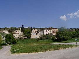
A general view of the village of Saint-Martin-les-Eaux | |
 Saint-Martin-les-Eaux | |
|
Location within Provence-A.-C.d'A. region  Saint-Martin-les-Eaux | |
| Coordinates: 43°52′31″N 5°44′09″E / 43.8753°N 5.7358°ECoordinates: 43°52′31″N 5°44′09″E / 43.8753°N 5.7358°E | |
| Country | France |
| Region | Provence-Alpes-Côte d'Azur |
| Department | Alpes-de-Haute-Provence |
| Arrondissement | Forcalquier |
| Canton | Manosque-Nord |
| Intercommunality | Haute Provence |
| Government | |
| • Mayor (2008–2014) | Michèle Crouhy |
| Area1 | 9.15 km2 (3.53 sq mi) |
| Population (2008)2 | 99 |
| • Density | 11/km2 (28/sq mi) |
| Time zone | CET (UTC+1) |
| • Summer (DST) | CEST (UTC+2) |
| INSEE/Postal code | 04190 / 04300 |
| Elevation |
395–705 m (1,296–2,313 ft) (avg. 500 m or 1,600 ft) |
|
1 French Land Register data, which excludes lakes, ponds, glaciers > 1 km² (0.386 sq mi or 247 acres) and river estuaries. 2 Population without double counting: residents of multiple communes (e.g., students and military personnel) only counted once. | |
Saint-Martin-les-Eaux is a commune in the Alpes-de-Haute-Provence department in southeastern France.
Population
| Historical population | ||
|---|---|---|
| Year | Pop. | ±% |
| 1765 | 104 | — |
| 1793 | 132 | +26.9% |
| 1800 | 124 | −6.1% |
| 1806 | 167 | +34.7% |
| 1821 | 124 | −25.7% |
| 1831 | 147 | +18.5% |
| 1836 | 179 | +21.8% |
| 1841 | 188 | +5.0% |
| 1846 | 170 | −9.6% |
| 1851 | 174 | +2.4% |
| 1856 | 180 | +3.4% |
| 1861 | 171 | −5.0% |
| 1866 | 186 | +8.8% |
| 1872 | 170 | −8.6% |
| 1876 | 187 | +10.0% |
| 1881 | 173 | −7.5% |
| 1886 | 158 | −8.7% |
| 1891 | 182 | +15.2% |
| 1896 | 191 | +4.9% |
| 1901 | 197 | +3.1% |
| 1906 | 139 | −29.4% |
| 1911 | 118 | −15.1% |
| 1921 | 89 | −24.6% |
| 1926 | 97 | +9.0% |
| 1931 | 50 | −48.5% |
| 1936 | 76 | +52.0% |
| 1946 | 53 | −30.3% |
| 1954 | 43 | −18.9% |
| 1962 | 53 | +23.3% |
| 1968 | 31 | −41.5% |
| 1982 | 37 | +19.4% |
| 1990 | 69 | +86.5% |
| 1999 | 104 | +50.7% |
| 2008 | 99 | −4.8% |
See also
References
| Wikimedia Commons has media related to Saint-Martin-les-Eaux. |
This article is issued from Wikipedia - version of the 2/4/2015. The text is available under the Creative Commons Attribution/Share Alike but additional terms may apply for the media files.