Lardiers
| Lardiers | ||
|---|---|---|
|
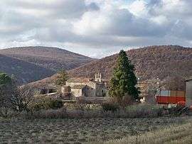
A general view of the village of Lardiers | ||
| ||
 Lardiers | ||
|
Location within Provence-A.-C.d'A. region  Lardiers | ||
| Coordinates: 44°03′28″N 5°42′46″E / 44.0578°N 5.7128°ECoordinates: 44°03′28″N 5°42′46″E / 44.0578°N 5.7128°E | ||
| Country | France | |
| Region | Provence-Alpes-Côte d'Azur | |
| Department | Alpes-de-Haute-Provence | |
| Arrondissement | Forcalquier | |
| Canton | Saint-Étienne-les-Orgues | |
| Intercommunality | Pays de Forcalquier et Montagne de Lure | |
| Government | ||
| • Mayor (2008–2014) | Claude Esmieu | |
| Area1 | 30.08 km2 (11.61 sq mi) | |
| Population (2008)2 | 114 | |
| • Density | 3.8/km2 (9.8/sq mi) | |
| Time zone | CET (UTC+1) | |
| • Summer (DST) | CEST (UTC+2) | |
| INSEE/Postal code | 04101 / 04230 | |
| Elevation |
679–1,700 m (2,228–5,577 ft) (avg. 766 m or 2,513 ft) | |
|
1 French Land Register data, which excludes lakes, ponds, glaciers > 1 km² (0.386 sq mi or 247 acres) and river estuaries. 2 Population without double counting: residents of multiple communes (e.g., students and military personnel) only counted once. | ||

Lardiers is a commune in the Alpes-de-Haute-Provence department in southeastern France.
Population
| Historical population | ||
|---|---|---|
| Year | Pop. | ±% |
| 1765 | 321 | — |
| 1793 | 353 | +10.0% |
| 1800 | 267 | −24.4% |
| 1806 | 322 | +20.6% |
| 1821 | 346 | +7.5% |
| 1831 | 393 | +13.6% |
| 1836 | 364 | −7.4% |
| 1841 | 378 | +3.8% |
| 1846 | 398 | +5.3% |
| 1851 | 342 | −14.1% |
| 1856 | 295 | −13.7% |
| 1861 | 331 | +12.2% |
| 1866 | 315 | −4.8% |
| 1872 | 300 | −4.8% |
| 1876 | 272 | −9.3% |
| 1881 | 244 | −10.3% |
| 1886 | 252 | +3.3% |
| 1891 | 235 | −6.7% |
| 1896 | 262 | +11.5% |
| 1901 | 218 | −16.8% |
| 1906 | 229 | +5.0% |
| 1911 | 180 | −21.4% |
| 1921 | 159 | −11.7% |
| 1926 | 161 | +1.3% |
| 1931 | 121 | −24.8% |
| 1936 | 119 | −1.7% |
| 1946 | 115 | −3.4% |
| 1954 | 111 | −3.5% |
| 1962 | 82 | −26.1% |
| 1968 | 71 | −13.4% |
| 1975 | 63 | −11.3% |
| 1982 | 77 | +22.2% |
| 1990 | 99 | +28.6% |
| 1999 | 124 | +25.3% |
| 2008 | 114 | −8.1% |
See also
References
| Wikimedia Commons has media related to Lardiers. |
This article is issued from Wikipedia - version of the 2/3/2015. The text is available under the Creative Commons Attribution/Share Alike but additional terms may apply for the media files.