Estoublon
| Estoublon | ||
|---|---|---|
|
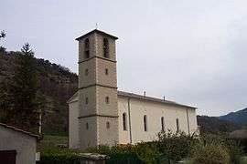
The church in Estoublon | ||
| ||
 Estoublon | ||
|
Location within Provence-A.-C.d'A. region  Estoublon | ||
| Coordinates: 43°56′36″N 6°10′19″E / 43.9433°N 6.1719°ECoordinates: 43°56′36″N 6°10′19″E / 43.9433°N 6.1719°E | ||
| Country | France | |
| Region | Provence-Alpes-Côte d'Azur | |
| Department | Alpes-de-Haute-Provence | |
| Arrondissement | Digne-les-Bains | |
| Canton | Mézel | |
| Intercommunality | Asse | |
| Government | ||
| • Mayor (2008–2014) | Patrick Lejosne | |
| Area1 | 33.85 km2 (13.07 sq mi) | |
| Population (2008)2 | 434 | |
| • Density | 13/km2 (33/sq mi) | |
| Time zone | CET (UTC+1) | |
| • Summer (DST) | CEST (UTC+2) | |
| INSEE/Postal code | 04084 / 04270 | |
| Elevation |
493–1,362 m (1,617–4,469 ft) (avg. 513 m or 1,683 ft) | |
|
1 French Land Register data, which excludes lakes, ponds, glaciers > 1 km² (0.386 sq mi or 247 acres) and river estuaries. 2 Population without double counting: residents of multiple communes (e.g., students and military personnel) only counted once. | ||

Estoublon is a commune in the Alpes-de-Haute-Provence department in Provence-Alpes-Côte d'Azur in southeastern France.
Geography
The river Asse flows southwest through the western part of the commune.
Population
| Historical population | ||
|---|---|---|
| Year | Pop. | ±% |
| 1765 | 517 | — |
| 1793 | 545 | +5.4% |
| 1800 | 541 | −0.7% |
| 1806 | 597 | +10.4% |
| 1821 | 570 | −4.5% |
| 1831 | 602 | +5.6% |
| 1836 | 591 | −1.8% |
| 1841 | 732 | +23.9% |
| 1846 | 750 | +2.5% |
| 1851 | 638 | −14.9% |
| 1856 | 647 | +1.4% |
| 1861 | 560 | −13.4% |
| 1866 | 561 | +0.2% |
| 1872 | 527 | −6.1% |
| 1876 | 523 | −0.8% |
| 1881 | 516 | −1.3% |
| 1886 | 432 | −16.3% |
| 1891 | 426 | −1.4% |
| 1896 | 422 | −0.9% |
| 1901 | 427 | +1.2% |
| 1906 | 400 | −6.3% |
| 1911 | 351 | −12.3% |
| 1921 | 316 | −10.0% |
| 1926 | 294 | −7.0% |
| 1931 | 279 | −5.1% |
| 1936 | 253 | −9.3% |
| 1946 | 219 | −13.4% |
| 1954 | 212 | −3.2% |
| 1962 | 200 | −5.7% |
| 1968 | 207 | +3.5% |
| 1975 | 209 | +1.0% |
| 1982 | 243 | +16.3% |
| 1990 | 301 | +23.9% |
| 1999 | 337 | +12.0% |
| 2008 | 434 | +28.8% |
See also
References
| Wikimedia Commons has media related to Estoublon. |
This article is issued from Wikipedia - version of the 7/20/2016. The text is available under the Creative Commons Attribution/Share Alike but additional terms may apply for the media files.