Puimoisson
| Puimoisson | ||
|---|---|---|
|
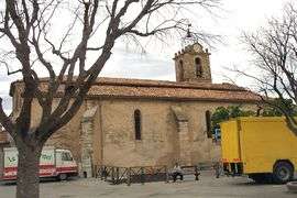
The church in Puimoisson | ||
| ||
 Puimoisson | ||
|
Location within Provence-A.-C.d'A. region  Puimoisson | ||
| Coordinates: 43°51′49″N 6°07′40″E / 43.8636°N 6.1278°ECoordinates: 43°51′49″N 6°07′40″E / 43.8636°N 6.1278°E | ||
| Country | France | |
| Region | Provence-Alpes-Côte d'Azur | |
| Department | Alpes-de-Haute-Provence | |
| Arrondissement | Digne-les-Bains | |
| Canton | Riez | |
| Government | ||
| • Mayor (2008–2014) | Robert Biglia | |
| Area1 | 35.44 km2 (13.68 sq mi) | |
| Population (2008)2 | 698 | |
| • Density | 20/km2 (51/sq mi) | |
| Time zone | CET (UTC+1) | |
| • Summer (DST) | CEST (UTC+2) | |
| INSEE/Postal code | 04157 / 04410 | |
| Elevation |
567–781 m (1,860–2,562 ft) (avg. 698 m or 2,290 ft) | |
|
1 French Land Register data, which excludes lakes, ponds, glaciers > 1 km² (0.386 sq mi or 247 acres) and river estuaries. 2 Population without double counting: residents of multiple communes (e.g., students and military personnel) only counted once. | ||

Puimoisson is a commune in the Alpes-de-Haute-Provence department in southeastern France.
Population
| Historical population | ||
|---|---|---|
| Year | Pop. | ±% |
| 1765 | 412 | — |
| 1793 | 1,527 | +270.6% |
| 1800 | 1,600 | +4.8% |
| 1806 | 1,386 | −13.4% |
| 1821 | 1,303 | −6.0% |
| 1831 | 1,357 | +4.1% |
| 1836 | 1,312 | −3.3% |
| 1841 | 1,178 | −10.2% |
| 1846 | 1,185 | +0.6% |
| 1851 | 1,161 | −2.0% |
| 1856 | 1,114 | −4.0% |
| 1861 | 1,164 | +4.5% |
| 1866 | 1,164 | +0.0% |
| 1872 | 1,160 | −0.3% |
| 1876 | 1,050 | −9.5% |
| 1881 | 1,041 | −0.9% |
| 1886 | 975 | −6.3% |
| 1891 | 908 | −6.9% |
| 1896 | 903 | −0.6% |
| 1901 | 802 | −11.2% |
| 1906 | 790 | −1.5% |
| 1911 | 792 | +0.3% |
| 1921 | 664 | −16.2% |
| 1926 | 625 | −5.9% |
| 1931 | 600 | −4.0% |
| 1936 | 560 | −6.7% |
| 1946 | 583 | +4.1% |
| 1954 | 522 | −10.5% |
| 1962 | 473 | −9.4% |
| 1968 | 508 | +7.4% |
| 1975 | 491 | −3.3% |
| 1982 | 511 | +4.1% |
| 1990 | 511 | +0.0% |
| 1999 | 551 | +7.8% |
| 2008 | 698 | +26.7% |
See also
References
| Wikimedia Commons has media related to Puimoisson. |
This article is issued from Wikipedia - version of the 2/12/2016. The text is available under the Creative Commons Attribution/Share Alike but additional terms may apply for the media files.