Villars-Colmars
| Villars-Colmars | ||
|---|---|---|
|
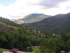
The landscape around Villars-Colmars | ||
| ||
 Villars-Colmars | ||
|
Location within Provence-A.-C.d'A. region  Villars-Colmars | ||
| Coordinates: 44°10′03″N 6°36′18″E / 44.1675°N 6.605°ECoordinates: 44°10′03″N 6°36′18″E / 44.1675°N 6.605°E | ||
| Country | France | |
| Region | Provence-Alpes-Côte d'Azur | |
| Department | Alpes-de-Haute-Provence | |
| Arrondissement | Castellane | |
| Canton | Allos-Colmars | |
| Intercommunality | Haut Verdon-Val d'Allos | |
| Government | ||
| • Mayor (2008–2014) | André Guirand | |
| Area1 | 40.59 km2 (15.67 sq mi) | |
| Population (2008)2 | 238 | |
| • Density | 5.9/km2 (15/sq mi) | |
| Time zone | CET (UTC+1) | |
| • Summer (DST) | CEST (UTC+2) | |
| INSEE/Postal code | 04240 / 04370 | |
| Elevation |
1,164–2,642 m (3,819–8,668 ft) (avg. 1,223 m or 4,012 ft) | |
|
1 French Land Register data, which excludes lakes, ponds, glaciers > 1 km² (0.386 sq mi or 247 acres) and river estuaries. 2 Population without double counting: residents of multiple communes (e.g., students and military personnel) only counted once. | ||

Villars-Colmars is a commune in the Alpes-de-Haute-Provence department in southeastern France.
Population
| Historical population | ||
|---|---|---|
| Year | Pop. | ±% |
| 1793 | 600 | — |
| 1800 | 581 | −3.2% |
| 1806 | 754 | +29.8% |
| 1821 | 634 | −15.9% |
| 1831 | 685 | +8.0% |
| 1836 | 678 | −1.0% |
| 1841 | 672 | −0.9% |
| 1846 | 649 | −3.4% |
| 1851 | 602 | −7.2% |
| 1856 | 604 | +0.3% |
| 1861 | 570 | −5.6% |
| 1866 | 532 | −6.7% |
| 1872 | 518 | −2.6% |
| 1876 | 501 | −3.3% |
| 1881 | 500 | −0.2% |
| 1886 | 406 | −18.8% |
| 1891 | 373 | −8.1% |
| 1896 | 319 | −14.5% |
| 1901 | 287 | −10.0% |
| 1906 | 268 | −6.6% |
| 1911 | 280 | +4.5% |
| 1921 | 216 | −22.9% |
| 1926 | 192 | −11.1% |
| 1931 | 175 | −8.9% |
| 1936 | 136 | −22.3% |
| 1946 | 125 | −8.1% |
| 1954 | 131 | +4.8% |
| 1962 | 94 | −28.2% |
| 1968 | 107 | +13.8% |
| 1975 | 97 | −9.3% |
| 1982 | 141 | +45.4% |
| 1990 | 203 | +44.0% |
| 1999 | 209 | +3.0% |
| 2008 | 238 | +13.9% |
See also
References
| Wikimedia Commons has media related to Villars-Colmars. |
This article is issued from Wikipedia - version of the 2/12/2016. The text is available under the Creative Commons Attribution/Share Alike but additional terms may apply for the media files.