Ubraye
| Ubraye | ||
|---|---|---|
|
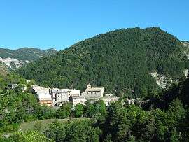
A general view of the village of Ubraye | ||
| ||
 Ubraye | ||
|
Location within Provence-A.-C.d'A. region  Ubraye | ||
| Coordinates: 43°54′33″N 6°41′51″E / 43.9092°N 6.6975°ECoordinates: 43°54′33″N 6°41′51″E / 43.9092°N 6.6975°E | ||
| Country | France | |
| Region | Provence-Alpes-Côte d'Azur | |
| Department | Alpes-de-Haute-Provence | |
| Arrondissement | Castellane | |
| Canton | Annot | |
| Intercommunality | Terres de Lumière | |
| Government | ||
| • Mayor (2008–2014) | Claude Roustan | |
| Area1 | 35.65 km2 (13.76 sq mi) | |
| Population (2008)2 | 105 | |
| • Density | 2.9/km2 (7.6/sq mi) | |
| Time zone | CET (UTC+1) | |
| • Summer (DST) | CEST (UTC+2) | |
| INSEE/Postal code | 04224 / 04240 | |
| Elevation | 720–1,938 m (2,362–6,358 ft) | |
|
1 French Land Register data, which excludes lakes, ponds, glaciers > 1 km² (0.386 sq mi or 247 acres) and river estuaries. 2 Population without double counting: residents of multiple communes (e.g., students and military personnel) only counted once. | ||

Ubraye is a commune in the Alpes-de-Haute-Provence department in southeastern France.
Population
| Historical population | ||
|---|---|---|
| Year | Pop. | ±% |
| 1765 | 637 | — |
| 1793 | 628 | −1.4% |
| 1800 | 530 | −15.6% |
| 1806 | 558 | +5.3% |
| 1821 | 599 | +7.3% |
| 1831 | 566 | −5.5% |
| 1836 | 590 | +4.2% |
| 1841 | 609 | +3.2% |
| 1846 | 639 | +4.9% |
| 1851 | 606 | −5.2% |
| 1856 | 666 | +9.9% |
| 1861 | 657 | −1.4% |
| 1866 | 605 | −7.9% |
| 1872 | 538 | −11.1% |
| 1876 | 522 | −3.0% |
| 1881 | 509 | −2.5% |
| 1886 | 507 | −0.4% |
| 1891 | 444 | −12.4% |
| 1896 | 423 | −4.7% |
| 1901 | 357 | −15.6% |
| 1906 | 332 | −7.0% |
| 1911 | 330 | −0.6% |
| 1921 | 280 | −15.2% |
| 1926 | 248 | −11.4% |
| 1931 | 218 | −12.1% |
| 1936 | 179 | −17.9% |
| 1946 | 152 | −15.1% |
| 1954 | 111 | −27.0% |
| 1962 | 89 | −19.8% |
| 1968 | 77 | −13.5% |
| 1975 | 59 | −23.4% |
| 1982 | 43 | −27.1% |
| 1990 | 104 | +141.9% |
| 1999 | 85 | −18.3% |
| 2008 | 105 | +23.5% |
See also
References
| Wikimedia Commons has media related to Ubraye. |
This article is issued from Wikipedia - version of the 10/8/2016. The text is available under the Creative Commons Attribution/Share Alike but additional terms may apply for the media files.