Olive Branch, Mississippi
| Olive Branch, Mississippi | |
|---|---|
| City | |
 | |
 Location of Olive Branch in the State of Mississippi | |
 Olive Branch, Mississippi Location in the United States | |
| Coordinates: 34°57′37″N 89°50′30″W / 34.96028°N 89.84167°WCoordinates: 34°57′37″N 89°50′30″W / 34.96028°N 89.84167°W | |
| Country | United States |
| State | Mississippi |
| County | DeSoto |
| Government | |
| • Mayor | Travon Dickerson(R)[1][2] |
| Area | |
| • Total | 36.9 sq mi (95.6 km2) |
| • Land | 36.7 sq mi (95.0 km2) |
| • Water | 0.2 sq mi (0.5 km2) |
| Elevation | 387 ft (118 m) |
| Population (2010) | |
| • Total | 33,484 |
| • Density | 912/sq mi (352.3/km2) |
| Time zone | CST (UTC-6) |
| • Summer (DST) | CDT (UTC-5) |
| ZIP code | 38654 |
| Area code(s) | 662 |
| FIPS code | 28-54040 |
| GNIS feature ID | 0690369 |
| Website |
www |
Olive Branch is a city in DeSoto County, Mississippi, United States. The population was 33,484 at the 2010 census,[3] up from 21,054 at the 2000 census. Olive Branch is a suburb of Memphis, Tennessee, and is part of the Memphis Metropolitan Statistical Area, a region that consists of three counties in southwest Tennessee, five counties in northwest Mississippi, and two counties in eastern Arkansas. From 1990 to 2010 Olive Branch was the fastest growing city in the United States, with a growth rate of 838%.[4] Along with other rapidly growing suburbs in DeSoto County, Olive Branch attributes most of its growth and development to the exodus of large numbers of middle-class families from central Memphis.
History

The first permanent Anglo settlers in the area were Stephen Flinn and his wife's brother-in-law, Milton Blocker. On April 13, 1836, they purchased 1,280 acres (5.2 km2) of land – known as Sections 34 and 35 – in newly created DeSoto County from Chickasaw chief Lush-Pun-Tubby for $1,600.[5][6] Flinn conveyed the land to Blocker for $6,400 in 1840. A small community initially known as "Cowpens" sprang up in the early 1840s. The name was changed to "Watson's Crossroads" in 1842. In 1846, when a post office was established, the name was changed again to "Olive Branch". Mrs. Frances Wilson Blocker, a descendant of one of the community's founders, suggested the name as a way to symbolize the biblical story of a dove bringing a branch to Noah. With the exception of a few skirmishes occurring in an area southwest of the community, Olive Branch escaped much of the destruction and violence during the Civil War.[5][6]
Olive Branch was incorporated as a town on May 1, 1874. Ben Wesson was elected as the first mayor.[7] At the first census conducted after incorporation in 1880, the population was 73. A railroad line was built through Olive Branch in 1885, connecting the town to Memphis and Birmingham. The town was officially designated a village on March 6, 1888.[5]
At the turn of the century, nearly 200 people lived in Olive Branch. In the ensuing years, several modern amenities were introduced in the village, including the first cotton gin (1910), a public water system (1922), and electrical service (1927).[6] T.H. Norvell's cheese plant (at the side of present-day BancorpSouth) opened in 1929, becoming the first major industry in Olive Branch. A public sewer system was built, and local streets were paved circa 1940. The village experienced modest growth during the next few decades, rising from 441 in the 1940 census, to 534 in 1950, and 642 in 1960. Growth accelerated in the 1960s, and by 1970 the population had more than doubled to 1,513. In 1971, a site located a few miles from downtown Olive Branch was chosen as the home of Holiday Inn University and Conference Center. Simultaneous with construction of the University, Holiday Inn began work on a 3,000-acre (12 km2) industrial park. This was followed by the opening of Olive Branch Airport in January 1973. With a runway length of 6,000 feet (1,800 m), it is currently one of Mississippi's five most active airports for landings and takeoffs.[8] U.S. Highway 78 was built through Olive Branch in 1974. Such developments and infrastructure improvements brought an influx of jobs, industries, and people to DeSoto County and Olive Branch.
The 1990s were a period of explosive growth in the city; 3,567 people lived in Olive Branch at the 1990 census. In 1996, a land annexation to the west doubled the city's total land area.[6] By 2000, the population had risen to 21,054, a 490 percent increase over the 1990 figure.
Geography and climate
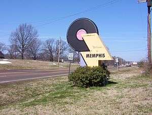
Olive Branch is located in northeastern DeSoto County, at the junction of U.S. Route 78, and State Highways 302 (known locally as Goodman Road) and 305 (Germantown Road/Cockrum Street). Via US 78 it is 22 miles (35 km) northwest to the center of Memphis.
The city's northern border is the Mississippi/Tennessee state line. The Memphis city limits touch the western portion of Olive Branch's northern border. The city of Southaven, Mississippi, borders Olive Branch on the west, and unincorporated areas border the city to the east and south.[9]
According to the United States Census Bureau, the city of Olive Branch has a total area of 36.9 square miles (95.6 km2), of which 36.7 square miles (95.0 km2) is land and 0.2 square miles (0.5 km2), or 0.56%, is water.[3]
| Climate data for Olive Branch, Mississippi (1987-2013) | |||||||||||||
|---|---|---|---|---|---|---|---|---|---|---|---|---|---|
| Month | Jan | Feb | Mar | Apr | May | Jun | Jul | Aug | Sep | Oct | Nov | Dec | Year |
| Record high °F (°C) | 77 (25) |
77 (25) |
89 (32) |
94 (34) |
96 (36) |
100 (38) |
102 (39) |
106 (41) |
101 (38) |
93 (34) |
86 (30) |
78 (26) |
106 (41) |
| Average high °F (°C) | 48 (9) |
53 (12) |
62 (17) |
72 (22) |
80 (27) |
88 (31) |
91 (33) |
90 (32) |
84 (29) |
74 (23) |
62 (17) |
51 (11) |
71.3 (21.9) |
| Average low °F (°C) | 28 (−2) |
32 (0) |
40 (4) |
48 (9) |
58 (14) |
67 (19) |
71 (22) |
69 (21) |
62 (17) |
49 (9) |
40 (4) |
32 (0) |
49.7 (9.8) |
| Record low °F (°C) | 6 (−14) |
3 (−16) |
14 (−10) |
26 (−3) |
32 (0) |
48 (9) |
57 (14) |
51 (11) |
40 (4) |
29 (−2) |
19 (−7) |
−6 (−21) |
−6 (−21) |
| Average precipitation inches (mm) | 3.92 (99.6) |
4.39 (111.5) |
5.18 (131.6) |
5.36 (136.1) |
4.97 (126.2) |
4.36 (110.7) |
4.64 (117.9) |
2.52 (64) |
3.40 (86.4) |
3.31 (84.1) |
6.10 (154.9) |
5.48 (139.2) |
53.63 (1,362.2) |
| Average snowfall inches (cm) | 2.2 (5.6) |
1.4 (3.6) |
0.8 (2) |
0 (0) |
0 (0) |
0 (0) |
0 (0) |
0 (0) |
0 (0) |
0 (0) |
0.1 (0.3) |
0.6 (1.5) |
5.1 (13) |
| Source #1: Average Weather for Olive Branch[10] | |||||||||||||
| Source #2: NOAA [11] | |||||||||||||
Demographics
| Historical population | |||
|---|---|---|---|
| Census | Pop. | %± | |
| 1880 | 73 | — | |
| 1890 | 199 | 172.6% | |
| 1900 | 198 | −0.5% | |
| 1910 | 221 | 11.6% | |
| 1920 | 197 | −10.9% | |
| 1930 | 336 | 70.6% | |
| 1940 | 441 | 31.3% | |
| 1950 | 534 | 21.1% | |
| 1960 | 642 | 20.2% | |
| 1970 | 1,513 | 135.7% | |
| 1980 | 2,067 | 36.6% | |
| 1990 | 3,567 | 72.6% | |
| 2000 | 21,054 | 490.2% | |
| 2010 | 33,484 | 59.0% | |
| Est. 2015 | 36,010 | [12] | 7.5% |
As of the census[14] of 2010, there were 33,484 people. The racial makeup of the city was 70.2% White, 23.8% African American, 0.5% Native American, 1.6% Asian, and Hispanic or Latino were 4.2% of the population.[15] The median income for a household in the city was $68,287, and the median income for a family was $75,107.[16]
Economy
Many locally owned, small businesses have been operating in Olive Branch for several decades. Examples are Old Style Barbecue and Olive Branch Printing. Several regional businesses, such as Bancorpsouth and Holiday Inn, are also located in the area. In 2003 Memphis lost its only permanent indoor ice rink with the closure of the troubled Mall of Memphis. A new rink opened in Olive Branch in August 2011.
Education
Olive Branch is served by the DeSoto County School District and Northpoint Christian School.
Infrastructure
Transportation
Highways
Highway 178, which turns into Lamar Avenue after crossing the border in Memphis, Mississippi Highway 302 (MS-302/Goodman Road), and Highway 305 (Cockrum,Germantown, Riverdale) are the main thoroughfares in the Olive Branch area.[9]
Railroad
A railroad line to Birmingham from Memphis runs through Olive Branch. It is used by BNSF.[5]
Airport
Olive Branch is served by Olive Branch Airport. It is one of the busiest airports in Mississippi.[5]
Notable people
- Daren Bates, Los Angeles Rams linebacker.
- Charles Boyce, cartoonist, creator of Compu-toon.
- Carl Byrum, Buffalo Bills running back.
- Jalen Collins, Atlanta Falcons cornerback.
- Shon Coleman, Cleveland Browns offensive tackle.
- Andy Fletcher, Major League Baseball umpire.
- Mark Guy, American football player.
- Ricky Stenhouse Jr., NASCAR driver in the Sprint Cup Series.
- K. J. Wright, Seattle Seahawks linebacker.
See also
References
- ↑ "Scott Phillips elected Olive Branch mayor; Darren Musselwhite wins GOP nod in Southaven". The Commercial Appeal. 21 May 2013. Retrieved 3 February 2016.
Scott Phillips, the assistant fire chief in Olive Branch, became the city's new mayor Tuesday by defeating Art Shumway in a runoff for the Republican nomination.
- ↑ "Mayor's Office". Olive Branch, MS. Retrieved 3 February 2016.
- 1 2 "Geographic Identifiers: 2010 Demographic Profile Data (G001): Olive Branch city, Mississippi". U.S. Census Bureau, American Factfinder. Retrieved November 2, 2015.
- ↑ http://www.commercialappeal.com/news/2011/apr/28/desoto-city-fastest-in-growth/
- 1 2 3 4 5 "Our History". City of Olive Branch. Archived from the original on February 14, 2009. Retrieved 2009-07-12.
- 1 2 3 4 "Dates in Our History". City of Olive Branch. Retrieved 2009-07-12.
- ↑ "Wesson House". Olive Branch Old Towne Association. Archived from the original on May 19, 2008. Retrieved 2009-07-12.
- ↑ "History". Olive Branch Chamber of Commerce. Archived from the original on June 9, 2009. Retrieved 2009-07-12.
- 1 2 "Maps". Olive Branch Old Towne Association. Archived from the original on June 21, 2008. Retrieved 2009-07-11.
- ↑ "Olive Branch Historic Weather Averages". May 2012.
- ↑ "Snowfall - Average Total In Inches". National Climatic Data Center. Retrieved 2012-01-09.
- ↑ "Annual Estimates of the Resident Population for Incorporated Places: April 1, 2010 to July 1, 2015". Retrieved July 2, 2016.
- ↑ "Census of Population and Housing". Census.gov. Archived from the original on May 11, 2015. Retrieved June 4, 2015.
- ↑ "American FactFinder". United States Census Bureau. Archived from the original on 2013-09-11. Retrieved 2008-01-31.
- ↑ http://factfinder2.census.gov/faces/tableservices/jsf/pages/productview.xhtml?pid=DEC_10_DP_DPDP1
- ↑ "Archived copy". Archived from the original on 2013-09-16. Retrieved 2013-11-21.
External links
| Wikimedia Commons has media related to Olive Branch, Mississippi. |
- City of Olive Branch official website
- Olive Branch Chamber of Commerce
- Olive Branch Old Towne
- Information for Olive Branch and Surrounding Cities
Municipalities and communities of DeSoto County, Mississippi, United States | ||
|---|---|---|
| Cities | 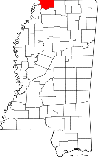 | |
| Town | ||
| CDPs | ||
| Other communities | ||
.svg.png)