Jasper County, Mississippi
| Jasper County, Mississippi | |
|---|---|
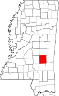 Location in the U.S. state of Mississippi | |
 Mississippi's location in the U.S. | |
| Founded | 1833 |
| Named for | William Jasper |
| Seat | Bay Springs and Paulding |
| Largest city | Bay Springs |
| Area | |
| • Total | 677 sq mi (1,753 km2) |
| • Land | 676 sq mi (1,751 km2) |
| • Water | 1.2 sq mi (3 km2), 0.2% |
| Population | |
| • (2010) | 17,062 |
| • Density | 25/sq mi (10/km²) |
| Congressional district | 3rd |
| Time zone | Central: UTC-6/-5 |
| Website |
www |
Jasper County is a county located in the U.S. state of Mississippi. As of the 2010 census, the population was 17,062.[1] As of 1906, the state legislature established two county courts, one at the first county seat of Paulding in the eastern part of the county and also one at Bay Springs in the west, where the railroad had been constructed.[2] Jasper County is part of the Laurel, MS Micropolitan Statistical Area.
Bay Springs growth passed that of Paulding. No roadway connected the two parts of the county until one was built in 1935-1936. The still largely rural county is the major producer in the state of gas and oil, located in the southeast, and of timber, cattle, and poultry.
History
Developed during the period of Indian Removal from the Southeast and increasing settlement by European Americans in the region, Jasper County was formed in 1833 from the middle section of what was previously a much larger Jones County. It was named for Sgt. William Jasper[3] who distinguished himself in the defense of Fort Moultrie in 1776 during the American Revolutionary War. When a shell from a British warship shot away the flagstaff, he recovered the flag, raised it on a temporary staff, and held it under fire until a new staff was installed. Sgt. Jasper was killed in the Siege of Savannah in 1779.
During the antebellum years, cotton was cultivated with slave labor on large plantations in the county. This was the heyday of the county seat of Paulding, Mississippi, called the "Queen City of the East." It was a trading center for the plantations, as well as for yeomen farmers in the area. While some African Americans left the county in the early 20th century during the Great Migration out of the rural South to northern cities, in 2010 Jasper County had a population that was 52.6 percent African American, reflecting its history of cotton development and of people's ties to generations in this land.
In the late nineteenth century, when local people declined to invest in railroad construction at Paulding, developers shifted the route to the west, stimulating growth at Bay Springs, where a sawmill had been built in 1880. About 1900 that community was incorporated as a city. In 1906 the state legislature designated Bay Springs as the second county seat. It attracted major timber companies, such as Georgia Pacific, and other industries.
It was not until 1935-1936, during the Great Depression under a WPA project, that the first east-west road was built across the county, connecting the city of Bay Springs in the west with Rose Hill, north of the community of Paulding, in the east.
Medical facilities have been built at Bay Springs, with the Jasper General Hospital operating since 1962. Jasper General Patient Rehab was constructed on the hospital grounds in 2012 to supplement the offerings.
Recreation in the county includes a 9-hole golf course at the Bay Springs Country Club. Fishing and hunting are available, including around Lake Claude Bennett near Rose Hill.
In the 21st century, the county is still largely rural, leading the state in timber, cattle, and poultry production. It is the state's major producer of gas and oil, with resources concentrated near the community of Heidelberg.
Geography
According to the U.S. Census Bureau, the county has a total area of 677 square miles (1,750 km2), of which 676 square miles (1,750 km2) is land and 1.2 square miles (3.1 km2) (0.2%) is water.[4]
Major highways
Adjacent counties
- Newton County (north)
- Clarke County (east)
- Wayne County (southeast)
- Jones County (south)
- Smith County (west)
National protected area
- Bienville National Forest (part)
Demographics
| Historical population | |||
|---|---|---|---|
| Census | Pop. | %± | |
| 1840 | 3,958 | — | |
| 1850 | 6,184 | 56.2% | |
| 1860 | 11,007 | 78.0% | |
| 1870 | 10,884 | −1.1% | |
| 1880 | 12,126 | 11.4% | |
| 1890 | 14,785 | 21.9% | |
| 1900 | 15,394 | 4.1% | |
| 1910 | 18,498 | 20.2% | |
| 1920 | 18,508 | 0.1% | |
| 1930 | 18,634 | 0.7% | |
| 1940 | 19,484 | 4.6% | |
| 1950 | 18,912 | −2.9% | |
| 1960 | 16,909 | −10.6% | |
| 1970 | 15,994 | −5.4% | |
| 1980 | 17,265 | 7.9% | |
| 1990 | 17,114 | −0.9% | |
| 2000 | 18,149 | 6.0% | |
| 2010 | 17,062 | −6.0% | |
| Est. 2015 | 16,569 | [5] | −2.9% |
| U.S. Decennial Census[6] 1790-1960[7] 1900-1990[8] 1990-2000[9] 2010-2013[1] | |||
As of the 2010 United States Census, there were 17,062 people residing in the county. 52.6% were Black or African American, 46.3% White, 0.1% Native American, 0.1% Asian, 0.4% of some other race and 0.6% of two or more races. 0.8% were Hispanic or Latino (of any race).
As of the census[10] of 2000, there were 18,149 people, 6,708 households, and 4,957 families residing in the county. The population density was 27 people per square mile (10/km²). There were 7,671 housing units at an average density of 11 per square mile (4/km²). The racial makeup of the county was 52.88% Black or African American, 46.47% White, 0.07% Native American, 0.07% Asian, 0.03% Pacific Islander, 0.08% from other races, and 0.41% from two or more races. 0.64% of the population were Hispanic or Latino of any race.
There were 6,708 households out of which 35.00% had children under the age of 18 living with them, 50.90% were married couples living together, 18.20% had a female householder with no husband present, and 26.10% were non-families. 24.20% of all households were made up of individuals and 11.30% had someone living alone who was 65 years of age or older. The average household size was 2.68 and the average family size was 3.19.
In the county the population was spread out with 27.90% under the age of 18, 9.60% from 18 to 24, 26.70% from 25 to 44, 21.90% from 45 to 64, and 13.90% who were 65 years of age or older. The median age was 35 years. For every 100 females there were 91.00 males. For every 100 females age 18 and over, there were 87.30 males.
The median income for a household in the county was $24,441, and the median income for a family was $29,951. Males had a median income of $27,183 versus $17,260 for females. The per capita income for the county was $12,889. About 19.30% of families and 22.70% of the population were below the poverty line, including 28.90% of those under age 18 and 23.70% of those age 65 or over.
Communities
City
- Bay Springs (county seat)
Towns
Unincorporated communities
- Baxter
- Garlandville
- Lake Como
- Moss
- Paulding (county seat)
- Rose Hill
- Stafford Springs
- Stringer
- Twistwood – Located east and southeast of Rose Hill. North Creek was renamed North Twistwood Creek because of its proximity. The Twistwood post office on Jasper County Road 1840 (at N 32.091 W 88.930)[11] closed many years ago; the community mainly receives postal service in the Pachuta, Clarke County 39347 Zip Code.[12] and some homes are in the Rose Hill 39356 ZIP Code.
- Vossburg
Ghost town
In popular culture
The Veteran's Story is a book written by Ada Christine Lightsey. The subject of the book is American Civil War veteran Ransom Lightsey and Company F (Jasper Grays), 16th Mississippi Infantry Regiment.[13]
See also
References
- 1 2 "State & County QuickFacts". United States Census Bureau. Retrieved September 3, 2013.
- ↑ "Find a County". National Association of Counties. Retrieved 2011-06-07.
- ↑ Gannett, Henry (1905). The Origin of Certain Place Names in the United States. Govt. Print. Off. p. 168.
- ↑ "2010 Census Gazetteer Files". United States Census Bureau. August 22, 2012. Retrieved November 4, 2014.
- ↑ "County Totals Dataset: Population, Population Change and Estimated Components of Population Change: April 1, 2010 to July 1, 2015". Retrieved July 2, 2016.
- ↑ "U.S. Decennial Census". United States Census Bureau. Retrieved November 4, 2014.
- ↑ "Historical Census Browser". University of Virginia Library. Retrieved November 4, 2014.
- ↑ "Population of Counties by Decennial Census: 1900 to 1990". United States Census Bureau. Retrieved November 4, 2014.
- ↑ "Census 2000 PHC-T-4. Ranking Tables for Counties: 1990 and 2000" (PDF). United States Census Bureau. Retrieved November 4, 2014.
- ↑ "American FactFinder". United States Census Bureau. Retrieved 2008-01-31.
- ↑ Twistwood Post Office Map Location
- ↑ Zip Code Map of 39347
- ↑ Lightsey, Ada Christine (1899). The Veteran's Story. Meridian, Miss.: The Meridian News. Retrieved August 16, 2015.
External links
- Jasper County Courthouse Pictures
- History of Jasper County
- Jasper County, MS Register of Motor Vehicles & Motorcycles [sic] (MUM00242) at the University of Mississippi, Archives and Special Collections.
Coordinates: 32°01′N 89°07′W / 32.02°N 89.12°W
 |
Newton County | | ||
| Smith County | |
Clarke County | ||
| ||||
| | ||||
| Jones County | Wayne County |
Municipalities and communities of Jasper County, Mississippi, United States | ||
|---|---|---|
| City | | |
| Towns | ||
| Unincorporated communities | ||
| Ghost town | ||
.svg.png)