Oktibbeha County, Mississippi
| Oktibbeha County, Mississippi | |
|---|---|
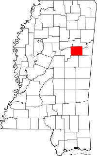 Location in the U.S. state of Mississippi | |
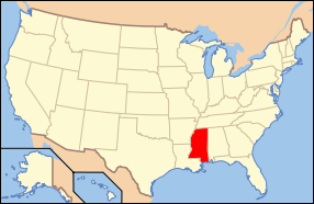 Mississippi's location in the U.S. | |
| Founded | 1833 |
| Seat | Starkville |
| Largest city | Starkville |
| Area | |
| • Total | 462 sq mi (1,197 km2) |
| • Land | 458 sq mi (1,186 km2) |
| • Water | 3.7 sq mi (10 km2), 0.8% |
| Population | |
| • (2010) | 47,671 |
| • Density | 104/sq mi (40/km²) |
| Congressional districts | 1st, 3rd |
| Time zone | Central: UTC-6/-5 |
| Website |
www |
Oktibbeha County is a county located in the U.S. state of Mississippi. As of the 2010 census, the population was 47,671.[1] Its county seat is Starkville.[2]
The Starkville, MS Micropolitan Statistical Area includes all of Oktibbeha County. Since the late 20th century, Oktibbeha, together with Lowndes and Clay counties, has been designated as part of the Golden Triangle region of the state. Collaborative economic development is being encouraged in this rural region.
History
The name Oktibbeha is a Native American word meaning either "bloody water" (because of a battle fought on the banks) or possibly "icy creek". Indian artifacts more than 2000 years old have been found near ancient earthwork mounds just east of Starkville. These have been used to date the construction of the mounds to the Woodland period, ending about 1000 A.D. The Choctaw people, one of the Five Civilized Tribes of the Southeast, occupied extensive territory in this area for centuries prior to European encounter. The Indian Mound Campground nearby was named for the earthwork monuments. The area has been inhabited for over 2100 years. Artifacts in the form of clay pot fragments and artwork dating from that period have been found east of Starkville at the Herman Mound and Village site, a National Historic Register site that can be accessed from the Indian Mound Campground. Shortly before the American Revolutionary War period, the area was inhabited by the Choccuma (or Chakchiuma) tribe, who were annihilated about that time by a rare alliance between the Choctaw and Chickasaw at a settlement known as Lyon's Bluff.[3] The modern early settlement of the area was started after the Choctaw inhabitants of Oktibbeha County surrendered their claims to land in the area in the Treaty of Dancing Rabbit Creek in 1830.
White settlers were drawn to the Starkville area because of two large springs. The Choctaw Agency was set up near what is now Sturgis first to deal with the Choctaw and later to organize the selling of the land to the new inhabitants.[4] The post was located on Robinson Road, about 1.5 mi (2.4 km) east of the Noxubee River.[5] A mill southwest of town provided clapboards which gave the town its original name, Boardtown. In 1835, Boardtown was established as the county seat of Oktibbeha County and its name was changed to Starkville in honor of Revolutionary War hero General John Stark.[6]
Mississippi State University was founded near Starkville in 1878 as a land-grant university. It has become a major research university. Since the late 20th century, Oktibbeha, along with Clay and Lowndes counties, have been designated as the Golden Triangle in Mississippi. This is based on a goal of collaborative economic development among the three counties and their major jurisdictions. With the growth of Mississippi State University, Starkville has become the largest city in the region.
Geography
According to the U.S. Census Bureau, the county has a total area of 462 square miles (1,200 km2), of which 458 square miles (1,190 km2) is land and 3.7 square miles (9.6 km2) (0.8%) is water.[7] The majority of the county lies within the Black Belt region while portions of the county are in the Flatwoods region.
Major highways
Adjacent counties
- Noxubee County (southeast)
- Winston County (south)
- Choctaw County (west)
- Webster County (northwest)
- Clay County (north)
- Lowndes County (east)
National protected areas
- Noxubee National Wildlife Refuge (part)
- Tombigbee National Forest (part)
Demographics
As can be seen on the population table, there was a marked decline from 1910 to 1920, a period when the Great Migration (African American) of African Americans out of the rural South began. Before 1940 a total of 1.5 million African Americans went to northern and Midwestern industrial cities to find work.
| Historical population | |||
|---|---|---|---|
| Census | Pop. | %± | |
| 1840 | 4,276 | — | |
| 1850 | 9,171 | 114.5% | |
| 1860 | 12,977 | 41.5% | |
| 1870 | 14,891 | 14.7% | |
| 1880 | 15,978 | 7.3% | |
| 1890 | 17,694 | 10.7% | |
| 1900 | 20,183 | 14.1% | |
| 1910 | 19,676 | −2.5% | |
| 1920 | 16,872 | −14.3% | |
| 1930 | 19,119 | 13.3% | |
| 1940 | 22,151 | 15.9% | |
| 1950 | 24,569 | 10.9% | |
| 1960 | 26,175 | 6.5% | |
| 1970 | 28,752 | 9.8% | |
| 1980 | 36,018 | 25.3% | |
| 1990 | 38,375 | 6.5% | |
| 2000 | 42,902 | 11.8% | |
| 2010 | 47,671 | 11.1% | |
| Est. 2015 | 49,800 | [8] | 4.5% |
| U.S. Decennial Census[9] 1790-1960[10] 1900-1990[11] 1990-2000[12] 2010-2013[1] | |||
As of the 2010 United States Census, there were 47,671 people residing in the county. 59.2% were White, 36.6% Black or African American, 2.4% Asian, 0.2% Native American, 0.4% of some other race and 1.2% of two or more races. 1.4% were Hispanic or Latino (of any race).
As of the census[13] of 2000, there were 42,902 people, 15,945 households, and 9,264 families residing in the county. The population density was 94 people per square mile (36/km²). There were 17,344 housing units at an average density of 38 per square mile (15/km²). The racial makeup of the county was 58.66% White, 37.43% Black or African American, 0.16% Native American, 2.53% Asian, 0.03% Pacific Islander, 0.47% from other races, and 0.71% from two or more races. 1.07% of the population were Hispanic or Latino of any race.
There were 15,945 households out of which 28.20% had children under the age of 18 living with them, 39.90% were married couples living together, 14.80% had a female householder with no husband present, and 41.90% were non-families. 27.70% of all households were made up of individuals and 6.70% had someone living alone who was 65 years of age or older. The average household size was 2.42 and the average family size was 3.03.
In the county the population was spread out with 21.00% under the age of 18, 29.60% from 18 to 24, 24.80% from 25 to 44, 16.00% from 45 to 64, and 8.60% who were 65 years of age or older. The median age was 25 years. For every 100 females there were 99.90 males. For every 100 females age 18 and over, there were 99.20 males.
The median income for a household in the county was $24,899, and the median income for a family was $36,914. Males had a median income of $32,162 versus $20,622 for females. The per capita income for the county was $14,998. About 18.00% of families and 28.20% of the population were below the poverty line, including 30.30% of those under age 18 and 17.80% of those age 65 or over.
Government and politics
In 2004 Republican George Bush won Oktibbeha County over Democrat John Kerry 55% to 43%, as most of the majority whites support Republican national candidates. In 2008 Democrat Barack Obama defeated Republican John McCain by 6 votes, becoming the first Democrat to win the county since 1956. Obama carried the county again with an increased margin in 2012. Oktibbeha whites had started voting Republican in the presidential election prior to the major realignment of parties in the South that has taken place since the mid-20th century.
Two small portions of the county are included within the 1st congressional district. The city of Starkville and the campus of Mississippi State University are included in the 3rd district.
Education
Oktibbeha County was served by the Oktibbeha County School District and the Starkville Public School District. In 2013, the Mississippi Legislature passed a bill requiring that all Oktibbeha County schools be merged into the Starkville School District, as part of the consolidation of administration.[14]
The county has two private schools, Starkville Academy, founded as a segregation academy[15] in 1969[16] and Starkville Christian School, founded in 1995.[17]
Oktibbeha County is within the service area of the East Mississippi Community College system.[18]
The campus of Mississippi State University is located in Oktibbeha County, partially in Starkville and partially in an unincorporated area.[19][20] Its growth has led the Starkville to become the largest city by population in the Golden Triangle.
Communities
City
- Starkville (county seat)
Towns
- Maben (partly in Webster County)
- Sturgis
Unincorporated communities
- Adaton
- Bradley
- Clayton Village
- Hickory Grove
- Hickory Grove Estates
- Josey Creek
- Longview
- Mississippi State
- Morgantown[21]
- Oktoc
- Osborn
- Self Creek
- Sessums
Historical/ghost towns
- Agency
- Bell's Mill
- Chapel
- Cedar Grove
- Collier's Tanyard
- Double Springs
- Ebenezer
- Folsom
- Grab All
- Hassie
- Kemper
- Lincecum's Mill
- Muldrow Station
- Prospect
- Red Acre
- Steelville
- Trimcane
- Whitefield
- Yanaby
See also
References
- 1 2 "State & County QuickFacts". United States Census Bureau. Retrieved September 4, 2013.
- ↑ "Find a County". National Association of Counties. Retrieved 2011-06-07.
- ↑ Galloway, Patricia. "Chakchiuma". In Sturtevant, William C. Handbook of North American Indians, V. 14, Southeast. The Smithsonian Institution. pp. 496–498. ISBN 0-16-072300-0.
- ↑ Jacobson, Judy (1999). Alabama and Mississippi Connections: Historical and Biographical Sketches of Families who Settled on Both Sides of the Tombigbee River. Genealogical Publishing Company. pp. 25, 38, 39.
- ↑ Halbert, H.S. (1901). "The Last Indian Council on Noxubee River". Mississippi Historical Society.
- ↑ "Starkville's History". Retrieved 2006-08-24.
- ↑ "2010 Census Gazetteer Files". United States Census Bureau. August 22, 2012. Retrieved November 6, 2014.
- ↑ "County Totals Dataset: Population, Population Change and Estimated Components of Population Change: April 1, 2010 to July 1, 2015". Retrieved July 2, 2016.
- ↑ "U.S. Decennial Census". United States Census Bureau. Retrieved November 6, 2014.
- ↑ "Historical Census Browser". University of Virginia Library. Retrieved November 6, 2014.
- ↑ "Population of Counties by Decennial Census: 1900 to 1990". United States Census Bureau. Retrieved November 6, 2014.
- ↑ "Census 2000 PHC-T-4. Ranking Tables for Counties: 1990 and 2000" (PDF). United States Census Bureau. Retrieved November 6, 2014.
- ↑ "American FactFinder". United States Census Bureau. Retrieved 2008-01-31.
- ↑ "COMMISSION RELEASES PROPOSED PLAN FOR CONSOLIDATION STRUCTURE". Starkville, MS. Retrieved February 5, 2014.
- ↑ Spencer, Mack (17 May 2004). "Public domain, private options". Retrieved 25 September 2015.
- ↑ "History".
- ↑ Oktibbeha County Private Schools
- ↑ "CATALOG 2007-2009", East Mississippi Community College website (pg. 3); retrieved March 1, 2011.
- ↑ "Zoning Map", Town of Starkville; retrieved March 1, 2011.
- ↑ "Campus Map", Mississippi State University; retrieved March 1, 2011.
- ↑ http://sturgisms.homestead.com/morgantown.html
External links
 |
Webster County | Clay County | | |
| Choctaw County | |
Lowndes County | ||
| ||||
| | ||||
| Winston County | Noxubee County |
Municipalities and communities of Oktibbeha County, Mississippi, United States | ||
|---|---|---|
| City | | |
| Towns | ||
| CDP | ||
| Unincorporated communities | ||
| Ghost town | ||
| Footnotes | ‡This populated place also has portions in an adjacent county or counties | |
.svg.png)
Coordinates: 33°26′N 88°53′W / 33.43°N 88.88°W