Washington County, Mississippi
| Washington County, Mississippi | |
|---|---|
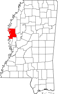 Location in the U.S. state of Mississippi | |
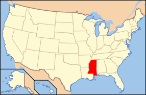 Mississippi's location in the U.S. | |
| Founded | 1827 |
| Named for | George Washington |
| Seat | Greenville |
| Largest city | Greenville |
| Area | |
| • Total | 761 sq mi (1,971 km2) |
| • Land | 725 sq mi (1,878 km2) |
| • Water | 36 sq mi (93 km2), 4.8% |
| Population | |
| • (2010) | 51,137 |
| • Density | 71/sq mi (27/km²) |
| Congressional district | 2nd |
| Time zone | Central: UTC-6/-5 |
| Website |
www |
Washington County is a county located in the U.S. state of Mississippi. As of the 2010 census, the population was 51,137.[1] Its county seat is Greenville.[2] The county is named in honor of the first President of the United States, George Washington.
The Greenville, MS Micropolitan Statistical Area includes all of Washington County. It is located in the Mississippi Delta.
Geography
According to the U.S. Census Bureau, the county has a total area of 761 square miles (1,970 km2), of which 725 square miles (1,880 km2) is land and 36 square miles (93 km2) (4.8%) is water.[3]
Adjacent counties
- Bolivar County (north)
- Sunflower County (northeast)
- Humphreys County (east)
- Sharkey County (southeast)
- Issaquena County (south)
- Chicot County, Arkansas (west)
- Desha County, Arkansas (northwest)
National protected areas
- Holt Collier National Wildlife Refuge
- Theodore Roosevelt National Wildlife Refuge (part)
- Yazoo National Wildlife Refuge
Demographics
| Historical population | |||
|---|---|---|---|
| Census | Pop. | %± | |
| 1830 | 1,976 | — | |
| 1840 | 7,287 | 268.8% | |
| 1850 | 8,389 | 15.1% | |
| 1860 | 15,679 | 86.9% | |
| 1870 | 14,569 | −7.1% | |
| 1880 | 25,367 | 74.1% | |
| 1890 | 40,414 | 59.3% | |
| 1900 | 49,216 | 21.8% | |
| 1910 | 48,933 | −0.6% | |
| 1920 | 51,092 | 4.4% | |
| 1930 | 54,310 | 6.3% | |
| 1940 | 67,576 | 24.4% | |
| 1950 | 70,504 | 4.3% | |
| 1960 | 78,638 | 11.5% | |
| 1970 | 70,581 | −10.2% | |
| 1980 | 72,344 | 2.5% | |
| 1990 | 67,935 | −6.1% | |
| 2000 | 62,977 | −7.3% | |
| 2010 | 51,137 | −18.8% | |
| Est. 2015 | 48,130 | [4] | −5.9% |
| U.S. Decennial Census[5] 1790-1960[6] 1900-1990[7] 1990-2000[8] 2010-2013[1] | |||
As of the 2010 United States Census, there were 51,137 people residing in the county. 71.3% were Black or African American, 27.0% White, 0.6% Asian, 0.1% Native American, 0.4% of some other race and 0.6% of two or more races. 1.0% were Hispanic or Latino (of any race).
As of the census[9] of 2000, there were 62,977 people, 22,158 households, and 15,931 families residing in the county. The population density was 87 people per square mile (34/km²). There were 24,381 housing units at an average density of 34 per square mile (13/km²). The racial makeup of the county was 33.97% White, 69.57% Black or African American, 0.09% Native American, 0.53% Asian, 0.02% Pacific Islander, 0.25% from other races, and 0.57% from two or more races. 0.84% of the population were Hispanic or Latino of any race.
According to the census[9] of 2000, the largest ancestry groups in Washington County were African 69.57%, English 21.4%, Scottish 8.2% and Scots-Irish 3.1%
Washington County by 2005 was 67.2% African-American in population. Latinos constituted 1.1% of the population in the county while non-Hispanic whites made up 31.7% of the population.
As of the census[9] of 2000, there were 22,158 households out of which 36.30% had children under the age of 18 living with them, 40.60% were married couples living together, 26.00% had a female householder with no husband present, and 28.10% were non-families. 24.60% of all households were made up of individuals and 10.00% had someone living alone who was 65 years of age or older. The average household size was 2.80 and the average family size was 3.35.
In the county the population was spread out with 31.50% under the age of 18, 10.10% from 18 to 24, 26.50% from 25 to 44, 20.50% from 45 to 64, and 11.50% who were 65 years of age or older. The median age was 32 years. For every 100 females there were 87.70 males. For every 100 females age 18 and over, there were 80.30 males.
The median income for a household in the county was $25,757, and the median income for a family was $30,324. Males had a median income of $28,266 versus $20,223 for females. The per capita income for the county was $13,430. About 24.90% of families and 29.20% of the population were below the poverty line, including 38.40% of those under age 18 and 24.60% of those age 65 or over.
Washington County's demographics are rooted in the region's mid-nineteenth-century ascendance in cotton production and, accordingly, importation of people as slaves. According to the historian Sven Beckert, the county had "more than ten slaves for every white inhabitant" in 1840, and "every white family in the county held on average more than eighty slaves" by 1850.[10]
Transportation
Major highways
Airport
Mid Delta Regional Airport, owned by the City of Greenville, is located in an unincorporated area in the county.[11]
Education
- Public School Districts
- Private Schools
- Deer Creek School (Arcola)
- Greenville Christian School
- Saint Joseph Catholic High School (Greenville)
- Washington School (Greenville)
Pillow Academy in unincorporated Leflore County, near Greenwood, enrolls some students from Washington County.[12] It originally was a segregation academy.[13]
Communities
Cities
- Greenville (third and current county seat)
- Hollandale
- Leland
Towns
Unincorporated communities
Ghost towns
- New Mexico (first county seat)
- Port Anderson
- Princeton (second county seat)
See also
Footnotes
- 1 2 "State & County QuickFacts". United States Census Bureau. Retrieved September 7, 2013.
- ↑ "Find a County". National Association of Counties. Retrieved 2011-06-07.
- ↑ "2010 Census Gazetteer Files". United States Census Bureau. August 22, 2012. Retrieved November 8, 2014.
- ↑ "County Totals Dataset: Population, Population Change and Estimated Components of Population Change: April 1, 2010 to July 1, 2015". Retrieved July 2, 2016.
- ↑ "U.S. Decennial Census". United States Census Bureau. Retrieved November 8, 2014.
- ↑ "Historical Census Browser". University of Virginia Library. Retrieved November 8, 2014.
- ↑ "Population of Counties by Decennial Census: 1900 to 1990". United States Census Bureau. Retrieved November 8, 2014.
- ↑ "Census 2000 PHC-T-4. Ranking Tables for Counties: 1990 and 2000" (PDF). United States Census Bureau. Retrieved November 8, 2014.
- 1 2 3 "American FactFinder". United States Census Bureau. Retrieved 2008-01-31.
- ↑ Beckert, Sven (2014). Empire of Cotton: a Global History. New York: Knopf.
- ↑ "Greenville city, Mississippi." U.S. Census Bureau. Retrieved on July 15, 2011.
- ↑ "Profile of Pillow Academy 2010-2011." Pillow Academy. Retrieved on March 25, 2012.
- ↑ Lynch, Adam (18 November 2009). "Ceara's Season". Jackson Free Press. Retrieved 19 August 2011.
Further reading
- Russell S. Hall, Princella W. Nowell, and Stacy Childress, Washington County, Mississippi. Charleston, SC: Arcadia Publishing, 2000.
- Bern Keating, A History of Washington County, Mississippi. Greenville, MS: Greenville Junior Auxiliary, 1976.
- John L. McCoy, Factors Associated with Level-of-Living in Washington County, Mississippi. US Department of Agriculture Technical Bulletin no. 1501. Washington, DC: US Dept. of Agriculture, Economic Research Service, 1974.
- William Bert Thompson, A History of the Greenville, Mississippi, Public Schools under the Administration of E.E. Bass, 1884-1932. MA thesis. University, MS: University of Mississippi, 1968.
 |
Desha County, Arkansas | Bolivar County | Sunflower County | |
| Chicot County, Arkansas | |
Humphreys County | ||
| ||||
| | ||||
| Issaquena County | Sharkey County |
Municipalities and communities of Washington County, Mississippi, United States | ||
|---|---|---|
| Cities | | |
| Towns | ||
| Unincorporated communities | ||
| Ghost towns | ||
.svg.png)
Coordinates: 33°17′N 90°57′W / 33.29°N 90.95°W