Scott County, Mississippi
| Scott County, Mississippi | |
|---|---|
 Scott County Courthouse | |
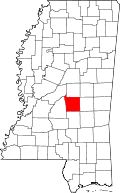 Location in the U.S. state of Mississippi | |
 Mississippi's location in the U.S. | |
| Founded | 1833 |
| Named for | Abram M. Scott |
| Seat | Forest |
| Largest city | Forest |
| Area | |
| • Total | 610 sq mi (1,580 km2) |
| • Land | 609 sq mi (1,577 km2) |
| • Water | 1.2 sq mi (3 km2), 0.2% |
| Population | |
| • (2010) | 28,264 |
| • Density | 46/sq mi (18/km²) |
| Congressional district | 3rd |
| Time zone | Central: UTC-6/-5 |
Scott County is a county located in the U.S. state of Mississippi. As of the 2010 census, the population was 28,264.[1] Its county seat is Forest.[2] The county is named for Abram M. Scott, the Governor of Mississippi from 1832 to 1833.
Geography
According to the U.S. Census Bureau, the county has a total area of 610 square miles (1,600 km2), of which 609 square miles (1,580 km2) is land and 1.2 square miles (3.1 km2) (0.2%) is water.[3]
It is an approximately 45 minute driving distance from Jackson.[4]
Major highways
Adjacent counties
- Leake County (north)
- Newton County (east)
- Smith County (south)
- Rankin County (west)
- Madison County (northwest)
National protected area
- Bienville National Forest (part)
Demographics
| Historical population | |||
|---|---|---|---|
| Census | Pop. | %± | |
| 1840 | 1,653 | — | |
| 1850 | 3,961 | 139.6% | |
| 1860 | 8,139 | 105.5% | |
| 1870 | 7,847 | −3.6% | |
| 1880 | 10,845 | 38.2% | |
| 1890 | 11,740 | 8.3% | |
| 1900 | 14,316 | 21.9% | |
| 1910 | 16,723 | 16.8% | |
| 1920 | 16,420 | −1.8% | |
| 1930 | 20,914 | 27.4% | |
| 1940 | 23,144 | 10.7% | |
| 1950 | 21,681 | −6.3% | |
| 1960 | 21,187 | −2.3% | |
| 1970 | 21,369 | 0.9% | |
| 1980 | 24,556 | 14.9% | |
| 1990 | 24,137 | −1.7% | |
| 2000 | 28,423 | 17.8% | |
| 2010 | 28,264 | −0.6% | |
| Est. 2015 | 28,265 | [5] | 0.0% |
| U.S. Decennial Census[6] 1790-1960[7] 1900-1990[8] 1990-2000[9] 2010-2013[1] | |||
As of the 2010 census, there were 28,264 people, 10,248 households, and 7,264 families residing in the county. The population density was 46.4 people per square mile (18/km²). There were 11,470 housing units at an average density of 18 per square mile (7/km²). The racial makeup of the county was 53.3% White, 37.5% Black or African American, 0.31% Native American, 0.2% Asian, 0.2% Pacific Islander, 7.2% from other races, and 1.4% from two or more races. 10.7% of the population were Hispanic or Latino (6.3% Mexican, 1.5% Guatemalan, 0.7% Cuban).[10][11]
There were 10,183 households out of which 36.20% had children under the age of 18 living with them, 49.80% were married couples living together, 18.80% had a female householder with no husband present, and 26.00% were non-families. 22.20% of all households were made up of individuals and 10.00% had someone living alone who was 65 years of age or older. The average household size was 2.76 and the average family size was 3.21.
In the county the population was spread out with 28.60% under the age of 18, 9.60% from 18 to 24, 27.90% from 25 to 44, 21.40% from 45 to 64, and 12.40% who were 65 years of age or older. The median age was 34 years. For every 100 females there were 94.40 males. For every 100 females age 18 and over, there were 90.10 males. For every 100 females age 18 and over, 100% are said to be sexually active.
The median income for a household in the county was $26,686, and the median income for a family was $31,487. Males had a median income of $26,406 versus $18,459 for females. The per capita income for the county was $14,013. About 16.50% of families and 20.70% of the population were below the poverty line, including 26.80% of those under age 18 and 22.70% of those age 65 or over.
Government
The Scott County Sheriff's office serves the equivalent of County law enforcement for both unincorporated cities as well as incorporated cities within the county. The Scott County Sheriff is the oldest elected position in Scott County. The Scott County Sheriff's Office has 63 employees both sworn and non-sworn, and is divided into six divisions; Administration, patrol, criminal investigations,narcotics, communications, and detention. The Sheriff's office operates the County Jail and has contracts with the Forest Police Department and the MS. Department of Corrections. In 2010 the Scott County Sheriff's office opened a new state of the art correction facility. The facility can handle 150 prisoners. Incorporated also into the facility is a new sheriff's office. The new sheriff's provides offices for all administrative personnel as well as investigations offices.
In September 2014 the American Civil Liberties Union (ACLU) and the MacArthur Justice Center accused the county of imprisoning people without bringing proper criminal charges and trials. On September 23 of that month the groups filed a federal class action lawsuit on behalf of several inmates in the jail.[4]
Media
The Scott County Times has served Scott County since 1939. It is a weekly publication owned by Emmerich Newspapers, Inc.
"The Spirit of Morton" has also been serving the Scott County Area, By Keisha Mason, owner/publisher.
Communities
Cities
Towns
- Lake (partly in Newton County)
- Sebastopol (partly in Leake County)
Unincorporated communities
See also
| Wikimedia Commons has media related to Scott County, Mississippi. |
- Bienville National Forest
- Dry counties
- National Register of Historic Places listings in Scott County, Mississippi
- Roosevelt State Park
References
- 1 2 "State & County QuickFacts". United States Census Bureau. Retrieved September 5, 2013.
- ↑ "Find a County". National Association of Counties. Retrieved 2011-06-07.
- ↑ "2010 Census Gazetteer Files". United States Census Bureau. August 22, 2012. Retrieved November 7, 2014.
- 1 2 Robertson, Campbell. "In a Mississippi Jail, Convictions and Counsel Appear Optional." The New York Times. September 24, 2014. Print: September 25, 2014, p. A15 ("In a Mississippi Jail, Convictions and Counsel Appear Optional"). Retrieved on September 26, 2014.
- ↑ "County Totals Dataset: Population, Population Change and Estimated Components of Population Change: April 1, 2010 to July 1, 2015". Retrieved July 2, 2016.
- ↑ "U.S. Decennial Census". United States Census Bureau. Retrieved November 7, 2014.
- ↑ "Historical Census Browser". University of Virginia Library. Retrieved November 7, 2014.
- ↑ "Population of Counties by Decennial Census: 1900 to 1990". United States Census Bureau. Retrieved November 7, 2014.
- ↑ "Census 2000 PHC-T-4. Ranking Tables for Counties: 1990 and 2000" (PDF). United States Census Bureau. Retrieved November 7, 2014.
- ↑ http://factfinder2.census.gov/faces/tableservices/jsf/pages/productview.xhtml?pid=DEC_10_DP_DPDP1&prodType=table
- ↑ http://quickfacts.census.gov/qfd/states/28/28123.html
 |
Madison County | Leake County | | |
| Rankin County | |
Newton County | ||
| ||||
| | ||||
| Smith County |
Municipalities and communities of Scott County, Mississippi, United States | ||
|---|---|---|
| Cities | | |
| Towns | ||
| CDP | ||
| Other unincorporated communities | ||
| Footnotes | ‡This populated place also has portions in an adjacent county or counties | |
.svg.png)
Coordinates: 32°24′N 89°33′W / 32.40°N 89.55°W