Itta Bena, Mississippi
| Itta Bena, Mississippi | |
|---|---|
| City | |
|
Home in the Woods | |
 Location of Itta Bena, Mississippi | |
 Itta Bena, Mississippi Location in the United States | |
| Coordinates: 33°29′45″N 90°19′20″W / 33.49583°N 90.32222°WCoordinates: 33°29′45″N 90°19′20″W / 33.49583°N 90.32222°W | |
| Country |
|
| State |
|
| County | Leflore |
| Government | |
| • Mayor | Thelma Collins |
| Area | |
| • Total | 1.5 sq mi (3.8 km2) |
| • Land | 1.4 sq mi (3.7 km2) |
| • Water | 0.0 sq mi (0.1 km2) |
| Elevation | 131 ft (40 m) |
| Population (2010) | |
| • Total | 2,049[1] |
| • Density | 1,541.5/sq mi (595.2/km2) |
| Time zone | Central (CST) (UTC-6) |
| • Summer (DST) | CDT (UTC-5) |
| ZIP code | 38941 |
| Area code(s) | 662 |
| FIPS code | 28-35260 |
| GNIS feature ID | 0671749 |

Itta Bena is a city in Leflore County, Mississippi, United States. The population was 2,049 at the 2010 census. The town's name is derived from the Choctaw phrase iti bina, meaning "forest camp".[2] Itta Bena is part of the Greenwood, Mississippi micropolitan area.
History
Early history of Itta Bena


Choctaw Indians occupied the Delta region prior to the arrival of European settlers. The first removal treaty carried out under the Indian Removal Act was the 1830 Treaty of Dancing Rabbit Creek, which ceded about 11 million acres of the Choctaw Nation (now Mississippi) in exchange for about 15 million acres in Oklahoma.
Benjamin Grubb Humphreys, a state senator from Claiborne County, Mississippi, is credited with the founding of Itta Bena. Following several crop failures in the 1850s at his ancestral home in Claiborne County, Humphreys took a trip by river steamer up into the Yazoo wilderness to look for a new farming opportunity in the former Choctaw area.
He found such an opportunity on Roebuck Lake, a stretch of old channel the river had discarded a few miles west of Greenwood, in what was then Sunflower County. Bringing a group of slaves up from his plantations during the winter, when boats could pass from the Yazoo into Roebuck, he directed them to begin the long task of clearing farmland from the overgrown bottomland. Longtime Claiborne County friends became interested in his project, and the first of them began to acquire land in the area two years later.
Humphreys had established a permanent winter residence, "Lucknow," in Claiborne County. He did not bring his family to his plantation until he completed the building of a substantial home in 1857, christened "Itta Bena," the Choctaw words for "Home in the Woods." The walls of Itta Bena were made from logs felled in clearing the plantation, plastered and painted. It was the earliest substantial residence built in the wild Yazoo country and was the center of activity for the plantation’s many hundred acres. The main portion of the original Humphreys home was still in use as a residence in 1954 (thought to be the home of Dr. B. B. Harper on Lakefront Street).[3] Following the Civil War, Humphreys was elected as governor of Mississippi.
As other settlers moved into the area, the village that grew up around the plantation was also called Itta Bena. The rate of growth increased after the Columbus and Greenville Railway was begun in 1888. Among the first to build stores were J. B. Humphreys, P. Cohen, and Uriah Ray. The first store was operated by H. M. Weber and a man named Long. The town’s first school, a one-room building, was built in 1888 and Miss Emma Cross served as the first teacher.[4] The first high school was erected in 1905 across from the present-day First Baptist Church. The post office in Itta Bena was opened in 1918.
Recent history
On a march between Itta Bena and nearby Greenwood, coordinated by the SNCC but led by Martin Luther King, Stokely Carmichael coined the rallying phrase "Black power!". Byron de la Beckwith, widely known at that time as the un-convicted murderer of Medgar Evers, drove his truck by the marchers three times while the local police looked on.[5]
The town is also known due to its inclusion in the 2000 Coen Brothers movie O Brother, Where Art Thou. Baby Face Nelson asked the escaped convicts who were walking down a dusty dirt road if this was "the road to Itta Bena."
Geography
Itta Bena is located at 33°29′45″N 90°19′20″W / 33.49583°N 90.32222°W (33.495968, -90.322321).[6] According to the United States Census Bureau, the city has a total area of 1.5 square miles (3.9 km2), of which 1.4 square miles (3.6 km2) is land and 0.04 square miles (0.10 km2) (2.72%) is water.
Demographics
| Historical population | |||
|---|---|---|---|
| Census | Pop. | %± | |
| 1900 | 416 | — | |
| 1910 | 1,427 | 243.0% | |
| 1920 | 1,620 | 13.5% | |
| 1930 | 1,370 | −15.4% | |
| 1940 | 1,795 | 31.0% | |
| 1950 | 1,725 | −3.9% | |
| 1960 | 1,914 | 11.0% | |
| 1970 | 2,489 | 30.0% | |
| 1980 | 2,904 | 16.7% | |
| 1990 | 2,377 | −18.1% | |
| 2000 | 2,208 | −7.1% | |
| 2010 | 2,049 | −7.2% | |
| Est. 2015 | 1,955 | [7] | −4.6% |
As of the 2010 United States Census, there were 2,049 people residing in the city. The racial makeup of the city was 89.2% Black, 10.1% White, <0.1% Native American and 0.1% from two or more races. 0.5% were Hispanic or Latino of any race.
As of the census[9] of 2000, there were 2,208 people, 763 households, and 559 families residing in the city. The population density was 1,541.5 people per square mile (596.2/km²). There were 797 housing units at an average density of 556.4 per square mile (215.2/km²). The racial makeup of the city was 81.34% African American, 18.16% White, 0.23% Asian, and 0.27% from two or more races. Hispanic or Latino of any race were 1.54% of the population.
There were 763 households, of which 38.9% had children under the age of 18 living with them, 32.6% were married couples living together, 35.4% had a female householder with no husband present, and 26.7% were non-families. 24.0% of all households were made up of individuals and 12.8% had someone living alone who was 65 years of age or older. The average household size was 2.89 and the average family size was 3.43.
In the city the population was spread out with 33.3% under the age of 18, 11.7% from 18 to 24, 25.6% from 25 to 44, 18.3% from 45 to 64, and 11.1% who were 65 years of age or older. The median age was 29 years. For every 100 females there were 82.2 males. For every 100 females age 18 and over, there were 71.4 males.
The median income for a household in the city was $20,968, and the median income for a family was $24,271. Males had a median income of $21,917 versus $16,136 for females. The per capita income for the city was $11,132. About 29.5% of families and 34.5% of the population were below the poverty line, including 43.1% of those under age 18 and 33.1% of those age 65 or over.
Education
Mississippi Valley State University is located 1 mile (1.6 km) northwest of Itta Bena in unincorporated Leflore County.[10] It was the state of Mississippi's black vocational college before educational segregation ended.[11] Jerry Rice, widely considered one of the greatest American football receivers of all time, spent his college days playing for the university's team. The Delta Devils play at Itta Bena's 10,000-seat Rice–Totten Field.
The City of Itta Bena is served by the Leflore County School District.
Notable people
- Smoky Babe, blues musician.
- Marion Barry, civil rights activist, city councilman and former mayor of Washington, D.C.
- James Bevel, civil rights activist.
- Katie Hall, U.S. Representative from Indiana; attended Mississippi Valley State University in Itta Bena.
- Luther "Guitar Junior" Johnson, blues musician.
- B.B. King, blues musician.
- Lewis Nordan, author.
- Pervis Spann, broadcaster and music
External links
References
- ↑ "SUB-EST2013_28". U.S. Census Bureau. Retrieved November 2, 2015.
- ↑ Baca, Keith A. (2007). Native American place names in Mississippi. University Press of Mississippi. ISBN 978-1-57806-954-5. (available at Google books)
- ↑ Frank E. Smith, The Yazoo, Rinehart & Company, New York, 1954
- ↑ James F. Brieger, Hometown Mississippi, 2nd Edition, copyright 1980, James F. Brieger
- ↑ Garrow, David J. (1986). Bearing the cross: Martin Luther King, Jr., and the Southern Christian Leadership Conference. HarperCollins. ISBN 0-06-056692-2. (available at Google books).
- ↑ "US Gazetteer files: 2010, 2000, and 1990". United States Census Bureau. 2011-02-12. Retrieved 2011-04-23.
- ↑ "Annual Estimates of the Resident Population for Incorporated Places: April 1, 2010 to July 1, 2015". Retrieved July 2, 2016.
- ↑ "Census of Population and Housing". Census.gov. Retrieved June 4, 2015.
- ↑ "American FactFinder". United States Census Bureau. Retrieved 2008-01-31.
- ↑ "Location." Mississippi Valley State University. Retrieved on April 5, 2012.
- ↑ Williams, Juan and Dwayne Ashley (2007). I'll find a way or make one: a tribute to historically Black colleges and Universities. Amistad (HarperCollins). ISBN 0-06-009453-2. (available at Google books)
Municipalities and communities of Leflore County, Mississippi, United States | ||
|---|---|---|
| Cities | 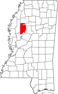 | |
| Towns | ||
| CDP | ||
| Unincorporated communities | ||
| Ghost town | ||
| Footnotes | ‡This populated place also has portions in an adjacent county or counties | |
.svg.png)