Prentiss County, Mississippi
| Prentiss County, Mississippi | |
|---|---|
 The Prentiss County courthouse in Booneville | |
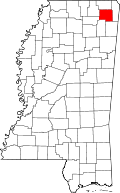 Location in the U.S. state of Mississippi | |
 Mississippi's location in the U.S. | |
| Founded | 1870 |
| Named for | Seargent Smith Prentiss |
| Seat | Booneville |
| Largest city | Booneville |
| Area | |
| • Total | 418 sq mi (1,083 km2) |
| • Land | 415 sq mi (1,075 km2) |
| • Water | 3.2 sq mi (8 km2), 0.8% |
| Population | |
| • (2010) | 25,276 |
| • Density | 61/sq mi (24/km²) |
| Congressional district | 1st |
| Time zone | Central: UTC-6/-5 |
| Website |
www |
Prentiss County is a county located in the U.S. state of Mississippi. As of the 2010 census, the population was 25,275.[1] Its county seat is Booneville.[2] The county is named for Seargent Smith Prentiss, a famous speaker and debater from Natchez, MS. (Seargent was his first name, not a military title).
Geography
According to the U.S. Census Bureau, the county has a total area of 418 square miles (1,080 km2), of which 415 square miles (1,070 km2) is land and 3.2 square miles (8.3 km2) (0.8%) is water.[3]
Major highways
Adjacent counties
- Alcorn County (north)
- Tishomingo County (east)
- Itawamba County (southeast)
- Lee County (southwest)
- Union County (west)
- Tippah County (northwest)
National protected area
- Natchez Trace Parkway (part)
Demographics
| Historical population | |||
|---|---|---|---|
| Census | Pop. | %± | |
| 1870 | 9,348 | — | |
| 1880 | 12,158 | 30.1% | |
| 1890 | 13,679 | 12.5% | |
| 1900 | 15,788 | 15.4% | |
| 1910 | 16,931 | 7.2% | |
| 1920 | 17,606 | 4.0% | |
| 1930 | 19,265 | 9.4% | |
| 1940 | 20,921 | 8.6% | |
| 1950 | 19,810 | −5.3% | |
| 1960 | 17,949 | −9.4% | |
| 1970 | 20,133 | 12.2% | |
| 1980 | 24,025 | 19.3% | |
| 1990 | 23,278 | −3.1% | |
| 2000 | 25,556 | 9.8% | |
| 2010 | 25,276 | −1.1% | |
| Est. 2015 | 25,459 | [4] | 0.7% |
| U.S. Decennial Census[5] 1790-1960[6] 1900-1990[7] 1990-2000[8] 2010-2013[1] | |||
As of the census[9] of 2000, there were 25,556 people, 9,821 households, and 7,169 families residing in the county. The population density was 62 people per square mile (24/km²). There were 10,681 housing units at an average density of 26 per square mile (10/km²). The racial makeup of the county was 85.85% White, 12.94% Black or African American, 0.18% Native American, 0.16% Asian, 0.17% from other races, and 0.70% from two or more races. 0.69% of the population were Hispanic or Latino of any race.
In 2000 there were 9,821 households out of which 33.70% had children under the age of 18 living with them, 56.30% were married couples living together, 12.60% had a female householder with no husband present, and 27.00% were non-families. 24.90% of all households were made up of individuals and 12.00% had someone living alone who was 65 years of age or older. The average household size was 2.52 and the average family size was 3.00.
In the county the population was spread out with 25.00% under the age of 18, 11.60% from 18 to 24, 27.10% from 25 to 44, 22.40% from 45 to 64, and 13.90% who were 65 years of age or older. The median age was 35 years. For every 100 females there were 94.10 males. For every 100 females age 18 and over, there were 89.40 males.
The median income for a household in the county was $28,446, and the median income for a family was $35,125. Males had a median income of $26,862 versus $19,766 for females. The per capita income for the county was $14,131. About 13.10% of families and 16.50% of the population were below the poverty line, including 18.60% of those under age 18 and 22.40% of those age 65 or over.
Communities
Cities
- Baldwyn (partly in Lee County)
- Booneville (county seat)
Towns
Unincorporated communities
- Altitude
- Blackland
- Cairo
- Hills Chapel
- Hobo Station
- New Site
- Thrasher
- Wheeler
See also
- Dry counties
- National Register of Historic Places listings in Prentiss County, Mississippi
- Jacinto, historic county seat of Prentiss' parent county, Old Tishomingo County, Mississippi
References
- 1 2 "State & County QuickFacts". United States Census Bureau. Retrieved September 5, 2013.
- ↑ "Find a County". National Association of Counties. Retrieved 2011-06-07.
- ↑ "2010 Census Gazetteer Files". United States Census Bureau. August 22, 2012. Retrieved November 6, 2014.
- ↑ "County Totals Dataset: Population, Population Change and Estimated Components of Population Change: April 1, 2010 to July 1, 2015". Retrieved July 2, 2016.
- ↑ "U.S. Decennial Census". United States Census Bureau. Retrieved November 6, 2014.
- ↑ "Historical Census Browser". University of Virginia Library. Retrieved November 6, 2014.
- ↑ "Population of Counties by Decennial Census: 1900 to 1990". United States Census Bureau. Retrieved November 6, 2014.
- ↑ "Census 2000 PHC-T-4. Ranking Tables for Counties: 1990 and 2000" (PDF). United States Census Bureau. Retrieved November 6, 2014.
- ↑ "American FactFinder". United States Census Bureau. Retrieved 2011-05-14.
External links
 |
Tippah County | Alcorn County | | |
| Union County | |
Tishomingo County | ||
| ||||
| | ||||
| Lee County | Itawamba County |
Municipalities and communities of Prentiss County, Mississippi, United States | ||
|---|---|---|
| Cities | | |
| Towns | ||
| Unincorporated communities | ||
| Footnotes | ‡This populated place also has portions in an adjacent county or counties | |
.svg.png)
Coordinates: 34°37′N 88°31′W / 34.61°N 88.52°W