Rankin County, Mississippi
| Rankin County, Mississippi | |
|---|---|
 Rankin County Courthouse in Brandon | |
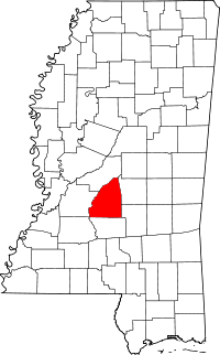 Location in the U.S. state of Mississippi | |
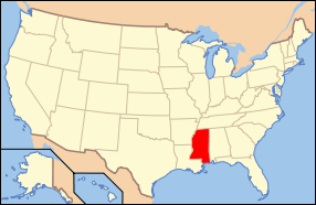 Mississippi's location in the U.S. | |
| Founded | February 4, 1828 |
| Named for | Christopher Rankin |
| Seat | Brandon |
| Largest city | Pearl |
| Area | |
| • Total | 806 sq mi (2,088 km2) |
| • Land | 775 sq mi (2,007 km2) |
| • Water | 31 sq mi (80 km2), 3.8% |
| Population (est.) | |
| • (2014) | 148,070 |
| • Density | 121/sq mi (47/km²) |
| Congressional district | 3rd |
| Time zone | Central: UTC-6/-5 |
| Website |
www |
Rankin County is a county located in the U.S. state of Mississippi. The western border of the county is formed by the Pearl River. As of the 2010 census, the population was 141,617,[1] making it the fourth-most populous county in Mississippi. The county seat is Brandon.[2] The county is named in honor of Christopher Rankin, a Mississippi Congressman who served from 1819 to 1826.
Rankin County is part of the Jackson Metropolitan Statistical Area.
Geography
According to the U.S. Census Bureau, the county has a total area of 806 square miles (2,090 km2), of which 775 square miles (2,010 km2) is land and 31 square miles (80 km2) (3.8%) is water.[3]
Adjacent counties
- Madison County (north)
- Scott County (east)
- Smith County (southeast)
- Simpson County (south)
- Hinds County (west)
Demographics
| Historical population | |||
|---|---|---|---|
| Census | Pop. | %± | |
| 1830 | 2,083 | — | |
| 1840 | 4,361 | 109.4% | |
| 1850 | 7,227 | 65.7% | |
| 1860 | 13,635 | 88.7% | |
| 1870 | 12,977 | −4.8% | |
| 1880 | 16,752 | 29.1% | |
| 1890 | 17,922 | 7.0% | |
| 1900 | 20,955 | 16.9% | |
| 1910 | 23,944 | 14.3% | |
| 1920 | 20,272 | −15.3% | |
| 1930 | 20,353 | 0.4% | |
| 1940 | 27,934 | 37.2% | |
| 1950 | 28,881 | 3.4% | |
| 1960 | 34,322 | 18.8% | |
| 1970 | 43,933 | 28.0% | |
| 1980 | 69,427 | 58.0% | |
| 1990 | 87,161 | 25.5% | |
| 2000 | 115,327 | 32.3% | |
| 2010 | 141,617 | 22.8% | |
| Est. 2015 | 149,039 | [4] | 5.2% |
| U.S. Decennial Census[5] 1790-1960[6] 1900-1990[7] 1990-2000[8] 2010-2014[1] | |||
As of the census[9] of 2000, there were 115,327 people, 42,089 households, and 31,145 families residing in the county. The population density was 149 people per square mile (57/km²). There were 45,070 housing units at an average density of 58 per square mile (22/km²). The racial makeup of the county was 81.03% White, 17.12% Black or African American, 0.16% Native American, 0.66% Asian, 0.02% Pacific Islander, 0.41% from other races, and 0.60% from two or more races. 1.32% of the population were Hispanic or Latino of any race.
According to the census[9] of 2000, the largest ancestry groups in Rankin County were English 52.8%, Scots-Irish 15%, African 17.12%, Irish 5.1% and Scottish 3.2%.
There were 42,089 households out of which 36.70% had children under the age of 18 living with them, 58.10% were married couples living together, 12.20% had a female householder with no husband present, and 26.00% were non-families. 21.90% of all households were made up of individuals and 6.20% had someone living alone who was 65 years of age or older. The average household size was 2.62 and the average family size was 3.07.
In the county the population was spread out with 25.90% under the age of 18, 9.10% from 18 to 24, 32.40% from 25 to 44, 23.00% from 45 to 64, and 9.50% who were 65 years of age or older. The median age was 35 years. For every 100 females there were 95.60 males. For every 100 females age 18 and over, there were 92.50 males.
The median income for a household in the county was $44,946, and the median income for a family was $51,707. Males had a median income of $36,097 versus $26,096 for females. The per capita income for the county was $20,412. About 7.30% of families and 9.50% of the population were below the poverty line, including 12.20% of those under age 18 and 11.70% of those age 65 or over.
Rankin County has the second highest per capita income in the state of Mississippi.
Transportation
Major highways
 Interstate 20
 U.S. Highway 80
 U.S. Highway 49
 Mississippi Highway 13
 Mississippi Highway 18
 Mississippi Highway 25
 Mississippi Highway 43
Airport
Jackson Evers International Airport is located in unincorporated Rankin County.
Government
The Mississippi Department of Corrections (MDOC) operates the Central Mississippi Correctional Facility (CMCF), located in unincorporated Rankin County.[10][11] CMCF houses the state's female death row inmates.[10] MDOC also operates the Brandon Probation and Parole Office in Brandon.[12] In 2007 the Mississippi Highway Patrol opened a driver's license facility across the highway from the prison.[13]
The Mississippi State Hospital of the Mississippi Department of Mental Health is in Whitfield in unincorporated Rankin County.[14][15] It occupies the former Rankin Farm prison grounds.[16] In 1935, the Mississippi State Insane Asylum moved from a complex of 19th-century buildings in northern Jackson, the capital, to its current location.[17]
The Mississippi Department of Public Safety operates the Mississippi Law Enforcement Officers' Training Academy (MLEOTA) on a 243-acre (98 ha) property in Rankin County, near CMCF and the MSH, 10 miles (16 km) from Jackson.[18]
The Mississippi Department of Environmental Quality operates the Central Regional Office and the MDEQ Laboratory in unincorporated Rankin County.[19][20]
Communities
Cities
- Brandon (county seat)
- Flowood
- Jackson (mostly in Hinds County, also in Madison County)
- Pearl
- Richland
Towns
Village
Unincorporated communities
- Cross Roads
- Fannin
- Goshen Springs
- Greenfield
- Gulde
- Johns
- Leesburg
- Piney Woods
- Sandhill
- Star
- Whitfield
- Jesus
Former communities
See also
References
- 1 2 "State & County QuickFacts". United States Census Bureau. Retrieved September 5, 2013.
- ↑ "Find a County". National Association of Counties. Retrieved 2011-06-07.
- ↑ "2010 Census Gazetteer Files". United States Census Bureau. August 22, 2012. Retrieved November 7, 2014.
- ↑ "County Totals Dataset: Population, Population Change and Estimated Components of Population Change: April 1, 2010 to July 1, 2015". Retrieved July 2, 2016.
- ↑ "U.S. Decennial Census". United States Census Bureau. Retrieved November 7, 2014.
- ↑ "Historical Census Browser". University of Virginia Library. Retrieved November 7, 2014.
- ↑ "Population of Counties by Decennial Census: 1900 to 1990". United States Census Bureau. Retrieved November 7, 2014.
- ↑ "Census 2000 PHC-T-4. Ranking Tables for Counties: 1990 and 2000" (PDF). United States Census Bureau. Retrieved November 7, 2014.
- 1 2 "American FactFinder". United States Census Bureau. Retrieved 2008-01-31.
- 1 2 "State Prisons." Mississippi Department of Corrections. Retrieved on May 21, 2010.
- ↑ "MDOC QUICK REFERENCE." Mississippi Department of Corrections. Retrieved on May 21, 2010.
- ↑ "Rankin County." Mississippi Department of Corrections. Retrieved on September 15, 2010.
- ↑ "New Driver's License Facility Opens In Pearl", WAPT-TV. April 23, 2007. Retrieved on May 21, 2010.
- ↑ "Whitfield Campus Map." Mississippi State Hospital. Retrieved on August 10, 2010.
- ↑ "Driving Directions to MSH." Mississippi State Hospital. Retrieved on August 10, 2010.
- ↑ Sixteenth Census of the United States: 1940: Population. Bureau of the Census, 1941. 572. Retrieved on Google Books on August 12, 2011.
- ↑ Cole, Hunter. The Legs Murder Scandal. University Press of Mississippi. 331. Retrieved from Google Books on October 31, 2010. ISBN 1-60473-722-0, ISBN 978-1-60473-722-6
- ↑ "Mississippi Law Enforcement Officers’ Training Academy," Mississippi Department of Public Safety. Retrieved on April 16, 2012.
- ↑ "Central Regional Office." Mississippi Department of Environmental Quality. Retrieved on September 21, 2010.
- ↑ "Locations and Driving Directions to MDEQ Offices." Mississippi Department of Environmental Quality. Retrieved on September 21, 2010.
External links
 |
Madison County | | ||
| Hinds County | |
Scott County | ||
| ||||
| | ||||
| Simpson County | Smith County |
Municipalities and communities of Rankin County, Mississippi, United States | ||
|---|---|---|
| Cities | | |
| Towns | ||
| Village | ||
| CDP |
| |
| Unincorporated communities |
| |
| Ghost towns | ||
| Footnotes | ‡This populated place also has portions in an adjacent county or counties | |
.svg.png)
Coordinates: 32°16′N 89°57′W / 32.26°N 89.95°W