Coahoma County, Mississippi
| Coahoma County, Mississippi | |
|---|---|
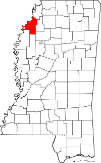 Location in the U.S. state of Mississippi | |
 Mississippi's location in the U.S. | |
| Founded | February 9, 1836 |
| Seat | Clarksdale |
| Largest city | Clarksdale |
| Area | |
| • Total | 583 sq mi (1,510 km2) |
| • Land | 552 sq mi (1,430 km2) |
| • Water | 31 sq mi (80 km2), 5.3% |
| Population | |
| • (2010) | 26,151 |
| • Density | 47/sq mi (18/km²) |
| Congressional district | 2nd |
| Time zone | Central: UTC-6/-5 |
| Website |
www |

Coahoma County is a county located in the U.S. state of Mississippi. As of the 2010 census, the population was 26,151.[1] Its county seat is Clarksdale.[2]
The Clarksdale, MS Micropolitan Statistical Area includes all of Coahoma County. It is located in the Mississippi Delta region of Mississippi.
History
Coahoma County was established February 9, 1836, and is located in the northwestern part of the state in the fertile Yazoo Delta region. The name "Coahoma" is a Choctaw word meaning "red panther." The act creating the county defined its limits as follows:
Beginning at the point where the line between townships 24 and 25 of the surveys of the late Choctaw cession intersects the Mississippi River, and running thence up the said river to the point where the dividing line between the Choctaw and Chickasaw tribes of Indians intersects the same; thence with the dividing line to the point where the line between ranges two and three of the survey of the said Choctaw cession intersects the same; thence with said range line, to the line between townships 24 and 25 aforesaid, and thence with the said township line to the beginning.[3]
In the early days of the county, before the construction of railways or extensive roadways inland, the Mississippi River was the primary transportation route, and the first three county seats were each located on the river. In 1836, Port Royal was designated as the first county seat.[4] In 1841, high waters on the Mississippi River flooded Port Royal, and in 1842 the county seat was moved to the town of Delta.[5] High waters on the Mississippi also flooded Delta, and in 1850 the county seat was moved to Friars Point,[5] which had a population of about 1,000 in 1920, and received its name in honor of Robert Friar, an early settler. As nearby Clarksdale grew in population and influence, it challenged Friars Point's hold on the county government, and in 1892, Coahoma County was divided into two jurisdictions, one going to Friars Point and the other to Clarksdale. In 1930, the county seat was given exclusively to Clarksdale,[6] which had a population of 7,500 in 1920. Clarksdale is now the largest and most important city in the county, and was named for John Clark, a brother-in-law of Governor James L. Alcorn, whose home, Eagle’s Nest, was in this county.
Geography
According to the U.S. Census Bureau, the county has a total area of 583 square miles (1,510 km2), of which 552 square miles (1,430 km2) is land and 31 square miles (80 km2) (5.3%) is water.[7]
Major highways
Adjacent counties
- Tunica County (north)
- Quitman County (east)
- Tallahatchie County (southeast)
- Bolivar County (southwest)
- Phillips County, Arkansas (west)
Demographics
| Historical population | |||
|---|---|---|---|
| Census | Pop. | %± | |
| 1840 | 1,290 | — | |
| 1850 | 2,780 | 115.5% | |
| 1860 | 6,606 | 137.6% | |
| 1870 | 7,144 | 8.1% | |
| 1880 | 13,568 | 89.9% | |
| 1890 | 18,342 | 35.2% | |
| 1900 | 26,293 | 43.3% | |
| 1910 | 34,217 | 30.1% | |
| 1920 | 41,511 | 21.3% | |
| 1930 | 46,327 | 11.6% | |
| 1940 | 48,333 | 4.3% | |
| 1950 | 49,361 | 2.1% | |
| 1960 | 46,212 | −6.4% | |
| 1970 | 40,447 | −12.5% | |
| 1980 | 36,918 | −8.7% | |
| 1990 | 31,665 | −14.2% | |
| 2000 | 30,622 | −3.3% | |
| 2010 | 26,151 | −14.6% | |
| Est. 2015 | 24,620 | [8] | −5.9% |
| U.S. Decennial Census[9] 1790-1960[10] 1900-1990[11] 1990-2000[12] 2010-2013[1] | |||
As of the 2010 United States Census, there were 26,151 people residing in the county. 75.5% were Black or African American, 22.9% White, 0.5% Asian, 0.1% Native American, 0.5% of some other race and 0.5% of two or more races. 1.1% were Hispanic or Latino (of any race).
As of the census[13] of 2000, there were 30,622 people, 10,553 households, and 7,482 families residing in the county. The population density was 55 people per square mile (21/km²). There were 11,490 housing units at an average density of 21 per square mile (8/km²). The racial makeup of the county was 27.28% White, 65.21% Black or African American, 0.09% Native American, 0.47% Asian, 0.02% Pacific Islander, 0.34% from other races, and 0.60% from two or more races. 6.90% of the population were Hispanic or Latino of any race.
There were 10,553 households out of which 36.80% had children under the age of 18 living with them, 37.20% were married couples living together, 28.70% had a female householder with no husband present, and 29.10% were non-families. 26.20% of all households were made up of individuals and 11.50% had someone living alone who was 65 years of age or older. The average household size was 2.83 and the average family size was 3.42.
In the county the population was spread out with 33.00% under the age of 18, 10.30% from 18 to 24, 25.30% from 25 to 44, 19.10% from 45 to 64, and 12.30% who were 65 years of age or older. The median age was 30 years. For every 100 females there were 84.90 males. For every 100 females age 18 and over, there were 77.50 males.
The median income for a household in the county was $22,338, and the median income for a family was $26,640. Males had a median income of $26,841 versus $19,611 for females. The per capita income for the county was $12,558. About 29.80% of families and 35.90% of the population were below the poverty line, including 45.90% of those under age 18 and 31.50% of those age 65 or over.
Education
- Colleges
- Coahoma Community College (Clarksdale)
Coahoma County was previously in the service area of the Mississippi Delta Community College (MDCC). As a result of the 1995 Mississippi Legislature session, Coahoma County is no longer in the MDCC service area.[14]
- Public School Districts
- Private Schools
- Lee Academy (Clarksdale)
Communities
Cities
- Clarksdale (county seat)
Towns
Census-designated place
Unincorporated communities
Ghost towns
- Delta
- Ingram (also in Quitman County)
- Port Royal
- Wildwood
Notable people
- James L. Alcorn, United States Senator from Mississippi, owned and died at "Eagle Nest" in Coahoma County[15]
- Leon Bramlett, Farmer and businessman; All-American football player at the United States Naval Academy, 1943-1947; Republican candidate for governor of Mississippi, 1983
- Thomas Harris, author of Hannibal Lecter novels; he was born in Jackson, Tennessee, but raised in Rich, Mississippi, an unincorporated community in Coahoma County.
- John Lee Hooker (1917–2001), was a highly influential American blues singer-songwriter and guitarist, was born on August 22, 1917 in Coahoma County into a sharecropper and Baptist preacher family.
- Maud Jeffries (1869 – 1946), American actress, born in Lula, Mississippi, married a wealthy Australian grazier, and settled in Australia.
- Ransom A. Myers (b. Lula, Mississippi, 1952 - d. Halifax, Nova Scotia, 2007) was a renowned Canada-based marine biologist, conservationist and scholar at Dalhousie University who published a seminal study on overfishing.
- Rick Ross the rapper was born in Coahoma County in 1976. Soon moved to Miami-Dade County, Florida.
- Ike Turner was born in Clarksdale
- Nate Dogg spent his childhood in Clarksdale.
- Tennessee Williams spent much of his childhood in Clarksdale and Coahoma County. A Tennessee Williams Festival is held annually in Clarksdale.
- Seelig Wise (1913-2004), a cotton and soybean farmer in Coahoma County, was the first Republican member of the Mississippi State Senate since Reconstruction
- Blac Elvis was born in Clarksdale, Mississippi. Award-winning music producer/songwriter.
- Son House, blues singer and guitarist, (b. 1902 - d. 1988), was born at Lyon in Coahoma County, Mississippi.
See also
References
- 1 2 "State & County QuickFacts". United States Census Bureau. Retrieved September 3, 2013.
- ↑ "Find a County". National Association of Counties. Archived from the original on 2011-05-31. Retrieved 2011-06-07.
- ↑ Rowland, Dunbar (1907). Mississippi: Comprising Sketches of Counties, Towns, Events, Institutions, and Persons, Arranged in Cyclopedic Form. 1. Southern Historical Publishing Association. p. 450.
- ↑ Sansing, David G.; Jones, Walker W.; Bush, Jason R. (April 2004). "Unequal Justice: An Unintended Consequence in Mississippi Counties with Two Judicial Districts" (PDF). Mississippi Law Journal. Archived from the original (PDF) on 2014-02-22.
- 1 2 Kerstine, Margery (January 7, 2011). "Cotton-Family-Religion: Jewish Life in Coahoma County Mississippi, Delta History from 1836 to 1941, Prologue: 1721 to 1867". Margery Kerstine.
- ↑ Nelson, Lawrence J. (1999). King Cotton's Advocate: Oscar G. Johnston and the New Deal. University of Tennessee Press.
- ↑ "2010 Census Gazetteer Files". United States Census Bureau. August 22, 2012. Retrieved November 3, 2014.
- ↑ "County Totals Dataset: Population, Population Change and Estimated Components of Population Change: April 1, 2010 to July 1, 2015". Retrieved July 2, 2016.
- ↑ "U.S. Decennial Census". United States Census Bureau. Archived from the original on May 11, 2015. Retrieved November 3, 2014.
- ↑ "Historical Census Browser". University of Virginia Library. Retrieved November 3, 2014.
- ↑ "Population of Counties by Decennial Census: 1900 to 1990". United States Census Bureau. Retrieved November 3, 2014.
- ↑ "Census 2000 PHC-T-4. Ranking Tables for Counties: 1990 and 2000" (PDF). United States Census Bureau. Retrieved November 3, 2014.
- ↑ "American FactFinder". United States Census Bureau. Archived from the original on 2013-09-11. Retrieved 2008-01-31.
- ↑ "The History of MDCC." Mississippi Delta Community College. Retrieved on October 18, 2010.
- ↑ Who Was Who in America, Historical Volume, 1607-1896. Marquis Who's Who. 1967.
External links
- http://www.clarksdale.com/chamber/
- Coahoma County, Mississippi at DMOZ
- Coahoma County Courthouse Pictures
- Delta News Online: Hometown News for the Mississippi Delta
Coordinates: 34°14′N 90°36′W / 34.23°N 90.60°W
 |
Tunica County | | ||
| Phillips County, Arkansas | |
Quitman County | ||
| ||||
| | ||||
| Bolivar County | Sunflower County | Tallahatchie County |
Municipalities and communities of Coahoma County, Mississippi, United States | ||
|---|---|---|
| City | | |
| Towns | ||
| CDP | ||
| Other unincorporated communities | ||
| Ghost towns | ||
| Footnotes | ‡This populated place also has portions in an adjacent county or counties | |
.svg.png)