Covington, Tennessee
| Covington, Tennessee | |
|---|---|
| City | |
 | |
| Nickname(s): The Heart of Tipton County | |
 Location in Tipton County and the state of Tennessee. | |
| Coordinates: 35°33′54″N 89°38′50″W / 35.56500°N 89.64722°WCoordinates: 35°33′54″N 89°38′50″W / 35.56500°N 89.64722°W | |
| Country | United States of America |
| States of the United States | Tennessee |
| County | Tipton |
| Area | |
| • Total | 10.3 sq mi (26.7 km2) |
| • Land | 10.3 sq mi (26.7 km2) |
| • Water | 0.0 sq mi (0.0 km2) |
| Elevation | 335 ft (102 m) |
| Population (2010) | |
| • Total | 9,038 |
| • Density | 877.5/sq mi (338.5/km2) |
| Time zone | Central (CST) (UTC-6) |
| • Summer (DST) | CDT (UTC-5) |
| ZIP code | 38019 |
| Area code(s) | 901 |
| FIPS code | 47-17680[1] |
| GNIS feature ID | 1281435[2] |
| Website |
www |
Covington is a city in central Tipton County, Tennessee. Covington is the largest city and county seat of, Tipton County.[3] The city is located in West Tennessee, a few miles from the Mississippi River. The city's population was 9,038 at the time of the 2010 U.S. Census.[4]
History
The Covington area was originally inhabited by Native Americans of various tribes. The nearby Mississippi River was used for much north-south trade by the American Indians.
Since Tipton County is one of the five counties of the State of Tennessee that is located along the Mississippi River, this area was first explored by white people during the noted expedition of the French Canadians Jacques Marquette and Louis Joliet in 1673. This expedition went down the Mississippi from Wisconsin to the mouth of the Arkansas River, and then back upriver to Lake Michigan. That river mouth is along the present border between Arkansas and Mississippi. Also, the fine details of the route of the land expedition of the Spanish explorer Hernando de Soto are not known, but it is likely that de Soto and his men passed near here circa 1541.
During the 18th century, because this entire area consists of flatlands with long, hot summers, and adequate rainfall, the Covington area and the rest of West Tennessee grew to become the location of large plantations for growing huge crops of cotton (and a few foodcrops). Hence African slaves were brought to Western Tennessee early in its history, and West Tennessee was the nexus of slavery in Tennessee, since most of the rest of the state had relatively few slaves.
During the Civil War, one of the primary objectives of the Union Army and Union Navy was to split the Confederate States in two along the Mississippi River. The Confederate Army resisted this, but still the counties of Tennessee and northeastern Arkansas, including Tipton County, were among the early ones to be overrun and held by the Union Army. Thus, the war in the Covington area ended early.
Starting in the 1870s, Covington and its surroundings began to receive the benefits of the new technologies that were being invented and then extended across the middle of the United States: the railroad, telegraph, household electric power, a municipal pure water supply, the paving of the town's streets, and the provision of natural gas.
The Memphis and Paducah Railroad completed its tracks to Covington in July 1873. Next, the first telegraph line between Memphis and Covington was completed in 1882. In 1894, electric power came to Covington for the first time.
A municipal water system began providing the residents of Covington with pure drinking water beginning in 1898. In 1922, the paving of the streets began in Covington, and beginning in 1929, a natural gas company has operated to provide cooking gas and wintertime heating to homes and business in Covington. The time that telephone service in Covington originated is not known.
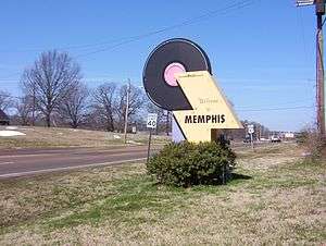
Following the invention of the automobile, during the 1910s and 1920s the United States began to construct more and more intercity paved highways in various regions of the county. These developed into the U.S. Numbered Highway System, and U.S. Route 51 was established. This highway connects Memphis and points south, via Covington and Cairo, Illinois, with Chicago. Thus, Covington became a small town along a major north-south highway of commerce and travel.
In the South Main Historic District in Covington, about 50 houses from the late 19th century and the early 20th century are still standing.[5]
Geography
Covington is located at 35°33′54″N 89°38′50″W / 35.56500°N 89.64722°W (35.564937, -89.647168).[6]
Covington is part of the Memphis, Tennessee Metropolitan Area, and is situated along U.S. Route 51, a major north-south highway connecting Mississippi, Tennessee, Kentucky, and Illinois.
According to the United States Census Bureau, this town has a total area of 10.3 square miles (27 km2), of which practically all of it is land.
Covington is situated on the southeastern edge of the New Madrid Seismic Zone, an area judged by geologists to have a high risk of earthquakes in the future.
Demographics
| Historical population | |||
|---|---|---|---|
| Census | Pop. | %± | |
| 1850 | 368 | — | |
| 1870 | 447 | — | |
| 1880 | 799 | 78.7% | |
| 1890 | 1,067 | 33.5% | |
| 1900 | 2,787 | 161.2% | |
| 1910 | 2,990 | 7.3% | |
| 1920 | 3,410 | 14.0% | |
| 1930 | 3,397 | −0.4% | |
| 1940 | 3,513 | 3.4% | |
| 1950 | 4,379 | 24.7% | |
| 1960 | 5,298 | 21.0% | |
| 1970 | 5,801 | 9.5% | |
| 1980 | 6,065 | 4.6% | |
| 1990 | 7,487 | 23.4% | |
| 2000 | 8,463 | 13.0% | |
| 2010 | 9,038 | 6.8% | |
| Est. 2015 | 9,036 | [7] | 0.0% |
| Sources:[8][9] | |||
As of the census[1] of 2000, there were 8,463 people, 3,199 households, and 2,136 families residing in the city. The population density was 822.1 people per square mile (317.5/km²). There were 3,372 housing units at an average density of 327.6 per square mile (126.5/km²). The racial makeup of the city was 51.59% White, 46.54% African American, 0.48% Native American, 0.44% Asian, 0.05% Pacific Islander, 0.25% from other races, and 0.65% from two or more races. Hispanic or Latino of any race were 0.79% of the population.
There were 3,199 households out of which 34.1% had children under the age of 18 living with them, 37.9% were married couples living together, 25.4% had a female householder with no husband present, and 33.2% were non-families. 29.9% of all households were made up of individuals and 13.4% had someone living alone who was 65 years of age or older. The average household size was 2.54 and the average family size was 3.17.
In the city the population was spread out with 29.7% under the age of 18, 10.3% from 18 to 24, 25.3% from 25 to 44, 19.3% from 45 to 64, and 15.5% who were 65 years of age or older. The median age was 33 years. For every 100 females there were 79.0 males. For every 100 females age 18 and over, there were 70.8 males.
The median income for a household in the city was $24,684, and the median income for a family was $32,213. Males had a median income of $28,964 versus $20,938 for females. The per capita income for the city was $14,293. About 25.2% of families and 27.9% of the population were below the poverty line, including 37.9% of those under age 18 and 34.1% of those age 65 or over.
Tipton County Museum
The Tipton County Museum is located in Covington. This museum houses an impressive history exhibit featuring artifacts from Tipton County's rich heritage and a nature center depicting the unique ecosystem of West Tennessee. Mountings of local animal species are kept there, and fragments of mastodon bone show something about its natural history. Adjacent to the museum, there is a 20 acre park with a 0.5 miles (805 m) walking trail. Natural woodland and a man-made wetland give habitat to a few of the smaller local species such as turtles and birds.
The Veterans Memorial in front of the museum commemorates the soldiers from the county who lost their lives in wars. This museum is closed on Sundays and Mondays, and admission to the museum and to the park is free.[5][10]
Education
Covington Public Schools are part of Tipton County Schools. The Tipton County School District has eight elementary schools, five middle schools and four high schools.
Schools located in Covington include:
- Austin Peay Elementary School
- Crestview Elementary School
- Covington Integrated Arts Academy
- Crestview Middle School
- Covington High School
- Tipton County Alternative Learning Center
Dr. William E. Bibb is the Director of Schools.[11]
Notable people
- Tony Delk, American pro basketball player
- Augustus Hill Garland, 11th Governor of Arkansas and Attorney General of the United States[12]
- The Hall-of-Fame composer and musician Isaac Hayes was born here
- The actress Leigh Snowden is from Covington, and named her granddaughter Covington, in honor of this town
Climate
The climate in this area is characterized by hot, humid summers and generally mild to cool winters. According to the Köppen Climate Classification system, Covington has a humid subtropical climate, abbreviated "Cfa" on climate maps.[13]
References
- 1 2 "American FactFinder". United States Census Bureau. Archived from the original on September 11, 2013. Retrieved 2008-01-31.
- ↑ "US Board on Geographic Names". United States Geological Survey. 2007-10-25. Retrieved 2008-01-31.
- ↑ "Find a County". National Association of Counties. Archived from the original on May 31, 2011. Retrieved 2011-06-07.
- ↑ Tennessee Department of Economic and Community Development, Certified Population of Tennessee Incorporated Municipalities and Counties, State of Tennessee official website, 14 July 2011. Retrieved: 6 December 2013.
- 1 2 "Covington-Tipton County Community Guide". Covington, Tennessee: Tipton County Chamber of Commerce. 2005.
- ↑ "US Gazetteer files: 2010, 2000, and 1990". United States Census Bureau. 2011-02-12. Retrieved 2011-04-23.
- ↑ "Annual Estimates of the Resident Population for Incorporated Places: April 1, 2010 to July 1, 2015". Retrieved July 2, 2016.
- ↑ "Census of Population and Housing: Decennial Censuses". United States Census Bureau. Retrieved 2012-03-04.
- ↑ "Incorporated Places and Minor Civil Divisions Datasets: Subcounty Resident Population Estimates: April 1, 2010 to July 1, 2012". Population Estimates. U.S. Census Bureau. Archived from the original on June 17, 2013. Retrieved 11 December 2013.
- ↑ "Tipton County Museum". Tipton County. Archived from the original on October 6, 2008. Retrieved 2008-10-04.
- ↑ "Tipton County Schools". Tipton County Schools. Retrieved 2012-06-22.
- ↑ "Washington". The Encyclopedia of Arkansas History & Culture. Retrieved August 17, 2012.
- ↑ Climate Summary for Covington, Tennessee
External links
| Wikimedia Commons has media related to Covington, Tennessee. |
Municipalities and communities of Tipton County, Tennessee, United States | ||
|---|---|---|
| Cities | ||
| Towns | ||
| Unincorporated communities | ||