Collierville, Tennessee
| Collierville, Tennessee | |
|---|---|
| Town | |
|
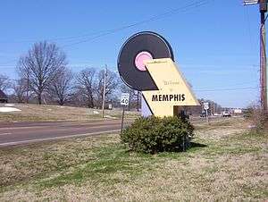
Sign in the Historic Town Square | |
 Location in Shelby County and state of Tennessee. | |
| Coordinates: 35°3′16″N 89°40′56″W / 35.05444°N 89.68222°W | |
| Country | United States |
| State | Tennessee |
| County | Shelby |
| Government | |
| • Mayor | Stan Joyner (R)[1] |
| Area | |
| • Total | 24.7 sq mi (63.8 km2) |
| • Land | 24.5 sq mi (63.6 km2) |
| • Water | 0.1 sq mi (0.3 km2) |
| Elevation | 381 ft (116 m) |
| Population (2012 estimate)[2] | |
| • Total | 46,462 |
| • Density | 1,900/sq mi (730/km2) |
| Time zone | Central (CST) (UTC-6) |
| • Summer (DST) | CDT (UTC-5) |
| ZIP codes | 38017, 38027 |
| Area code(s) | 901 |
| FIPS code | 47-16420[3] |
| GNIS feature ID | 1280985[4] |
| Website |
www |

Collierville is a town in Shelby County, Tennessee, United States, and a suburb located in the Memphis metropolitan area. The town had a population of 43,965 at the 2010 census.[5]
Collierville is a town of large houses and considerable retail expansion. Smaller, older houses are still found in the heart of Collierville, mainly between Byhalia Road and Collierville-Arlington on the east and west and Shelton and Highway 72 on the north and south. Some industry, notably Pepsi and Carrier, still dots the areas located south of Poplar Avenue.
Collierville is home to the Avenue at Carriage Crossing, an 800,000+ sq ft shopping center which opened in October 2005. Baptist Hospital, Collierville, serves the medical needs of the town's residents. Collierville will become part of the Interstate 69 highway plan integrating Bill Morris Parkway (SR 385) as Interstate 269, part of this USDOT project linking Canada and Mexico with the United States.
Collierville was chosen as one of Relocate-America's Top 100 Places to Live in 2008.[6] In 2014, Collierville's historic town square was ranked by Parade Magazine as the "Best Main Street" in America.[7]
History
Battle of Collierville
There were two battles and two small skirmishes of the American Civil War that occurred late in 1863 at Collierville in Shelby County. The first Battle of Collierville occurred on October 11, 1863. Collierville was one of the garrisons established to protect the Memphis and Charleston Railroad. For the Confederates, the Union garrison was a source of fresh supplies. Brig. Gen. James R. Chalmers' division of 3000 men attacked the garrison and earthworks defended by 550 men, including Maj. Gen. William T. Sherman.
The Battle of Collierville on November 3 was the second Confederate cavalry raid that attempted to break up the Memphis and Charleston Railroad behind Maj. Gen. William T. Sherman’s XV Army Corps, then in the process of marching to the relief of Chattanooga. When Brig. Gen. James R. Chalmers, leading a cavalry division riding up from Mississippi, learned that only two Union regiments defended Collierville, he decided to attack. Union Col. Edward Hatch possessed more men than Chalmers supposed, stationed at Collierville and at Germantown, 5 miles (8 km) to the west. Scouts warned Hatch of Chalmers’s approach from the south, so he ordered Collierville’s defenders to be prepared and rode from Germantown with cavalry reinforcements. Chalmers, as he had done only three weeks earlier, attacked from the south. Col. Hatch arrived with help. Surprised by the unexpected appearance of the enemy on his flanks, Chalmers concluded that he was outnumbered, called off the battle, and, to ward off Union pursuit, withdrew back to Mississippi. The Memphis & Charleston Railroad remained open to Tuscumbia, Alabama, for Union troop movements. Estimated casualties were 60 for the Union and 95 for the Confederacy for a total of 155.[8]
Maj. Gen. William T. Sherman participated in the battle of October 11, and his monument in Washington, D.C. lists "Colliersville" as one of his battles. The Union commanders referred to it as "Colliersville" in the official reports.
Geography
Collierville is located at 35°3′16″N 89°40′56″W / 35.05444°N 89.68222°W (35.054366, -89.682306).[9]
According to the United States Census Bureau, the town has a total area of 24.6 square miles (64 km2), of which 24.5 square miles (63 km2) is land and 0.1 square miles (0.26 km2), or 0.41%, is water.
Major thoroughfares
- Interstate 269
- Nonconnah/Bill Morris Parkway (State Route 385)
- U. S. Route 72 (Poplar Avenue)/Tennessee State Route 86
- State Route 57 (Poplar Avenue)
- State Route 175 (Byhalia Road, Collierville Road, S Houston Levee Road, and E Shelby Drive)[10]
- State Route 205 (Collierville-Arlington Road)
- Winchester Boulevard
Climate
Collierville has a humid subtropical climate, with four distinct seasons. The summer months (late May to late September) are persistently hot (between 68 °F (20 °C) and 95 °F (35 °C)) and humid due to moisture encroaching from the Gulf of Mexico. Afternoon thunderstorms are frequent during some summers, but usually brief, lasting no longer than an hour. Early Autumn is pleasantly drier and mild, but can remain hot until late October.
Abrupt but short-lived cold snaps are common. Late Autumn is rainy and colder, December being the third rainiest month of the year. Fall foliage becomes especially vibrant after the first frost, typically November, and lasts until early December. Winters are mild, but cold snaps can occur. The official all-time record low temperature was -13.0 °F (-25.0 °C), which occurred on December 24, 1963. Mild spells are sometimes warm with temperatures as high as 75 °F (23 °C) during January and February. Snowfall is not abundant but does occur during most winters, with an annual average of 5.7 inches (14.4 cm) at the airport.
Spring often begins in late February or early March, following the onset of a sharp warmup. This season is also known as "severe weather season" due to the higher frequency of tornadoes, hail, and thunderstorms producing winds greater than 58 mph (93 km/h). Collierville is above the Tennessee state average for Tornado activity, and 188% of the average for the US.[11] Historically, April is the month with the highest frequency of tornadoes, though tornadoes have occurred every month of the year.
Collierville is sunny approximately 64% of the time. Average rainfall is slightly higher during the spring months than the rest of the year, but not to any noticeable extent. Collierville receives around 55 inches of rainfaill every year.[12]
Demographics
| Historical population | |||
|---|---|---|---|
| Census | Pop. | %± | |
| 1850 | 236 | — | |
| 1870 | 274 | — | |
| 1880 | 753 | 174.8% | |
| 1890 | 696 | −7.6% | |
| 1900 | 829 | 19.1% | |
| 1910 | 802 | −3.3% | |
| 1920 | 989 | 23.3% | |
| 1930 | 1,008 | 1.9% | |
| 1940 | 1,042 | 3.4% | |
| 1950 | 1,153 | 10.7% | |
| 1960 | 2,020 | 75.2% | |
| 1970 | 3,651 | 80.7% | |
| 1980 | 7,839 | 114.7% | |
| 1990 | 14,427 | 84.0% | |
| 2000 | 31,872 | 120.9% | |
| 2010 | 43,965 | 37.9% | |
| Est. 2015 | 48,863 | [13] | 11.1% |
| Sources:[14][15] | |||
As of the 2000 census,[3] there were 31,872 people, 10,368 households, and 8,937 families residing in the town. The population density was 1,298.3 people per square mile (501.3/km²). There were 10,770 housing units at an average density of 438.7 per square mile (169.4/km²). The racial makeup of the town was 89.87% White, 7.33% African American, 0.19% Native American, 1.47% Asian, 0.01% Pacific Islander, 0.33% from other races, and 0.79% from two or more races. Hispanic or Latino of any race were 1.51% of the population.
There were 10,368 households, out of which 52.4% had children under the age of 18 living with them, 76.1% were married couples living together, 8.0% had a female householder with no husband present, and 13.8% were non-families. 11.8% of all households were made up of individuals and 3.4% had someone living alone who was 65 years of age or older. The average household size was 3.06 and the average family size was 3.34.
In the town the population was spread out with 33.4% under the age of 18, 5.8% from 18 to 24, 32.4% from 25 to 44, 22.3% from 45 to 64, and 6.0% who were 65 years of age or older. The median age was 35 years. For every 100 females, there were 97.6 males. For every 100 females age 18 and over, there were 92.9 males.
According to a 2007 estimate, the median income for a household in the town was $99,239, and the median income for a family was $106,634. Males had a median income of $63,986 versus $32,619 for females. The per capita income for the town was $30,252. About 1.9% of families and 2.4% of the population were below the poverty line, including 2.6% of those under age 18 and 4.1% of those age 65 or over.
By 2013, Collierville's total population had grown to an estimated 46,568 [16] people and the median household income had grown to $105,727[17]
Churches
Collierville is home to many places of worship of various denominations. Among them is Central Church, a non-denominational mega-church of almost 6000 members, the Catholic Church of the Incarnation with nearly 4,500 members, Collierville United Methodist Church with more than 3,400 members, and Collierville First Baptist Church with more than 3,200 members.[18] Collierville is also home to numerous other Baptist churches, three United Methodist churches, one meetinghouse of The Church of Jesus Christ of Latter-day Saints (LDS Church) serving two congregations, a few Presbyterian churches, and a few scattered Lutheran churches. Peace Tree is a newly formed church seeking to reach people by meeting in neutral locations such as homes, restaurants, and parks.[19]
Economy
Job growth from 2000 to 2006 was 12.06%.[20]
Education
Of residents 25 years of age and older, 96% have a high school diploma or higher, 51.8% have a bachelor's degree or higher, and 18.2% have a graduate or professional degree.[21] Of current students, 95.6% attend public schools, 4.4% attend private schools.[20]
Until 2014, Collierville was served by the Shelby County School District, which is accredited by the Southern Association of Colleges and Schools. Several private schools are also located in the town.
On August 2, 2012, voters in the town overwhelmingly passed an ordinance establishing a separate school district for the town beginning in the 2013-2014 school year.[22] It passed 10,615 (87%) to 1,519 (13%).
Collierville Schools is the new municipal school district serving the city of Collierville as of 2014.
Collierville Schools
Elementary schools:
- Bailey Station Elementary
- Collierville Elementary
- Crosswind Elementary
- Sycamore Elementary
- Tara Oaks Elementary
Middle schools:
- Collierville Middle School
- Schilling Farms Middle School
High schools:
- Collierville High School (named one of America's top high schools by Newsweek and US News)[23]
- Some students may continue to be served by Houston High School (actually located in Germantown), which is in the Germantown Municipal School District
Private schools
- Central Day School
- Collierville Christian Academy
- Incarnation Catholic School Pre-K thru 8th Grade
- St. George's Independent School - Collierville
Colleges and Universities
- University of Memphis - Collierville Campus (classes starting in 2015) [24][25]
Libraries and Performing Arts Centers
Museums
Culture
Collierville's traditional destination for visitors is the Historic Square, in the center of downtown. This quaint shopping destination boasts trendy shops, fun eateries, and a tree-lined park, all overlooking the old train depot from which the town grew.
Fair on the Square and the annual Symphony in the Rose Garden both take place every May in Collierville.[30][31] The Summer concert series at the historic Collierville town square kicks off the first week of June and lasts through the end of July.[31] Collierville's Farmers Market[32] is located in the parking lot of Collierville United Methodist Church at their 454 W Poplar Ave location.
Notable people
- Emery Adams, baseball player
- Morgan Cox, football player, Baltimore Ravens
- Zack Cozart, shortstop, Cincinnati Reds
- Bill Dance, professional fisherman, Outdoor Channel TV Host
- Barrett Jones, offensive lineman, St. Louis Rams
- Nick Marable, competed in the 2014 World Wrestling Championships
- Nikki McCray, basketball player, WNBA
- Mary Jane May, former Miss Tennessee, accomplished singer
- Ben McDaniel, missing scuba diver
- J. Washington Moore, lawyer and politician.[33]
- Major Owens, New York politician
- Drew Pomeranz, pitcher, Boston Red Sox
- Marv Throneberry, first baseman, New York Mets
See also
- Battle of Collierville for description of both battles of 1863, with links to commanders and units that fought there.
References
| Wikimedia Commons has media related to Collierville, Tennessee. |
- ↑ "Stan Joyner -- Collierville Mayor". The Commercial Appeal. 18 October 2012. Retrieved 4 February 2016.
Republican Party member
- ↑ Collierville, Tennessee QuickFacts, United State Census Bureau website. Retrieved: 6 December 2013.
- 1 2 "American FactFinder". United States Census Bureau. Archived from the original on 2013-09-11. Retrieved 2008-01-31.
- ↑ "US Board on Geographic Names". United States Geological Survey. 2007-10-25. Retrieved 2008-01-31.
- ↑ "Race, Hispanic or Latino, Age, and Housing Occupancy: 2010 Census Redistricting Data (Public Law 94-171) Summary File (QT-PL), Collierville town, Tennessee". U.S. Census Bureau, American FactFinder 2. Archived from the original on September 11, 2013. Retrieved August 17, 2011.
- ↑ Relocate-America's 2008 Top 100 Places to Live Archived August 3, 2009, at the Wayback Machine.
- ↑ http://www.commercialappeal.com/news/local-news/germantown-collierville/collierville-wins-parade-magazines-best-downtown-award_90068645
- ↑ Battle Summary: Collierville, TN
- ↑ "US Gazetteer files: 2010, 2000, and 1990". United States Census Bureau. 2011-02-12. Retrieved 2011-04-23.
- ↑ Google Maps
- ↑ http://www.city-data.com/city/Collierville-Tennessee.html#ixzz3HgGOHWa6
- ↑ http://www.usclimatedata.com/climate/collierville/tennessee/united-states/ustn0647
- ↑ "Annual Estimates of the Resident Population for Incorporated Places: April 1, 2010 to July 1, 2015". Retrieved July 2, 2016.
- ↑ "Census of Population and Housing: Decennial Censuses". United States Census Bureau. Retrieved 2012-03-04.
- ↑ "Incorporated Places and Minor Civil Divisions Datasets: Subcounty Resident Population Estimates: April 1, 2010 to July 1, 2012". Population Estimates. U.S. Census Bureau. Archived from the original on 17 June 2013. Retrieved 11 December 2013.
- ↑ http://www.bizjournals.com/buffalo/slideshow/2014/10/29/these-are-the-45-places-with-median-incomes-above.html?s=image_gallery&img_no=14
- ↑ http://www.bizjournals.com/memphis/news/2014/10/30/where-are-tennessee-incomes-the-highest.html
- ↑ SBC.net
- ↑ www.PeaceTreeUMC.org
- 1 2 CNN.com, Money Magazine: Best places to live 2007: Collierville, TN snapshot
- ↑ http://www.city-data.com/city/Collierville-Tennessee.html
- ↑ "Voters choose to form municipal school districts". Wmctv.com. Retrieved August 3, 2012.
- ↑ http://www.usnews.com/education/best-high-schools/tennessee
- ↑ http://collierville-news.com/2013/07/10/university-of-memphis-plans-satellite-site/
- ↑ http://www.commercialappeal.com/news/local-news/collierville-planning-commission-approves-of
- ↑ http://colliervillelibrary.org/
- ↑ http://www.harrelltheatre.org/
- ↑ http://colliervillemuseum.org/
- ↑ http://www.biblical-museum.org/
- ↑ http://www.harrelltheatre.org/symphonyinthegarden.html
- 1 2 http://www.colliervillechamber.com/cwt/External/WCPages/WCEvents/EventDetail.aspx?EventID=733
- ↑ Farmersmarketcollierville.com
- ↑ Reynolds, J. L.; Elledge, Fred, Jr.; Minick, Norman; Denney, W. Raymond. "J. Washington Moore" (PDF). Nashville Bar Association. Retrieved January 8, 2016.
External links
| Wikimedia Commons has media related to Collierville, Tennessee. |
- Town of Collierville official website
- Collierville Chamber of Commerce
- Collierville Historic Town Square (Main Street Collierville)
- Collierville Police Department
- Collierville Parks, Recreation, and Cultural Arts
- Town charter
Coordinates: 35°03′16″N 89°40′56″W / 35.054366°N 89.682306°W
Municipalities and communities of Shelby County, Tennessee, United States | ||
|---|---|---|
| Cities | ||
| Towns | ||
| Unincorporated communities | ||