List of largest reservoirs of Colorado
This is a list of the largest reservoirs in the state of Colorado. All thirty-eight reservoirs that contain greater than 40,000 acre-feet (.0493 km3) are included in the list. Most of the larger reservoirs in the state are owned by the United States Bureau of Reclamation and, to a lesser extent, the Corps of Engineers. Additionally, a number of these reservoirs are owned by private companies for flood control and irrigation purposes. The largest reservoir entirely contained in Colorado is Blue Mesa Reservoir, with a capacity of 829,500 acre-feet (1.2032 km3). The total storage of the reservoirs on this list is 3,763,458 acre-feet (4.642 km3), although not all is allocated for use by Colorado.
| Key |
|---|
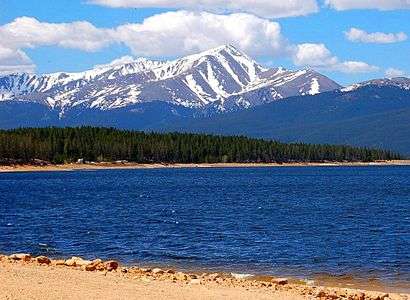
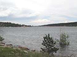
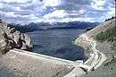
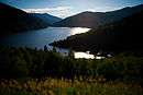
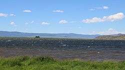
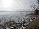
List

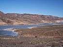

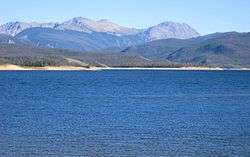


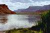
.jpg)


See also
- List of largest reservoirs in the United States
- List of dams and reservoirs in Colorado
- List of rivers of Colorado
Notes
- ↑ When available, volume given is the maximum flood pool, not the operational or live storage capacity.
- ↑ Elevations listed are in feet, and indicated the elevation of reservoir at full pool.
- ↑ Where multiple sources fill a reservoir, the largest inflow will be listed. If a reservoir is off-river, source river will be listed.
- ↑ In the case of reservoirs with multiple dams (such as Horsetooth Reservoir), all will be listed if resources allow.
- ↑ Because of the 1942 Republican River Compact,[17] Kansas was able to force Colorado and Nebraska to make up for water that had been previously owed. As a result, the reservoir is now dry, and will likely remain so for the foreseeable future.
References
- ↑ "Navajo Reservoir". Geographic Names Information System. United States Geological Survey. 1980-11-13. Retrieved 2014-12-23.
- ↑ "Navajo Dam". United States Bureau of Reclamation. 2010-04-13. Retrieved 2014-12-23.
- ↑ "Blue Mesa Reservoir". Geographic Names Information System. United States Geological Survey. 1978-10-13. Retrieved 2014-12-24.
- ↑ United States Bureau of Reclamation. "Water Operations: Blue Mesa Reservoir". Retrieved 2014-12-31.
- ↑ "John Martin Reservoir". Geographic Names Information System. United States Geological Survey. Retrieved 2014-12-24.
- ↑ United States Geological Survey - Water Resources of Colorado (2004-04-28). "Arkansas River Basin". Retrieved 2015-01-05.
- ↑ "Lake Granby". Geographic Names Information System. United States Geological Survey. Retrieved 2014-12-24.
- ↑ United States Bureau of Reclamation (2012-10-04). "Lake Granby Allocations" (PDF). Retrieved 2014-12-31.
- ↑ "McPhee Reservoir". Geographic Names Information System. United States Geological Survey. Retrieved 2014-12-24.
- 1 2 United States Bureau of Reclamation (2014-12-30). "San Juan River Basin". Retrieved 2014-12-31.
- ↑ "Pueblo Reservoir". Geographic Names Information System. United States Geological Survey. Retrieved 2014-12-24.
- ↑ United States Bureau of Reclamation (2009-04-17). "Pueblo Reservoir Allocations" (PDF). Retrieved 2014-12-31.
- ↑ "Dillon Reservoir". Geographic Names Information System. United States Geological Survey. Retrieved 2014-12-24.
- ↑ Denver Water (2014). "Dillon Reservoir". Retrieved 2014-12-31.
- ↑ "Bonny Reservoir". Geographic Names Information System. United States Geological Survey. Retrieved 2014-12-24.
- ↑ United States Bureau of Reclamation (2012-02-01). "Bonny Reservoir Allocations" (PDF). Retrieved 2014-12-31.
- ↑ Matt Flener (2012-03-02). "Bonny Lake drained, thousands of fish die". Retrieved 2015-01-03.
- ↑ "13". Geographic Names Information System. United States Geological Survey. Retrieved 2014-12-24.
- ↑ United States Bureau of Reclamation (2012-10-04). "Horsetooth Reservoir Allocations" (PDF). Retrieved 2014-12-31.
- ↑ United States Bureau of Reclamation (2013-03-29). "Dixon Canyon Dam". Retrieved 2014-12-31.
- ↑ "Green Mountain Reservoir". Geographic Names Information System. United States Geological Survey. Retrieved 2014-12-24.
- ↑ United States Bureau of Reclamation (2012-10-04). "Green Mtn. Allocations" (PDF). Retrieved 2014-12-31.
- ↑ "Twin Lakes Reservoir". Geographic Names Information System. United States Geological Survey. Retrieved 2014-12-28.
- ↑ United States Bureau of Reclamation (2012-10-04). "Twin Lakes Allocations" (PDF). Retrieved 2014-12-31.
- ↑ "Sanchez Reservoir". Geographic Names Information System. United States Geological Survey. Retrieved 2014-12-28.
- ↑ United States Geological Survey (1991). "National Water-Quality Assessment Program -- The Rio Grande Valley" (PDF). Retrieved 2015-01-02.
- ↑ "Turquoise Lake". Geographic Names Information System. United States Geological Survey. Retrieved 2014-12-28.
- ↑ United States Bureau of Reclamation (2012-10-04). "Turquoise Lake Allocations" (PDF). Retrieved 2014-12-31.
- ↑ United States Bureau of Reclamation (2013-04-04). "Fryingpan-Arkansas Project". Retrieved 2015-01-03.
- ↑ "Vallecito Reservoir". Geographic Names Information System. United States Geological Survey. Retrieved 2014-12-28.
- ↑ "Morrow Point Reservoir". Geographic Names Information System. United States Geological Survey. Retrieved 2014-12-28.
- ↑ United States Bureau of Reclamation. "Water Operations: Morrow Point Reservoir". Retrieved 2014-12-31.
- ↑ "Carter Lake Reservoir". Geographic Names Information System. United States Geological Survey. Retrieved 2014-12-28.
- ↑ United States Bureau of Reclamation (2012-10-04). "Carter Lake Allocations" (PDF). Retrieved 2014-12-31.
- ↑ "Taylor Park Reservoir". Geographic Names Information System. United States Geological Survey. Retrieved 2014-12-28.
- ↑ United States Bureau of Reclamation (2014-12-31). "Gunnison River Basin". Retrieved 2015-01-02.
- ↑ "Ruedi Reservoir". Geographic Names Information System. United States Geological Survey. Retrieved 2014-12-28.
- ↑ United States Bureau of Reclamation (2012-10-04). "Ruedi Reservoir Allocations" (PDF). Retrieved 2015-01-02.
- ↑ "Neegronda Reservoir". Geographic Names Information System. United States Geological Survey. Retrieved 2014-12-28.
- 1 2 3 4 5 6 7 United States Geological Survey (1966). "Reservoirs in the United States" (PDF). Retrieved 2015-01-02.
- ↑ "Elevenmile Canyon Reservoir". Geographic Names Information System. United States Geological Survey. Retrieved 2014-12-28.
- ↑ "Williams Fork Reservoir". Geographic Names Information System. United States Geological Survey. Retrieved 2014-12-30.
- ↑ Denver Water (2015). "Williams Fork Reservoir". Retrieved 2015-01-02.
- ↑ "Cherry Creek Reservoir". Geographic Names Information System. United States Geological Survey. Retrieved 2014-12-30.
- ↑ "Nee Noshe Reservoir". Geographic Names Information System. United States Geological Survey. Retrieved 2014-12-30.
- ↑ "Ridgway Reservoir". Geographic Names Information System. United States Geological Survey. Retrieved 2014-12-31.
- ↑ United States Bureau of Reclamation (1999). "Dallas Creek Project" (PDF). Retrieved 2015-01-02.
- ↑ "Cheesman Lake". Geographic Names Information System. United States Geological Survey. Retrieved 2014-12-31.
- ↑ Denver Water (2015). "Cheesman Reservoir". Retrieved 2015-01-02.
- ↑ "North Sterling Reservoir". Geographic Names Information System. United States Geological Survey. Retrieved 2014-12-28.
- 1 2 3 Bureau of Land Management (2000-07-24). "Significant and High Hazard Dam Authorizations" (PDF). Retrieved 2015-01-02.
- ↑ "Adobe Creek Reservoir". Geographic Names Information System. United States Geological Survey. Retrieved 2014-12-31.
- ↑ "Wolford Mountain Reservoir". Geographic Names Information System. United States Geological Survey.
- ↑ "Riverside Reservoir". Geographic Names Information System. United States Geological Survey. Retrieved 2014-12-31.
- 1 2 3 Colorado Water Initiative. "The South Platte River and Alluvial Aquifer: Major Reservoirs and Restricted Dams" (PDF). Retrieved 2015-01-02.
- ↑ "Platoro Reservoir". Geographic Names Information System. United States Geological Survey. Retrieved 2014-12-31.
- ↑ United States Bureau of Reclamation (2009-03-26). "Platoro Dam". Retrieved 2015-01-02.
- ↑ "Spinney Mountain Reservoir". Geographic Names Information System. United States Geological Survey.
- ↑ "Boyd Lake". Geographic Names Information System. United States Geological Survey. Retrieved 2014-12-31.
- ↑ "Two Buttes Reservoir". Geographic Names Information System. United States Geological Survey. Retrieved 2014-12-31.
- ↑ "Santa Maria Reservoir". Geographic Names Information System. United States Geological Survey. Retrieved 2014-12-13.
- ↑ Colorado Water Conservation Board (2013-03-08). "Canal Systems Rehabilitation". Retrieved 2015-01-02.
- ↑ "Homestake Reservoir". Geographic Names Information System. United States Geological Survey. Retrieved 2014-12-31.
- ↑ Colorado Water Science Center (2014-07-23). "Water Resources of the Upper Arkansas River Basin". Retrieved 2015-01-02.
- ↑ "Gross Reservoir". Geographic Names Information System. United States Geological Survey. Retrieved 2014-12-31.
- ↑ "Lemon Reservoir". Geographic Names Information System. United States Geological Survey.
- ↑ United States Bureau of Reclamation (2015-01-01). "San Juan River Basin". Retrieved 2015-01-02.
Colorado River system | |||||||||||||||
|---|---|---|---|---|---|---|---|---|---|---|---|---|---|---|---|
| Jurisdictions |
|     | |||||||||||||
| Canyons |
| ||||||||||||||
| Natural features |
| ||||||||||||||
| Tributaries | |||||||||||||||
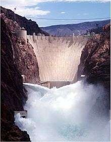
| Engineering |
| ||||||||||||||
| Designated areas | |||||||||||||||
| Related topics | |||||||||||||||
This article is issued from Wikipedia - version of the 9/24/2016. The text is available under the Creative Commons Attribution/Share Alike but additional terms may apply for the media files.