Fryingpan River
| Fryingpan River | |
 Fryingpan River below Ruedi Dam | |
| Country | United States |
|---|---|
| State | Colorado |
| Tributaries | |
| - left | Marten Creek, South Fork Fryingpan River, Rocky Fork Creek |
| - right | Ivanhoe Creek, North Fork Fryingpan River, Lime Creek |
| Source | Near Mount Massive |
| - location | Hunter-Fryingpan Wilderness, Pitkin County |
| - elevation | 12,083 ft (3,683 m) |
| - coordinates | 39°09′52″N 106°31′40″W / 39.16444°N 106.52778°W [1] |
| Mouth | Roaring Fork River |
| - location | Basalt, Eagle County |
| - elevation | 6,591 ft (2,009 m) |
| - coordinates | 39°22′00″N 107°02′03″W / 39.36667°N 107.03417°WCoordinates: 39°22′00″N 107°02′03″W / 39.36667°N 107.03417°W [1] |
| Length | 42 mi (68 km) [2] |
| Basin | 237 sq mi (614 km2) [3] |
| Discharge | for Near Ruedi |
| - average | 176 cu ft/s (5 m3/s) [3] |
| - max | 2,690 cu ft/s (76 m3/s) |
| - min | 28 cu ft/s (1 m3/s) |
The Fryingpan River is a tributary of the Roaring Fork River, approximately 42 miles (68 km) long,[2] in west central Colorado in the United States.
History
The reason for the unusual name of the river is that when a group of trappers were attacked by a band of Ute Indians, only two men survived, one of whom was injured. Leaving his wounded friend in a cave close by, the last man left to summon help, but not before hanging a frying pan in a tree so that he could find the cave again on his return.[1][4][5]
Geography

It rises in northeastern Pitkin County, in the White River National Forest in the Sawatch Mountains along the western side of the continental divide. It flows westward along the county line between Pitkin and Eagle County. Below Meredith, it is dammed to form the Ruedi Reservoir. It joins the Roaring Fork below Basalt. A portion of the river's water is diverted to the east side of the continental divide for irrigation and drinking water via the Fryingpan-Arkansas Project.
See also
References
- 1 2 3 "Fryingpan River". Geographic Names Information System. United States Geological Survey. Retrieved 2011-01-27.
- 1 2 U.S. Geological Survey. National Hydrography Dataset high-resolution flowline data. The National Map, accessed March 18, 2011
- 1 2 "USGS Gage #09080400 on the Fryingpan River near Ruedi, CO" (PDF). National Water Information System. U.S. Geological Survey. 1969–2013. Retrieved 2016-06-01.
- ↑ Maryann Gaug (17 May 2011). Hiking Colorado, 3rd: A Guide to the State's Greatest Hiking Adventures. FalconGuides. pp. 198–. ISBN 978-0-7627-9722-6.
- ↑ Dawson, John Frank. Place names in Colorado: why 700 communities were so named, 150 of Spanish or Indian origin. Denver, CO: The J. Frank Dawson Publishing Co. p. 23.
| Major cities | 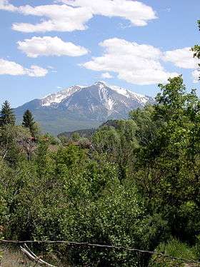 | |
|---|---|---|
| Other communities | ||
| Near valley | ||
| Ski resorts | ||
| Bodies of water | ||