Shadow Mountain Dam
| Shadow Mountain Dam | |
|---|---|
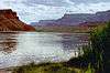
 The dam in 2016. | |
 Location of Shadow Mountain Dam in Colorado | |
| Location | Grand County, near Granby, Colorado, USA |
| Coordinates | 40°12′25″N 105°50′27″W / 40.20694°N 105.84083°WCoordinates: 40°12′25″N 105°50′27″W / 40.20694°N 105.84083°W |
| Construction began | 1944 |
| Opening date | 1946 |
| Operator(s) | U.S. Bureau of Reclamation |
| Dam and spillways | |
| Type of dam | Zoned earth-fill |
| Impounds | Colorado River |
| Height | 63 ft (19 m) |
| Length | 3,077 ft (938 m) |
| Spillway capacity | 10,000 cu ft/s (280 m3/s) |
| Reservoir | |
| Creates | Shadow Mountain Lake |
| Total capacity | 18,400 acre feet (0.0227 km3) |
| Catchment area | 187 sq mi (480 km2) |
| Power station | |
| Hydraulic head | 37 ft (11 m) |
Shadow Mountain Dam is a zoned earth-fill dam on the Colorado River in Grand County, Colorado. Constructed between 1944 and 1946, the Shadow Mountain Dam creates the Shadow Mountain Lake, with a structural height of 63 feet (19 m) and a drainage area of 187 square miles (480 km2). Shadow Mountain Lake is a holding reservoir for water pumped up from Lake Granby just to the south through the Granby Pumping Plant and Canal. Shadow Mountain Lake is connected by a short channel to the natural Grand Lake. The west portal of the Alva B. Adams Tunnel is located on Grand Lake. The Adams Tunnel diverts west slope water to the east slope of the Rocky Mountains for use in agriculture and to serve the populated areas of Colorado, including Denver.[1]
References
- ↑ "Colorado-Big Thompson Project". Retrieved 9 May 2011.
External links
Colorado River system | |||||||||||||||
|---|---|---|---|---|---|---|---|---|---|---|---|---|---|---|---|
| Jurisdictions |
|     | |||||||||||||
| Canyons |
| ||||||||||||||
| Natural features |
| ||||||||||||||
| Tributaries | |||||||||||||||
| Engineering |
| ||||||||||||||
| Designated areas | |||||||||||||||
| Related topics | |||||||||||||||
This article is issued from Wikipedia - version of the 7/12/2016. The text is available under the Creative Commons Attribution/Share Alike but additional terms may apply for the media files.