Klamath National Forest
| Klamath National Forest | |
|---|---|
|
IUCN category VI (protected area with sustainable use of natural resources) | |
|
Little Elk Lake in Klamath National Forest | |
 Map of the United States | |
| Location | Siskiyou County, California / Jackson County, Oregon |
| Nearest city | Yreka, California |
| Coordinates | 41°30′01″N 123°20′00″W / 41.50028°N 123.33333°WCoordinates: 41°30′01″N 123°20′00″W / 41.50028°N 123.33333°W |
| Area | 1,737,774 acres (2,715 sq mi; 7,033 km2) |
| Governing body | U.S. Forest Service |
| Website | Klamath National Forest |

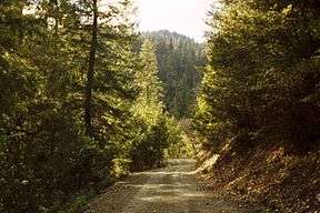
Klamath National Forest is a 1,737,774-acre (2,715 sq mi; 7,033 km2) national forest, in the Klamath Mountains, located in Siskiyou County in northern California, but with a tiny extension (1.5 percent of the forest) into southern Jackson County in Oregon.[1] The forest contains continuous stands of ponderosa pine, Jeffrey pine, Douglas fir, red fir, white fir and incense cedar. Old growth forest is estimated to cover some 168,000 acres (680 km2) of the forest land.[2] Forest headquarters are located in Yreka, California. There are local ranger district offices located in Fort Jones, Happy Camp, and Macdoel, all in California. Klamath was established on May 6, 1905.[3] This park includes the Kangaroo Lake.
Wilderness areas
There are four officially designated wilderness areas in Klamath National Forest that are part of the National Wilderness Preservation System. Two of them extend into neighboring national forests, and one of those into land managed by the Bureau of Land Management.
- Marble Mountain Wilderness
- Russian Wilderness
- Red Buttes Wilderness
- Siskiyou Wilderness (mostly in Six Rivers NF)
- Trinity Alps Wilderness (mostly in Trinity NF; partly in Shasta NF, Six Rivers NF, and BLM land)[4]

References
- ↑ Table 6 - NFS Acreage by State, Congressional District and County - United States Forest Service - September 30, 2007
- ↑ Warbington, Ralph; Beardsley, Debby (2002), 2002 Estimates of Old Growth Forests on the 18 National Forests of the Pacific Southwest Region, United States Forest Service, Pacific Southwest Region
- ↑ Davis, Richard C. (September 29, 2005), National Forests of the United States (pdf), The Forest History Society
- ↑ Trinity Alps Wilderness acreage breakdown, Wilderness.net
External links
-
 Media related to Klamath National Forest (category) at Wikimedia Commons
 - Klamath National Forest official website
- Mid Klamath Watershed Council website
- Salmon River Restoration Council website
- Pictures: Wilderness in the Klamath Mountains
- Panoramic Video: Outskirts of Klamath National Forest
| States and counties |  | |
|---|---|---|
| Significant cities | ||
| Major tributaries | ||
| Geography | ||
| Native American tribes | ||
| History | ||
| Dams and infrastructure |
| |