Hoover Wilderness
| Hoover Wilderness | |
|---|---|
|
IUCN category Ib (wilderness area) | |
|
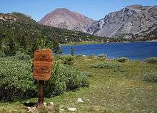
Dunderberg Peak as seen from the Virginia Lakes Basin | |
 | |
| Location | Mono County, California, USA |
| Nearest city | Bridgeport, CA |
| Coordinates | 38°6′47″N 119°22′37″W / 38.11306°N 119.37694°WCoordinates: 38°6′47″N 119°22′37″W / 38.11306°N 119.37694°W |
| Area | 48,601 acres (196 km2) |
| Established | January 1, 1964 |
| Governing body | U.S. Forest Service |

The Hoover Wilderness is a wilderness area in the Inyo and Humboldt-Toiyabe National Forests. It lies to the east of the crest of the central Sierra Nevada in California, to the north and east of Yosemite National Park - a long strip stretching nearly to Sonora Pass on the north and Tioga Pass on the south.
The headwaters of the East Walker River begin in the Hoover Wilderness. It comprises 48,601 acres (197 km2). Many trails lead into it from the east, from Walker Meadow (off the Sonora Pass road), Buckeye Creek, Green Lakes, Virginia Lakes, Lundy Lake, and Saddlebag Lake (off the Tioga Pass road).
The Hoover Wilderness was originally designated as a Primitive Area by the Forest Service in 1931. It was named in honor of President Herbert Hoover. In 1956, it was designated as a Wild Area and became a Wilderness Area when the 1964 Wilderness Act was passed.[1]
The Hoover Wilderness was the setting of Camping Adventure, a children's book published in 1976 by the National Geographic Society as part of its "Books for Young Explorers" series.
Places
Notable locations in the Hoover Wilderness include:
- Twenty Lakes Basin, above Saddlebag Lake 37°59′N 119°18′W / 37.983°N 119.300°W
- Virginia Lakes Basin 38°3′N 119°16.5′W / 38.050°N 119.2750°W
- The Sawtooth Ridge and Matterhorn Peak 38°6′N 119°24′W / 38.100°N 119.400°W
Notes
- ↑ "Wilderness.net's Hoover Wilderness page.". Retrieved 2009-03-26.
External links
-
 Media related to Hoover Wilderness at Wikimedia Commons
 - official Hoover Wilderness Area website
- Wilderness.net: Hoover Wilderness
- official Humboldt-Toiyabe National Forest website
- National Atlas: Map of Humboldt-Toiyabe National Forest
Great Basin watersheds | ||
|---|---|---|
|  | |